|
Hadži-Prodan's Cave
The Hadži-Prodan's Cave ( sr-Cyrl-Latn, Хаџи-Проданова пећина, Hadži-Prodanova pećina) is an archaeological site of the Paleolithic period and a national natural monument, located in the village Raščići around from Ivanjica in western central Serbia. The rather narrow and high entrance with at an altitude of above sea level sits about above the Rašćanska river valley bed and is oriented towards the south. The long cave was formed during the Late Cretaceous in "thick-bedded to massive" Senonian limestone. Prehistoric pottery shards and Pleistocene faunal fossils had already been collected by Zoran Vučićević from Ivanjica. Animal fossils especially Cave bear (''Ursus spelaeus'') and Iron Age artifact discoveries during an unrelated areal survey were reportedly made at the cave entrance and in the main cavern. The site is named in honor of Hadži-Prodan, a 19th century Serbian revolutionary. Excavations Hadži Prodanova has been the subject of resea ... [...More Info...] [...Related Items...] OR: [Wikipedia] [Google] [Baidu] |
Ivanjica
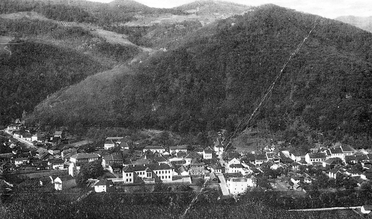
) , motto = , image_map = , map_caption = , pushpin_map_caption = Location within Serbia##Location within Europe , pushpin_relief = 1 , pushpin_map = Serbia#Europe , coordinates = , coor_pinpoint = , coordinates_footnotes = , subdivision_type = Country , subdivision_name = , subdivision_type1 = Region , subdivision_name1 = Šumadija and Western Serbia , subdivision_type2 = District , subdivision_name2 = Moravica , subdivision_type3 = Settlements , subdivision_name3 = 49 , established_title = Village status , established_date = 1833 , established_title1 = Town status , established_date1 = , founder = , seat_type = , seat = , government_footnotes = , leader_party = SNS , leader_title = Mayor , leader_name ... [...More Info...] [...Related Items...] OR: [Wikipedia] [Google] [Baidu] |
Kraljevo
Kraljevo ( sr-cyr, Краљево, ) is a city and the administrative center of the Raška District in central Serbia. It is situated on the confluence of West Morava and Ibar, in the geographical region of Šumadija, between the mountains of Kotlenik in the north, and Stolovi in the south. In 2011 the city urban area has a population of 68,749 inhabitants, while the city administrative area has 125,488 inhabitants. With an area of 1530 km², it is the largest municipality (after Belgrade) in Serbia by area. Name Formerly known as Rudo Polje (Рудо Поље), Karanovac (Карановац) and Rankovićevo (Ранковићево), Kraljevo received its present name, meaning "the King's Town", from King Milan I of Serbia in honor of his own coronation and six Serbian kings that had been crowned in that area. The modern coat of arms of the city features seven crowns symbolizing the seven kings. History and sights The "lower" Ibar region is thought to be the first area w ... [...More Info...] [...Related Items...] OR: [Wikipedia] [Google] [Baidu] |
Detritus
In biology, detritus () is dead particulate organic material, as distinguished from dissolved organic material. Detritus typically includes the bodies or fragments of bodies of dead organisms, and fecal material. Detritus typically hosts communities of microorganisms that colonize and decompose (i.e. remineralize) it. In terrestrial ecosystems it is present as leaf litter and other organic matter that is intermixed with soil, which is denominated " soil organic matter". The detritus of aquatic ecosystems is organic material that is suspended in the water and accumulates in depositions on the floor of the body of water; when this floor is a seabed, such a deposition is denominated "marine snow". Theory The corpses of dead plants or animals, material derived from animal tissues (e.g. molted skin), and fecal matter gradually lose their form due to physical processes and the action of decomposers, including grazers, bacteria, and fungi. Decomposition, the process by which or ... [...More Info...] [...Related Items...] OR: [Wikipedia] [Google] [Baidu] |
Gravettian
The Gravettian was an archaeological industry of the European Upper Paleolithic that succeeded the Aurignacian circa 33,000 years BP. It is archaeologically the last European culture many consider unified, and had mostly disappeared by 22,000 BP, close to the Last Glacial Maximum, although some elements lasted until 17,000 BP. In Spain and France, it was succeeded by the Solutrean, and developed into or continued as the Epigravettian in Italy, the Balkans, Ukraine and Russia. The Gravettian culture is known for Venus figurines, which were typically carved from either ivory or limestone. The culture was first identified at the site of La Gravette in the southwestern French department of Dordogne.Kipfer, Barbara Ann. "Encyclopedic Dictionary of Archaeology". Kluwer Academic/Plenum Publishers, 2000. P. 216. Gravettian culture The Gravettians were hunter-gatherers who lived in a bitterly cold period of European prehistory, and the Gravettian lifestyle was shaped by t ... [...More Info...] [...Related Items...] OR: [Wikipedia] [Google] [Baidu] |
Epigravettian
The Epigravettian (Greek: ''epi'' "above, on top of", and Gravettian) was one of the last archaeological industries and cultures of the European Upper Paleolithic. It emerged after the Last Glacial Maximum around ~21,000 cal. BP or 19,050 BC, and is considered to be a cultural derivative of the Gravettian culture. Initially named ''Tardigravettian'' (Late Gravettian) in 1964 by Georges Laplace in reference to several lithic industries found in Italy, it was later renamed in order to better emphasize its independent character. Three subphases, the ''Early Epigravettian'' (20,000 to 16,000 BP), the ''Evolved Epigravettian'' (16,000 to 14,000 BP) and the ''Final Epigravettian'' (14,000 to 8,000 BP), have been established, that were further subdivided and reclassified. In this sense, the Epigravettian is simply the Gravettian after ~21,000 BP, when the Solutrean had replaced the Gravettian in most of France and Spain. Several Epigravettian cultural centers have developed contempor ... [...More Info...] [...Related Items...] OR: [Wikipedia] [Google] [Baidu] |
Flint
Flint, occasionally flintstone, is a sedimentary cryptocrystalline form of the mineral quartz, categorized as the variety of chert that occurs in chalk or marly limestone. Flint was widely used historically to make stone tools and start fires. It occurs chiefly as nodules and masses in sedimentary rocks, such as chalks and limestones.''The Flints from Portsdown Hill'' Inside the nodule, flint is usually dark grey, black, green, white or brown in colour, and often has a glassy or waxy appearance. A thin layer on the outside of the nodules is usually different in colour, typically white and rough in texture. The nodules can often be found along s and |
Upper Palaeolithic
The Upper Paleolithic (or Upper Palaeolithic) is the third and last subdivision of the Paleolithic or Old Stone Age. Very broadly, it dates to between 50,000 and 12,000 years ago (the beginning of the Holocene), according to some theories coinciding with the appearance of behavioral modernity in early modern humans, until the advent of the Neolithic Revolution and agriculture. Anatomically modern humans (i.e. ''Homo sapiens'') are believed to have emerged in Africa around 300,000 years ago, it has been argued by some that their ways of life changed relatively little from that of archaic humans of the Middle Paleolithic, until about 50,000 years ago, when there was a marked increase in the diversity of artefacts found associated with modern human remains. This period coincides with the most common date assigned to expansion of modern humans from Africa throughout Asia and Eurasia, which contributed to the extinction of the Neanderthals. The Upper Paleolithic has the earlie ... [...More Info...] [...Related Items...] OR: [Wikipedia] [Google] [Baidu] |
Clay
Clay is a type of fine-grained natural soil material containing clay minerals (hydrous aluminium phyllosilicates, e.g. kaolin, Al2 Si2 O5( OH)4). Clays develop plasticity when wet, due to a molecular film of water surrounding the clay particles, but become hard, brittle and non–plastic upon drying or firing. Most pure clay minerals are white or light-coloured, but natural clays show a variety of colours from impurities, such as a reddish or brownish colour from small amounts of iron oxide. Clay is the oldest known ceramic material. Prehistoric humans discovered the useful properties of clay and used it for making pottery. Some of the earliest pottery shards have been dated to around 14,000 BC, and clay tablets were the first known writing medium. Clay is used in many modern industrial processes, such as paper making, cement production, and chemical filtering. Between one-half and two-thirds of the world's population live or work in buildings made with clay, often ... [...More Info...] [...Related Items...] OR: [Wikipedia] [Google] [Baidu] |
Holocene
The Holocene ( ) is the current geological epoch. It began approximately 11,650 cal years Before Present (), after the Last Glacial Period, which concluded with the Holocene glacial retreat. The Holocene and the preceding Pleistocene together form the Quaternary period. The Holocene has been identified with the current warm period, known as MIS 1. It is considered by some to be an interglacial period within the Pleistocene Epoch, called the Flandrian interglacial.Oxford University Press – Why Geography Matters: More Than Ever (book) – "Holocene Humanity" section https://books.google.com/books?id=7P0_sWIcBNsC The Holocene corresponds with the rapid proliferation, growth and impacts of the human species worldwide, including all of its written history, technological revolutions, development of major civilizations, and overall significant transition towards urban living in the present. The human impact on modern-era Earth and its ecosystems may be considered of global si ... [...More Info...] [...Related Items...] OR: [Wikipedia] [Google] [Baidu] |
Stratigraphy
Stratigraphy is a branch of geology concerned with the study of rock (geology), rock layers (Stratum, strata) and layering (stratification). It is primarily used in the study of sedimentary rock, sedimentary and layered volcanic rocks. Stratigraphy has three related subfields: lithostratigraphy (lithologic stratigraphy), biostratigraphy (biologic stratigraphy), and chronostratigraphy (stratigraphy by age). Historical development Catholic priest Nicholas Steno established the theoretical basis for stratigraphy when he introduced the law of superposition, the principle of original horizontality and the principle of lateral continuity in a 1669 work on the fossilization of organic remains in layers of sediment. The first practical large-scale application of stratigraphy was by William Smith (geologist), William Smith in the 1790s and early 19th century. Known as the "Father of English geology", Smith recognized the significance of Stratum, strata or rock layering and the importance ... [...More Info...] [...Related Items...] OR: [Wikipedia] [Google] [Baidu] |
Last Glacial Maximum
The Last Glacial Maximum (LGM), also referred to as the Late Glacial Maximum, was the most recent time during the Last Glacial Period that ice sheets were at their greatest extent. Ice sheets covered much of Northern North America, Northern Europe, and Asia and profoundly affected Earth's climate by causing drought, desertification, and a large drop in sea levels. Based on changes in position of ice sheet margins dated via terrestrial cosmogenic nuclides and radiocarbon dating, growth of ice sheets commenced 33,000 years ago and maximum coverage was between 26,500 years and 19–20,000 years ago, when deglaciation commenced in the Northern Hemisphere, causing an abrupt rise in sea level. Decline of the West Antarctica ice sheet occurred between 14,000 and 15,000 years ago, consistent with evidence for another abrupt rise in the sea level about 14,500 years ago. Glacier fluctuations around the Strait of Magellan suggest the peak in glacial surface area was constrained to betwee ... [...More Info...] [...Related Items...] OR: [Wikipedia] [Google] [Baidu] |
Central Balkan
The Central Balkan National Park ( bg, Национален парк Централен Балкан) lies in the heart of Bulgaria, nestled in the central and higher portions of the Balkan Mountains. Its altitude varies from 550 m. near the town of Karlovo to 2376 m. at Botev Peak, the highest summit in the mountain range. It was established on 31 October 1991. The Central Balkan National Park is the third largest protected territory in Bulgaria, spanning an area of 716.69 km² with total length of 85 km from the west to the east and an average width of 10 km. It occupies territory from 5 of the 28 provinces of the country: Lovech, Gabrovo, Sofia, Plovdiv and Stara Zagora. The national park includes nine nature reserves covering 28% of its territory: Boatin, Tsarichina, Kozya Stena, Steneto, Severen Dzhendem, Peeshti Skali, Sokolna, Dzhendema and Stara Reka. The Central Balkan National Park is one of the largest and most valuable of the protected areas in Eu ... [...More Info...] [...Related Items...] OR: [Wikipedia] [Google] [Baidu] |


