|
Hachen
Hachen is an ''Ortschaft'' (subdivision) of the town of Sundern in the Hochsauerlandkreis, Hochsauerland district of North Rhine-Westphalia, Germany. It is the second largest ''Ortschaft'' of Sundern. Location Hachen and the associated village of Reigern border the Arnsberg districts of Müschede and to the north and east. Hachen borders to the west, Langscheid to the southwest and to the south. It is located between the tourist destinations of Arnsberg Forest Nature Park and the Sauerland-Rothaargebirge Nature Park, and is about 3 km from the Sorpesee. History Middle Ages Hachen was already documented in 793 in the goods register of Werden Abbey. The place name can also be found more frequently in Westphalia with compound place names. The spelling of the name changed over the centuries (for example, Hagnen in 793, Hakkene in 1000, Hagne in the Middle Ages). The current place name was granted in a document by Pope Alexander II from 1173. Hachen was probably a free city s ... [...More Info...] [...Related Items...] OR: [Wikipedia] [Google] [Baidu] |
Sundern
Sundern is a town in the Hochsauerland district, in North Rhine-Westphalia, Germany. The name Sundern is common in Westphalia, as it means "ground given away for private usage" in the Westphalian dialect. Geography Sundern is situated approximately south-west of Arnsberg. Around Sundern extends the nature park ''Homert'' which attracts tourists, many from the Netherlands. Winter tourism is also substantial, primarily in the municipality ''Wildewiese'' with its skiing area. The Sorpesee, an artificial lake, is used by watersportsmen, campers and fishermen. Neighbouring municipalities Division of the town Sundern consists of 16 ''Ortschaften'' (subdivisions): §3, Stadt Sundern * [...More Info...] [...Related Items...] OR: [Wikipedia] [Google] [Baidu] |
Müschede
Müschede is a village in the city of Arnsberg in North Rhine-Westphalia, Germany Germany,, officially the Federal Republic of Germany, is a country in Central Europe. It is the second most populous country in Europe after Russia, and the most populous member state of the European Union. Germany is situated betwe .... Geography Müschede is located on the eastern slope of Röhrtals, between the villages Hüsten and Hachenburg. Opposite the town is "der Müssenberg," a 427.5 meter tall mountain, the highest elevation in the city Arnsberg. Between the Ruhr and the built-up area of Müschede is the site of the former military training area, which has evolved in recent years into a popular recreation area. With an area of 11.41 square kilometers, Müschede makes up about 5.6% of the total area of Arnsberg. External links Official website Schützenfest Müschede {{DEFAULTSORT:Muschede Former municipalities in North Rhine-Westphalia Hochsauerlandkreis ... [...More Info...] [...Related Items...] OR: [Wikipedia] [Google] [Baidu] |
Westphalia
Westphalia (; german: Westfalen ; nds, Westfalen ) is a region of northwestern Germany and one of the three historic parts of the state of North Rhine-Westphalia. It has an area of and 7.9 million inhabitants. The territory of the region is almost identical with the historic Province of Westphalia, which was a part of the Kingdom of Prussia from 1815 to 1918 and the Free State of Prussia from 1918 to 1946. In 1946, Westphalia merged with North Rhine, another former part of Prussia, to form the newly created state of North Rhine-Westphalia. In 1947, the state with its two historic parts was joined by a third one: Lippe, a former principality and free state. The seventeen districts and nine independent cities of Westphalia and the single district of Lippe are members of the Westphalia-Lippe Regional Association (''Landschaftsverband Westfalen-Lippe''). Previous to the formation of Westphalia as a province of Prussia and later state part of North Rhine-Westphalia, ... [...More Info...] [...Related Items...] OR: [Wikipedia] [Google] [Baidu] |
Federal Statistical Office Of Germany
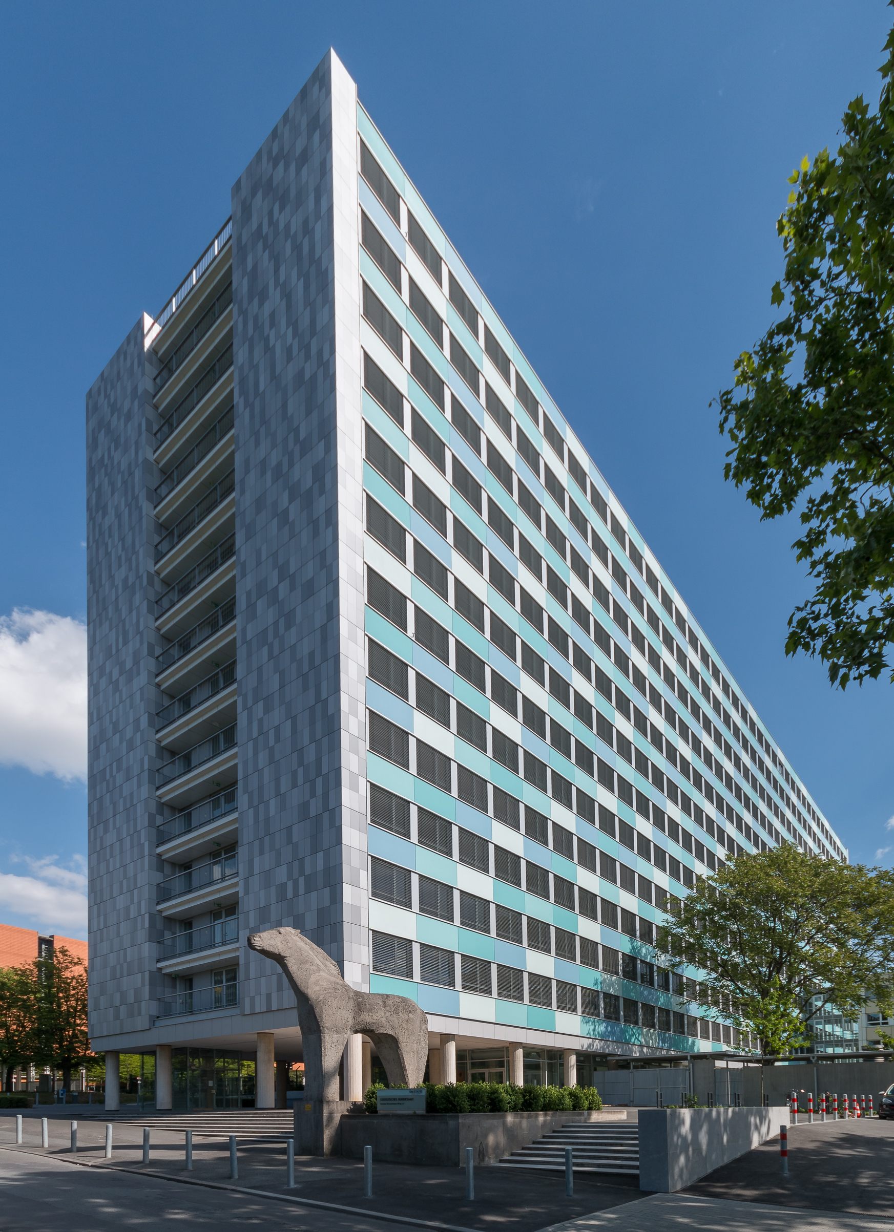
The Federal Statistical Office (german: Statistisches Bundesamt, shortened ''Destatis'') is a federal authority of Germany. It reports to the Federal Ministry of the Interior. The Office is responsible for collecting, processing, presenting and analysing statistical information concerning the topics economy, society and environment. The purpose is providing objective, independent and highly qualitative statistical information for the whole public. About 2300 staff members are employed in the departments in Wiesbaden, Bonn and Berlin. The department in Wiesbaden is the main office and runs the largest library specialised in statistical literature in Germany. It is also the Office of the President who is also by tradition, but not by virtue of the office, the Federal Returning Officer. In this position, they are the supervisor of the elections of the German Parliament ("Bundestag") and of the European Parliament. The Berlin Information Point is the service centre of the Federal ... [...More Info...] [...Related Items...] OR: [Wikipedia] [Google] [Baidu] |
Second World War
World War II or the Second World War, often abbreviated as WWII or WW2, was a world war that lasted from 1939 to 1945. It involved the vast majority of the world's countries—including all of the great powers—forming two opposing military alliances: the Allies and the Axis powers. World War II was a total war that directly involved more than 100 million personnel from more than 30 countries. The major participants in the war threw their entire economic, industrial, and scientific capabilities behind the war effort, blurring the distinction between civilian and military resources. Aircraft played a major role in the conflict, enabling the strategic bombing of population centres and deploying the only two nuclear weapons ever used in war. World War II was by far the deadliest conflict in human history; it resulted in 70 to 85 million fatalities, mostly among civilians. Tens of millions died due to genocides (including the Holocaust), starvat ... [...More Info...] [...Related Items...] OR: [Wikipedia] [Google] [Baidu] |
Cadastral Map
A cadastre or cadaster is a comprehensive recording of the real estate or real property's metes-and-bounds of a country.Jo Henssen, ''Basic Principles of the Main Cadastral Systems in the World,'/ref> Often it is represented graphically in a cadastral map. In most countries, legal systems have developed around the original administrative systems and use the cadastre to define the dimensions and location of land parcels described in legal documentation. A land parcel or cadastral parcel is defined as "a continuous area, or more appropriately volume, that is identified by a unique set of homogeneous property rights". Cadastral surveys document the Boundary (real estate), boundaries of land ownership, by the production of documents, diagrams, sketches, plans (''plats'' in the US), charts, and maps. They were originally used to ensure reliable facts for land valuation and taxation. An example from early England is the Domesday Book in 1086. Napoleon established a comprehensive ... [...More Info...] [...Related Items...] OR: [Wikipedia] [Google] [Baidu] |
Guild
A guild ( ) is an association of artisans and merchants who oversee the practice of their craft/trade in a particular area. The earliest types of guild formed as organizations of tradesmen belonging to a professional association. They sometimes depended on grants of letters patent from a monarch or other ruler to enforce the flow of trade to their self-employed members, and to retain ownership of tools and the supply of materials, but were mostly regulated by the city government. A lasting legacy of traditional guilds are the guildhalls constructed and used as guild meeting-places. Guild members found guilty of cheating the public would be fined or banned from the guild. Typically the key "privilege" was that only guild members were allowed to sell their goods or practice their skill within the city. There might be controls on minimum or maximum prices, hours of trading, numbers of apprentices, and many other things. These rules reduced free competition, but sometimes mainta ... [...More Info...] [...Related Items...] OR: [Wikipedia] [Google] [Baidu] |
Lippstadt
Lippstadt () is a town in North Rhine-Westphalia, Germany. It is the largest town within the district of Soest. Lippstadt is situated about 60 kilometres east of Dortmund, 40 kilometres south of Bielefeld and 30 kilometres west of Paderborn. Geography Lippstadt is situated in the Lippe valley, roughly 70 kilometres east of Dortmund and roughly 30 kilometres west of Paderborn. The historic town centre is situated between several branches of the river Lippe. Neighbouring municipalities Division of the town Lippstadt consists of 18 districts: History Lippstadt was founded in 1168 by Bernhard II zur Lippe. In the early 13th century Lippstadt, with a population of 2700, had four parish churches. There was an Augustinian abbey which had existed since 1281. From 1400, the enclave and town of Lippstadt were to be a condominium shared by the county of Lippe and the counts of Cleves-Mark, who were succeeded by the Hohenzollerns (Brandenburg/Prussia), a situation that endured until ... [...More Info...] [...Related Items...] OR: [Wikipedia] [Google] [Baidu] |
Pope Alexander II
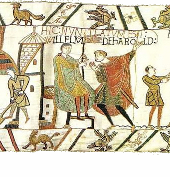
Pope Alexander II (1010/1015 – 21 April 1073), born Anselm of Baggio, was the head of the Roman Catholic Church and ruler of the Papal States from 1061 to his death in 1073. Born in Milan, Anselm was deeply involved in the Pataria reform movement. Elected according to the terms of his predecessor's bull, ''In nomine Domini'', Anselm's was the first election by the cardinals without the participation of the people and minor clergy of Rome. He also authorized the Norman Conquest of England in 1066. Early life and work Anselm was born in the parish of Cesano Boscone in the town of Corsico some 7 km (5 mi) from Milan of a noble family. The family took its name from Baggio. a suburb of Milan, where the family held the office of "captain". According to the ''Liber pontificalis'', his father's name was Anselmus or Ardericus. Contemporary sources do not provide any information on where Anselm might have obtained his education. It was traditionally believed that An ... [...More Info...] [...Related Items...] OR: [Wikipedia] [Google] [Baidu] |
Werden Abbey
Werden Abbey (german: Kloster Werden) was a Benedictine monastery in Essen-Werden (Germany), situated on the Ruhr. The foundation of the abbey Near Essen Saint Ludger founded a monastery in 799 and became its first abbot. The little church which Saint Ludger built here in honor of Saint Stephen was completed in 804 and dedicated by Saint Ludger himself, who had meanwhile become Bishop of Münster. Upon the death of Ludger on 26 March 809, the abbacy of Werden passed by inheritance first to his younger brother Hildigrim I (809–827), then successively to four of his nephews: Gerfried (827–839), Thiadgrim (ruled less than a year), Altfried (839–848), Hildigrim II (849–887). Under Hildigrim I, also Bishop of Châlons-sur-Marne, the new monastery of Helmstedt in the Diocese of Halberstadt was founded from Werden. It was ruled over by a provost, and remained a dependency of Werden till its secularization in 1803. Werden was a wealthy abbey with possessions in Westphali ... [...More Info...] [...Related Items...] OR: [Wikipedia] [Google] [Baidu] |
Hochsauerlandkreis
Hochsauerlandkreis (meaning “High Sauerland District” in German) is a Kreis (district) in the east of North Rhine-Westphalia, Germany. Neighboring districts are Soest, Paderborn, Höxter, Waldeck-Frankenberg, Siegen-Wittgenstein, Olpe, Märkischer Kreis. The district is named “High Sauerland” because two of the highest mountains of the Sauerland mountainous landscape, Langenberg and Kahler Asten are in its territory. With 2,766 ft / 843 m (Langenberg) and 2,762 ft / 842 m (Kahler Asten) these are also the highest mountains of North Rhine-Westphalia. History The district was established in 1975 in the reorganization of the districts in North Rhine-Westphalia by merging the previous districts Arnsberg, Brilon and Meschede. Geography Geographically the district covers a big part of the Sauerland mountains, including the highest and third highest elevation – the Langenberg near Olsberg with 2,766 ft / 843 m, and the better known Kahler Asten ... [...More Info...] [...Related Items...] OR: [Wikipedia] [Google] [Baidu] |


