|
Höljes
Höljes is a minor locality situated in Torsby Municipality, Värmland County, Sweden with 79 inhabitants in 2015. History The earliest farm in the area that later became Norra Finnskoga parish is Höljes. Erik Fernow's description of Värmland, Beskrivning öfwer Wermeland (1773 - 79), tells that there was only one inhabitant in northern Värmland during the 14th century and he lived in Höljes. His closest neighbor lived 150 km from him in Gräs in Sunnemo. The farm that Fernow is referring to is probably Gammalgården. Another recorder believes that well into the 16th century there was only one village in Norra Finnskoga, and it was Höljes, located where the Klarälven makes an islet-adorned extension called Höljessjön. Geography Höljes is located in the northernmost region of its province and county, about by road north of municipal centre Torsby. It is very isolated from any other settlements in Värmland and is in one of the most sparsely populated areas of Sweden ... [...More Info...] [...Related Items...] OR: [Wikipedia] [Google] [Baidu] |
Höljesbanan
Höljesbanan, also known as Höljes Motorstadion, is a rallycross circuit situated in the village of Höljes, in the Finnskogen ('Finnwoods') of the Swedish county Värmland, beside the river Klarälven and close to the Norwegian border. The circuit opened in February 1976 and is one of the most famous rallycross circuits in the world. Traditionally held over the first weekend of July the venue plays host to the so-called 'Magic Weekend' of rallycross when it runs the Swedish round of the European and World Rallycross championships. History The circuit was originally part of a go-kart centre opened in 1972 by the Finnskoga Motorklubb following the influx of Swedish drivers into Formula One, but quickly fell into disuse and it was decided the nearby gravel pit was to be turned into a rallycross circuit in October 1974. On February 1, 1976, the circuit held its first event in front of 3,500 people on a bitterly cold winters' day, and was won by Per Eklund. The circuit w ... [...More Info...] [...Related Items...] OR: [Wikipedia] [Google] [Baidu] |
World RX Of Sweden
The World RX of Sweden is a Rallycross event held in Sweden for the FIA World Rallycross Championship. The event made its debut in the 2014 season, at the Höljesbanan circuit in the village of Höljes. Past winners Source References External links {{commons category, World RX of Sweden Sweden Sweden, formally the Kingdom of Sweden,The United Nations Group of Experts on Geographical Names states that the country's formal name is the Kingdom of SwedenUNGEGN World Geographical Names, Sweden./ref> is a Nordic country located on ... Auto races in Sweden ... [...More Info...] [...Related Items...] OR: [Wikipedia] [Google] [Baidu] |
Värmland
Värmland () also known as Wermeland, is a '' landskap'' (historical province) in west-central Sweden. It borders Västergötland, Dalsland, Dalarna, Västmanland, and Närke, and is bounded by Norway in the west. Latin name versions are ''Varmelandia'', ''Vermelandia'', ''Wermelandia'', ''Værmalandia'', ''Værmolandia'', ''Virmolandia'' and ''Vermillandia''. Some of the Latinised forms show the origin of the name to come from the large local lake by the name of (from older ''*Virmil''); others from the river name ''*Værma'', the main outlet of that lake. The province was originally part of Götaland, and became part of Svealand in 1815. Geography The largest lake is Vänern. Most streams of importance lead to Vänern. However, the province is rich in small lakes, ponds and streams. The scenery, with mountains and lakes, is usually regarded as picturesque and has inspired painters and writers. Western Värmland There are several mountain plateaus in the western part of V ... [...More Info...] [...Related Items...] OR: [Wikipedia] [Google] [Baidu] |
Klarälven
Klarälven ("The clear river" in Swedish) is a river flowing through Norway and Sweden. Together with Göta älv, which it is called as the river has passed through the lake Vänern, thus regarded as an entity, Göta älv—Klarälven is the longest river in Scandinavia and in the Nordic countries and its Swedish part the longest river of Sweden. These two rivers also have the largest drainage basin in the same areas, including all the rivers that run into Vänern, of which is located in Sweden and in Norway. It emanates at the northeast side of Mount Brändstöten and flows through a couple of smaller lakes down to Lake Rogen in Härjedalen, Sweden, and then passes through the Norwegian Hedmark, where it flows through the lake Femunden. There it is known as Femundelva and Trysilelva. The rest of the river, the longest part, flows through Värmland to ultimately discharge in a delta into Vänern at Karlstad. In its turn, Vänern drains then into Göta älv, reaching the sea ... [...More Info...] [...Related Items...] OR: [Wikipedia] [Google] [Baidu] |
Swedish Meteorological And Hydrological Institute
The Swedish Meteorological and Hydrological Institute ( sv, Sveriges meteorologiska och hydrologiska institut, abbreviated SMHI) is a Government agency in Sweden and operates under the Ministry of the Environment. SMHI has expertise within the areas of meteorology, hydrology and oceanography, and has extensive service and business operations within these areas. History In 1873, ''Statens Meteorologiska Centralanstalt'' was founded, an autonomous part of the Royal Swedish Academy of Sciences, but the first meteorological observations began on July 1, 1874. It was not until 1880 that the first forecasts were issued. The latter will be broadcast on Stockholm radio from 19 February 1924.. In 1908, the Hydrographic Office (''Hydrografiska byrån'', HB) was created. Its task is to scientifically map Sweden's freshwater and collaborate with the weather service in taking certain weather observations such as precipitation and snow cover. In 1919, the two services merged and became th ... [...More Info...] [...Related Items...] OR: [Wikipedia] [Google] [Baidu] |
Snow Pack
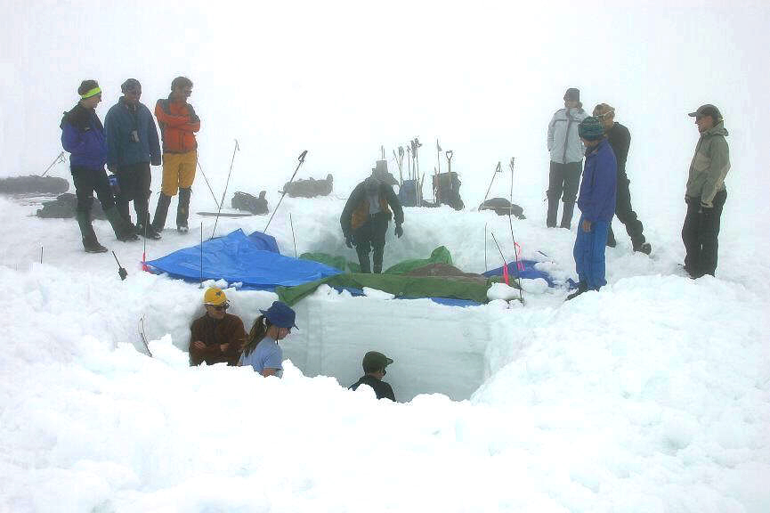
Snowpack forms from layers of snow that accumulate in geographic regions and high elevations where the climate includes cold weather for extended periods during the year. Snowpacks are an important water resource that feed streams and rivers as they melt. Therefore, snowpacks are both the drinking water source for many communities and a potential source of flooding (in case of sudden melting). Snowpacks also contribute mass to glaciers in their accumulation zone. Assessing the formation and stability of snowpacks is important in the study and prediction of avalanches. Scientists study the physical properties of snow under different conditions and their evolution, and more specifically snow metamorphism, snow hydrology (that is, the contribution of snow melt to catchment hydrology), the evolution of snow cover with climate change and its effect on the ice–albedo feedback and hydrology, both on the ground and by using remote sensing. Snow is also studied in a more global context ... [...More Info...] [...Related Items...] OR: [Wikipedia] [Google] [Baidu] |
Diurnal Temperature Variation
In meteorology, diurnal temperature variation is the variation between a high air temperature and a low temperature that occurs during the same day. Temperature lag Temperature lag is an important factor in diurnal temperature variation: peak daily temperature generally occurs ''after'' noon, as air keeps net absorbing heat even after noon, and similarly minimum daily temperature generally occurs substantially after midnight, indeed occurring during early morning in the hour around dawn, since heat is lost all night long. The analogous annual phenomenon is seasonal lag. As solar energy strikes the Earth's surface each morning, a shallow layer of air directly above the ground is heated by conduction. Heat exchange between this shallow layer of warm air and the cooler air above is very inefficient. On a warm summer's day, for example, air temperatures may vary by from just above the ground to waist height. Incoming solar radiation exceeds outgoing heat energy for many hours afte ... [...More Info...] [...Related Items...] OR: [Wikipedia] [Google] [Baidu] |
Climate Change
In common usage, climate change describes global warming—the ongoing increase in global average temperature—and its effects on Earth's climate system. Climate change in a broader sense also includes previous long-term changes to Earth's climate. The current rise in global average temperature is more rapid than previous changes, and is primarily caused by humans burning fossil fuels. Fossil fuel use, deforestation, and some agricultural and industrial practices increase greenhouse gases, notably carbon dioxide and methane. Greenhouse gases absorb some of the heat that the Earth radiates after it warms from sunlight. Larger amounts of these gases trap more heat in Earth's lower atmosphere, causing global warming. Due to climate change, deserts are expanding, while heat waves and wildfires are becoming more common. Increased warming in the Arctic has contributed to melting permafrost, glacial retreat and sea ice loss. Higher temperatures are also causing m ... [...More Info...] [...Related Items...] OR: [Wikipedia] [Google] [Baidu] |
Frost Hollow
In meteorology, an inversion is a deviation from the normal change of an atmospheric property with altitude. It almost always refers to an inversion of the air temperature lapse rate, in which case it is called a temperature inversion. Normally, air temperature decreases with an increase in altitude, but during an inversion warmer air is held above cooler air. An inversion traps air pollution, such as smog, close to the ground. An inversion can also suppress convection by acting as a "cap". If this cap is broken for any of several reasons, convection of any moisture present can then erupt into violent thunderstorms. Temperature inversion can notoriously result in freezing rain in cold climates. Normal atmospheric conditions Usually, within the lower atmosphere (the troposphere) the air near the surface of the Earth is warmer than the air above it, largely because the atmosphere is heated from below as solar radiation warms the Earth's surface, which in turn then warms the ... [...More Info...] [...Related Items...] OR: [Wikipedia] [Google] [Baidu] |
Seasonal Lag
Seasonal lag is the phenomenon whereby the date of maximum average air temperature at a geographical location on a planet is delayed until some time after the date of maximum insolation (i.e. the summer solstice). This also applies to the minimum temperature being delayed until some time after the date of minimum insolation. In most Northern Hemisphere regions, the month of February is usually colder than the month of November despite February having significantly later sunsets and more daylight overall. Conversely, the month of August is usually hotter than the month of May despite August having later sunrises, increasingly earlier sunsets, and less daylight overall. In all cases, the change in average air temperature lags behind the more consistent change in daylight patternsdelaying the perceived start of the next season for a month or so. An analogous temperature lag phenomenon occurs in diurnal temperature variation, where maximum daily temperature occurs after noon (maximu ... [...More Info...] [...Related Items...] OR: [Wikipedia] [Google] [Baidu] |
Götaland
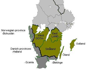
Götaland (; also '' Geatland'', '' Gothia'', ''Gothland'', ''Gothenland'' or ''Gautland'') is one of three lands of Sweden and comprises ten provinces. Geographically it is located in the south of Sweden, bounded to the north by Svealand, with the deep woods of Tiveden, Tylöskog and Kolmården marking the border. Götaland once consisted of petty kingdoms, and their inhabitants were called ''Gautar'' in Old Norse. However, the term mainly referred to the population of modern Västergötland. It is agreed that these were the same as the ''Geats'', the people of the hero Beowulf in England's national epic, ''Beowulf''. The modern state of Sweden started forming when some provinces of Götaland gradually became more and more politically intertwined with those of Svealand. This process can be traced back to at least the 11th century, and would continue for several hundred years. Other parts of modern Götaland were at that time either Danish or Norwegian. The province of Smålan ... [...More Info...] [...Related Items...] OR: [Wikipedia] [Google] [Baidu] |
Humid Continental Climate
A humid continental climate is a climatic region defined by Russo-German climatologist Wladimir Köppen in 1900, typified by four distinct seasons and large seasonal temperature differences, with warm to hot (and often humid) summers and freezing cold (sometimes severely cold in the northern areas) winters. Precipitation is usually distributed throughout the year but often do have dry seasons. The definition of this climate regarding temperature is as follows: the mean temperature of the coldest month must be below or depending on the isotherm, and there must be at least four months whose mean temperatures are at or above . In addition, the location in question must not be semi-arid or arid. The cooler ''Dfb'', ''Dwb'', and ''Dsb'' subtypes are also known as hemiboreal climates. Humid continental climates are generally found between latitudes 30° N and 60° N, within the central and northeastern portions of North America, Europe, and Asia. They are rare and isolat ... [...More Info...] [...Related Items...] OR: [Wikipedia] [Google] [Baidu] |


.png)
