|
Huérfano Mountain
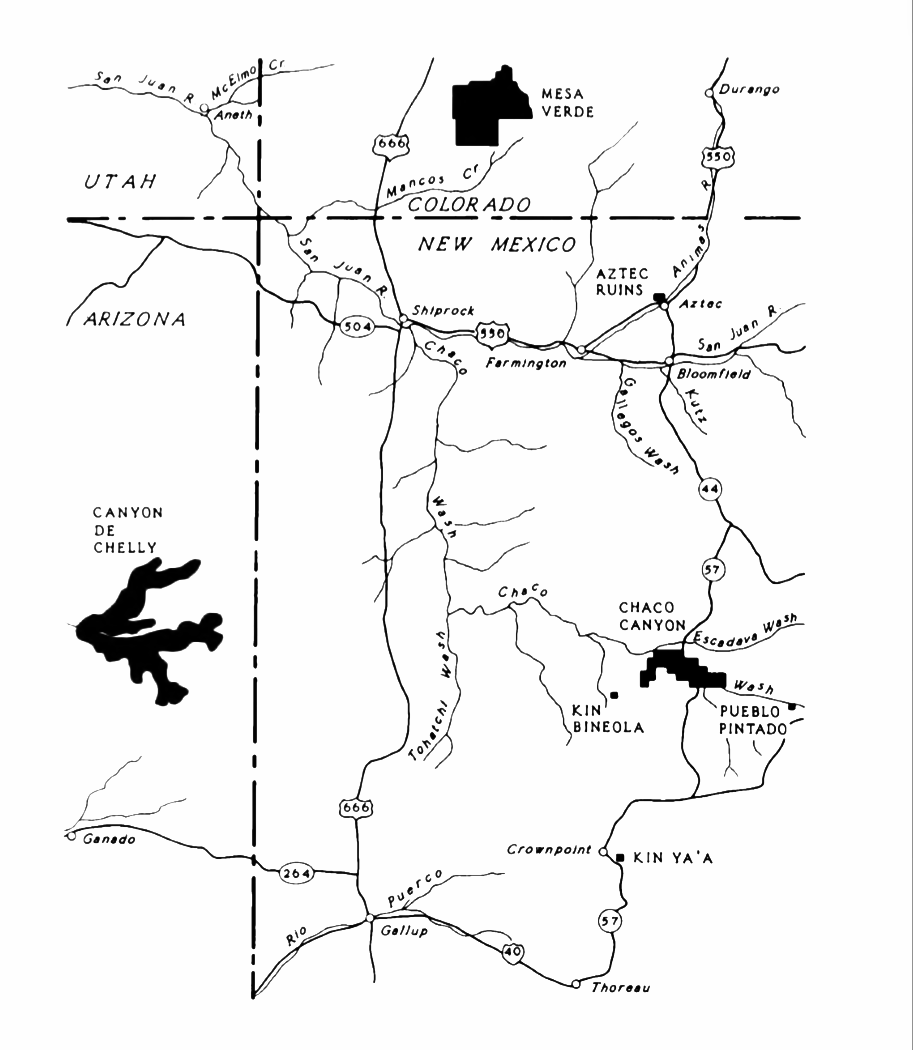
Huérfano Mountain (Navajo: ''Dził Náʼoodiłii'', "People Encircling the Mountain"), also known as Huerfano Mesa and El Huerfano, is one of the six sacred mountains in the mythology of the Navajo people. Located in San Juan County, New Mexico, the mountain is believed in Navajo culture to be the home of Yódí Atʼééd (Soft Goods Girl) and Yódí Ashkii (Soft Goods Boy). It is also thought to be the original home of ''Áłtsé Hastiin'' (First Man) and ''Áłtsé Asdzą́ą́'' (First Woman). Located at the center of the Navajo's ancestral homeland, the '' Dinetah'', Huérfano Mountain is composed of Eocene sandstone, and is considered one of two sacred "inner mountains". An Ancestral Puebloan long-distance communication system that utilized smoke and mirrors existed in the region, and direct lines of sight have been established between Huérfano Mountain, Chimney Rock Pueblo, and the Chacoan great house Pueblo Alto Pueblo Alto ("High Village" in Spanish) is an Ancest ... [...More Info...] [...Related Items...] OR: [Wikipedia] [Google] [Baidu] |
Navajo Language
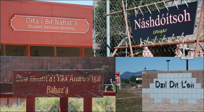
Navajo or Navaho ( ; Navajo: or ) is a Southern Athabaskan languages, Southern Athabaskan language of the Na-Dene languages, Na-Dené family, through which it is related to languages spoken across the western areas of North America. Navajo is spoken primarily in the Southwestern United States, especially in the Navajo Nation. It is one of the most widely spoken Indigenous languages of the Americas#Northern America, Native American languages and is the most widely spoken north of the Mexico–United States border, with almost 170,000 Americans speaking Navajo at home as of 2011. The language has struggled to keep a healthy speaker base, although this problem has been alleviated to some extent by extensive education programs in the Navajo Nation. In World War II, speakers of the Navajo language joined the military and developed a code for sending secret messages. These Code talker#Navajo, code talkers' messages are widely credited with saving many lives and winning some of the ... [...More Info...] [...Related Items...] OR: [Wikipedia] [Google] [Baidu] |
Navajo People
The Navajo or Diné are an Native Americans in the United States, Indigenous people of the Southwestern United States. Their traditional language is Navajo language, Diné bizaad, a Southern Athabascan language. The states with the largest Diné populations are Arizona (140,263) and New Mexico (108,305). More than three-quarters of the Diné population resides in these two states.American Factfinder United States Census Bureau The overwhelming majority of Diné are enrolled in the Navajo Nation. Some Diné are enrolled in the Colorado River Indian Tribes, another federally recognized tribe. With more than 399,494Becenti, Arlyssa [...More Info...] [...Related Items...] OR: [Wikipedia] [Google] [Baidu] |
San Juan County, New Mexico
San Juan County () is a County (United States), county located in the U.S. state of New Mexico. As of the 2020 United States census, 2020 census, its population was 121,661 making it the fifth-most populous county in New Mexico. Its county seat is Aztec, New Mexico, Aztec. The county was created in 1887. San Juan County is part of the Farmington, New Mexico, metropolitan statistical area. It is in the state's northwest corner and includes the New Mexico portion of the Four Corners. Geography According to the United States Census Bureau, U.S. Census Bureau, the county has a total area of , of which (0.5%) are covered by water. Indian reservations (and off-reservation trust lands) comprise 63.4% of the county's land area. The Navajo Nation takes up 60.45% and the Ute Mountain Ute Tribe Reservation occupies another 2.93%. The physical features include three rivers - the San Juan, Animas, and La Plata Rivers, and the Chuska Mountains and Shiprock Pinnacle to the west, volcan ... [...More Info...] [...Related Items...] OR: [Wikipedia] [Google] [Baidu] |
Eocene
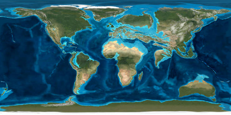
The Eocene ( ) is a geological epoch (geology), epoch that lasted from about 56 to 33.9 million years ago (Ma). It is the second epoch of the Paleogene Period (geology), Period in the modern Cenozoic Era (geology), Era. The name ''Eocene'' comes from the Ancient Greek (''Ēṓs'', 'Eos, Dawn') and (''kainós'', "new") and refers to the "dawn" of modern ('new') fauna that appeared during the epoch.See: *Letter from William Whewell to Charles Lyell dated 31 January 1831 in: * From p. 55: "The period next antecedent we shall call Eocene, from ήως, aurora, and χαινος, recens, because the extremely small proportion of living species contained in these strata, indicates what may be considered the first commencement, or ''dawn'', of the existing state of the animate creation." The Eocene spans the time from the end of the Paleocene Epoch to the beginning of the Oligocene Epoch. The start of the Eocene is marked by a brief period in which the concentration of the carbon isoto ... [...More Info...] [...Related Items...] OR: [Wikipedia] [Google] [Baidu] |
Sandstone
Sandstone is a Clastic rock#Sedimentary clastic rocks, clastic sedimentary rock composed mainly of grain size, sand-sized (0.0625 to 2 mm) silicate mineral, silicate grains, Cementation (geology), cemented together by another mineral. Sandstones comprise about 20–25% of all sedimentary rocks. Most sandstone is composed of quartz or feldspar, because they are the most resistant minerals to the weathering processes at the Earth's surface. Like uncemented sand, sandstone may be imparted any color by impurities within the minerals, but the most common colors are tan, brown, yellow, red, grey, pink, white, and black. Because sandstone beds can form highly visible cliffs and other topography, topographic features, certain colors of sandstone have become strongly identified with certain regions, such as the red rock deserts of Arches National Park and other areas of the Southwestern United States, American Southwest. Rock formations composed of sandstone usually allow the p ... [...More Info...] [...Related Items...] OR: [Wikipedia] [Google] [Baidu] |
Ancestral Puebloans
The Ancestral Puebloans, also known as Ancestral Pueblo peoples or the Basketmaker-Pueblo culture, were an ancient Native American culture of Pueblo peoples spanning the present-day Four Corners region of the United States, comprising southeastern Utah, northeastern Arizona, northwestern New Mexico, and southwestern Colorado. They are believed to have developed, at least in part, from the Oshara tradition, which developed from the Picosa culture. The Ancestral Puebloans lived in a range of structures that included small family pit houses, larger structures to house clans, grand pueblos, and cliff-sited dwellings for defense. They had a complex network linking hundreds of communities and population centers across the Colorado Plateau. They held a distinct knowledge of celestial sciences that found form in their architecture. The kiva, a congregational space that was used mostly for ceremonies, was an integral part of the community structure. Archaeologists continue to d ... [...More Info...] [...Related Items...] OR: [Wikipedia] [Google] [Baidu] |
Chimney Rock National Monument
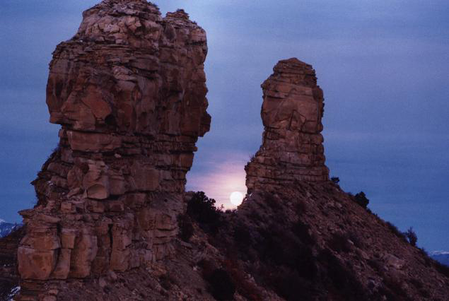
Chimney Rock National Monument is a U.S. National Monument in San Juan National Forest in southwestern Colorado which includes an archaeological site. This area is located in Archuleta County, Colorado, between Durango and Pagosa Springs, and is managed for archaeological protection, public interpretation, and education. The Chimney Rock Archaeological Site has been listed on the National Register of Historic Places since 1970. U.S. President Barack Obama created Chimney Rock National Monument by proclamation on September 21, 2012, under authority of the Antiquities Act. Geography Chimney Rock National Monument lies on 4,726 acres (19 km2) of San Juan National Forest land surrounded by the Southern Ute Indian Reservation. The Chimney Rock Archeological Area, listed in the National Register of Historic Places in 1970, consists of a central 960 acres. Chimney Rock itself is approximately 315 feet (96 m) tall. Next to Chimney Rock is Companion Rock, which is a po ... [...More Info...] [...Related Items...] OR: [Wikipedia] [Google] [Baidu] |
Chaco Culture National Historical Park
Chaco Culture National Historical Park is a United States National Historical Park in the American Southwest hosting a large concentration of pre-Columbian indigenous ruins of pueblos. The park is located in northwestern New Mexico, between Albuquerque and Farmington, in a remote canyon cut by the Chaco Wash. Containing the most sweeping collection of ancient ruins north of Mexico, the park preserves one of the most important cultural and historical areas in the United States. Between AD 900 and 1150, Chaco Canyon was a major cultural center for the Ancestral Puebloans. Chacoans quarried sandstone blocks and hauled timber from great distances, assembling fifteen major complexes that remained the largest buildings ever built in North America until the 19th century. Evidence of archaeoastronomy at Chaco has been proposed, with the "Sun Dagger" petroglyph at Fajada Butte a popular example. Many Chacoan buildings may have been aligned to capture the solar and lunar cycles, ... [...More Info...] [...Related Items...] OR: [Wikipedia] [Google] [Baidu] |
Great House (pueblo)
A great house is a large, multi-storied Ancestral Puebloans, Ancestral Puebloan structure; they were built between 850 and 1150. Whereas the term "great house" typically refers to structures in Chaco Culture National Historical Park, Chaco Canyon, they are also found in more northerly locations in the San Juan Basin, including the Mesa Verde region. The purpose of the structures is unclear, but may have been to house large numbers of people, religious leaders, or royalty. They were designed and constructed to provide shelter to inhabitants in an arid climate and had protective walls and small windows. History and purpose Great house construction flourished during the late 11th and early 12th centuries, and may have begun as early as 800. Mesa Verdeans usually built their great houses on the site of older villages. The earliest examples of structures similar to great houses have been found along the Mimbres River in New Mexico. Archeologists differ as to their purpose, but they m ... [...More Info...] [...Related Items...] OR: [Wikipedia] [Google] [Baidu] |
Pueblo Alto
Pueblo Alto ("High Village" in Spanish) is an Ancestral Puebloan The Ancestral Puebloans, also known as Ancestral Pueblo peoples or the Basketmaker-Pueblo culture, were an ancient Native American culture of Pueblo peoples spanning the present-day Four Corners region of the United States, comprising southe ... Great house (pueblo), great house and archaeological site located in Chaco Culture National Historical Park in northwestern New Mexico in the United States. Location Pueblo Alto is located at the top of a mesa near the middle of Chaco Canyon, from Pueblo Bonito. Its location made the community visible to most of the inhabitants of the San Juan Basin; indeed, it was only north of Tsin Kletsin, on the opposite side of the canyon. Description Begun between AD 1020 and 1050, the complex comprises 89 rooms in a single-story layout. Storage room, Storerooms at Pueblo Alto opened to the outside rather than into the interior rooms. Pueblo Alto shares its mesa wi ... [...More Info...] [...Related Items...] OR: [Wikipedia] [Google] [Baidu] |


