|
Humber Bay
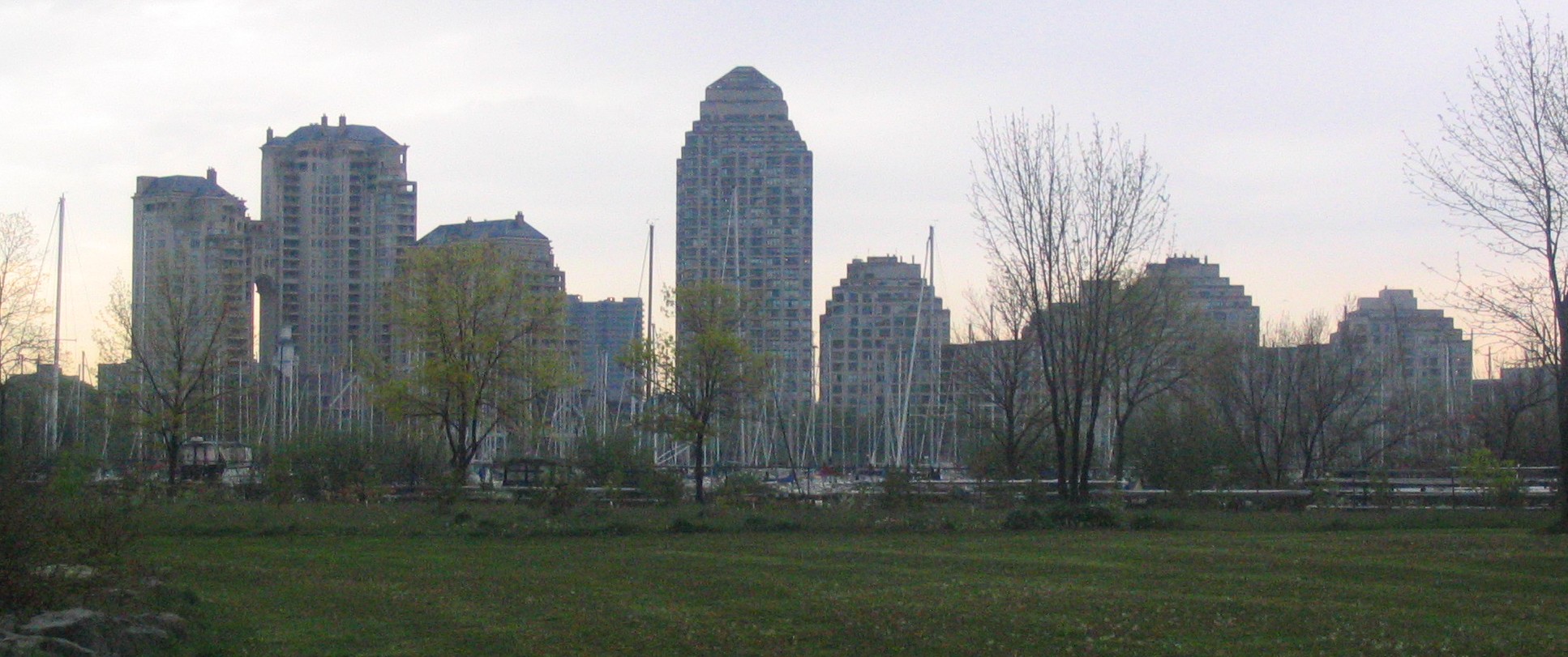
Humber Bay is a bay of Lake Ontario south of Toronto, Ontario, Canada. It is located between Ontario Place on the east and Mimico Creek to the west. The bay gives its name to Etobicoke's Humber Bay neighbourhood. History Prior to 1809 the bay was lined with a sandy shore with forest behind it. The area remained natural until later in the 19th century when it became developed with boathouses and various roadhouses and hotels. In 1802 a ferry service to cross Humber River was established by Richard Wilson. In 1882 ferry service, Humber River Ferry Company Limited was started from the Humber to Toronto by a consortium of hotel owners (Charles Nurse, John Duck and Octavius Hicks). This service ceased operations in 1886, but later and different ferry operations continued into the 1890s to Bathurst Street and York Street. The Toronto Harbour Commission reshaped the waterfront, infilling the shoreline by 100 yards from the Humber River east to Wilson Park Avenue. This would result ... [...More Info...] [...Related Items...] OR: [Wikipedia] [Google] [Baidu] |
Queen Elizabeth Way
The Queen Elizabeth Way (QEW) is a 400-series highway in the Canadian province of Ontario linking Toronto with the Niagara Peninsula and Buffalo, New York. The freeway begins at the Peace Bridge in Fort Erie and travels around the western end of Lake Ontario, ending at Highway 427 in Toronto. The physical highway, however, continues as the Gardiner Expressway into downtown Toronto. The QEW is one of Ontario's busiest highways, with an average of close to 200,000 vehicles per day on some sections. Major highway junctions are at Highway 420 in Niagara Falls, Highway 405 in Niagara-on-the-Lake, Highway 406 in St. Catharines, the Red Hill Valley Parkway in Hamilton, Highway 403 and Highway 407 in Burlington, Highway403 at the Oakville–Mississauga boundary, and Highway427 in Etobicoke. Within the Regional Municipality of Halton the QEW is signed concurrently with Highway403. The speed limit is throughout most of its length, with the e ... [...More Info...] [...Related Items...] OR: [Wikipedia] [Google] [Baidu] |
Long Branch, Toronto
Long Branch is a neighbourhood and former municipality in the south-west of Toronto, Ontario, Canada. It is located in the south-western corner of the former Township (and later, City) of Etobicoke on the shore of Lake Ontario. The Village of Long Branch was a partially independent municipality from 1930 to 1967. Long Branch is located within a land grant from the government to Colonel Samuel Smith in the late 18th century. After Smith's death, a small portion of it was developed as a summer resort in the late 1800s. Character Long Branch is primarily a residential district, composed mostly of single-family, detached homes. Along Lake Shore Boulevard West, numerous business are located in a low-rise commercial strip. South of Lake Shore Boulevard West, the area of single-family homes extends down to the lake. The area's lakeshore is primarily privately owned, except for Long Branch Park and Marie Curtis Park. Long Branch's population in 2011 was 9,625, a decline from 10,365 in 2 ... [...More Info...] [...Related Items...] OR: [Wikipedia] [Google] [Baidu] |
New Toronto
New Toronto is a neighbourhood and former municipality in Toronto, Ontario, Canada. It is located in the south-west area of Toronto, along Lake Ontario. The Town of New Toronto was established in 1890, and was designed and planned as an industrial centre by a group of industrialists from Toronto who had visited Rochester, New York. New Toronto was originally a part of the Township of Etobicoke. It was an independent municipality from 1913 to 1967, being one of the former ' Lakeshore Municipalities' amalgamated into the Borough of Etobicoke, and eventually amalgamated into Toronto. The neighbourhood has retained the name. Boundaries New Toronto is bounded by Lake Ontario to the south, with a western boundary of Twenty Third Street (south of Lake Shore Blvd. West) and the midpoint between Twenty-Second and Twenty-Fourth Streets (north of Lake Shore Blvd. West), the Canadian National Railway mainline to the north, and Dwight Avenue to the east. To the east is the neighbourhood ... [...More Info...] [...Related Items...] OR: [Wikipedia] [Google] [Baidu] |
Mimico
Mimico is a neighbourhood (and a former municipality) in Toronto, Ontario, Canada, being located in the south-west area of Toronto on Lake Ontario. It is in the south-east corner of the former Township (and later, City) of Etobicoke, and was an independent municipality from 1911 to 1967. Mimico is the oldest of the former Lakeshore Municipalities. The Town of Mimico was established by a plan of sub-division in 1856, but was not sub-divided from the former Township of Etobicoke until 1911. The land area of Mimico originated mainly from three family farms, namely: Stock Estate (North of Portland), Hendry Estate (between Royal York and Queens Ave), Van Every Estate (between Royal York Rd and Dwight Ave). Mimico was an independent municipality until 1967, when it was amalgamated into the new Borough of Etobicoke (later, City of, in 1984), which was itself amalgamated in 1998 into the current city of Toronto. Today, Mimico is primarily a residential area with two commercial strips; on ... [...More Info...] [...Related Items...] OR: [Wikipedia] [Google] [Baidu] |
Toronto Islands
The Toronto Islands are a chain of 15 small islands in Lake Ontario, south of mainland Toronto, Ontario, Canada. Comprising the only group of islands in the western part of Lake Ontario, the Toronto Islands are located just offshore from the city's downtown area, provide shelter for Toronto Harbour, and separate Toronto from the rest of Lake Ontario. The islands are home to the Toronto Island Park, the Billy Bishop Toronto City Airport, several private yacht clubs, a public marina, Centreville Amusement Park, a year-round residential neighbourhood, and several public beaches. The island community is the largest urban car-free community in North America. Public ferries operate year-round from Jack Layton Ferry Terminal, and privately operated water taxis operate from May to September. A pedestrian tunnel connects the mainland to the airport. The Toronto Islands are a popular tourist and recreational destination. Bicycles are accommodated on the ferries at no charge and can ... [...More Info...] [...Related Items...] OR: [Wikipedia] [Google] [Baidu] |
The Queensway – Humber Bay
''The'' () is a grammatical article in English, denoting persons or things already mentioned, under discussion, implied or otherwise presumed familiar to listeners, readers, or speakers. It is the definite article in English. ''The'' is the most frequently used word in the English language; studies and analyses of texts have found it to account for seven percent of all printed English-language words. It is derived from gendered articles in Old English which combined in Middle English and now has a single form used with pronouns of any gender. The word can be used with both singular and plural nouns, and with a noun that starts with any letter. This is different from many other languages, which have different forms of the definite article for different genders or numbers. Pronunciation In most dialects, "the" is pronounced as (with the voiced dental fricative followed by a schwa) when followed by a consonant sound, and as (homophone of pronoun ''thee'') when followed by a ... [...More Info...] [...Related Items...] OR: [Wikipedia] [Google] [Baidu] |
High Park
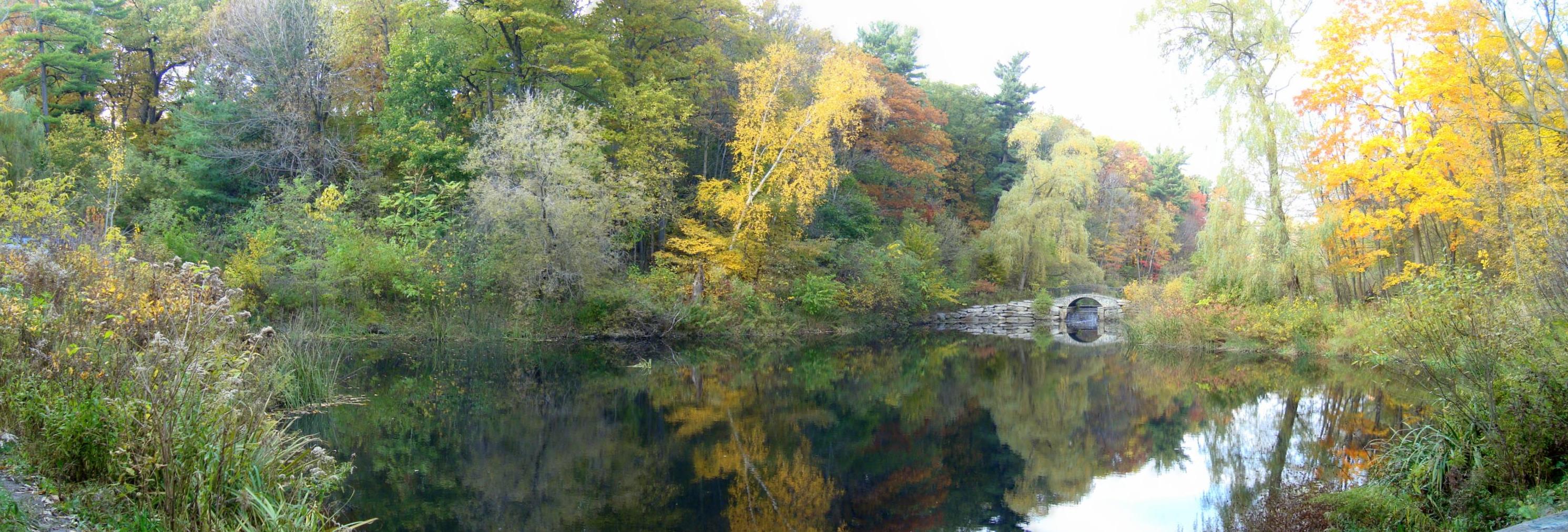
High Park is a municipal park in Toronto, Ontario, Canada. High Park is a mixed recreational and natural park, with sporting facilities, cultural facilities, educational facilities, gardens, playgrounds and a zoo. One-third of the park remains in a natural state, with a rare oak savannah ecology. High Park was opened to the public in 1876 and is based on a bequest of land from John George Howard to the City of Toronto. It spans and is the second-largest municipal park in Toronto, after Centennial Park. High Park is located to the west of downtown Toronto, north of Humber Bay, and is maintained by the City of Toronto Parks Department. It stretches south from Bloor Street West to The Queensway, just north of Lake Ontario. It is bounded on the west by Ellis Park Road and Grenadier Pond and on the east by Parkside Drive. Description The landscape in the park is hilly, with two deep ravines extending the full north-south distance of the park. Significant natural parts of the ... [...More Info...] [...Related Items...] OR: [Wikipedia] [Google] [Baidu] |
Sunnyside, Toronto
Sunnyside is a lakefront district in Toronto, Ontario, Canada. It includes a beach and park area along Lake Ontario's Humber Bay, from west of Exhibition Place to the mouth of the Humber River. The area has several recreation uses, including rowing clubs, sports clubs, picnic areas, playgrounds, a nightclub, a bathing pavilion and public pool. The area is a long strip along the lakeshore, bounded by the Gardiner Expressway and rail lines, which separate it from the Parkdale, Roncesvalles and Swansea neighbourhoods to the north. The name originates in a local farm owned by John Howard, which was situated just to the north, on the location of the current St. Joseph's Health Centre hospital. The area is first noted in Toronto history as the location of the landing of an 1813 attack in the War of 1812. As Toronto grew, High Park preserved the open space to the north, while the Sunnyside area along the lake was taken over by new rail lines and a hydro-electric line serving Toronto ... [...More Info...] [...Related Items...] OR: [Wikipedia] [Google] [Baidu] |
Humber Bay Arch Bridge
The Humber Bay Arch Bridge (also known as the Humber River Arch Bridge, the Humber River Pedestrian Bridge, or the Gateway Bridge) is a pedestrian and bicycle through arch bridge south of Lake Shore Boulevard West in Toronto, Ontario, Canada. Completed in the mid-1990s, the bridge is part of the Martin Goodman Trail and is in length, with a clear span of over the mouth of the Humber River to protect the environmental integrity of the waterway. Design The bridge is constructed of two diameter high-strength steel pipes, bent into twin arches that rise above grade, and suspend the deck by way of 44 stainless-steel hangers, each in diameter. The foundation consists of concrete-filled caissons which go down below grade to the bedrock. Designed in 1994 by Montgomery Sisam Architects of Toronto and Delcan Corporation (bridge engineers), it was constructed by Sonterlan Construction, and is the recipient of numerous local architectural, design and engineering awards. The bridge i ... [...More Info...] [...Related Items...] OR: [Wikipedia] [Google] [Baidu] |
Battle Of York
The Battle of York was a War of 1812 battle fought in York, Upper Canada (today's Toronto, Ontario, Canada) on April 27, 1813. An American force supported by a naval flotilla landed on the lakeshore to the west and advanced against the town, which was defended by an outnumbered force of regulars, militia and Ojibwe natives under the overall command of Major General Roger Hale Sheaffe, the Lieutenant Governor of Upper Canada. Sheaffe's forces were defeated and Sheaffe retreated with his surviving regulars to Kingston, abandoning the militia and civilians. The Americans captured the fort, town, and dockyard. They themselves suffered heavy casualties, including force leader Brigadier General Zebulon Pike and others killed when the retreating British blew up the fort's magazine. The American forces subsequently carried out several acts of arson and looting in the town before they withdrew several days later. Although the Americans won a clear victory, the battle did not have dec ... [...More Info...] [...Related Items...] OR: [Wikipedia] [Google] [Baidu] |
Fort Rouillé
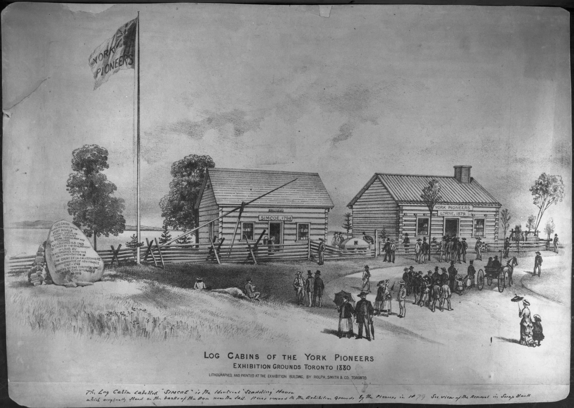
Fort Rouillé was a French trading post located in what is now Toronto, Ontario, Canada. Fort Rouillé was constructed by the French in 1751, building upon the success of a trading post they established in the area a year earlier, known as Fort Toronto. Fort Rouillé was named for Antoine Louis Rouillé, who at the time of its establishment was Secretary of State for the Navy in the administration of King Louis XV of France. It served as a trading post with the local indigenous peoples from the region. Fort Rouillé was evacuated and burnt down by its French garrison after the French defeat at Fort Niagara in July 1759, during the French and Indian War. The remains of the fort were demolished in the 19th century. The fort site is now part of the public lands of Exhibition Place. The location is marked by an obelisk monument, with the outline of the fort marked in concrete. History During the late 17th and 18th centuries, the area surrounding Toronto was frequently used by Fre ... [...More Info...] [...Related Items...] OR: [Wikipedia] [Google] [Baidu] |

.jpg)


.png)


