|
Hudson–Bergen Light Rail
The Hudson–Bergen Light Rail (HBLR) is a light rail system in Hudson County, New Jersey, United States. Owned by New Jersey Transit (NJT) and operated by the 21st Century Rail Corporation, it connects the communities of Bayonne, Jersey City, Hoboken, Weehawken, Union City (at the city line with West New York), and North Bergen. The system began operating its first segment in April 2000, expanded in phases during the next decade, and was completed with the opening of its southern terminus on January 31, 2011. The line generally runs parallel to the Hudson River and Upper New York Bay, while its northern end and its western branch travel through the lower Hudson Palisades. HBLR has 24 stations along a total track length of for each of its two tracks and serves over 52,000 weekday passengers. Despite its name, the system does not serve Bergen County, into which long-standing plans for expansion have not advanced. The project was financed by a mixture of state and federa ... [...More Info...] [...Related Items...] OR: [Wikipedia] [Google] [Baidu] |
Jersey Avenue Station (Hudson–Bergen Light Rail)
Jersey Avenue is a station on the Hudson–Bergen Light Rail (HBLR) located south of Grand Street in Jersey City, New Jersey. The station opened on April 15, 2000. There are two tracks and an island platform. Northbound service from the station is available to Hoboken Terminal and Tonnelle Avenue in North Bergen. Southbound service is available to terminals at West Side Avenue in Jersey City or 8th Street in Bayonne. Connection to PATH trains to Midtown Manhattan and to New Jersey Transit commuter train service are available at Hoboken Terminal. Transfers to PATH trains to Newark, Harrison, and Downtown Manhattan are available at Exchange Place. The station is in the developing Liberty Harbor neighborhood near the Jersey City Medical Center The Jersey City Medical Center is a hospital in Jersey City, New Jersey. The hospital has had different facilities in the city. It is currently located on a 15-acre campus at Grand Street and Jersey Avenue overlooking New York H ... [...More Info...] [...Related Items...] OR: [Wikipedia] [Google] [Baidu] |
Union City, New Jersey
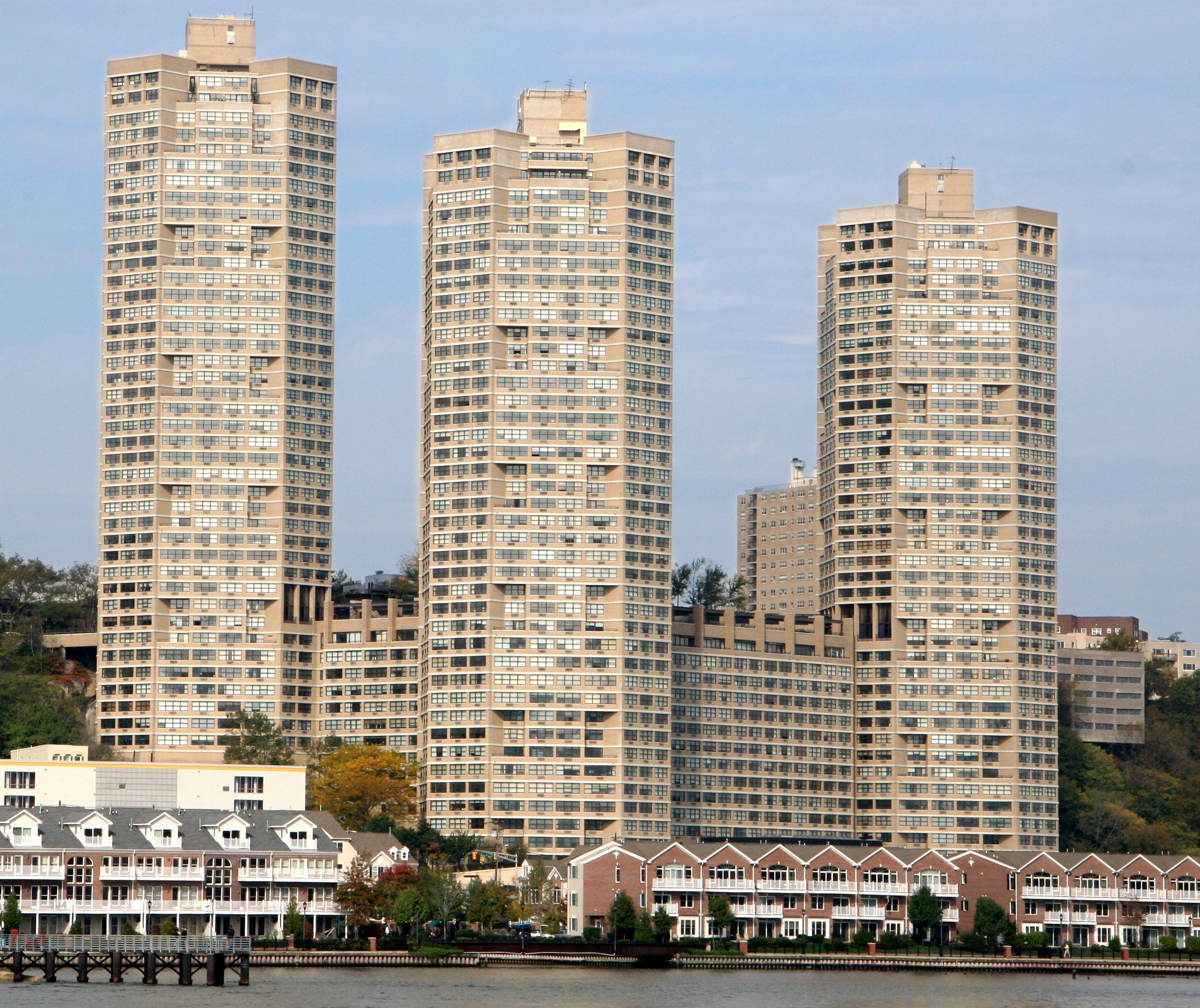
Union City is a city in the northern part of Hudson County, New Jersey, United States. According to the 2020 United States Census the city had a total population of 68,589,DP-1 - Profile of General Population and Housing Characteristics: 2010 for Union City city, Hudson County, New Jersey . Accessed January 24, 2012. [...More Info...] [...Related Items...] OR: [Wikipedia] [Google] [Baidu] |
Washington Group International
Washington Group International was an American corporation which provided integrated engineering, construction, and management services to businesses and governments around the world. Based in Boise, Idaho, WGI had approximately 25,000 employees working in over 40 US states and more than 30 countries. Its primary areas of expertise were: infrastructure, mining, industrial/process, energy & environment, and power. It was acquired by URS Corporation of San Francisco in November 2007 for $3.1 billion, subsequently purchased by AECOM. Washington Construction At the age of 30, Dennis R. Washington founded Washington Construction Company in Missoula, Montana in 1964. He guided the company to the top of the civil construction market in Montana, and expanded into mining, industrial construction, and environmental cleanup work. As his company grew into a major regional firm, Washington's vision for the future continued to expand also - leading to a series of acquisitions that produced an ... [...More Info...] [...Related Items...] OR: [Wikipedia] [Google] [Baidu] |
List Of Fixed Crossings Of The North River (Hudson River)
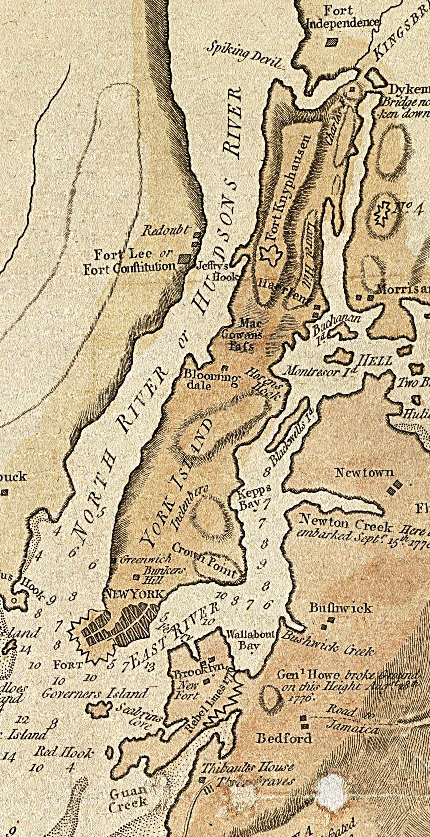
North River is an alternative name for the southernmost portion of the Hudson River in the vicinity of New York City and northeastern New Jersey in the United States. The entire watercourse was known as the North River by the Dutch in the early seventeenth century; the term fell out of general use for most of the river's 300+ mile course during the early 1900s. The name remains in limited use among local mariners and others and on some nautical charts and maps. The term is also used for infrastructure on and under the river, such as the North River piers, North River Tunnels, and the North River Wastewater Treatment Plant. At different times "North River" has referred to: * the entire Hudson * the approximate 160-mile portion of the Hudson below its confluence with the Mohawk River, which is under tidal influence * the portion of it running between Manhattan and New Jersey * the length flowing between Lower Manhattan and Hudson County, New Jersey. Its history is strongly co ... [...More Info...] [...Related Items...] OR: [Wikipedia] [Google] [Baidu] |
Hudson Waterfront
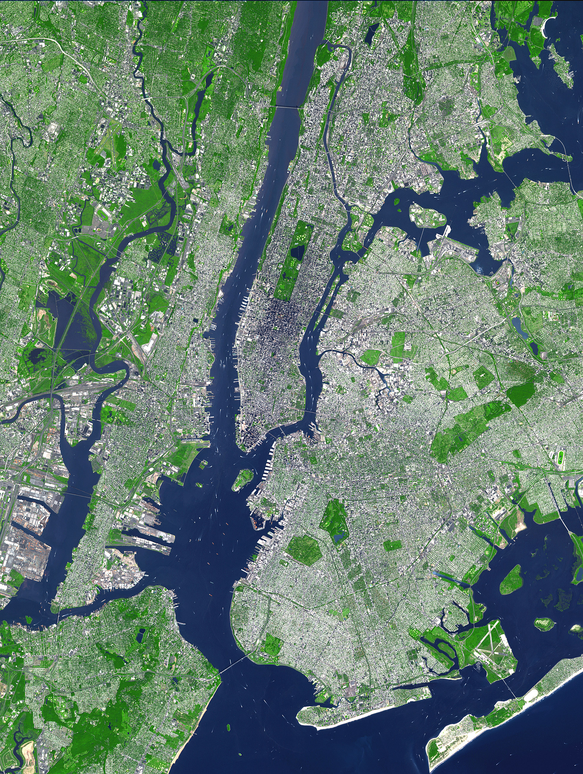
The Hudson Waterfront is an urban area of northeastern New Jersey along the lower reaches of the Hudson River, the Upper New York Bay and the Kill van Kull. Though the term can specifically mean the shoreline, it is often used to mean the contiguous urban area between the Bayonne Bridge and the George Washington Bridge that is approximately long. Historically, the region has been known as Bergen Neck, the lower peninsula, and Bergen Hill, lower Hudson Palisades. It has sometimes been called the Gold Coast. The municipalities comprising the Hudson Waterfront are Bayonne, Jersey City, Hoboken, Union City, Weehawken, West New York, Guttenberg and North Bergen in Hudson County and Fairview, Cliffside Park, Edgewater and Fort Lee in Bergen County. To the east, lies the New York City boroughs of Manhattan and Brooklyn, to the south Staten Island, to the west Newark Bay and the New Jersey Meadowlands, and to the north the Northern Valley & Palisades Interstate Park. The ... [...More Info...] [...Related Items...] OR: [Wikipedia] [Google] [Baidu] |
Public Transportation
Public transport (also known as public transportation, public transit, mass transit, or simply transit) is a system of transport for passengers by group travel systems available for use by the general public unlike private transport, typically managed on a schedule, operated on established routes, and that charge a posted fee for each trip. There is no rigid definition; the ''Encyclopædia Britannica'' specifies that public transportation is within urban areas, and air travel is often not thought of when discussing public transport—dictionaries use wording like "buses, trains, etc." Examples of public transport include city buses, trolleybuses, trams (or light rail) and passenger trains, rapid transit (metro/subway/underground, etc.) and ferries. Public transport between cities is dominated by airlines, coaches, and intercity rail. High-speed rail networks are being developed in many parts of the world. Most public transport systems run along fixed routes with set emba ... [...More Info...] [...Related Items...] OR: [Wikipedia] [Google] [Baidu] |
List Of United States Cities By Population Density
The following is a list of incorporated places in the United States with a population density of over 10,000 people per square mile. As defined by the United States Census Bureau, an incorporated place is a place that has a self-governing local government and as such has been " incorporated" by the state it is in. Each state has different laws defining how a place can be incorporated. An "incorporated place" as recognized by the U.S. Census Bureau can designate a variety of places, such as a city, town, village, borough, and township. The other type of place defined by the U.S. Census Bureau for statistical purposes are census-designated places. Census-designated places are distinct from incorporated places because they do not have a local government and thus depend on higher government bodies, such as a county, for governance. Census-designated places are defined as being in an unincorporated area. Census-designated places that have a population density of over 10,000 people p ... [...More Info...] [...Related Items...] OR: [Wikipedia] [Google] [Baidu] |
Transit-oriented Development
In urban planning, transit-oriented development (TOD) is a type of urban development that maximizes the amount of residential, business and leisure space within walking distance of public transport. It promotes a symbiotic relationship between dense, compact urban form and public transport use. In doing so, TOD aims to increase public transport ridership by reducing the use of private cars and by promoting sustainable urban growth. TOD typically includes a central transit stop (such as a train station, or light rail or bus stop) surrounded by a high-density mixed-use area, with lower-density areas spreading out from this center. TOD is also typically designed to be more walkable than other built-up areas, by using smaller block sizes and reducing the land area dedicated to automobiles. The densest areas of TOD are normally located within a radius of to mile (400 to 800 m) around the central transit stop, as this is considered to be an appropriate scale for pedestri ... [...More Info...] [...Related Items...] OR: [Wikipedia] [Google] [Baidu] |
Smart Growth
Smart growth is an urban planning and transportation theory that concentrates growth in compact walkable urban centers to avoid sprawl. It also advocates compact, transit-oriented, walkable, bicycle-friendly land use, including neighborhood schools, complete streets, and mixed-use development with a range of housing choices. The term "smart growth" is particularly used in North America. In Europe and particularly the UK, the terms " compact city", " urban densification" or "urban intensification" have often been used to describe similar concepts, which have influenced government planning policies in the UK, the Netherlands and several other European countries. Smart growth values long-range, regional considerations of sustainability over a short-term focus. Its sustainable development goals are to achieve a unique sense of community and place; expand the range of transportation, employment, and housing choices; equitably distribute the costs and benefits of development; pres ... [...More Info...] [...Related Items...] OR: [Wikipedia] [Google] [Baidu] |
Bergen County
Bergen County is the most populous county in the U.S. state of New Jersey.Annual Estimates of the Resident Population: April 1, 2010 to July 1, 2018 - 2018 Population Estimates , . Accessed May 17, 2019. As of the 2020 U.S. census, the county's population was 955,732, an increase of 50,616 (5.6%) from the 905,116 residents in the [...More Info...] [...Related Items...] OR: [Wikipedia] [Google] [Baidu] |
Bergen Hill
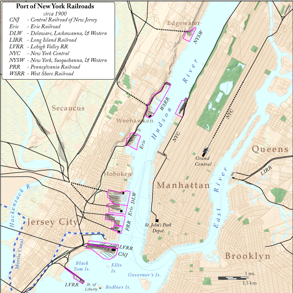
Bergen Hill refers to the lower Hudson Palisades in New Jersey, where they emerge on Bergen Neck, which in turn is the peninsula between the Hackensack and Hudson Rivers, and their bays. In Hudson County, it reaches a height of 260 feet. Rail Defining features of Bergen Hill include the 19th century and early 20th century railroad rights-of-way. Cuts and tunnels created to provide access to the terminals and ferries on the North River (Hudson River) and Upper New York Bay, and eventually under the river. From south to north they are: * The Central Railroad of New Jersey lines traveled on the CRRNJ Newark Bay Bridge across Newark Bay and through Bayonne and Greenville to its Communipaw Terminal. Portions are used by the Hudson Bergen Light Rail. * The Jersey City, Newark and Western Railway (later the Lehigh Valley Terminal Railway) freight line on the bridge over Newark Bay and across Pamrapo is now used by CSX Transportation as the National Docks Secondary to Por ... [...More Info...] [...Related Items...] OR: [Wikipedia] [Google] [Baidu] |
Upper New York Bay
New York Harbor is at the mouth of the Hudson River where it empties into New York Bay near the East River tidal estuary, and then into the Atlantic Ocean on the east coast of the United States. It is one of the largest natural harbors in the world, and is frequently named the best natural harbor in the world. It is also known as Upper New York Bay, which is enclosed by the New York City boroughs of Manhattan, Brooklyn, and Staten Island and the Hudson County, New Jersey municipalities of Jersey City and Bayonne. The name may also refer to the entirety of New York Bay including Lower New York Bay. Although the United States Board on Geographic Names does not use the term, ''New York Harbor'' has important historical, governmental, commercial, and ecological usages. Overview The harbor is fed by the waters of the Hudson River (historically called the North River as it passes Manhattan), as well as the Gowanus Canal. It is connected to Lower New York Bay by the Narr ... [...More Info...] [...Related Items...] OR: [Wikipedia] [Google] [Baidu] |


