|
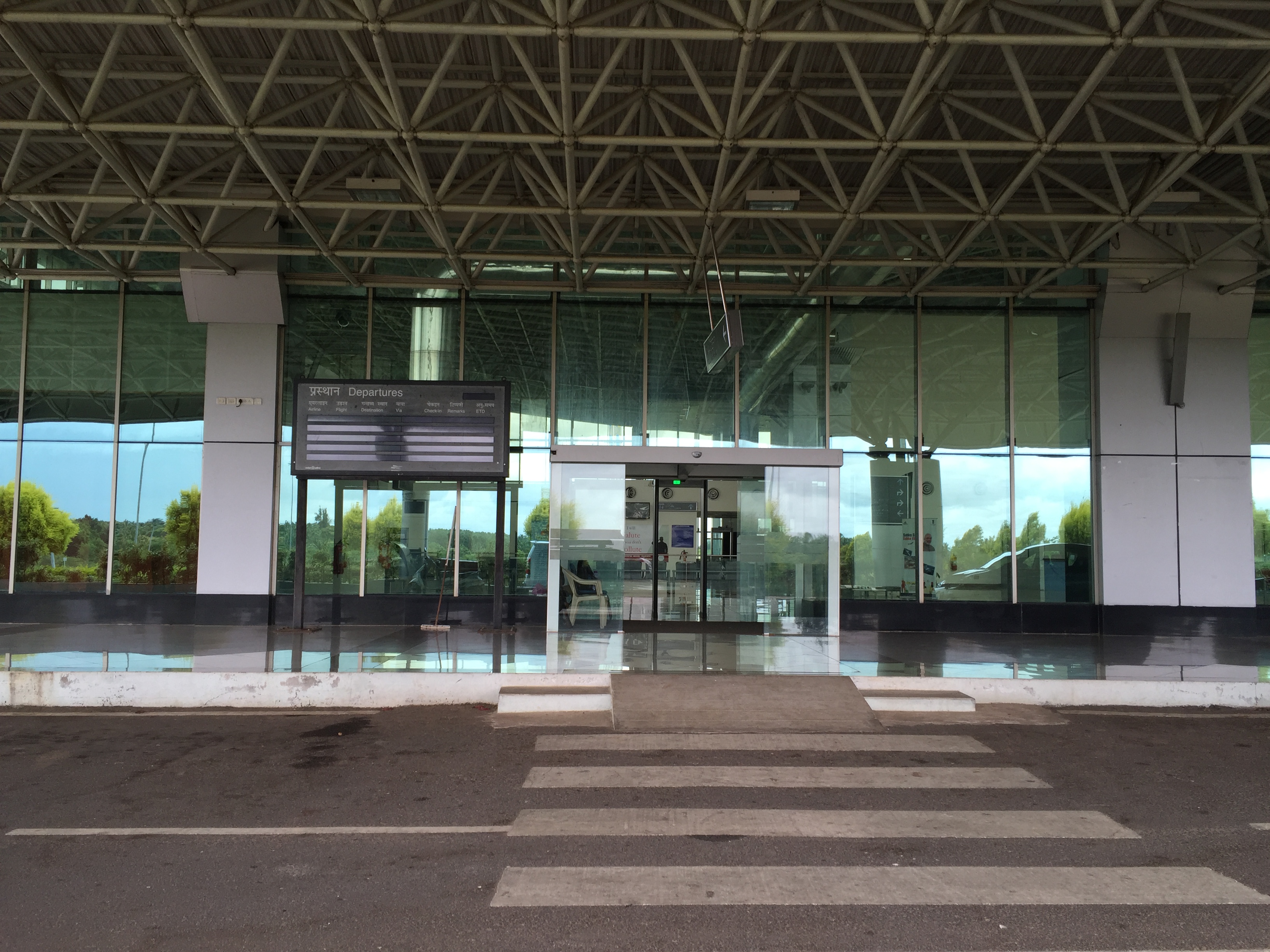
Hubballi Airport
Hubli Airport is a domestic airport serving the twin cities of Hubli and Dharwad in the state of Karnataka, India. It is situated on Gokul Road, 8 kilometres from Hubli and from Dharwad. It is connected with 10 destinations throughout the country. Hubli Airport has been made self-reliant in terms of electricity generation, with the commissioning of an 8 megawatt (MW) ground-mounted grid-connected photovoltaic solar plant in April 2021. History The need for an Airport at Hubli was felt way back in 1954 when the region was under the Mumbai (then Bombay) presidency. Due to States Reorganisation Act, 1956, States Reorganisation Act, Hubli shifted from being a part of Bombay presidency to the newly formed Karnataka state. Consequently land acquisition was delayed and done only by 1974. The construction and development of the airport was carried out by the Public Works Department (PWD) of Karnataka. Airport Authority of India took over the airport from Karnataka PWD during 1996 an ... [...More Info...] [...Related Items...] OR: [Wikipedia] [Google] [Baidu] |
Airports Authority Of India
The Airports Authority of India, or AAI, is a public sector enterprise under the ownership of the Ministry of Civil Aviation, Government of India. It is responsible for creating, upgrading, maintaining, and managing civil aviation infrastructure in India. It provides Communication Navigation Surveillance/Air Traffic Management (CNS/ATM) services over Indian airspace and adjoining oceanic areas. AAI is currently managing a total of 137 airports, including 34 international airports, 10 Customs Airports, 81 domestic airports, and 23 Civil enclaves at defense airfields. AAI also has ground installations at all airports and 25 other locations to ensure the safety of aircraft operations. AAI covers all major air routes over Indian landmass via 29 Radar installations at 11 locations along with 700 VOR/DVOR installations co-located with Distance Measuring Equipment (DME). 52 runways are provided with Instrument landing system (ILS) installations with Night Landing Facilities at most of ... [...More Info...] [...Related Items...] OR: [Wikipedia] [Google] [Baidu] |
Airbus A320
The Airbus A320 family is a series of narrow-body airliners developed and produced by Airbus. The A320 was launched in March 1984, first flew on 22 February 1987, and was introduced in April 1988 by Air France. The first member of the family was followed by the longer A321 (first delivered in January 1994), the shorter A319 (April 1996), and the even shorter A318 (July 2003). Final assembly takes place in Toulouse in France; Hamburg in Germany; Tianjin in China since 2009; and in Mobile, Alabama in the United States since April 2016. The twinjet has a six-abreast cross-section and is powered by either CFM56 or IAE V2500 turbofans, except the CFM56/PW6000 powered A318. The family pioneered the use of digital fly-by-wire and side-stick flight controls in airliners. Variants offer maximum take-off weights from , to cover a range. The 31.4 m (103 ft) long A318 typically accommodates 107 to 132 passengers. The 124-156 seat A319 is 33.8 m (111 ft) long. ... [...More Info...] [...Related Items...] OR: [Wikipedia] [Google] [Baidu] |
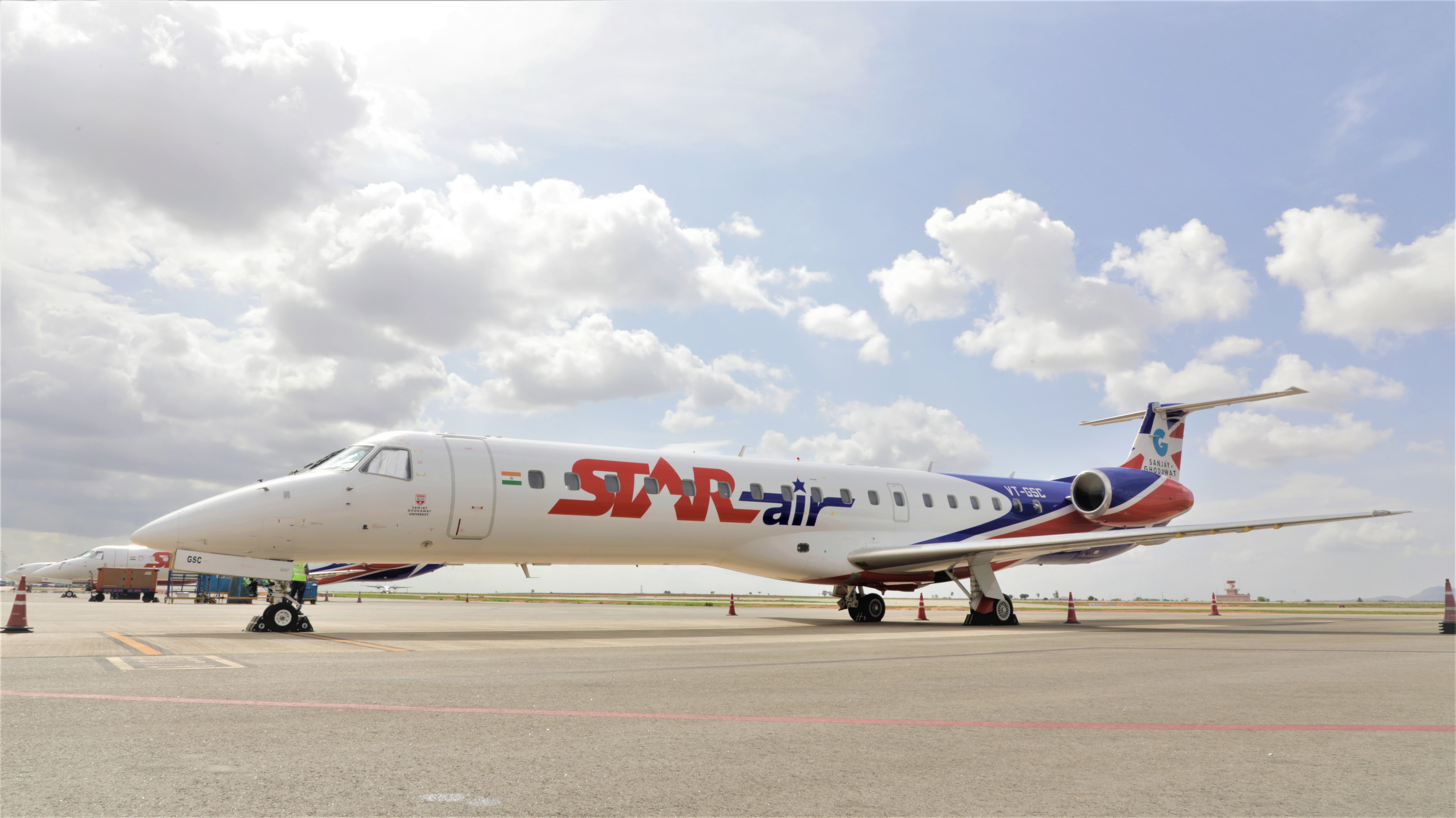
Star Air (India)
Ghodawat Enterprises Pvt. Ltd. doing business as Star Air, is an Indian commuter airline based at Kempegowda International Airport in Bangalore, Karnataka. It started operations in January 2019, offering flights within Karnataka state as well as to neighboring Andhra Pradesh, Gujarat, Madhya Pradesh, Rajasthan, Uttar Pradesh, Maharashtra, as part of the Central Government's UDAN scheme. The airline makes use of Embraer 145 LRs for its services. History Sanjay Ghodawat Group, the parent company of Star Air, sought permission from the Central Government in March 2017 to establish a scheduled passenger airline called Star Air. The airline acquired its first aircraft, an Embraer 145LR, in June 2018. It obtained its Air Operator's Certificate in early January of the following year and announced that it would operate flights under the Central Government's UDAN scheme, which aims to improve regional connectivity within India. Kempegowda International Airport in Bangalore was selected ... [...More Info...] [...Related Items...] OR: [Wikipedia] [Google] [Baidu] |
Mysore Airport
Mysore Airport , also known as Mandakalli Airport, is a domestic airport serving Mysore, a city in the Indian state of Karnataka. It is located near the village of Mandakalli, south of the city, and is owned and operated by the Airports Authority of India (AAI). As of January 2023, the airport has regular daily flights to Chennai, Hyderabad and Goa. The airport's history dates to the 1940s, when it was constructed by the Kingdom of Mysore. Passenger service, training flights of the Indian Air Force, and other operations took place at Mysore Airport during its first several decades. History In 1940, the Princely State of Mysore established the airport on of land. Following Indian independence in 1947, the Government of Karnataka assumed control of the airfield. The Ministry of Civil Aviation took control in 1950. Passenger service to Bangalore using Dakota aircraft began, but it did not last long as people found travel by road to be faster. Thereafter, ''The Hindu'' star ... [...More Info...] [...Related Items...] OR: [Wikipedia] [Google] [Baidu] |
Chhatrapati Shivaji Maharaj International Airport
Chhatrapati Shivaji Maharaj International Airport is an international airport serving Mumbai and the Mumbai Metropolitan Region (MMR). It is the second busiest airport in the country in terms of total and international passenger traffic after Delhi, and was the 14th busiest airport in Asia and 41st busiest airport in the world by passenger traffic in calendar year 2019. Its passenger traffic was about 49.8 million in year 2018. It is also the second busiest airport in terms of cargo traffic. In March 2017, the airport surpassed London's Gatwick Airport as the world's busiest to operate a single runway at a time. This was later surpassed again by Gatwick Airport at the end of 2019 due to passenger numbers falling at Mumbai. The airport's IATA code ''BOM'' is associated with "Bombay", the city's former legal name. It has two operating terminals spread over a total land area of and handles about 950 aircraft movements per day. It handled a record of 1,007 aircraft m ... [...More Info...] [...Related Items...] OR: [Wikipedia] [Google] [Baidu] |
Mangalore International Airport
Mangalore International Airport , is an international airport serving the coastal city of Mangalore, India. It is one of the only two international airports in Karnataka, the other being Kempegowda International Airport, Bangalore. Mangalore International Airport is the second busiest airport in Karnataka. In addition to domestic destinations, flights depart daily for major cities in the Middle East. The airport was named Bajpe Aerodrome, when it opened on 25 December 1951 by former Prime Minister Jawaharlal Nehru arrived then on a Douglas DC-3 aircraft. Overview The airport is near Bajpe, around northeast of Mangalore city centre. It is on top of a hill, with two tabletop runways (09/27 and 06/24). Only two other airports in India have tabletop runways – Kozhikode and Lengpui. The very small and basic terminal was renovated in the early 2000s, adding parking controls, additional seating and additional cafés. The airport was initially used for limited domestic fl ... [...More Info...] [...Related Items...] OR: [Wikipedia] [Google] [Baidu] |
Rajiv Gandhi International Airport
Rajiv Gandhi International Airport (RGIA) is an international airport that serves Hyderabad, the capital of the Indian state of Telangana. It is located in Shamshabad, about south of Hyderabad and it was opened on 23 March 2008 to replace Begumpet Airport, which was the sole civilian airport serving Hyderabad. It is named after Rajiv Gandhi, former Prime Minister of India. Built over an area of , it is the largest airport of India by area. It is owned and operated by GMR Hyderabad International Airport Limited (GHIAL), a public–private consortium. It has also ranked in AirHelp's list of top 10 airports in the world. The fourth busiest airport in India by passengers traffic, it handled 12.4 million passengers of cargo between both April 2021 and March 2022. Rajiv Gandhi International Airport is India's first greenfield airport built under a public-private partnership model. The airport has an integrated passenger terminal, a cargo terminal and two runways. There are ... [...More Info...] [...Related Items...] OR: [Wikipedia] [Google] [Baidu] |
Indira Gandhi International Airport
Indira Gandhi International Airport is the primary international airport serving Delhi, the capital of India, and the National Capital Region (NCR). The airport, spread over an area of , is situated in Palam, Delhi, southwest of the New Delhi Railway Station and from New Delhi city centre. Named after Indira Gandhi (1917–1984), the former Prime Minister of India, it is the busiest airport of India in terms of passenger traffic since 2009. It is also the busiest airport in the country in terms of cargo traffic, overtaking Mumbai during late 2015. As of 2022, it is the seventh busiest airport in the world, as per the latest rankings issued by UK-based air consultancy firm OAG. It is the second busiest airport in the world by seating capacity, having a seating capacity of 3,611,181 seats, and the busiest airport in Asia by passenger traffic handling nearly 37.14 million passengers in 2021. The airport was operated by the Indian Air Force before its management was tra ... [...More Info...] [...Related Items...] OR: [Wikipedia] [Google] [Baidu] |
Chennai International Airport
Chennai International Airport is an international airport serving the city of Chennai, Tamil Nadu and its metropolitan area. It is located in Tirusulam, southwest of the city centre. Chennai International Airport is the sixth busiest airport in India and third busiest airport for international traffic in India. It was also 49th busiest airport in Asia in 2018 making it one of the four major airports in India under the top 50 list of 2018. In financial year 2021, the airport handled 9.53 million passengers. The airport is served by the airport metro station of the Chennai Metro and the Tirusulam railway station of the Chennai Suburban Railway system. To cope with the passenger traffic, two new terminals, including one satellite terminal, are under construction to handle 40 million passengers per year. Once completed, it will be India's first airport to have a satellite terminal. The new satellite terminal will be connected through a four way underground walkalator for pas ... [...More Info...] [...Related Items...] OR: [Wikipedia] [Google] [Baidu] |
Kempegowda International Airport
Kempegowda International Airport is an international airport serving Bangalore, the capital of Karnataka, India. Spread over , it is located about north of the city near the suburb of Devanahalli. It is owned and operated by Bengaluru International Airport Limited (BIAL), a public–private consortium. The airport opened in May 2008 as an alternative to increased congestion at HAL Airport, the original primary commercial airport serving the city. It is named after Kempe Gowda I, the founder of Bangalore. Kempegowda International Airport became Karnataka's first fully solar powered airport developed by CleanMax Solar. Kempegowda International Airport is the third-busiest airport by passenger traffic, air traffic movements and domestic and total cargo handled in India, behind the airports in Delhi and Mumbai, and is the 29th busiest airport in Asia. In the FY 2021–22, the airport handled around 16.2 million passengers and of cargo. The airport has a single pa ... [...More Info...] [...Related Items...] OR: [Wikipedia] [Google] [Baidu] |
Required Navigation Performance
Required navigation performance (RNP) is a type of performance-based navigation (PBN) that allows an aircraft to fly a specific path between two 3D-defined points in space. Navigation precision Area navigation (RNAV) and RNP systems are fundamentally similar. The key difference between them is the requirement for on-board performance monitoring and alerting. A navigation specification that includes a requirement for on-board navigation performance monitoring and alerting is referred to as an RNP specification. One not having such a requirement is referred to as an RNAV specification. Therefore, if ATC radar monitoring is not provided, safe navigation in respect to terrain shall be self-monitored by the pilot and RNP shall be used instead of RNAV. RNP also refers to the level of performance required for a specific procedure or a specific block of airspace. An RNP of 10 means that a navigation system must be able to calculate its position to within a circle with a radius of 10 ... [...More Info...] [...Related Items...] OR: [Wikipedia] [Google] [Baidu] |
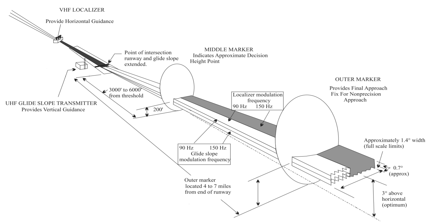
Instrument Landing System
In aviation, the instrument landing system (ILS) is a precision radio navigation system that provides short-range guidance to aircraft to allow them to approach a runway at night or in bad weather. In its original form, it allows an aircraft to approach until it is over the ground, within a of the runway. At that point the runway should be visible to the pilot; if it is not, they perform a missed approach. Bringing the aircraft this close to the runway dramatically increases the range of weather conditions in which a safe landing can be made. Other versions of the system, or "categories", have further reduced the minimum altitudes, runway visual ranges (RVRs), and transmitter and monitoring configurations designed depending on the normal expected weather patterns and airport safety requirements. ILS uses two directional radio signals, the ''localizer'' (108 to 112 MHz frequency), which provides horizontal guidance, and the ''glideslope'' (329.15 to 335 MHz frequen ... [...More Info...] [...Related Items...] OR: [Wikipedia] [Google] [Baidu] |
.jpg)


.jpg)

