|
Horten (town)
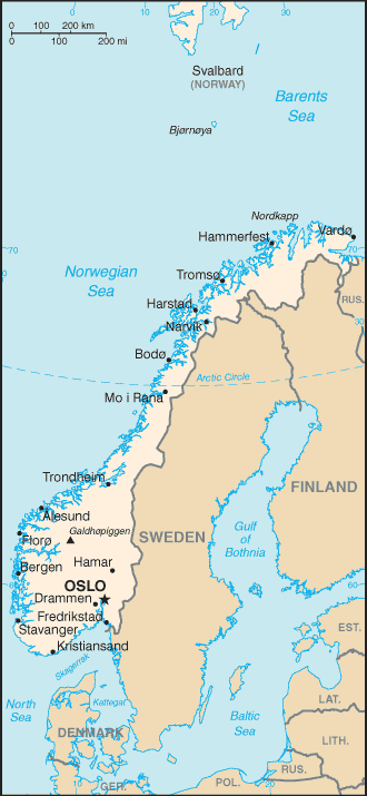
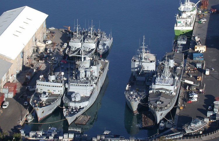
is a town in Horten Municipality in Vestfold county, Norway. The town is located along the Ytre Oslofjord about north of the town of Tønsberg and about to the southeast of the town of Holmestrand. The town of Moss lies about to the east, across the fjord. The town has a population (2023) of 20,859 and a population density of . History The development of the town of Horten is closely related to the Royal Norwegian Navy's activity in the area. By royal decree in 1818, Horten was designated as a military station similar to Fredriksvern (now called Stavern). The new naval harbor was to be built in the bay that is surrounded by a small peninsula and several islands. The navy's main shipyard was also built at Horten. In 1855, the entire naval facility was named Karljohansvern. Horten was designated as a ladested in 1857, which separated it from Borre Municipality and made it a self-governing urban municipality. In 1864, the naval school was transferred from Fredriksvern to ... [...More Info...] [...Related Items...] OR: [Wikipedia] [Google] [Baidu] |
List Of Towns And Cities In Norway
Below is a list of towns and cities in Norway. The Norwegian word for town or city is ''by''. Cities were formerly categorized as ''kjøpstad'' (market town) or '' ladested'' (small seaport), each with special rights. The special trading rights for cities were abolished in 1857, and the classification was entirely rescinded in 1952 and replaced by the simple classification ''by''. Overview From 1 January 1965 the focus was moved from the individual cities to their corresponding municipalities. Norwegian municipalities were classified as ''bykommune'' (urban municipality) or ''herredskommune'' (rural municipality). The distinction was rescinded by The Local Government Act of 1992. The municipalities were ordered by so-called municipality numbers, four-digit codes based on ISO 3166-2:NO which in 1946 were assigned to each municipality. Urban municipalities got a municipality number in which the third digit was a zero. Between 1960 and 1965 many Norwegian municipalities were merged ... [...More Info...] [...Related Items...] OR: [Wikipedia] [Google] [Baidu] |
Moss (town)
is a coastal town and a municipality in Viken county, Norway. The administrative centre of the municipality is the town of Moss. The city of Moss was established as a municipality on 1 January 1838 (see formannskapsdistrikt) and City in 1720. The rural municipality of Jeløy was merged with the city on 1 July 1943. The former municipality of Rygge was merged into it on January 1, 2020. Its administrative district covers areas east of the town, such as the island of Dillingøy in the lake Vansjø. Parts of the town are located on the peninsula of Jeløy. The city of Moss has 30,723 inhabitants (2012). Name The Old Norse form of the name was . It may be derived from an old root ''mer-'' which means to "divide" or "split". The adjacent topography shares similar etymology: * , Mosse-"marsh-river-border"+ (see , , Old Norse for river). The name is thought to be very old and the meaning of it is not clear. * , Mosse-"marsh-river-border"+ (Moss channel). * , Mosse-"marsh-ri ... [...More Info...] [...Related Items...] OR: [Wikipedia] [Google] [Baidu] |
World War II
World War II or the Second World War, often abbreviated as WWII or WW2, was a world war that lasted from 1939 to 1945. It involved the vast majority of the world's countries—including all of the great powers—forming two opposing military alliances: the Allies and the Axis powers. World War II was a total war that directly involved more than 100 million personnel from more than 30 countries. The major participants in the war threw their entire economic, industrial, and scientific capabilities behind the war effort, blurring the distinction between civilian and military resources. Aircraft played a major role in the conflict, enabling the strategic bombing of population centres and deploying the only two nuclear weapons ever used in war. World War II was by far the deadliest conflict in human history; it resulted in 70 to 85 million fatalities, mostly among civilians. Tens of millions died due to genocides (including the Holocaust), starvation, ma ... [...More Info...] [...Related Items...] OR: [Wikipedia] [Google] [Baidu] |
Kjøpstad
A (historically: ''kjøbstad'', ''kjöbstad'', or ''kaupstad'') is an old Scandinavian term for a "market town" that was used in the Kingdom of Denmark-Norway for several hundred years. The name comes from the on, kaupstaðr. Kjøpstads were places of trade and exporting materials (e.g. timber, flour, iron and other common goods). Towns were given the "dignity" or rank of being referred to as a ''kjøpstad'' when they reached a certain population and had established means of industry and other notable items such as dock yards, steam mills, iron works, churches, grammar schools. The citizens of a kjøpstad were able to buy and sell goods and conduct other economic activities. Ladested Norway also had a subordinate category to the market town, which was the "small seaport" ( no, ladested) or . These were a port or harbour with a monopoly to import and export goods and materials in both the port and a surrounding outlying district. These places were usually subordinate to the ... [...More Info...] [...Related Items...] OR: [Wikipedia] [Google] [Baidu] |
Borre Municipality
Borre is a former municipality in Vestfold county, Norway. The municipality existed from 1838 until its dissolution in 1988. Borre was merged with Horten in 1988, and the new municipality bore the name Borre until after a public referendum regarding the name in 2002. The administrative centre was the village of Borre. Other villages in Borre included Skoppum and Nykirke. After 1965, Åsgårdstrand was also part of Borre. The main churches in Borre were Borre Church and Nykirke Church. The historic Borre mound cemetery was located in the municipality. History The parish of Borre was established as a municipality on 1 January 1838 (see formannskapsdistrikt law). On 1 January 1858, the small town of Horten (population: 4,636) was separated from Borre Municipality when it was designated as a ladested, making it a separate urban municipality. This left Borre as a rural municipality with 2,954 residents. On 1 August 1921, an area of Borre (population: 287) was transferred i ... [...More Info...] [...Related Items...] OR: [Wikipedia] [Google] [Baidu] |
Karljohansvern
Karjohansvern (''Karljohansvern Orlogsstasjon, KJV'') at Horten was the main base for the Royal Norwegian Navy from 1850 to 1963. Background In 1818, it was decided to establish a naval base in Horten. It was first called ''Hortens verft'', and later ''Marinens Hovedværft'' until King Oscar I named it ''Carljohansværn værft'' in 1854 (after his father Karl Johan). The shipyards was begun in 1820 and the first launch, a frigate, was in 1828. On 9 April 1940 during the German invasion of Norway, a battle took place in the harbour when the Germans attempted to seize the base. The naval attack was repulsed, but German troops managed to outflank the Norwegians and force them to capitulate. Karljohansvern remained in German hands for the rest of World War II, while the ships operating out of it were pressed into their service. In 1953, the Norwegian Parliament determined the Navy's main base should be moved to Bergen. When the new headquarters at Haakonsvern was officially op ... [...More Info...] [...Related Items...] OR: [Wikipedia] [Google] [Baidu] |
Stavern
Stavern is a small water-side town in Larvik municipality in Vestfold County, Norway. It is south of the city of Larvik. Currently there are around 3,000 inhabitants in Stavern. It is a small town where tourism is one of the most important sources of income. During summer, the population increases to around 30,000-40,000 people, due to camping sites and cottages around the town centre as well as boats visiting the harbour. Stavern experiences 200 days of sunshine per year. Consequentially, Stavern's population more than doubles during summers. From the mid 1750s until 1864, Stavern was home to the nation's main naval base located in a shipyard in Fredriksvern. A gunpowder tower and commandant's house remain on Citadel Island, a current refuge for artists. The town is also home of Hall of Remembrance, a monument dedicated to seamen killed during World Wars I and II. History Stavern has probably been a harbour since ancient times. The name is found in written sources from the ... [...More Info...] [...Related Items...] OR: [Wikipedia] [Google] [Baidu] |
Fredriksvern
Fredriksvern (also called ''Friderichsværn'' (1801), ''Frederiksværn'' (1865), ''Fredriksværen'' (1900) and abbreviated ''Frsværn'') was an important Norwegian naval base, just south of Larvik in Vestfold. It is named after Fredrik V Denmark-Norway. The town of Stavern has in many ways come to be because of this naval base. History The military activities in the harbor of Stavern began with building of Staverns Fortress, part of a major construction of Norwegian Fortresses which took place from 1675 to 1679 under Christian IV. Stavern has probably been a harbor since ancient times. The name is found in written sources the 11th century and in the 12th century it is referred to as a good fishing harbor. Citadellet Fortress was built in the 1680s by count Ulrik Frederik Gyldenløve and had an important role during the last Nordic war from 1709 to 1720. During the winter of 1748 - 1749 King Fredrik V ordered construction of a shipyard and a drydock in Norway and in 1750 the f ... [...More Info...] [...Related Items...] OR: [Wikipedia] [Google] [Baidu] |
Military Station
A military base is a facility directly owned and operated by or for the military or one of its branches that shelters military equipment and personnel, and facilitates training and operations. A military base always provides accommodations for one or more units, but it may also be used as a command center, training ground or proving ground. In most cases, military bases rely on outside help to operate. However, certain complex bases are able to endure on their own for long periods because they are able to provide food, water and other necessities for their inhabitants while under siege. Bases for military aviation are called military air bases, or simply "air bases". Bases for military ships are called naval bases. The environmental impact of a given military base is dependent on its size and the manner of operation conducted at the base. Commonly, habitat destruction, reductions in soil quality, chemical contamination, and noise pollution are among the environmental dama ... [...More Info...] [...Related Items...] OR: [Wikipedia] [Google] [Baidu] |
Royal Norwegian Navy
The Royal Norwegian Navy ( no, Sjøforsvaret, , Sea defence) is the branch of the Norwegian Armed Forces responsible for naval operations of Norway. , the Royal Norwegian Navy consists of approximately 3,700 personnel (9,450 in mobilized state, 32,000 when fully mobilized) and 70 vessels, including 4 heavy frigates, 6 submarines, 14 patrol boats, 4 minesweepers, 4 minehunters, 1 mine detection vessel, 4 support vessels and 2 training vessels. It also includes the Coast Guard. This navy has a history dating back to 955. From 1509 to 1814, it formed part of the navy of Denmark-Norway, also referred to as the "Common Fleet". Since 1814, the Royal Norwegian Navy has again existed as a separate navy. In Norwegian, all its naval vessels since 1946 bear ship prefix "KNM", Kongelig Norske Marine (which accurately translates to Royal Norwegian Navy/Naval vessel). In English, they are permitted still to be ascribed prefix "HNoMS", meaning "His/Her Norwegian Majesty's Ship" ("HNMS" could b ... [...More Info...] [...Related Items...] OR: [Wikipedia] [Google] [Baidu] |
Population Density
Population density (in agriculture: standing stock or plant density) is a measurement of population per unit land area. It is mostly applied to humans, but sometimes to other living organisms too. It is a key geographical term.Matt RosenberPopulation Density Geography.about.com. March 2, 2011. Retrieved on December 10, 2011. In simple terms, population density refers to the number of people living in an area per square kilometre, or other unit of land area. Biological population densities Population density is population divided by total land area, sometimes including seas and oceans, as appropriate. Low densities may cause an extinction vortex and further reduce fertility. This is called the Allee effect after the scientist who identified it. Examples of the causes of reduced fertility in low population densities are * Increased problems with locating sexual mates * Increased inbreeding Human densities Population density is the number of people per unit of area, usuall ... [...More Info...] [...Related Items...] OR: [Wikipedia] [Google] [Baidu] |


