|
Horseshoe Hills
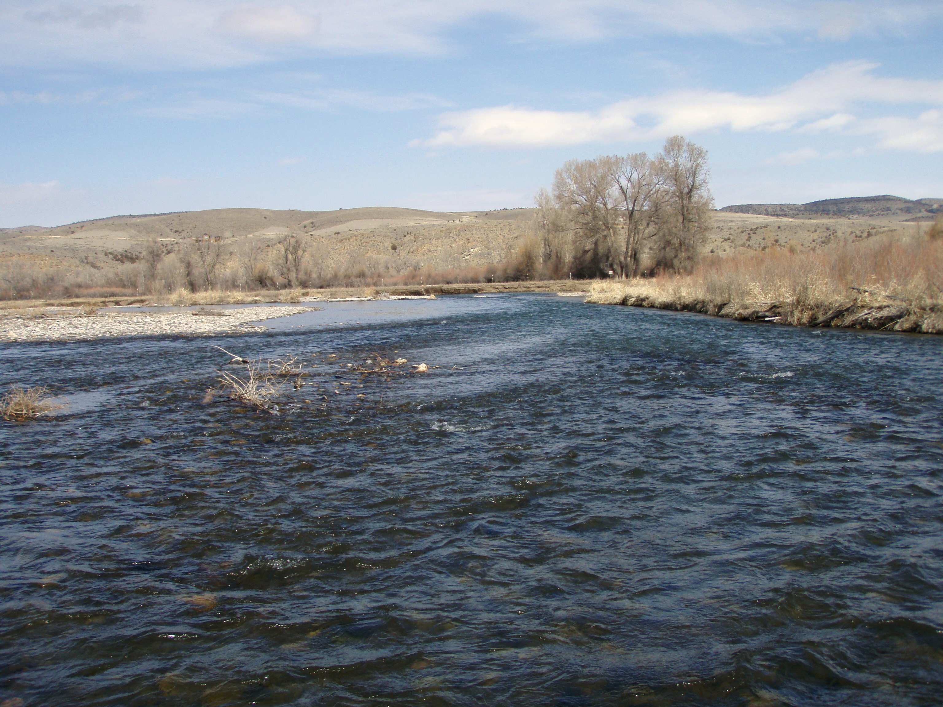
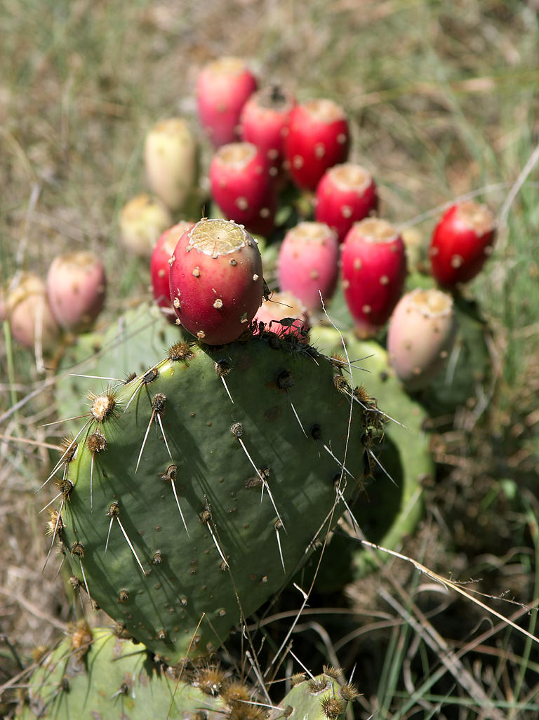
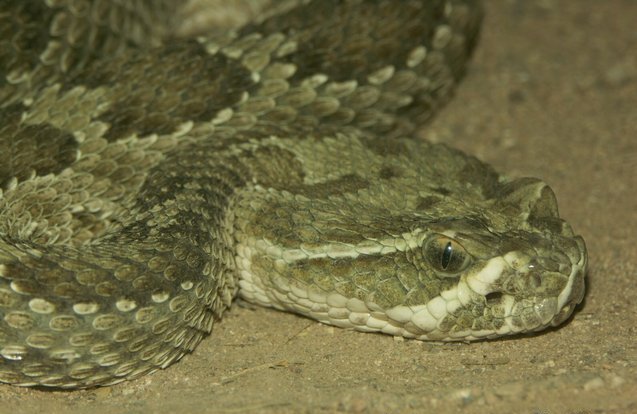
The Horseshoe Hills are a roughly crescent-shaped range of hills north of Manhattan, Montana in Gallatin County, Montana. They lie at in the area between the southern Big Belt Mountains and the northern Bridger Mountains (Montana), Bridger Range. The hills are bounded on the north by Sixteen Mile Creek (which begins in the Crazy Mountains), the first major tributary of the Missouri River. As they are in the rain shadow of the Boulder, Elkhorn, and Bull Mountains to the west, the Horseshoe Hills are notably dry, receiving of precipitation annually. This is especially true on the southern and southeastern flanks, which are also in the rain shadow of the hills themselves. In the driest areas, Missouri foxtail cacti, plains prickly pear cacti, and yucca abound, as well as Crotalus viridis, prairie rattlesnakes. Much of the hills are private property, but there is also some state, Bureau of Land Management, BLM, and United States National Forest, National Forest land. See also * List ... [...More Info...] [...Related Items...] OR: [Wikipedia] [Google] [Baidu] |
Hill
A hill is a landform that extends above the surrounding terrain. It often has a distinct Summit (topography), summit. Terminology The distinction between a hill and a mountain is unclear and largely subjective, but a hill is universally considered to be not as tall, or as Grade (slope), steep as a mountain. Geographers historically regarded mountains as hills greater than above sea level, which formed the basis of the plot of the 1995 film ''The Englishman who Went up a Hill but Came down a Mountain''. In contrast, hillwalkers have tended to regard mountains as peaks above sea level. The ''Oxford English Dictionary'' also suggests a limit of and Whittow states "Some authorities regard eminences above as mountains, those below being referred to as hills." Today, a mountain is usually defined in the UK and Ireland as any summit at least high, while the official UK government's definition of a mountain is a summit of or higher. Some definitions include a topographical pro ... [...More Info...] [...Related Items...] OR: [Wikipedia] [Google] [Baidu] |
Manhattan, Montana
Manhattan is a town in Gallatin County, Montana, United States. The population was 2,086 at the 2020 census. It is part of the ' Bozeman Micropolitan Statistical Area'. History In 1865, the town was called Hamilton. This changed in 1883 when they named it Moreland after the Moreland Irrigation Canal. Eventually it was changed to Manhattan after a malting company in the rise of the barley empire. Geography Manhattan is located at (45.857367, -111.331005). Interstate 90 passes by town, with access via exit 288. The Gallatin River is east of town. According to the United States Census Bureau, the town has a total area of , all land. Climate This climatic region is typified by large seasonal temperature differences, with warm to hot (and often humid) summers and cold (sometimes severely cold) winters. According to the Köppen Climate Classification system, Manhattan has a humid continental climate, abbreviated "Dfb" on climate maps. Demographics 2010 census As of the cens ... [...More Info...] [...Related Items...] OR: [Wikipedia] [Google] [Baidu] |
Gallatin County, Montana
Gallatin County is located in the U.S. state of Montana. With its county seat in Bozeman, it is the second-most populous county in Montana, with a population of 118,960 in the 2020 Census. The county's prominent geographical features are the Bridger mountains in the north, and the Gallatin mountains and Gallatin River in the south, named by Meriwether Lewis in 1805 for Albert Gallatin, the United States Treasury Secretary who formulated the Lewis and Clark Expedition. At the southern end of the county, West Yellowstone's entrance into Yellowstone National Park accounts for around half of all park visitors. Big Sky Resort, one of the largest ski resorts in the United States, lies in Gallatin and neighboring Madison counties, midway between Bozeman and West Yellowstone. History During the territorial era, a small patch of land known as "Lost Dakota" existed as a remote exclave of Dakota Territory until it was transferred to Gallatin County, Montana Territory, in 1873. Geogr ... [...More Info...] [...Related Items...] OR: [Wikipedia] [Google] [Baidu] |
Big Belt Mountains
The Big Belt Mountains are a section of the Rocky Mountains in the U.S. state of Montana. Situated mainly in the Helena National Forest, the mountains are used for logging and recreation for the surrounding residents. Nearby are the cities of Helena, Townsend, and White Sulphur Springs, as well as Canyon Ferry Lake and the Missouri River. The highest point in the Big Belt Range is Mount Edith at , while the center of the range is . The Big Belts lie primarily between the Missouri River drainage to the west and the Smith River drainage to the east. They are traversed by U.S. Highway 12 between Townsend in the Missouri drainage, and White Sulphur Springs in the upper Smith River drainage. The gulches on the western slopes of the Big Belts were noted historically for rich gold placer strikes. The richest were the 1864 and 1865 placer gold strikes in Confederate Gulch, including Montana Bar, which was one of the most concentrated gold placer strikes ever made. The range ta ... [...More Info...] [...Related Items...] OR: [Wikipedia] [Google] [Baidu] |
Bridger Mountains (Montana)
The Bridger Range, also known as the Bridger Mountains, is a subrange of the Rocky Mountains in southwestern Montana in the United States. The range runs mostly in a north–south direction between Bozeman and Maudlow. It is separated from the Gallatin Range to the south by Bozeman Pass; from the Horseshoe Hills to the west by Dry Creek; from the Crazy Mountains to the east by the Shields River valley; and from the Big Belt Mountains to the north by Sixteen Mile Creek. The highest point in the Bridger Range is Sacagawea Peak (), which is visible to the northeast from Bozeman. Although the range is mostly in Gallatin County, a small portion extends into Park County. Bozeman Pass, at an elevation of , is a narrow pass that lies between Bozeman and Livingston. The entire range is within Gallatin National Forest. History The range is named after Jim Bridger, a mountain man of the 19th century who pioneered the Bridger Trail through mountains in southern Wyoming into the Bighor ... [...More Info...] [...Related Items...] OR: [Wikipedia] [Google] [Baidu] |
Missouri Foxtail Cacti
''Escobaria missouriensis'', the Missouri foxtail cactus and formerly ''Coryphantha missouriensis'', is a species of low-growing North American cacti. It is found in along the Missouri River in the tallgrass prairie and shortgrass Great Plains, from Texas to Montana and the Dakotas, and in the Rocky Mountains woodlands of Ponderosa pine (''Pinus ponderosa''), pinyon-juniper, and Gambel oak (''Quercus gambelii)'' west of it. It is also native to the Southwestern United States in Arizona, New Mexico, and Utah.Flora of North America, Missouri foxtail cactus ''Coryphantha missouriensis'' . accessed 4.4.2011 Description ''Escobaria missouriensis'' grows up to high and forms clumps to or greater in diameter. They are generally l ...[...More Info...] [...Related Items...] OR: [Wikipedia] [Google] [Baidu] |
Prickly Pear Cacti
''Opuntia'', commonly called prickly pear or pear cactus, is a genus of flowering plants in the cactus family Cactaceae. Prickly pears are also known as ''tuna'' (fruit), ''sabra'', ''nopal'' (paddle, plural ''nopales'') from the Nahuatl word for the pads, or nostle, from the Nahuatl word for the fruit; or paddle cactus. The genus is named for the Ancient Greek city of Opus, where, according to Theophrastus, an edible plant grew and could be propagated by rooting its leaves. The most common culinary species is the Indian fig opuntia (''O. ficus-indica''). Description ''O. ficus-indica'' is a large, trunk-forming, segmented cactus that may grow to with a crown of over in diameter and a trunk diameter of . Cladodes (large pads) are green to blue-green, bearing few spines up to or may be spineless. Prickly pears typically grow with flat, rounded cladodes (also called platyclades) containing large, smooth, fixed spines and small, hairlike prickles called glochids that ... [...More Info...] [...Related Items...] OR: [Wikipedia] [Google] [Baidu] |
Yucca
''Yucca'' is a genus of perennial shrubs and trees in the family Asparagaceae, subfamily Agavoideae. Its 40–50 species are notable for their rosettes of evergreen, tough, sword-shaped leaves and large terminal panicles of white or whitish flowers. They are native to the hot and dry (arid) parts of the Americas and the Caribbean. Early reports of the species were confused with the cassava (''Manihot esculenta''). Consequently, Linnaeus mistakenly derived the generic name from the Taíno word for the latter, ''yuca''. The Aztecs living in Mexico since before the Spanish arrival, in Nahuatl, call the local yucca species (''Yucca gigantea'') , which gave the Spanish . is also used for ''Yucca filifera''. Distribution The natural distribution range of the genus ''Yucca'' (49 species and 24 subspecies) covers a vast area of the Americas. The genus is represented throughout Mexico and extends into Guatemala (''Yucca guatemalensis''). It also extends to the north through Baja Cali ... [...More Info...] [...Related Items...] OR: [Wikipedia] [Google] [Baidu] |
Crotalus Viridis
''Crotalus viridis'' (Common names: prairie rattlesnake, Great Plains rattlesnake, Wright AH, Wright AA. 1957. ''Handbook of Snakes of the United States and Canada''. Ithaca and London: Comstock Publishing Associates. (7th printing, 1985). 1,105 pp. (2 volumes). .) is a venomous pit viper species native to the western United States, southwestern Canada, and northern Mexico. Currently, two subspecies are recognized, including the prairie rattlesnake (''Crotalus viridis viridis''), the nominate subspecies, and the Hopi rattlesnake (''Crotalus viridis nuntius''). Taxonomy The taxonomic history of this species is convoluted. Previously, seven other ''C. viridis'' subspecies were also recognized, including '' C. v. abyssus'', '' C. v. caliginis'', '' C. v. cerberus'', '' C. v. concolor'', '' C. v. helleri'', '' C. v. lutosus'' and '' C. v. oreganus''. However, in 2001 Ashton and de Queiroz described their analysis of the variation of mitochondrial DNA across the range of this species ... [...More Info...] [...Related Items...] OR: [Wikipedia] [Google] [Baidu] |
Bureau Of Land Management
The Bureau of Land Management (BLM) is an agency within the United States Department of the Interior responsible for administering federal lands. Headquartered in Washington DC, and with oversight over , it governs one eighth of the country's landmass. President Harry S. Truman created the BLM in 1946 by combining two existing agencies: the General Land Office and the Grazing Service. The agency manages the federal government's nearly of subsurface mineral estate located beneath federal, state and private lands severed from their surface rights by the Homestead Act of 1862. Most BLM public lands are located in these 12 western states: Alaska, Arizona, California, Colorado, Idaho, Montana, Nevada, New Mexico, Oregon, Utah, Washington and Wyoming. The mission of the BLM is "to sustain the health, diversity, and productivity of the public lands for the use and enjoyment of present and future generations." Originally BLM holdings were described as "land nobody wanted" because home ... [...More Info...] [...Related Items...] OR: [Wikipedia] [Google] [Baidu] |
United States National Forest
In the United States, national forest is a classification of protected area, protected and managed federal lands. National forests are largely forest and woodland areas owned collectively by the American people through the Federal government of the United States, federal government, and managed by the United States Forest Service, a division of the United States Department of Agriculture. The U.S. Forest Service is also a forestry research organization who provides financial assistance to state and local forestry industry. As of 2020, there are List of U.S. National Forests, 154 national forests in the United States. History The National Forest System (NFS) was created by the Land Revision Act of 1891, which was enacted during the presidency of Benjamin Harrison. This act took land to form United States National Park, national parks in the West, including 15 reserves containing more than 13 million acres of land. At first one would be called a Forest Reserve; a later one w ... [...More Info...] [...Related Items...] OR: [Wikipedia] [Google] [Baidu] |


