|
Horse Flats
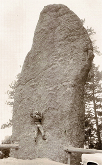
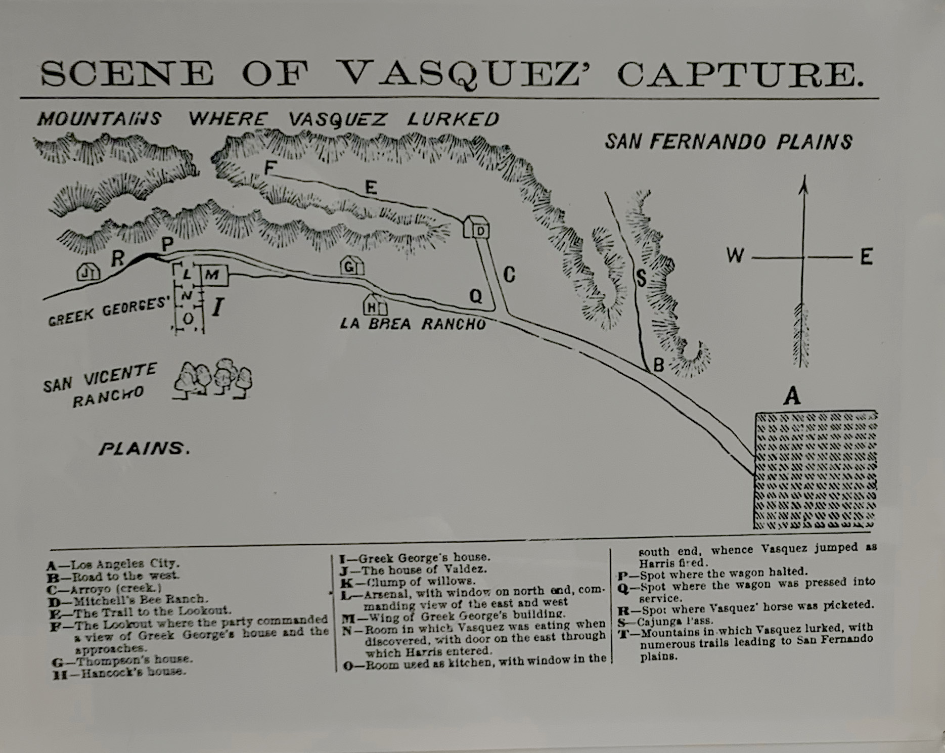
Horse Flats is a region of the San Gabriel Mountains in the Angeles National Forest north of Los Angeles. It is known for its US Forest Service campground (open April 1-November 15) and for the excellent granite bouldering near the campground. It is off California State Route 2. The elevation is . Closed in the winter months. In the campground is Mount Hillyer Trail, which connects to the Silver Moccasin Trail. History In the nineteenth century, the area was used by Tiburcio Vásquez Tiburcio Vásquez (April 11, 1835 – March 19, 1875) was a Californio ''bandido'' who was active in California from 1854 to 1874. The Vasquez Rocks, north of Los Angeles, were one of his many hideouts and are named after him. Early life T ... and his gang as a hideout and corral for their stolen livestockJohn W. Robinson, ''The San Gabriels'', pp 21-22, Big Santa Anita Historical Society, 1991. References {{reflist External linksHorse Flats Bouldering website [...More Info...] [...Related Items...] OR: [Wikipedia] [Google] [Baidu] |
San Gabriel Mountains
The San Gabriel Mountains ( es, Sierra de San Gabriel) are a mountain range located in northern Los Angeles County and western San Bernardino County, California, United States. The mountain range is part of the Transverse Ranges and lies between the Los Angeles Basin and the Mojave Desert, with Interstate 5 to the west and Interstate 15 to the east. The range lies in, and is surrounded by, the Angeles and San Bernardino National Forests, with the San Andreas Fault as its northern border. The highest peak in the range is Mount San Antonio, commonly referred to as Mt. Baldy. Mount Wilson is another notable peak, known for the Mount Wilson Observatory and the antenna farm that houses many of the transmitters for local media. The observatory may be visited by the public. On October 10, 2014, President Obama designated the area the San Gabriel Mountains National Monument. The Trust for Public Land has protected more than of land in the San Gabriel Mountains, its foothills and the A ... [...More Info...] [...Related Items...] OR: [Wikipedia] [Google] [Baidu] |
Angeles National Forest
The Angeles National Forest (ANF) of the U.S. Forest Service is located in the San Gabriel Mountains and Sierra Pelona Mountains, primarily within Los Angeles County in southern California. The ANF manages a majority of the San Gabriel Mountains National Monument. The national forest was established in 1908, incorporating the first San Bernardino National Forest and parts of the former Santa Barbara and San Gabriel National Forests. Angeles National Forest headquarters are located in Arcadia, California. Geography The Angeles National Forest covers a total of , protecting large areas of the San Gabriel Mountains and Sierra Pelona Mountains. It is located just north of the densely inhabited metropolitan area of Greater Los Angeles. While primarily within Los Angeles County, a small part extends eastward into southwestern San Bernardino County, in the Mount San Antonio ("Mount Baldy") area, and a tiny section also extends westward into northeastern Ventura County, in the Lake P ... [...More Info...] [...Related Items...] OR: [Wikipedia] [Google] [Baidu] |
Los Angeles
Los Angeles ( ; es, Los Ángeles, link=no , ), often referred to by its initials L.A., is the largest city in the state of California and the second most populous city in the United States after New York City, as well as one of the world's most populous megacities. Los Angeles is the commercial, financial, and cultural center of Southern California. With a population of roughly 3.9 million residents within the city limits , Los Angeles is known for its Mediterranean climate, ethnic and cultural diversity, being the home of the Hollywood film industry, and its sprawling metropolitan area. The city of Los Angeles lies in a basin in Southern California adjacent to the Pacific Ocean in the west and extending through the Santa Monica Mountains and north into the San Fernando Valley, with the city bordering the San Gabriel Valley to it's east. It covers about , and is the county seat of Los Angeles County, which is the most populous county in the United States with an ... [...More Info...] [...Related Items...] OR: [Wikipedia] [Google] [Baidu] |
Campground
A campsite, also known as a campground or camping pitch, is a place used for overnight stay in an outdoor area. In British English, a ''campsite'' is an area, usually divided into a number of pitches, where people can camp overnight using tents, campervans or caravans; this British English use of the word is synonymous with the US English expression ''campground''. In American English, the term ''campsite'' generally means an area where an individual, family, group, or military unit can pitch a tent or park a camper; a campground may contain many campsites. There are two types of campsites: an impromptu area (as one might decide to stop while backpacking or hiking, or simply adjacent to a road through the wilderness), and a designated area with various facilities. Campgrounds The term ''camp'' comes from the Latin word ''campus'', meaning "field". Therefore, a campground consists typically of open pieces of ground where a camper can pitch a tent or park a camper. More s ... [...More Info...] [...Related Items...] OR: [Wikipedia] [Google] [Baidu] |
Bouldering
Bouldering is a form of free climbing that is performed on small rock formations or artificial rock walls without the use of ropes or harnesses. While bouldering can be done without any equipment, most climbers use climbing shoes to help secure footholds, chalk to keep their hands dry and to provide a firmer grip, and bouldering mats to prevent injuries from falls. Unlike free solo climbing, which is also performed without ropes, bouldering problems (the sequence of moves that a climber performs to complete the climb) are usually less than tall. Traverses, which are a form of boulder problem, require the climber to climb horizontally from one end to another. Artificial climbing walls allow boulderers to climb indoors in areas without natural boulders. In addition, bouldering competitions take place in both indoor and outdoor settings. The sport was originally a method of training for roped climbs and mountaineering, so climbers could practice specific moves at a safe dis ... [...More Info...] [...Related Items...] OR: [Wikipedia] [Google] [Baidu] |
California State Route 2
State Route 2 (SR 2) is a state highway in the U.S. state of California. It connects the Los Angeles Basin with the San Gabriel Mountains and the Victor Valley in the Mojave Desert. The highway's southwestern end is at the intersection of Centinela Avenue at the Santa Monica-Los Angeles border and its northeastern end is at SR 138 east of Wrightwood. The SR 2 is divided into four segments, and it briefly runs concurrently with U.S. Route 101 (US 101) and Interstate 210 (I-210). The southwestern section of SR 2 runs along a segment of the east–west Santa Monica Boulevard, an old routing of US 66, to US 101 in East Hollywood; the second section runs along segments of both the north–south Alvarado Street and Glendale Boulevard in Echo Park; the third section to I-210 in Glendale is known as the north–south Glendale Freeway; and the northeastern portion from I-210 in La Cañada Flintridge to SR 138 is des ... [...More Info...] [...Related Items...] OR: [Wikipedia] [Google] [Baidu] |
Silver Moccasin Trail
The Silver Moccasin Trail is a trail located in the San Gabriel Mountains, northeast of Los Angeles. It begins at Chantry Flat Recreation Area above the city of Arcadia, California, traversing upward and down through several canyons and along the high ridges of the Angeles National Forest. This trail connects Mt. Baden-Powell, Mount Burnham, Throop Peak and Mount Hawkins. It comes to its highest point of at Mount Baden-Powell after which point it descends to its terminus at Vincent Gap on the Angeles Crest Highway near Wrightwood. Background The landscape of the Silver Moccasin Trail varies from lowland chaparral slopes, to oak-lined canyons, to the fir and pine forests of Mt. Baden-Powell, where several Southern California councils of the Boy Scouts of America have placed a monument to their founder, Lord Robert Baden-Powell. The Silver Moccasin Trail started as a series of Indian trails originally created by the local Native Americans (probably Tongva), but its use was cont ... [...More Info...] [...Related Items...] OR: [Wikipedia] [Google] [Baidu] |
Tiburcio Vásquez
Tiburcio Vásquez (April 11, 1835 – March 19, 1875) was a Californio ''bandido'' who was active in California from 1854 to 1874. The Vasquez Rocks, north of Los Angeles, were one of his many hideouts and are named after him. Early life Tiburcio Vásquez was born in Monterey, Alta California, Mexico (present-day California, United States) on April 11, 1835 to José Hermenegildo Vásquez and María Guadalupe Cantúa. In accord with Spanish tradition, Vásquez's birth was celebrated on the feast day of his namesake, St. Tiburtius. Thus, he always referred to his birthday as August 11, 1835. His great-grandfather came to Alta California with the De Anza Expedition of 1776. Vásquez was slightly built, about . Vásquez grew up in a moderately well-off middle-class family that owned land granted to his family by the Mexican government due to his father’s military service as a Spanish soldier. He spent plenty of time on his father’s and his Uncle Felipe Vasquez’s ranchos l ... [...More Info...] [...Related Items...] OR: [Wikipedia] [Google] [Baidu] |
Climbing Areas Of California
Climbing is the activity of using one's hands, feet, or any other part of the body to ascend a steep topographical object that can range from the world's tallest mountains (e.g. the eight thousanders), to small boulders. Climbing is done for locomotion, sporting recreation, and for competition, and is also done in trades that rely on ascension; such as emergency rescue and military operations. Climbing is done indoors and outdoors and on natural (e.g. rock and ice) and artificial surfaces. Professional mountain guides or rock climbing guides (e.g. the UIAGM), were a significant element in developing the popularity of the sport in the natural environment, and remain so today. Since the 1980s, the development of competition climbing and the availability of artificial climbing walls have dramatically increased the popularity of rock climbing as a sport and led to the emergence of professional rock climbers, such as Wolfgang Güllich, Chris Sharma, Lynn Hill and Cathe ... [...More Info...] [...Related Items...] OR: [Wikipedia] [Google] [Baidu] |
Landmarks In Los Angeles
A landmark is a recognizable natural or artificial feature used for navigation, a feature that stands out from its near environment and is often visible from long distances. In modern use, the term can also be applied to smaller structures or features, that have become local or national symbols. Etymology In old English the word ''landmearc'' (from ''land'' + ''mearc'' (mark)) was used to describe a boundary marker, an "object set up to mark the boundaries of a kingdom, estate, etc.". Starting from approx. 1560, this understanding of landmark was replaced by a more general one. A landmark became a "conspicuous object in a landscape". A ''landmark'' literally meant a geographic feature used by explorers and others to find their way back or through an area. For example, the Table Mountain near Cape Town, South Africa is used as the landmark to help sailors to navigate around southern tip of Africa during the Age of Exploration. Artificial structures are also sometimes built to a ... [...More Info...] [...Related Items...] OR: [Wikipedia] [Google] [Baidu] |


