|
Hormosira Banksii
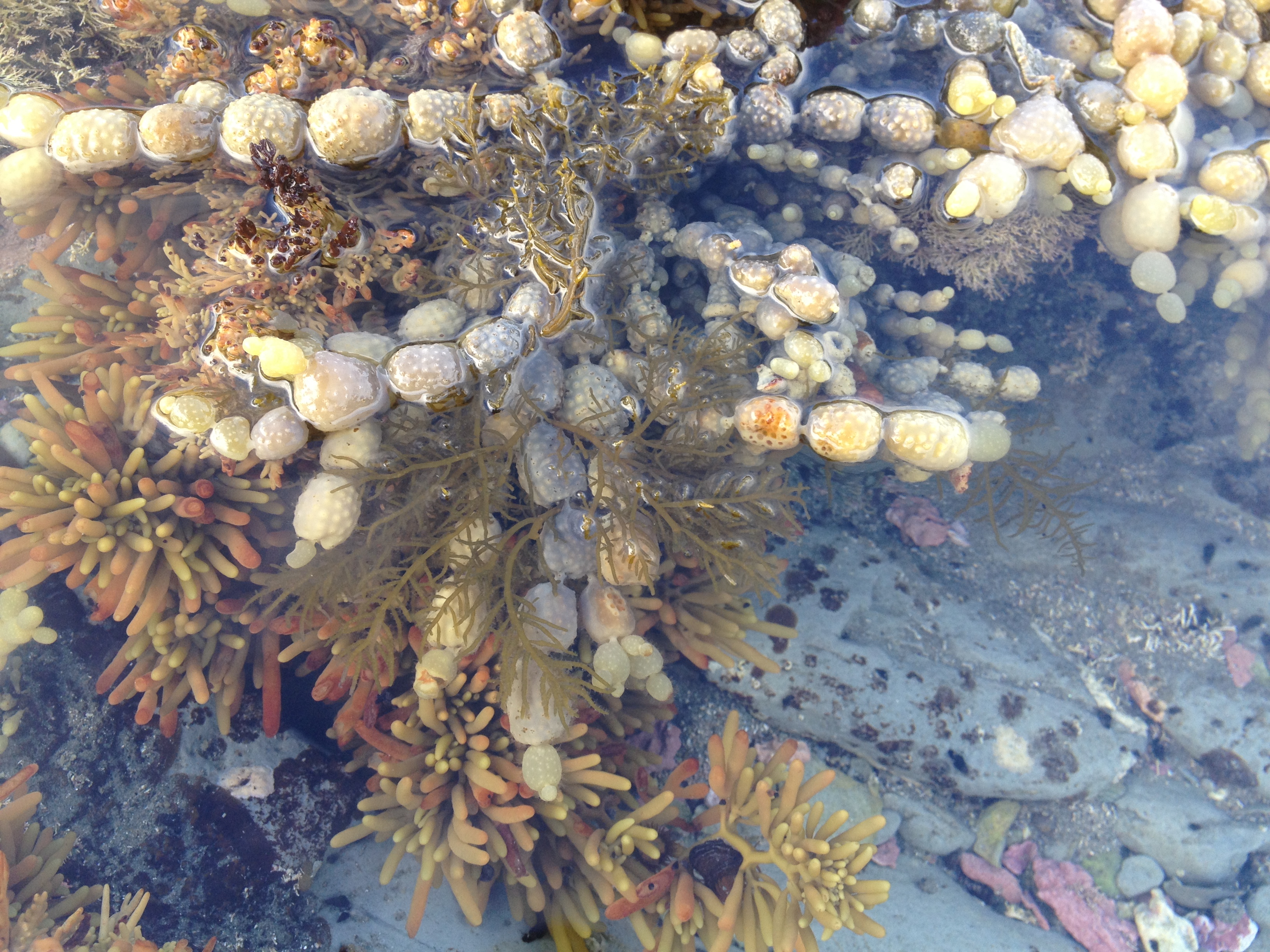
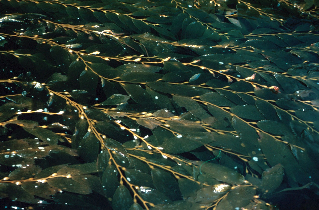
''Hormosira banksii'', also known as Neptune's necklace, Neptune's pearls, sea grapes, or bubbleweed) is a species of seaweed (brown algae, Fucales) native to Australia and New Zealand. The genus ''Hormosira'' is monotypic. Distribution ''Hormosira'' is native to southeastern Australia (including Tasmania, Lord Howe Island and Norfolk Island) and New Zealand. Despite substantial morphological variation across its range, the species represents a single species and the genus ''Hormosira'' is monotypic. Genetic analyses of mitochondrial COI and microsatellite DNA sequence data have indicated that there is low genetic variation across the range of the species in Australia. Description ''Hormosira'' is a perennial species of seaweed (brown algae, Fucales). It is abundant on low-energy rocky reefs within the intertidal zone, where it outcompetes other algal species due to its high tolerance to desiccation. Plants vary significantly in morphology. The thallus (or frond) of the species ... [...More Info...] [...Related Items...] OR: [Wikipedia] [Google] [Baidu] |
SAR Supergroup
The SAR supergroup, also just SAR or Harosa, is a clade that includes stramenopiles (heterokonts), alveolates, and Rhizaria. The name is an acronym derived from the first letters of each of these clades; it has been alternatively spelled "RAS". The term "Harosa" (at the subkingdom level) has also been used. The SAR supergroup is a node-based taxon. Note that as a formal taxon, "Sar" has only its first letter capitalized, while the earlier abbreviation, SAR, retains all uppercase letters. Both names refer to the same group of organisms, unless further taxonomic revisions deem otherwise. Members of the SAR supergroup were once included under the separate supergroups Chromalveolata (Chromista and Alveolata) and Rhizaria, until phylogenetic studies confirmed that stramenopiles and alveolates diverged with Rhizaria. This apparently excluded haptophytes and cryptomonads, leading Okamoto ''et al.'' (2009) to propose the clade Hacrobia to accommodate them. Phylogeny Based on a compi ... [...More Info...] [...Related Items...] OR: [Wikipedia] [Google] [Baidu] |
Norfolk Island
Norfolk Island (, ; Norfuk: ''Norf'k Ailen'') is an external territory of Australia located in the Pacific Ocean between New Zealand and New Caledonia, directly east of Australia's Evans Head and about from Lord Howe Island. Together with the neighbouring Phillip Island and Nepean Island, the three islands collectively form the Territory of Norfolk Island. At the 2021 census, it had inhabitants living on a total area of about . Its capital is Kingston. The first known settlers in Norfolk Island were East Polynesians but they had already departed when Great Britain settled it as part of its 1788 settlement of Australia. The island served as a convict penal settlement from 6 March 1788 until 5 May 1855, except for an 11-year hiatus between 15 February 1814 and 6 June 1825, when it lay abandoned. On 8 June 1856, permanent civilian residence on the island began when descendants of the ''Bounty'' mutineers were relocated from Pitcairn Island. In 1914 the UK handed Norfo ... [...More Info...] [...Related Items...] OR: [Wikipedia] [Google] [Baidu] |
Conceptacles
Conceptacles are specialized cavities of marine and freshwater algae that contain the reproductive organs. They are situated in the receptacle and open by a small ostiole.Boney, A.D. (1969). ''A Biology of Marine Algae''. Hutchinson Educational Ltd, London Conceptacles are present in Corallinaceae,Irvine, L.M. and Chamberlain, Y.M. (1994). ''Seaweeds of the British Isles''. Volume 1, Part 2B. Natural History Museum, London. and Hildenbrandiales, as well as the brown Fucales. In the Fucales there is no haploid phase in the reproductive cycle and therefore no alternation of generations.Fritsch, F.E. (1945). ''The Structure and Reproduction of the Algae''. Vol 2. Cambridge University Press, Cambridge The thallus is a sporophyte.Smith, G.M. (1938). ''Cryptogamic Botany. Algae and Fungi''. Second edition, Volume ''1'', McGraw-Hill Bok Company, Inc. The diploid plants produce male (antheridia) and female (oogonia) gametangia by meiosis. The gametes are released into the surrounding wate ... [...More Info...] [...Related Items...] OR: [Wikipedia] [Google] [Baidu] |
Monoecious
Monoecy (; adj. monoecious ) is a sexual system in seed plants where separate male and female cones or flowers are present on the same plant. It is a monomorphic sexual system alongside gynomonoecy, andromonoecy and trimonoecy. Monoecy is connected to anemophily. It can prevent self-pollination in an individual flower but cannot prevent self-pollination between male and female flowers on the same plant. Monoecy in angiosperms has been of interest for evolutionary biologists since Charles Darwin. Terminology Monoecious comes from the Greek words for one house. History The term monoecy was first introduced in 1735 by Carl Linnaeus. Darwin noted that the flowers of monoecious species sometimes showed traces of the opposite sex function. Monoecious hemp was first reported in 1929. Occurrence Monoecy is most common in temperate climates and is often associated with inefficient pollinators or wind-pollinated plants. It may be beneficial to reducing pollen-stigma interferenc ... [...More Info...] [...Related Items...] OR: [Wikipedia] [Google] [Baidu] |
Curio Bay
Curio Bay is a coastal embayment in the Southland District of New Zealand, best known as the site of a petrified forest some 180 million years old. It also hosts a yellow-eyed penguin colony, arguably the rarest of penguin species, with approximately 1600 breeding pairs in the extant population. The bay, along with neighbouring Porpoise Bay, is home to the endemic Hector's dolphin. Southern right whales are occasionally observed offshore, as on numerous parts of the country's coast. Located near the southernmost point of the South Island, Curio Bay is one of the major attractions in the Catlins, attracting around 100,000 visitors per year. The town of Waikawa has an information center for tourists. The now petrified logs, from ancient conifers closely related to modern kauri and Norfolk pine, were buried by ancient volcanic mud flows and gradually replaced by silica to produce the fossils now exposed by the sea. The fossilised forest grew at a time of semi-tropical clima ... [...More Info...] [...Related Items...] OR: [Wikipedia] [Google] [Baidu] |
Eaglehawk Neck
Eaglehawk Neck, officially Teralina / Eaglehawk Neck, is a narrow isthmus that connects the Tasman Peninsula with the Forestier Peninsula, and hence to mainland Tasmania, Australia. The locality of Eaglehawk Neck is in the local government area of Tasman in the South-east region of Tasmania. The locality is about north-east of the town of Nubeena. At the , the settlement of Eaglehawk Neck had a population of 385. Location and features Locally known as "the Neck", the isthmus itself is around long and under wide at its narrowest point. The area features rugged terrain and several unusual geological formations. These include the Tessellated Pavement, an area of flat rock that looks to be manmade but is in fact formed by erosion. A short walk further via Lufra Cove leads to Clyde Island, accessible for crossings at low tide, which sits at the northern entry to Pirates Bay. The island hosts two grave sites, and a rumbling blow hole cleaves the island. Eaglehawk Neck is a wel ... [...More Info...] [...Related Items...] OR: [Wikipedia] [Google] [Baidu] |
Long Reef (New South Wales)
Long Reef is a prominent headland in the Northern Beaches of Sydney, Australia. Connected to the mainland by a tombolo, the reef has an extensive wave-cut platform. Long Reef is a popular recreational destination and is one of the more interesting geological areas in Sydney. Geology Some of the oldest rocks in the Sydney area may be seen at Long Reef. Primarily from the Triassic they are from the Narrabeen Group of sedimentary rocks. The cliffs of Long Reef are composed of Bald Hill Claystone above Bulgo Sandstone. There was a wide volcanic Dike (geology), dyke made of dolerite, two metres tall from the Jurassic. However, this has been reduced by mining. The most commonly seen type of rock in Sydney, Hawkesbury sandstone, is absent at Long Reef. It is present at Dee Why headland, a small distance to the south, separated by a Fault (geology), fault under Dee Why beach. A Copper extraction, copper mine was active at Long Reef in the 1880s,information sign at Long Reef – by ... [...More Info...] [...Related Items...] OR: [Wikipedia] [Google] [Baidu] |
Kaikōura
Kaikōura () is a town on the east coast of the South Island of New Zealand. It is located on State Highway 1, 180 km north of Christchurch. The town has an estimated permanent resident population of (as of ). The town is the governmental seat of the territorial authority of the Kaikōura District, which is politically a part of the Canterbury region. Kaikōura was the first local authority in the Southern Hemisphere to achieve recognition by the EarthCheck Community Standard. The infrastructure of Kaikōura was heavily damaged in the 2016 Kaikōura earthquake, with one of the two deaths near the town. The bay and surrounding region were uplifted by as much as . History Early Māori history Māori have long been resident in Kaikōura and archeological evidence of moa bones suggesting that they hunted moa there. After the moa numbers declined, Kaikōura was still an attractive place to live with its abundance of sea food. Ngāi Tahu had been resident in the Kaikoura ... [...More Info...] [...Related Items...] OR: [Wikipedia] [Google] [Baidu] |
Holdfast (biology)
A holdfast is a root-like structure that anchors aquatic sessile organisms, such as seaweed, other sessile algae, stalked crinoids, benthic cnidarians, and sponges, to the substrate. Holdfasts vary in shape and form depending on both the species and the substrate type. The holdfasts of organisms that live in muddy substrates often have complex tangles of root-like growths. These projections are called haptera and similar structures of the same name are found on lichens. The holdfasts of organisms that live in sandy substrates are bulb-like and very flexible, such as those of sea pens, thus permitting the organism to pull the entire body into the substrate when the holdfast is contracted. The holdfasts of organisms that live on smooth surfaces (such as the surface of a boulder) have flattened bases which adhere to the surface. The organism derives no nutrition from this intimate contact with the substrate, as the process of liberating nutrients from the substrate requires ... [...More Info...] [...Related Items...] OR: [Wikipedia] [Google] [Baidu] |
Pneumatocyst
In phycology, a pneumatocyst is a floating structure that contains gas found on brown seaweed. A seaweed's thallus may have more than one. They provide buoyancy to lift the blades toward the surface, allowing them to receive more sunlight for photosynthesis Photosynthesis is a process used by plants and other organisms to convert light energy into chemical energy that, through cellular respiration, can later be released to fuel the organism's activities. Some of this chemical energy is stored i .... The proportion of gases in the pneumatocysts varies depending on the physiological status of the alga and the partial pressure of gases in the surrounding air or water. The pneumatocyst can hold O2, CO2, N2, and CO. References Further reading Brown algae {{Phaeophyceae-stub ... [...More Info...] [...Related Items...] OR: [Wikipedia] [Google] [Baidu] |
Desiccation
Desiccation () is the state of extreme dryness, or the process of extreme drying. A desiccant is a hygroscopic (attracts and holds water) substance that induces or sustains such a state in its local vicinity in a moderately sealed container. Industry Desiccation is widely employed in the oil and gas industry. These materials are obtained in a hydrated state, but the water content leads to corrosion or is incompatible with downstream processing. Removal of water is achieved by cryogenic condensation, absorption into glycols, and absorption onto desiccants such as silica gel. Laboratory A desiccator is a heavy glass or plastic container, now somewhat antiquated, used in practical chemistry for drying or keeping small amounts of materials very dry. The material is placed on a shelf, and a drying agent or ''desiccant'', such as dry silica gel or anhydrous sodium hydroxide, is placed below the shelf. Often some sort of humidity indicator is included in the desiccator to show, ... [...More Info...] [...Related Items...] OR: [Wikipedia] [Google] [Baidu] |
Intertidal Zone
The intertidal zone, also known as the foreshore, is the area above water level at low tide and underwater at high tide (in other words, the area within the tidal range). This area can include several types of habitats with various species of life, such as seastars, sea urchins, and many species of coral with regional differences in biodiversity. Sometimes it is referred to as the ''littoral zone'' or '' seashore'', although those can be defined as a wider region. The well-known area also includes steep rocky cliffs, sandy beaches, bogs or wetlands (e.g., vast mudflats). The area can be a narrow strip, as in Pacific islands that have only a narrow tidal range, or can include many meters of shoreline where shallow beach slopes interact with high tidal excursion. The peritidal zone is similar but somewhat wider, extending from above the highest tide level to below the lowest. Organisms in the intertidal zone are adapted to an environment of harsh extremes, living in water pr ... [...More Info...] [...Related Items...] OR: [Wikipedia] [Google] [Baidu] |


_holdfast.jpg)


