|
Hollandia Hut
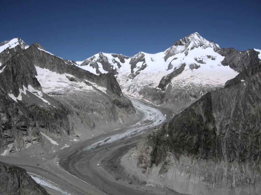
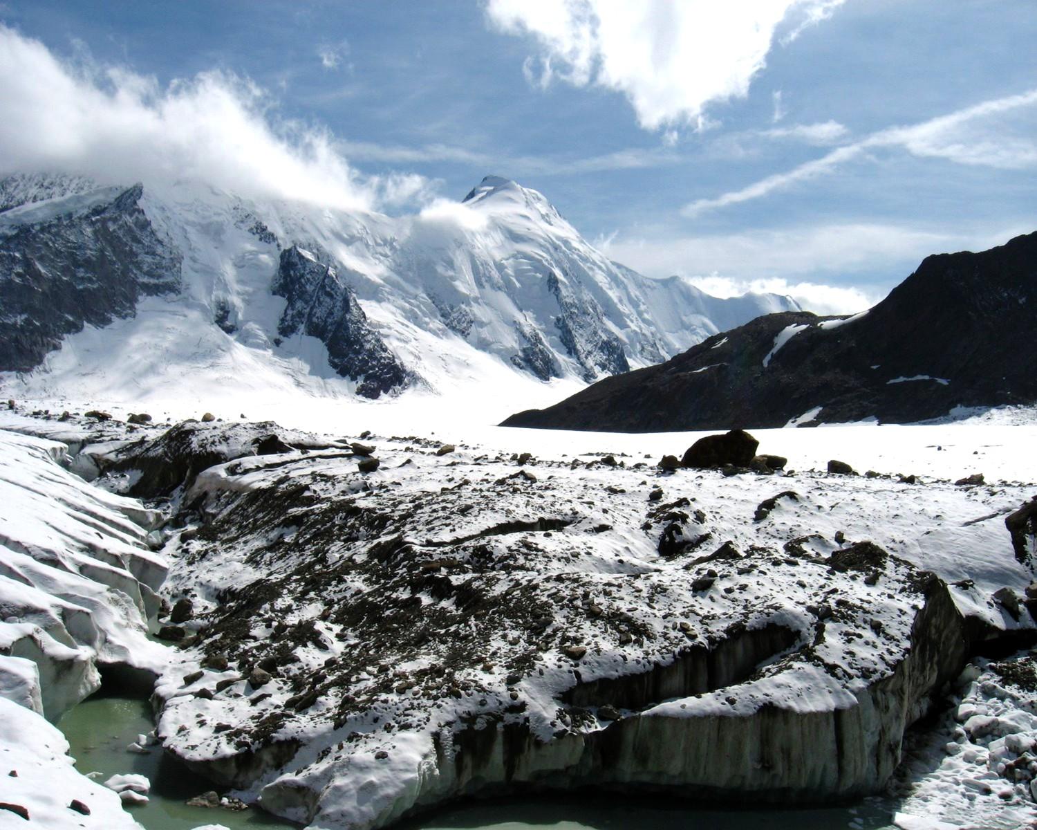
The Hollandia Hut (German: ''Hollandiahütte'') is a mountain hut of the Swiss Alpine Club, located east of Blatten in the canton of Valais. The hut lies at a height of 3,240 metres above sea level, just above the Lötschenlücke, the glacier pass connecting the Lötschental from the Aletsch Glacier. All accesses to the hut involve glacier crossing. The Hollandia Hut is a starting point for the ascents of the Ebnefluh, Mittaghorn, Aletschhorn, Sattelhorn, Gletscherhorn and Anungrat. See also *List of buildings and structures above 3000 m in Switzerland References *Swisstopo Swisstopo is the official name for the Swiss Federal Office of Topography (in German language, German: ''Bundesamt für Landestopografie''; French language, French: ''Office fédéral de topographie''; Italian language, Italian: ''Ufficio fed ... topographic maps External links Official website {{Valais-geo-stub Mountain huts in Switzerland Mountain huts in the Alps ... [...More Info...] [...Related Items...] OR: [Wikipedia] [Google] [Baidu] |
Hollandia
Hollandia may refer to: * HVV Hollandia, Dutch football team * Hollandia Victoria Combinatie, defunct Dutch football team * ''Hollandia'' (1742 ship), a ship of the Dutch East India Company, wrecked in 1743 on her maiden voyage * Jayapura, a city in Indonesia, known as ''Hollandia'' from 1910 to 1962 :* Sentani Airport, the city's airport, formerly known as ''Hollandia Airfield Complex'' :* Battle of Hollandia, 1944 battle between American and Japanese forces during World War II * Landing at Hollandia, a battle of the Western New Guinea campaign of World War II in April 1944 * Hollandia Hut, Swiss Alpine Club hut * Hollandia Roeiclub, Dutch rowing club * ''Hollandia'' (moth) * Hollandia beer, Dutch lager made by Bavaria Brewery (Netherlands) See also * Holandia (other) * Holland (other) Holland is a region within the Netherlands. Holland may also refer to: Places Netherlands *Holland may refer to the Netherlands as a whole, in informal contexts and spor ... [...More Info...] [...Related Items...] OR: [Wikipedia] [Google] [Baidu] |
Ebnefluh
The Ebnefluh, also known as the Äbeni Flue and the Ebenefluh, (3,962 m) is a mountain of the Bernese Alps, located on the border between the Swiss cantons of Bern and Valais Valais ( , , ; frp, Valês; german: Wallis ), more formally the Canton of Valais,; german: Kanton Wallis; in other official Swiss languages outside Valais: it, (Canton) Vallese ; rm, (Chantun) Vallais. is one of the 26 cantons forming the S .... It lies towards the eastern end of the Lauterbrunnen Wall. References External links The Ebnefluh on SummitPost Bernese Alps Mountains of the Alps Alpine three-thousanders Mountains of Valais Mountains of the canton of Bern Bern–Valais border Mountains of Switzerland Three-thousanders of Switzerland {{Valais-mountain-stub ... [...More Info...] [...Related Items...] OR: [Wikipedia] [Google] [Baidu] |
Swisstopo
Swisstopo is the official name for the Swiss Federal Office of Topography (in German language, German: ''Bundesamt für Landestopografie''; French language, French: ''Office fédéral de topographie''; Italian language, Italian: ''Ufficio federale di topografia''; Romansh language, Romansh: ''Uffizi federal da topografia''), Switzerland's national mapping agency. The current name was made official in 2002. It had been in use as the domain name for the institute's homepage, swisstopo.ch, since 1997. Maps The main class of products produced by Swisstopo are topographical maps on seven different Scale (map), scales. Swiss maps have been praised for their accuracy and quality. Regular maps * 1:25.000. This is the most detailed map, useful for many purposes. Those are popular with tourists, especially for famous areas like Zermatt and St. Moritz. These maps cost CHF 13.50 each (2004). 208 maps on this scale are published at regular intervals. The first map published on this scale ... [...More Info...] [...Related Items...] OR: [Wikipedia] [Google] [Baidu] |
List Of Buildings And Structures Above 3000 M In Switzerland
This is a list of buildings and infrastructures above in Switzerland. As this height approximately corresponds to the level of the climatic snow line in the Alps, infrastructures located above it are generally subject to harsh weather conditions and are more difficult to build. This list also includes structures located precisely on the Italian border (*) that could be partially in Switzerland. List See also *List of highest railway stations in Switzerland *List of mountains of Switzerland above 3000 m *List of mountain huts in the Alps References *Swisstopo Swisstopo is the official name for the Swiss Federal Office of Topography (in German language, German: ''Bundesamt für Landestopografie''; French language, French: ''Office fédéral de topographie''; Italian language, Italian: ''Ufficio fed ... topographic maps {{reflist * Mountaineering in Switzerland ... [...More Info...] [...Related Items...] OR: [Wikipedia] [Google] [Baidu] |
Gletscherhorn
The Gletscherhorn (3,983 m) is a mountain of the Bernese Alps, located on the border between the Swiss cantons of Bern and Valais. It forms the eastern edge of the Lauterbrunnen Wall, south of the Jungfrau. See also *List of mountains of the Alps above 3000 m *List of mountains of Switzerland This article contains a sortable table of many of the major mountains and hills of Switzerland. The table only includes those summits that have a topographic prominence of at least above other points, and ranks them by height and prominence. The ... References External linksGletscherhorn on Hikr Mountains of Switzerland Mountains of the Alps Alpine three-thousanders Bernese Alps Mountains of Valais Mountains of the canton of Bern Bern–Valais border Three-thousanders of Switzerland {{Valais-mountain-stub ... [...More Info...] [...Related Items...] OR: [Wikipedia] [Google] [Baidu] |
Sattelhorn
The Sattelhorn is a mountain of the Bernese Alps, overlooking the Lötschenlücke in the canton of Valais. It lies west of the Aletschhorn, between the Lang Glacier and the Oberaletsch Glacier The Oberaletsch Glacier (German: ''Oberaletschgletscher'', meaning ''Upper Aletsch Glacier'') is a valley glacier on the south side of the Bernese Alps, in the canton of Valais. It had a length of with an average width of just under and an area o .... References External links Sattelhorn on Hikr Mountains of the Alps Alpine three-thousanders Mountains of Switzerland Mountains of Valais Bernese Alps {{Valais-geo-stub ... [...More Info...] [...Related Items...] OR: [Wikipedia] [Google] [Baidu] |
Aletschhorn
The Aletschhorn () is a mountain in the Alps in Switzerland, lying within the Jungfrau-Aletsch region, which has been designated a World Heritage Site by UNESCO. The mountain shares part of its name with the Aletsch Glacier lying at its foot. The Aletschhorn, the second highest mountain of the Bernese Alps after the Finsteraarhorn, is the only one of the higher peaks that lies completely in Valais. It is the culminating point of a chain running parallel with the dividing ridge, and surpassing it in the height of its principal peaks. Standing thus between the principal range of the Bernese Alps and the Pennine chain, it shares with the Bietschhorn the advantage of occupying a central position in relation to the high peaks around it. The Aletschhorn is often thought to command the finest of all the panoramic views from Alpine summits. John Ball, ''The Alpine Guide: Central Alps'', 1869, p. 94 Geography On its northern flank lies the Aletschfirn, which is part of the Aletsch Gl ... [...More Info...] [...Related Items...] OR: [Wikipedia] [Google] [Baidu] |
Mittaghorn
The Mittaghorn is a mountain of the Bernese Alps, located on the border between the cantons of Bern and Valais Valais ( , , ; frp, Valês; german: Wallis ), more formally the Canton of Valais,; german: Kanton Wallis; in other official Swiss languages outside Valais: it, (Canton) Vallese ; rm, (Chantun) Vallais. is one of the cantons of Switzerland, 26 .... It is situated in the middle of the Lauterbrunnen Wall. References External links Mittaghorn on HikrMittaghorn on Summitpost Mountains of the Alps Alpine three-thousanders Mountains of Switzerland Mountains of Valais Mountains of the canton of Bern Bern–Valais border Bernese Alps Three-thousanders of Switzerland {{Valais-mountain-stub ... [...More Info...] [...Related Items...] OR: [Wikipedia] [Google] [Baidu] |
Aletsch Glacier
The Aletsch Glacier (german: Aletschgletscher, ) or Great Aletsch Glacier () is the largest glacier in the Alps. It has a length of about (2014), has about a volume of (2011), and covers about (2011) in the eastern Bernese Alps in the Swiss canton of Valais. The Aletsch Glacier is composed of four smaller glaciers converging at Konkordiaplatz, where its thickness was measured by the ETH to be still near . It then continues towards the valley before giving birth to the Massa. The Aletsch Glacier is – like most glaciers in the world today – a retreating glacier. As of 2016, since 1980 it lost of its length, since 1870 , and lost also more than of its thickness. The whole area, including other glaciers is part of the Protected Area, which was declared a UNESCO World Heritage Site in 2001. Geography The Aletsch Glacier is one of the many glaciers located between the cantons of Bern and Valais on the Bernese Alps located east of the Gemmi Pass. The whole area is consider ... [...More Info...] [...Related Items...] OR: [Wikipedia] [Google] [Baidu] |
German Language
German ( ) is a West Germanic languages, West Germanic language mainly spoken in Central Europe. It is the most widely spoken and Official language, official or co-official language in Germany, Austria, Switzerland, Liechtenstein, and the Italy, Italian province of South Tyrol. It is also a co-official language of Luxembourg and German-speaking Community of Belgium, Belgium, as well as a national language in Namibia. Outside Germany, it is also spoken by German communities in France (Bas-Rhin), Czech Republic (North Bohemia), Poland (Upper Silesia), Slovakia (Bratislava Region), and Hungary (Sopron). German is most similar to other languages within the West Germanic language branch, including Afrikaans, Dutch language, Dutch, English language, English, the Frisian languages, Low German, Luxembourgish, Scots language, Scots, and Yiddish. It also contains close similarities in vocabulary to some languages in the North Germanic languages, North Germanic group, such as Danish lan ... [...More Info...] [...Related Items...] OR: [Wikipedia] [Google] [Baidu] |
Lötschental
The Lötschental is the largest valley on the northern side of the Rhône valley in the canton of Valais in Switzerland. It lies in the Bernese Alps, with the Lonza running down the length of the valley from its source within the Langgletscher (lit.: Long Glacier). Geography The valley extends about from the Lötschenlücke (3178 m) at the top of the Langgletscher to the mouth of the valley at Steg/Gampel (630 m). It is surrounded by 3,000 meter high mountains, including the Bietschhorn (3,934 m), the Hockenhorn (3,293 m), the Wilerhorn (3,307 m) and the Petersgrat (3,205 m). The Jungfrau-Aletsch Protected Area is the most glaciated area in the Swiss Alps, and was declared a Natural World Heritage Site by decision of UNESCO on December 13, 2001, along with southern and eastern parts of the Lötschental. The main villages of the Lötschental are Wiler and Kippel, with 538 and 383 inhabitants respectively. Other villages in the valley include Ferden and Bl ... [...More Info...] [...Related Items...] OR: [Wikipedia] [Google] [Baidu] |
Lötschenlücke
The Lötschenlücke (el. 3153 m.) is a high mountain pass of the Bernese Alps, connecting the Lötschental to the valley of the Aletsch Glacier in the canton of Valais. Both sides of the pass are covered by glaciers: the Langgletscher on the west and the Grosser Aletschfirn on the east. The Lötschenlücke lies between the Mittaghorn on the north and the Sattelhorn on the south. The closest settlement is Fafleralp (east of Blatten) in the Lötschental. There are no settlements in the valley of the Aletsch Glacier. Above the pass, at 3,240 m, lies the Hollandia Hut of the Swiss Alpine Club. See also *List of mountain passes in Switzerland This is a list of mountain passes in Switzerland. They are generally situated in the Jura Mountains or in the Swiss Alps. Pass roads Trails Railway See also * List of highest road passes in Switzerland * List of highest paved roads in Sw ... References External linksLötschenlücke on Hikr Mountain passes of Valais Mountain ... [...More Info...] [...Related Items...] OR: [Wikipedia] [Google] [Baidu] |


