|
Hohloh
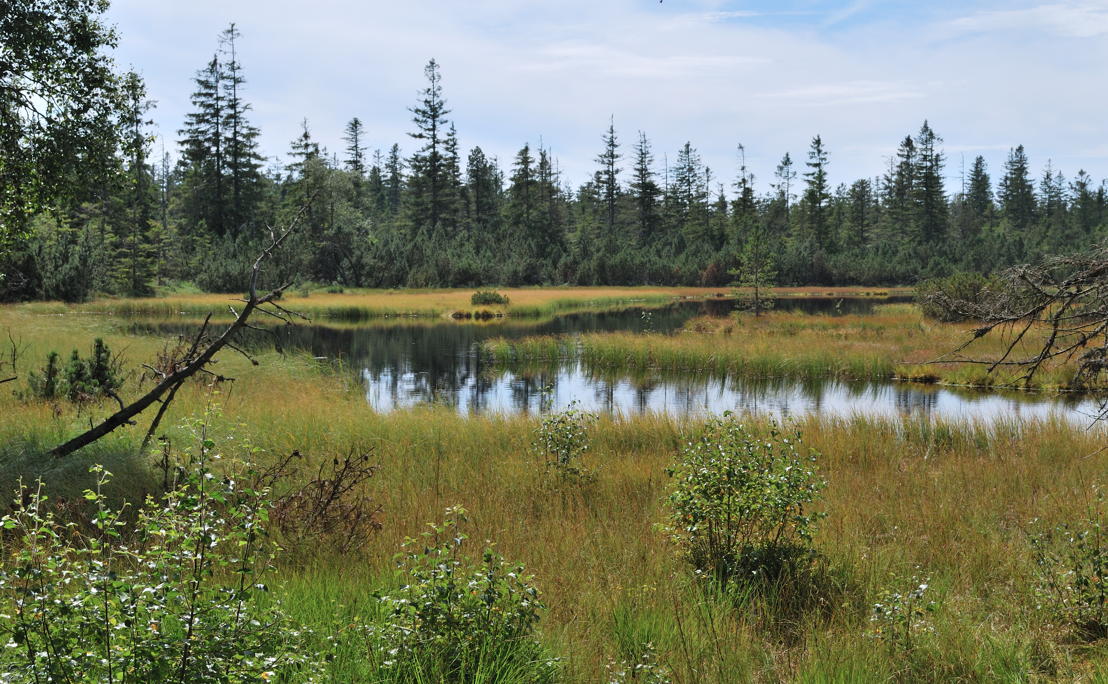
The Hohloh is a mountain, , on the eastern main ridge of the Northern Black Forest in Germany. It lies near the village of Kaltenbronn in the borough of Gernsbach, a town in the county of Rastatt in the German state of Baden-Württemberg. Its summit is the highest point in the borough of Gernsbach and the eastern chain of the Northern Black Forest, the ridge between the rivers Murg and Enz. A mountain pass runs northeast of the summit plateau between the two river valleys passing over the saddle of Schwarzmiss (). Characteristic of the Hohloh is its flat bunter sandstone ''kuppe'' with its observation tower, the Hohloh Tower (''Hohlohturm'') and a raised bog and bog lakes on the plateau which are protected. Geography Location The Hohloh lies within the Central/North Black Forest Nature Park, mainly on the forest estates of the Gernsbach hamlet of Kaltenbronn, which is situated 2 kilometres east of the summit. On the western edge of the plateau, parts of the mountains ... [...More Info...] [...Related Items...] OR: [Wikipedia] [Google] [Baidu] |
Kaltenbronn (Gernsbach)
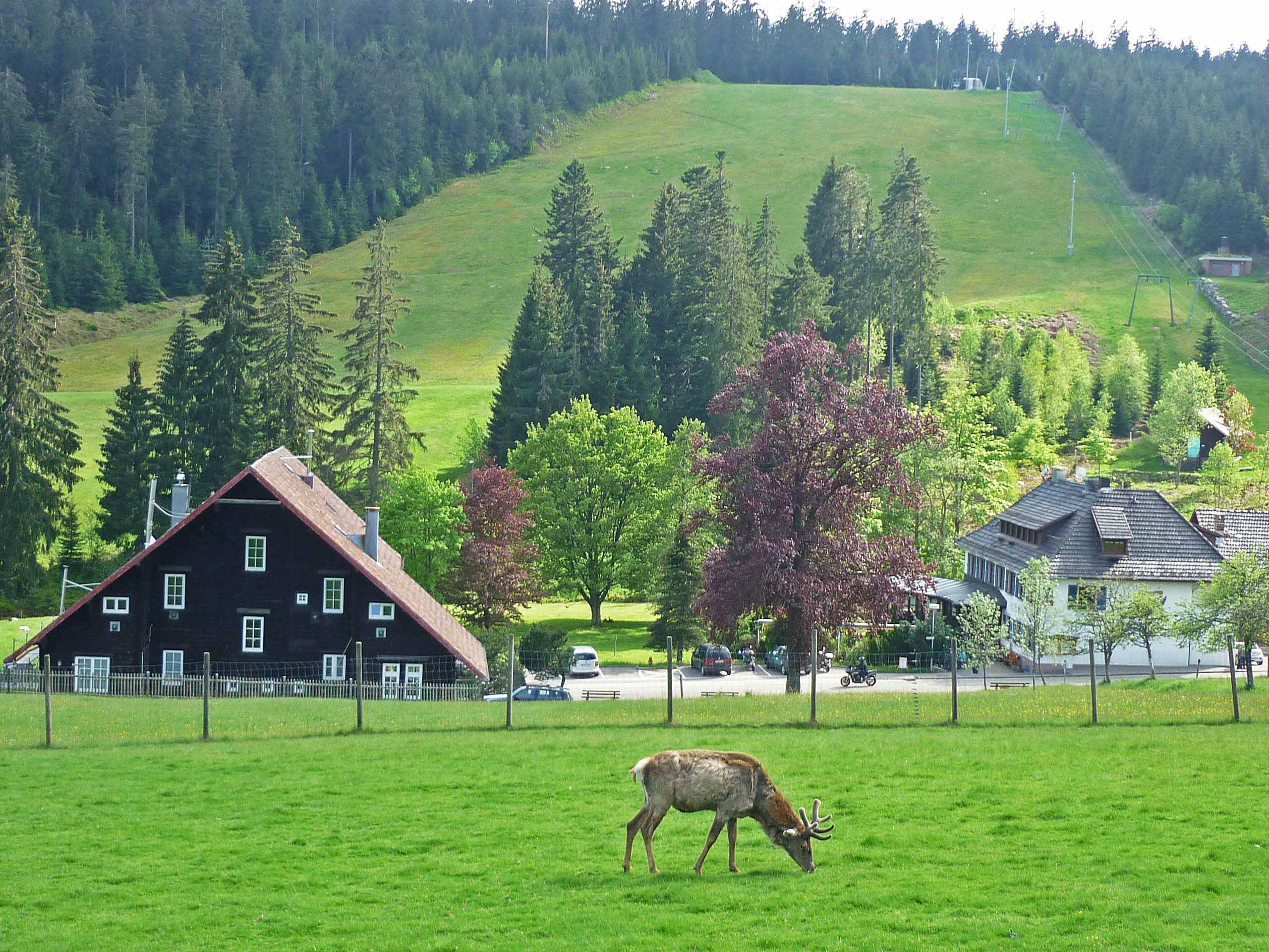
Kaltenbronn is a hamlet and old parish in the Black Forest in Germany that belongs to the parish of Reichental, Baden-Württemberg, Reichental in the municipality of Gernsbach in Baden-Württemberg. The hamlet in the northern Black Forest with its hotel, forester’s lodge and former Baden hunting lodge lies a little below the top of the Schwarzmiss Pass (933 m) between the Murg (Northern Black Forest), Murg and Enz valleys at a height of about 860 metres above Normalnull, sea level (NN) in the centre of the largest contiguous woodland in Baden-Württemberg. Kaltenbronn is crossed by the Landesstraße 76 B, the road over the pass between the valleys of the Murg and the Enz, and is accessible by public buses from both Gernsbach and Bad Wildbad. Its average annual temperature is 6 °C and its annual precipitation is 1,600 mm. It is covered by snow for an average of 75 days per year. Leisure Kaltenbronn is a day trippers’ destination and local recreation centre i ... [...More Info...] [...Related Items...] OR: [Wikipedia] [Google] [Baidu] |
Northern Black Forest
The Northern Black Forest (german: Nordschwarzwald) refers to the northern third of the Black Forest in Germany or, less commonly today, to the northern half of this mountain region. Geography The Northern Black Forest is bounded in the north by a line from Karlsruhe to Pforzheim and, in the south, by a line running from the Rench valley to Freudenstadt. Its northern boundary largely coincides with the emergence of the extensively forested bunter sandstone strata from the arable region of the Kraichgau; its southern boundary with the Central Black Forest (or, in the case of a bipartite division, the Southern Black Forest) varies depending on the definition or natural regional division used (see also Black Forest). Earlier, the Northern Black Forest was the entire northern half of the mountain range as far as the Kinzig (Rhine), line of the Kinzig valley, which divides the Black Forest east of Lahr/Schwarzwald, Lahr. To the west it is bounded by the Upper Rhine Plain, to the east ... [...More Info...] [...Related Items...] OR: [Wikipedia] [Google] [Baidu] |
Black Forest
The Black Forest (german: Schwarzwald ) is a large forested mountain range in the state of Baden-Württemberg in southwest Germany, bounded by the Rhine Valley to the west and south and close to the borders with France and Switzerland. It is the source of the Danube and Neckar rivers. Its highest peak is the Feldberg with an elevation of above sea level. Roughly oblong in shape, with a length of and breadth of up to , it has an area of about 6,009 km2 (2,320 sq mi). Historically, the area was known for forestry and the mining of ore deposits, but tourism has now become the primary industry, accounting for around 300,000 jobs. There are several ruined military fortifications dating back to the 17th century. History In ancient times, the Black Forest was known as , after the Celtic deity, Abnoba. In Roman times (Late antiquity), it was given the name ("Marcynian Forest", from the Germanic word ''marka'' = "border"). The Black Forest probably represented the bo ... [...More Info...] [...Related Items...] OR: [Wikipedia] [Google] [Baidu] |
County Of Rastatt
Rastatt is a ''Landkreis'' (district) in the west of Baden-Württemberg, Germany. Neighbouring districts are (from north clockwise) Karlsruhe, Calw, Freudenstadt and the Ortenaukreis. To the west it borders the French ''département'' Bas-Rhin. Rastatt completely surrounds the district-free city Baden-Baden. History The district was created in 1939 as the successor of the ''Oberamt Rastatt'' and later the ''Großkreis Baden''. In 1973 it was merged with the majority of the neighboring district Bühl, and some small parts of the district Kehl. Geography The district is located in the Rhine valley. The south-east part, however, is part of the Northern Black Forest. The highest elevation is the Hoher Ochsenkopf. The county has three small exclaves within the borough of Baden-Baden. The largest of these is home to the Waldenecksee, the smallest, the old abbey of Fremersberg. Partnerships Since 1968 the district has partnership with the Finnish city Vantaa. The partnership with the ... [...More Info...] [...Related Items...] OR: [Wikipedia] [Google] [Baidu] |
Weisenbach
Weisenbach is a municipality in the district of Rastatt in Baden-Württemberg in Germany Germany,, officially the Federal Republic of Germany, is a country in Central Europe. It is the second most populous country in Europe after Russia, and the most populous member state of the European Union. Germany is situated betwe .... Mayors *-1993 Gerhard Feißt *1993–2019: Toni Huber *since 2019: Daniel Retsch References Rastatt (district) {{Rastatt-geo-stub ... [...More Info...] [...Related Items...] OR: [Wikipedia] [Google] [Baidu] |
Murg (Nordschwarzwald)
The Murg is an 80.2-kilometre-long river (including its headstream, the ''Rechtmurg'') and a right tributary of the Rhine in Baden-Württemberg, Germany. It flows through the Northern Black Forest into the Upper Rhine Plain, crossing the counties of Freudenstadt and Rastatt. Geography Course The Murg valley is one of the largest and deepest valleys in the Black Forest (up to over 700 metres deep) and generally runs in a northerly direction. It separates the precipitation-rich main crest of the Northern Black Forest, including the Hornisgrinde (1,164 m), to the west, from the densely forested bunter sandstone plateaux in the east. The Murg originates from 2 large headstreams in the western part of the municipality of Baiersbronn. Below the Schliffkopf at about , the main headstream of the Right Murg (''Rechtmurg'') is formed by the Schurbach stream and Tränkenteich pond, a little above the ''Murgursprung'' ("Murg Source"). The other, left-hand headstream is the Red Murg ... [...More Info...] [...Related Items...] OR: [Wikipedia] [Google] [Baidu] |
Forbach (Baden)
Forbach ( , ) is a village and municipality in Baden-Württemberg, Germany. It lies in the district of Rastatt. It is located in the Murg river valley, in the northern part of the Black Forest The Black Forest (german: Schwarzwald ) is a large forested mountain range in the state of Baden-Württemberg in southwest Germany, bounded by the Rhine Valley to the west and south and close to the borders with France and Switzerland. It is t ... mountains. Forbach is further broken down into the following districts: Langenbrand, Bermersbach, Gausbach, Hundsbach, Herrenwies, Kirschbaumwasen, Erbersbronn, Raumünzach and Schwarzenbach. The tarn of Schurmsee lies within the municipality at a height of 794 metres. Mayors * 1998-2014: Kuno Kußmann (CDU) * since 2014: Katrin Buhrke (lawyer) Personalities * Günther Becker (1924-2007), composer * Manfred Gotta (born 1947), entrepreneur and advertising editor, lives in Forbach-Hundsbach References Rastatt (district) ... [...More Info...] [...Related Items...] OR: [Wikipedia] [Google] [Baidu] |
Reichental, Baden-Württemberg
Reichental is a village in Baden-Württemberg, Germany. It is administratively part of the town of Gernsbach in the Rastatt district. Geography The village is located south-east of Gernsbach on the Reichenbach stream, a tributary of the Murg River. The hamlet of Kaltenbronn to the south is part of Reichental. History The first documented mention of Reichental is as 'Richental' in the year 1339–1340. On January 1, 1975, Reichental was incorporated into the town of Gernsbach Gernsbach () is a town in the district of Rastatt, in Baden-Württemberg, Germany. It is located on the river Murg, east of Baden-Baden in the Black Forest. Twin towns are Baccarat in France and Pergola, Marche in Italy. The town is the hist ... References {{reflist Villages in Baden-Württemberg ... [...More Info...] [...Related Items...] OR: [Wikipedia] [Google] [Baidu] |
County Of Eberstein
The County of Eberstein was a territory within the Holy Roman Empire, situated in the southwest of modern Germany. From 1085 up into the 13th century, the Counts of Eberstein lived in the castle known today as Alt Eberstein which lies on a mountain top between the valleys of the rivers Murg and Oos (in ''Ebersteinburg'', now an outlying district of Baden-Baden). They then moved to ''Neu Eberstein'', today known as ''Schloss Eberstein'', near Gernsbach. From 1085, the counts were ''Vögte'' of Reichenbach Priory. After the financial ruin of Wolf von Eberstein in 1387, half of the family possessions had to be sold to the Margraves of Baden. When the last male member of the family died in 1660, the remaining possessions were taken over by the bishopric of Speyer and by the duchy of Württemberg. File:Grafschaft Eberstein in Schwaben - Map - Krieg von Hochfelden.JPG , Map of the County of Eberstein in 1283 File:Alt Ebersteinburg.JPG , The ruins of Alt Eberstein castle File:G ... [...More Info...] [...Related Items...] OR: [Wikipedia] [Google] [Baidu] |
Central/North Black Forest Nature Park
The Central/North Black Forest Nature Park (german: Naturpark Schwarzwald Mitte/Nord) is located in Baden-Württemberg in Germany. It covers an area of 3,750 km2 and was founded in December 2000. As of 2018, it is the third-largest nature park in Germany. In 2014, the Black Forest National Park opened within the Central/North Black Forest Nature Park. Location It is a maximum of 90 km from north to south and 65 km wide and covers the counties of Calw, Freudenstadt, Karlsruhe, Rastatt, Rottweil, Enzkreis, Ortenaukreis, Baden-Baden and Pforzheim with 105 municipalities in which around 700,000 people live. The Black Forest National Park is located within the nature park. To the south, it is adjoined by the Southern Black Forest Nature Park. Nature and landscape The Central/North Black Forest Nature Park is characterised by its deeply incised valleys, rock outcrops, streams, meadows and pastures. Geology and climate as well as centuries of human interference ... [...More Info...] [...Related Items...] OR: [Wikipedia] [Google] [Baidu] |


