|
Hogsty Reef
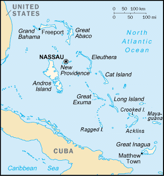
Hogsty Reef is an uninhabited coral atoll located in the southern Bahamas. It is located between Great Inagua (to the South) and Acklins Island (to the North). Geography and navigation It is a 5×3 mile coral atoll rising up from 6,000 ft deep surrounding waters. Atolls are presumed to form from extinct volcanoes – in a process whereby the volcano creates the sea mount which rises from the ocean depths, then subsides leaving a coral atoll. There are just a handful of these geological formations in the Atlantic, whereas there are hundreds in the Pacific. Hogsty is uninhabited and hardly anyone ever visits. There are just two tiny islands – hardly larger than sandbars – not enough to offer any real lee anchorage. The islands are small enough to walk/circumnavigate in 5–10 minutes. They do offer good shelling. Most charts and guides call out an anchorage in the lee of NW Cay. It is also possible to anchor at the head of the lagoon. The lagoon is mostly 20–30 ft ... [...More Info...] [...Related Items...] OR: [Wikipedia] [Google] [Baidu] |
Atoll
An atoll () is a ring-shaped island, including a coral rim that encircles a lagoon partially or completely. There may be coral islands or cays on the rim. Atolls are located in warm tropical or subtropical oceans and seas where corals can grow. Most of the approximately 440 atolls in the world are in the Pacific Ocean. Two different, well-cited models, the subsidence and antecedent karst models, have been used to explain the development of atolls.Droxler, A.W. and Jorry, S.J., 2021. ''The Origin of Modern Atolls: Challenging Darwin's Deeply Ingrained Theory.'' ''Annual Review of Marine Science'', 13, pp.537-573. According to Charles Darwin's ''subsidence model'', the formation of an atoll is explained by the subsidence of a volcanic island around which a coral fringing reef has formed. Over geologic time, the volcanic island becomes extinct and eroded as it subsides completely beneath the surface of the ocean. As the volcanic island subsides, the coral fringing reef becomes a ... [...More Info...] [...Related Items...] OR: [Wikipedia] [Google] [Baidu] |
Bahamas
The Bahamas (), officially the Commonwealth of The Bahamas, is an island country within the Lucayan Archipelago of the West Indies in the Atlantic Ocean, North Atlantic. It takes up 97% of the Lucayan Archipelago's land area and is home to 88% of the archipelago's population. The archipelagic state consists of more than 3,000 islands, cays, and islets in the Atlantic Ocean, and is located north of Cuba and northwest of the island of Hispaniola (split between the Dominican Republic and Haiti) and the Turks and Caicos Islands, southeast of the U.S. state of Florida, and east of the Florida Keys. The capital is Nassau, Bahamas, Nassau on the island of New Providence. The Royal Bahamas Defence Force describes The Bahamas' territory as encompassing of ocean space. The Bahama Islands were inhabited by the Lucayan people, Lucayans, a branch of the Arawakan-Taino language, speaking Taíno, for many centuries. Christopher Columbus was the first European to see the islands, making hi ... [...More Info...] [...Related Items...] OR: [Wikipedia] [Google] [Baidu] |
Great Inagua
Inagua is the southernmost district of the Bahamas, comprising the islands of Great Inagua and Little Inagua. The headquarters for the district council are in Matthew Town. History The original settlers were the Lucayan people, who arrived sometime between 500 and 800 CE, crossing in dugout canoes from Hispaniola and/or Cuba to the Bahamas. The name ''Heneagua'' was derived from a Spanish expression meaning 'water is to be found there'. Two names of apparent Lucayan origin, ''Inagua'' (meaning "Small Eastern Island") and ''Baneque'' (meaning "Big Water Island"), were used by the Spanish to refer to Great Inagua. Between the years of 1500 and 1825, many documented treasure laden ships were destroyed on Inaguan reefs. The two most valuable wrecks lost off the Inaguas were treasure-laden Spanish galleons: the ''Santa Rosa'' in 1599; and the ''Infanta'' in 1788. Other ships of considerable value that were wrecked there include the French ''Le Count De Paix'' in 1713, the British ... [...More Info...] [...Related Items...] OR: [Wikipedia] [Google] [Baidu] |
Acklins Island
Acklins is an island and district of the Bahamas. It is one of a group of islands arranged along a large, shallow lagoon called the Bight of Acklins, of which the largest are Crooked Island () in the north and Acklins () in the southeast, and the smaller are Long Cay (once known as Fortune Island, ()) in the northwest, and Castle Island in the south. History The islands were settled by American Loyalists in the late 1780s who set up cotton plantations maintained by over 1,000 slaves. After the abolition of slavery in the British Empire the plantations became uneconomical, and the replacement income from sponge diving has now dwindled as well with the rest of the natural sponge industry after the advent of synthetics. The inhabitants now live by fishing and small-scale farming. Although Acklins Island has relatively few historical landmarks, there are some noteworthy places. Acklins is home to numerous Lucayan people sites. An ancient site, thought to be one of the largest Lu ... [...More Info...] [...Related Items...] OR: [Wikipedia] [Google] [Baidu] |
Atolls
An atoll () is a ring-shaped island, including a coral rim that encircles a lagoon partially or completely. There may be coral islands or cays on the rim. Atolls are located in warm tropical or subtropical oceans and seas where corals can grow. Most of the approximately 440 atolls in the world are in the Pacific Ocean. Two different, well-cited models, the subsidence and antecedent karst models, have been used to explain the development of atolls.Droxler, A.W. and Jorry, S.J., 2021. ''The Origin of Modern Atolls: Challenging Darwin's Deeply Ingrained Theory.'' ''Annual Review of Marine Science'', 13, pp.537-573. According to Charles Darwin's ''subsidence model'', the formation of an atoll is explained by the subsidence of a volcanic island around which a coral fringing reef has formed. Over geologic time, the volcanic island becomes extinct and eroded as it subsides completely beneath the surface of the ocean. As the volcanic island subsides, the coral fringing reef becomes a b ... [...More Info...] [...Related Items...] OR: [Wikipedia] [Google] [Baidu] |
Liberty Ship
Liberty ships were a class of cargo ship built in the United States during World War II under the Emergency Shipbuilding Program. Though British in concept, the design was adopted by the United States for its simple, low-cost construction. Mass-produced on an unprecedented scale, the Liberty ship came to symbolize U.S. wartime industrial output. The class was developed to meet British orders for transports to replace ships that had been lost. Eighteen American shipyards built 2,710 Liberty ships between 1941 and 1945 (an average of three ships every two days), easily the largest number of ships ever produced to a single design. Their production mirrored (albeit on a much larger scale) the manufacture of "Hog Islander" and similar standardized ship types during World War I. The immensity of the effort, the number of ships built, the role of female workers in their construction, and the survival of some far longer than their original five-year design life combine to make them th ... [...More Info...] [...Related Items...] OR: [Wikipedia] [Google] [Baidu] |
SS Richmond P
SS is an abbreviation for ''Schutzstaffel'', a paramilitary organisation in Nazi Germany. SS, Ss, or similar may also refer to: Places *Guangdong Experimental High School (''Sheng Shi'' or ''Saang Sat''), China *Province of Sassari, Italy (vehicle plate code) *South Sudan (ISO 3166-1 code SS) *SS postcode area, UK, around Southend-on-Sea *San Sebastián, Spanish city Arts, entertainment, and media *SS (band), an early Japanese hardcore punk band * ''SS'' (manga), a Japanese comic 2000-2003 *SS Entertainment, a Korean entertainment company *''S.S.'', for Sosthenes Smith, H. G. Wells pseudonym for story ''A Vision of the Past'' *SS, the production code for the 1968 ''Doctor Who'' serial ''The Wheel in Space'' *''Sesame Street'', American kids' TV show Language *Ss (digraph) used in Pinyin * ß or ss, a German-language ligature * switch-reference in linguistics *'' Scilicet'', used as a section sign * (''in the strict sense'') in Latin *Swazi language (ISO 639-1 code "ss") Scienc ... [...More Info...] [...Related Items...] OR: [Wikipedia] [Google] [Baidu] |
Slave Ship
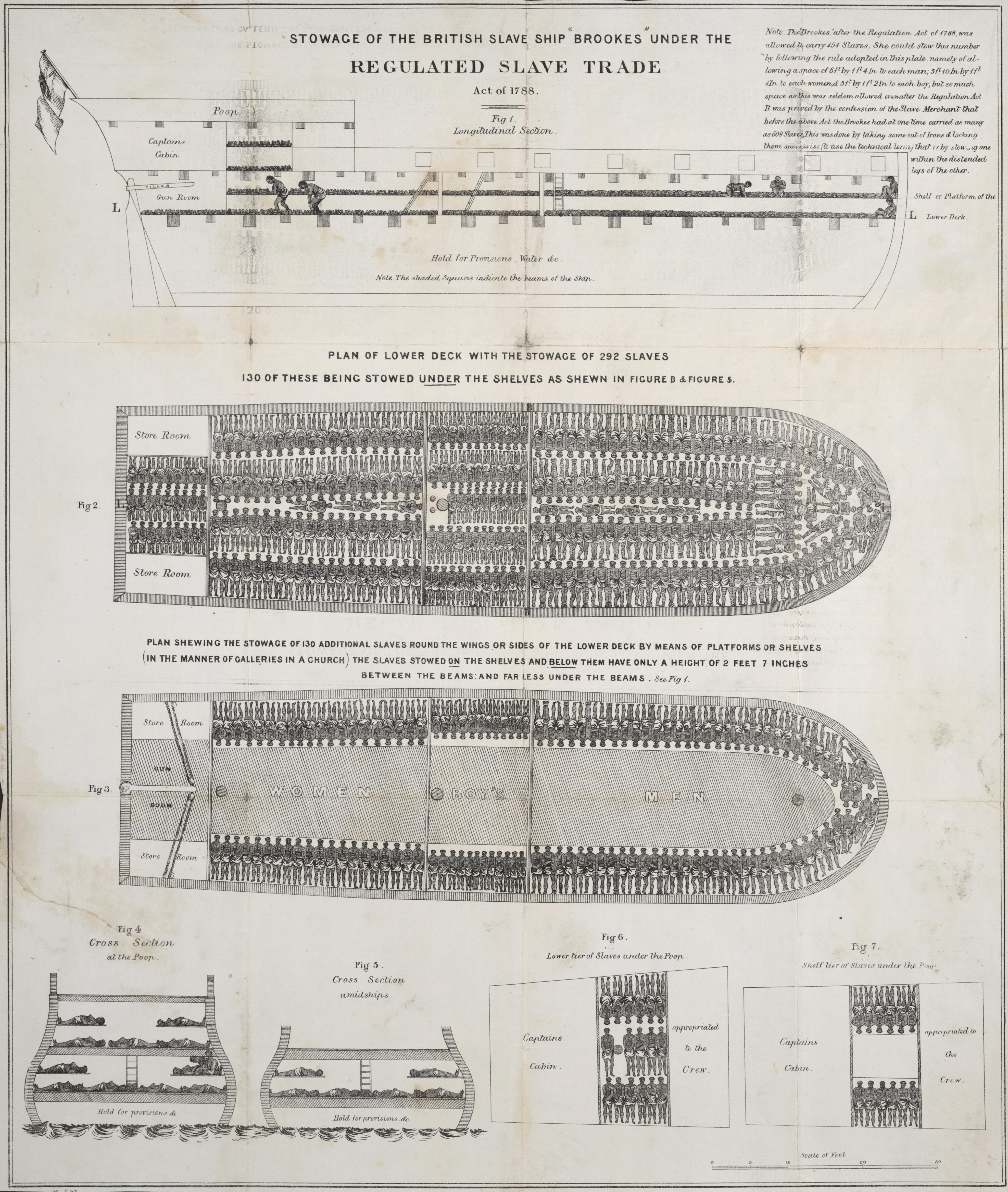
Slave ships were large cargo ships specially built or converted from the 17th to the 19th century for transporting slaves. Such ships were also known as "Guineamen" because the trade involved human trafficking to and from the Guinea coast in West Africa. Atlantic slave trade In the early 1600s, more than a century after the arrival of Europeans to the Americas, demand for unpaid labor to work plantations made slave-trading a profitable business. The Atlantic slave trade peaked in the last two decades of the 18th century, during and following the Kongo Civil War. To ensure profitability, the owners of the ships divided their hulls into holds with little headroom, so they could transport as many slaves as possible. Unhygienic conditions, dehydration, dysentery and scurvy led to a high mortality rate, on average 15% and up to a third of captives. Often the ships carried hundreds of slaves, who were chained tightly to plank beds. For example, the slave ship ''Henrietta Marie ... [...More Info...] [...Related Items...] OR: [Wikipedia] [Google] [Baidu] |
The Bahamas
The Bahamas (), officially the Commonwealth of The Bahamas, is an island country within the Lucayan Archipelago of the West Indies in the Atlantic Ocean, North Atlantic. It takes up 97% of the Lucayan Archipelago's land area and is home to 88% of the archipelago's population. The archipelagic state consists of more than 3,000 islands, cays, and islets in the Atlantic Ocean, and is located north of Cuba and northwest of the island of Hispaniola (split between the Dominican Republic and Haiti) and the Turks and Caicos Islands, southeast of the U.S. state of Florida, and east of the Florida Keys. The capital is Nassau, Bahamas, Nassau on the island of New Providence. The Royal Bahamas Defence Force describes The Bahamas' territory as encompassing of ocean space. The Bahama Islands were inhabited by the Lucayan people, Lucayans, a branch of the Arawakan-Taino language, speaking Taíno, for many centuries. Christopher Columbus was the first European to see the islands, making hi ... [...More Info...] [...Related Items...] OR: [Wikipedia] [Google] [Baidu] |
List Of Lighthouses In The Bahamas ...
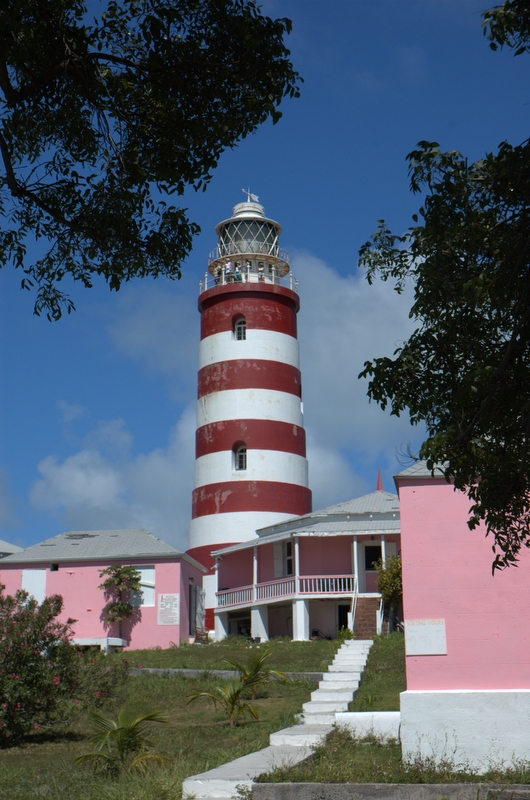
This is a list of lighthouses in the Bahamas. Abaco Islands Acklins Andros Island Berry Islands Bimini Cay Sal Bank Crooked Island Eleuthera Exuma Sound Grand Bahama Inagua Jumentos Cays Mayaguana New Providence See also * Transport in the Bahamas * Lighthouse * Lists of lighthouses References External links Amateur Radio Lighthouse Societylist of lighthouses in the Bahamas Lighthouses of the Bahamas* {{DEFAULTSORT:Lighthouses in the Bahamas Bahamas Bahamas transport-related lists Lighthouses A lighthouse is a tower, building, or other type of physical structure designed to emit light from a system of lamps and lenses and to serve as a beacon for navigational aid, for maritime pilots at sea or on inland waterways. Lighthouses mar ... [...More Info...] [...Related Items...] OR: [Wikipedia] [Google] [Baidu] |
Uninhabited Islands Of The Bahamas
The list of uninhabited regions includes a number of places around the globe. The list changes year over year as human beings migrate into formerly uninhabited regions, or migrate out of formerly inhabited regions. List As a group, the list of uninhabited places are called the "nonecumene". This is a special geography term which means the uninhabited area of the world. * Virtually all of the Ocean *Virtually all of Antarctica *Most of The Arctic *Most of Greenland *Most of The Sahara * Antipodes Islands * Ashmore and Cartier Islands * Bajo Nuevo Bank * Baker Island * Ball's Pyramid * Balleny Islands * Big Major Cay * Bouvet Island * Much of the interior of Brazil * Caroline Island * Clipperton Island * The semi-arid regions and deserts of Australia * Devon Island * Much of Eastern Oregon * Elephant Island * Elobey Chico * Ernst Thälmann Island * Much of Fiordland, New Zealand * Goa Island * Gough Island * Hans Island * Harmil * Hashima Island * Hatutu * Heard Island ... [...More Info...] [...Related Items...] OR: [Wikipedia] [Google] [Baidu] |


