|
Historical Bibliographies Of Tasmania
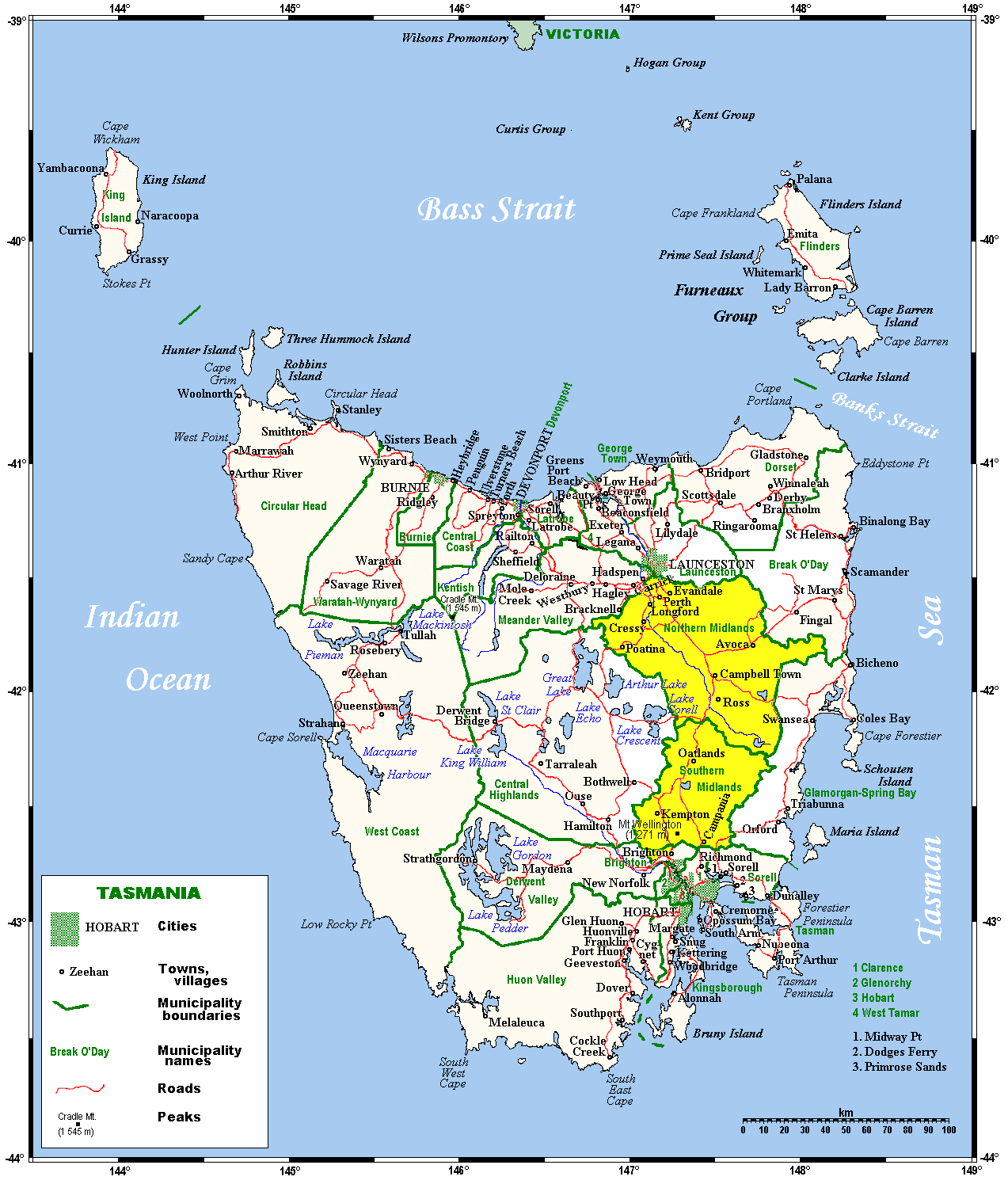
Historical bibliographies of Tasmania (also known as ''Tasmanian historical bibliographies'') were a series of books produced by the Centre of Tasmanian Historical Studies and the History Department of the University of Tasmania. They were based on major regions of Tasmania and the written sources available. A further four were planned but did not eventuate: North-West, Launceston, Upper Derwent and South East. Series * 1. Ely, Richard (Compiler) The History of the Huon, Channel Bruny Island Region: Printed Sources * 2. Jetson, Tim (Compiler) (1991) History of the Midlands - Central Plateau Region: Printed Sources * 3. Tim Jetson and Richard Ely, (1995) History of West and South-West Tasmania: A Guide to Printed Sources Notes External links * http://www.utas.edu.au/history_classics/publications/pubs_index.html See also *History of Tasmania The history of Tasmania begins at the end of the most recent ice age (approximately 10,000 years ago) when it is believed that t ... [...More Info...] [...Related Items...] OR: [Wikipedia] [Google] [Baidu] |
University Of Tasmania
The University of Tasmania (UTAS) is a public research university, primarily located in Tasmania, Australia. Founded in 1890, it is Australia's fourth oldest university. Christ College, one of the university's residential colleges, first proposed in 1840 in Lieutenant-Governor Sir John Franklin's Legislative Council, was modeled on the Oxford and Cambridge colleges, and was founded in 1846, making it the oldest tertiary institution in the country. The university is a sandstone university, a member of the international Association of Commonwealth Universities, and the Association of Southeast Asian Institutions of Higher Learning. The university offers various undergraduate and graduate programs in a range of disciplines, and has links with 20 specialist research institutes and co-operative research centres. Its Institute for Marine and Antarctic Studies has strongly contributed to the university's multiple 5 rating scores (''well above world standard'') for excellence in re ... [...More Info...] [...Related Items...] OR: [Wikipedia] [Google] [Baidu] |
Regions Of Tasmania
In the Australian state of Tasmania, there are many areas which are commonly known by regional names. Regions are areas that share similar characteristics. These characteristics may be natural such as the Furneaux Islands, the coastline, or the Central Highlands. Alternatively, the characteristics may be cultural, such as a viticulture land use. Tasmania is divided by numerous regional boundaries, based on different characteristics. In many cases boundaries defined by different government agencies are coterminous and are often cited by the Australian and local media that tend to distinguish between North West, West Coast, Southern, and East Coast. Some regions were historically identified in terms of land use. In the 1960s the ''Atlas of Tasmania'' was the definitive Tasmanian Government publication in relation to regional geographical variations in Tasmania. Local government In Tasmania the third tier of elected government after the federal and state governments are the local ... [...More Info...] [...Related Items...] OR: [Wikipedia] [Google] [Baidu] |
Midlands (Tasmania)
The Midlands is a region of Tasmania between Launceston and Hobart. It also refers to the relatively flat, dry agricultural area, so named because it covers the region between the two cities. Its name is probably also influenced from the Midlands in the United Kingdom. It lends its name to the Southern Midlands Council, Northern Midlands Council, and the Midland Highway. The region is sometimes conflated or confused with the adjacent region of the Central Highlands—with the added term ''Tasmania's heartland''. Geography Most of the Midlands is a region of relatively low plains drained mostly by tributaries of the Tamar River in the north and Jordan River in the south. The natural vegetation was predominantly grassland, but all of it is either grazed by cattle and sheep or cleared for growing better pasture species. On the eastern side it rises into low, unglaciated dolerite hills and mountains, largely covered with dry sclerophyllous forests, but on the west lies the hi ... [...More Info...] [...Related Items...] OR: [Wikipedia] [Google] [Baidu] |
Central Plateau (Tasmania)
Central Plateau Conservation Area is an animal and plant conservation area in Tasmania, Australia. It is adjacent to the Walls of Jerusalem National Park. The Central Plateau of Tasmania is the largest area of high ground in Tasmania. It is bound to the north east by the Great Western Tiers, many hydro electric schemes emanating from rivers that flow to the south - and to the west by Cradle Mountain-Lake St Clair National Park. Central Plateau is a large rural locality in the local government areas of Central Highlands and Meander Valley in the Central and Launceston regions of Tasmania. Its central point, to the west of Great Lake, is about north-west of the town of Hamilton. The 2016 census has a population of nil for the state suburb of Central Plateau. Central Plateau is a confirmed suburb/locality. Location Central Plateau surrounds the locality of Cramps Bay, on the eastern shore of Great Lake. The western part of the locality contains most of the Central Plateau Co ... [...More Info...] [...Related Items...] OR: [Wikipedia] [Google] [Baidu] |
Western Tasmania
The West Coast of Tasmania is mainly isolated rough country, associated with wilderness, mining and tourism. It served as the location of an early convict settlement in the early history of Van Diemen's Land, and contrasts sharply with the more developed and populous northern and eastern parts of the island state. Climate The west coast has a much cooler and wetter climate when compared to the east coast. Frequent low pressure systems hit the west coast causing heavy rain, snow, and ice. The West Coast Range blocks these systems from impacting the east, therefore making the West Coast a rain catchment with some areas receiving over of rain a year. In winter temperatures at sea level hover around , and when not raining, morning frost is common. The temperatures are much lower inland from the coast with maximums in winter often failing to surpass . Typically, the snow line in winter is around 900 metres (3000 ft), however sea level snow falls several times each winter as ... [...More Info...] [...Related Items...] OR: [Wikipedia] [Google] [Baidu] |
South West Tasmania
South West Tasmania is a region in Tasmania that has evoked curiosity as to its resources over the duration of European presence on the island. The more recent is the consideration as a potential area of resources for development and its consideration as World Heritage wilderness. The most notable controversies occurring in the region in the late twentieth century was the flooding of Lake Pedder and the proposed damming of the Franklin River by the Franklin Dam. Southwest is a locality that covers most of the region. The locality (and therefore the region) is in the local government areas of Derwent Valley (29%), Huon Valley (20%), Central Highlands (7%) and West Coast (44%). Its central point, near the encircled locality of Strathgordon, is about west of the town of New Norfolk, the administrative centre for the Derwent Valley Council. The 2016 census has a population of 15 for the state suburb of Southwest. Early surveys Most early walks through the region were for disc ... [...More Info...] [...Related Items...] OR: [Wikipedia] [Google] [Baidu] |
History Of Tasmania
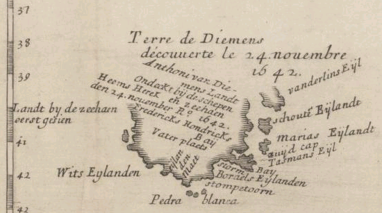
The history of Tasmania begins at the end of the most recent ice age (approximately 10,000 years ago) when it is believed that the island was joined to the Australian mainland. Little is known of the human history of the island until the British colonisation in the 19th century. Indigenous people Tasmania was inhabited by an Indigenous population, the Aboriginal Tasmanians, and evidence indicates their presence in the territory, later to become an island, at least 35,000 years ago. At the time of the British occupation and colonisation in 1803 the Indigenous population was estimated at between 3000 and 10,000. Historian Lyndall Ryan's analysis of population studies led her to conclude that there were about 7000 spread throughout the island's nine nations; Nicholas Clements, citing research by N.J.B. Plomley and Rhys Jones, settled on a figure of 3000 to 4000. The combination of the so-called Black War, internecine conflict and, from the late 1820s, the spread of infectious ... [...More Info...] [...Related Items...] OR: [Wikipedia] [Google] [Baidu] |


