|
Hinson's Island, Bermuda
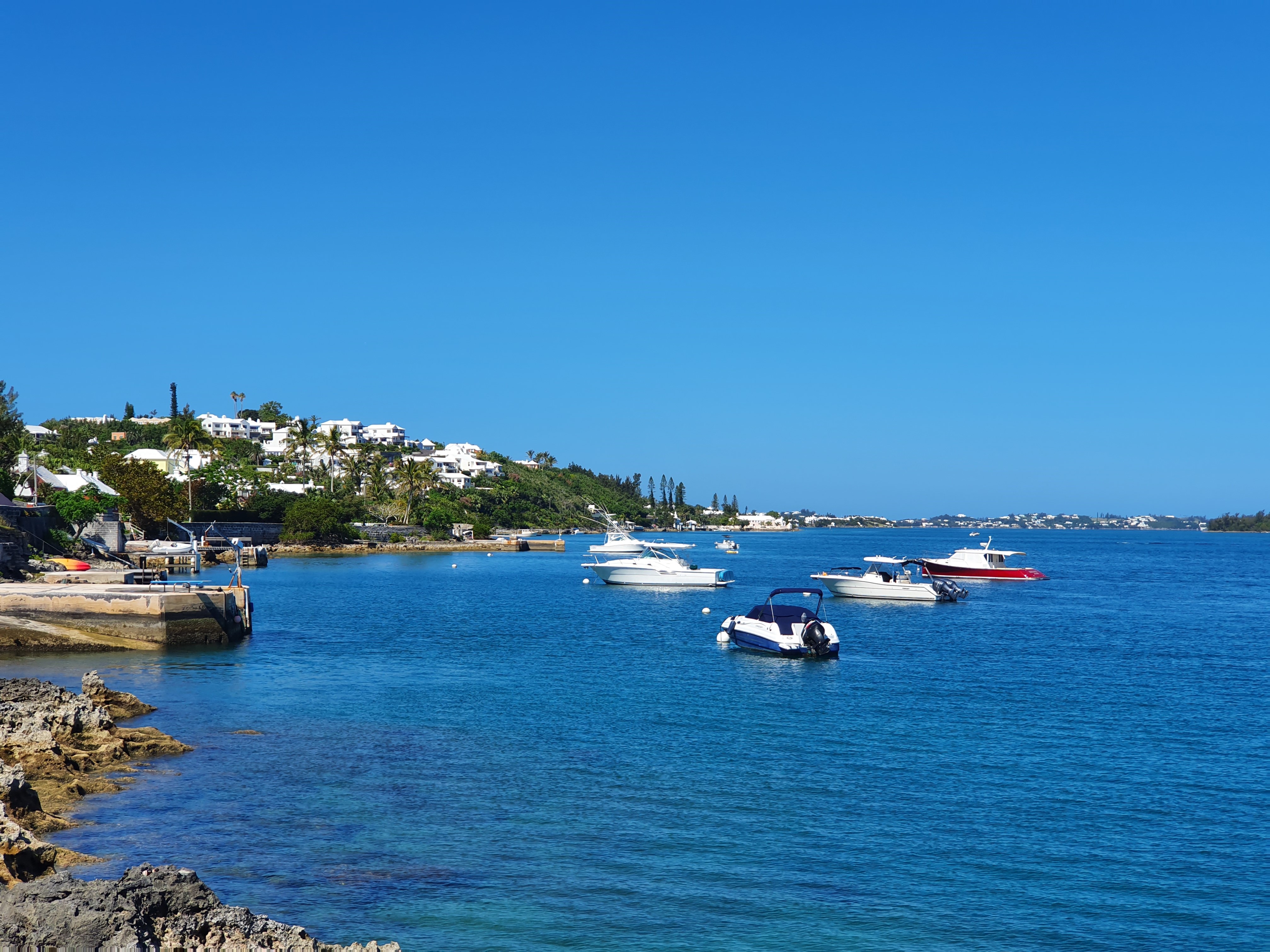
Hinson's Island is a small island within the Great Sound of Bermuda. It lies in the southeast of the sound, and is part of Paget parish, although it was formerly part of Warwick Parish and is still within the Warwick North constituency. Hinson's Island is the only island in Bermuda served by the government ferry system. The population of Hinson's Island is approximately 50 people. Hinson's (formerly known as Brown's or Godet's) Island is one of the larger islands in the Great Sound. Like its neighbours, it was used as a prisoner of war camp during the Second Boer War The Second Boer War ( af, Tweede Vryheidsoorlog, , 11 October 189931 May 1902), also known as the Boer War, the Anglo–Boer War, or the South African War, was a conflict fought between the British Empire and the two Boer Republics (the South ..., then became the base for Bermuda's first seaplane service. See also * List of lighthouses in Bermuda References Islands of Bermuda Paget Parish Lightho ... [...More Info...] [...Related Items...] OR: [Wikipedia] [Google] [Baidu] |
Great Sound, Bermuda
The Great Sound is large ocean inlet (a sound) located in Bermuda. It may be the submerged remains of a Pre-Holocene volcanic caldera. Other geologists dispute the origin of the Bermuda Pedestal as a volcanic hotspot. Geography The Great Sound dominates the southwest of the island chain and forms a natural harbour. It is surrounded on all sides by islands, except for the northeast, where it is open to the Atlantic Ocean. Peninsulas To the south, two small peninsulas jut into the sound separating it from the smaller Little Sound. In the east, the Great Sound narrows to form Hamilton Harbour. Bermuda's capital, Hamilton, is on the northern shore of this harbour. Islands Numerous islands lie within the Great Sound, most of them on the southeastern side of it, including Darrell's Island, Hawkins Island, Hinson's Island, Long Island, Marshall's Island, and Watling Island San Salvador Island (known as Watling's Island from the 1680s until 1925) is an island and district ... [...More Info...] [...Related Items...] OR: [Wikipedia] [Google] [Baidu] |
Bermuda
) , anthem = "God Save the King" , song_type = National song , song = " Hail to Bermuda" , image_map = , map_caption = , image_map2 = , mapsize2 = , map_caption2 = , subdivision_type = Sovereign state , subdivision_name = , established_title2 = English settlement , established_date2 = 1609 (officially becoming part of the Colony of Virginia in 1612) , official_languages = English , demonym = Bermudian , capital = Hamilton , coordinates = , largest_city = Hamilton , ethnic_groups = , ethnic_groups_year = 2016 , government_type = Parliamentary dependency under a constitutional monarchy , leader_title1 = Monarch , leader_name1 = Charles III , leader_title2 = Governor , leader_name2 = Rena Lalgie , leader_title3 = Premier , leader_name3 = Edward David Burt , legislature = Parliament , upper_house = Senate , lower_house = House of Assembly , area_km2 = 53.2 , area_sq_mi = 20.54 , area_rank = , percent_water = 27 , elevation_max_m = 79 , ... [...More Info...] [...Related Items...] OR: [Wikipedia] [Google] [Baidu] |
Paget Parish, Bermuda
Paget Parish is one of the nine parishes of Bermuda. It is named for William Paget, 4th Baron Paget de Beaudesert (1572–1629). The parish is located in the central south of the island chain, immediately south of Hamilton Harbor on the main island. It is joined to Warwick Parish in the southwest, and Devonshire Parish in the northeast. As with most of Bermuda's parishes, it covers just over 2.3 square miles (about 6.0 km2 or 1500 acres). It had a population of 5,899 in 2016. Other notable features of Paget include Bermuda College, the Bermuda Division of the British Red Cross, Bermuda Botanical Gardens and Masterworks Museum of Bermuda Art. Education Public primary schools: *St. Paul's PreschoolGOVERNMENT, PRIVATE SCHOOLS & BERMUD ... [...More Info...] [...Related Items...] OR: [Wikipedia] [Google] [Baidu] |
Warwick Parish, Bermuda
Warwick Parish is one of the nine parishes of Bermuda. It is named after Robert Rich, 2nd Earl of Warwick (1587-1658). It is located in the central south of the island chain, occupying part of the main island to the southeast of the Great Sound, Bermuda, Great Sound, the large expanse of water which dominates the geography of western Bermuda, and also a number of islands which lie within that sound. It is joined to Southampton Parish, Bermuda, Southampton Parish in the southwest, and to Paget Parish, Bermuda, Paget Parish in the northeast. As with most of Bermuda's parishes, it covers just over 2.3 square miles (about 6.0 km² or 1500 acres). It had a population of 9,002 in 2016. Natural features in Warwick include Warwick Long Bay, Bermuda, Warwick Long Bay, Riddell's Bay, Bermuda, Riddell's Bay, Darrell's Island, Bermuda, Darrell's Island, Hawkins Island, Bermuda, Hawkins Island, Long Island, Bermuda, Long Island, and Marshall's Island, Bermuda, Marshall's Island. Hinson ... [...More Info...] [...Related Items...] OR: [Wikipedia] [Google] [Baidu] |
Prisoner Of War
A prisoner of war (POW) is a person who is held captive by a belligerent power during or immediately after an armed conflict. The earliest recorded usage of the phrase "prisoner of war" dates back to 1610. Belligerents hold prisoners of war in custody for a range of legitimate and illegitimate reasons, such as isolating them from the enemy combatants still in the field (releasing and repatriating them in an orderly manner after hostilities), demonstrating military victory, punishing them, prosecuting them for war crimes, exploiting them for their labour, recruiting or even conscripting them as their own combatants, collecting military and political intelligence from them, or indoctrinating them in new political or religious beliefs. Ancient times For most of human history, depending on the culture of the victors, enemy fighters on the losing side in a battle who had surrendered and been taken as prisoners of war could expect to be either slaughtered or enslaved. Ear ... [...More Info...] [...Related Items...] OR: [Wikipedia] [Google] [Baidu] |
Second Boer War
The Second Boer War ( af, Tweede Vryheidsoorlog, , 11 October 189931 May 1902), also known as the Boer War, the Anglo–Boer War, or the South African War, was a conflict fought between the British Empire and the two Boer Republics (the South African Republic and the Orange Free State) over the Empire's influence in Southern Africa from 1899 to 1902. Following the discovery of gold deposits in the Boer republics, there was a large influx of "foreigners", mostly British from the Cape Colony. They were not permitted to have a vote, and were regarded as "unwelcome visitors", invaders, and they protested to the British authorities in the Cape. Negotiations failed and, in the opening stages of the war, the Boers launched successful attacks against British outposts before being pushed back by imperial reinforcements. Though the British swiftly occupied the Boer republics, numerous Boers refused to accept defeat and engaged in guerrilla warfare. Eventually, British scorched eart ... [...More Info...] [...Related Items...] OR: [Wikipedia] [Google] [Baidu] |
List Of Lighthouses In Bermuda ...
This is a list of lighthouses in Bermuda. Lighthouses See also * Lists of lighthouses and lightvessels References External links * {{North America topic, List of lighthouses in * Bermuda Lighthouses A lighthouse is a tower, building, or other type of physical structure designed to emit light from a system of lamps and lenses and to serve as a beacon for navigational aid, for maritime pilots at sea or on inland waterways. Lighthouses mark ... [...More Info...] [...Related Items...] OR: [Wikipedia] [Google] [Baidu] |
Islands Of Bermuda
Bermuda is an archipelago consisting of 181 islands. List of islands See also *Geography of Bermuda ReferencesBermuda's 123 Islands Listed by name, large and small, present and past SatelliteViews.net External links *{{DEFAULTSORT:List Of Islands Of Bermuda * |
Paget Parish
Paget Parish is one of the nine parishes of Bermuda. It is named for William Paget, 4th Baron Paget de Beaudesert (1572–1629). The parish is located in the central south of the island chain, immediately south of Hamilton Harbor on the main island. It is joined to Warwick Parish in the southwest, and Devonshire Parish in the northeast. As with most of Bermuda's parishes, it covers just over 2.3 square miles (about 6.0 km2 or 1500 acres). It had a population of 5,899 in 2016. Other notable features of Paget include Bermuda College, the Bermuda Division of the British Red Cross, Bermuda Botanical Gardens and Masterworks Museum of Bermuda Art. Education Public primary schools: *St. Paul's PreschoolGOVERNMENT, PRIVATE SCHOOLS & BERMU ... [...More Info...] [...Related Items...] OR: [Wikipedia] [Google] [Baidu] |


