|
Hinkhouse Peak
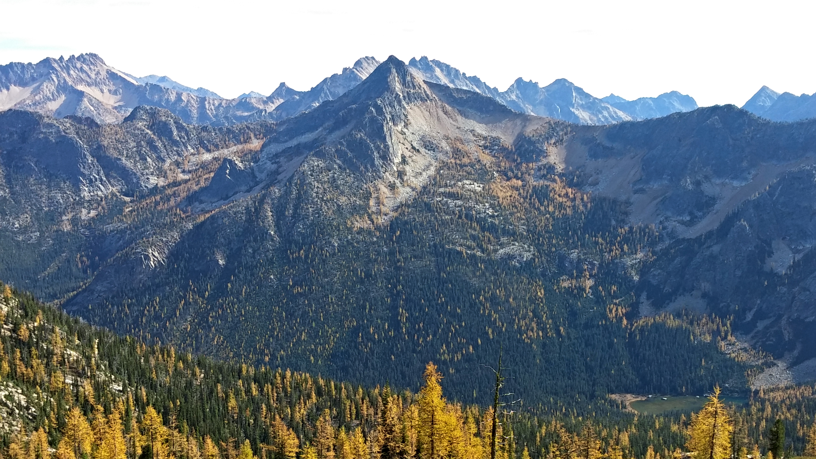
Hinkhouse Peak is a mountain summit located on the shared border of Okanogan County and Chelan County in Washington state. It is part of the Okanogan Range which is a sub-range of the North Cascades Range. Hinkhouse Peak is situated on land administered by the Okanogan–Wenatchee National Forest. The nearest higher neighbor is Liberty Bell Mountain, to the south. Hinkhouse Peak is situated north of Washington Pass, at the east end of a high ridge which connects to Cutthroat Peak. A high ridge extending northeast connects it to Constitution Crags. Most precipitation runoff from the peak drains into Early Winters Creek which is a tributary of the Methow River, but the south slope drains into a tributary of the Chelan River. Topographic relief is significant as it rises nearly above Early Winters Creek in approximately one mile. History The peak's name honors Jimmy D. Hinkhouse (1943–1995), a Washington state mountaineer, economist with the Boeing Corporation in Seattle, ... [...More Info...] [...Related Items...] OR: [Wikipedia] [Google] [Baidu] |
Early Winters Spires
The Early Winters Spires are two rock formations in the Liberty Bell Group of the North Cascade Range, set between Liberty Bell Mountain and Blue Lake Peak in Washington state, United States. The two spires (North and South) are virtually one granite massif, split by a deep cleft formed by jointing and erosion. The shapes of these spires are attributed to ice wedging, cleaving along master joints by soil acids, and perpetual weathering. North Early Winters Spire Elevation: 7,760 ft/ 2,366 m First ascent: May 28, 1950/. Wesley Grande, Pete Schoening, and Dick Widrig. South Early Winters Spire Elevation: 7,807 ft/ 2,380 m First ascent: July 20, 1937. Kenneth Adam, Raffi Bedayn, and W. Kenneth Davis were credited in their report of first ascent however, only Bedayn and Neil Ruge appear in the summit register. Climate Early Winters Spires are located in the marine west coast climate zone of western North America. Most weather fronts originate in the Pacific ... [...More Info...] [...Related Items...] OR: [Wikipedia] [Google] [Baidu] |
Topographic Relief
Terrain or relief (also topographical relief) involves the vertical and horizontal dimensions of land surface. The term bathymetry is used to describe underwater relief, while hypsometry studies terrain relative to sea level. The Latin word (the root of ''terrain'') means "earth." In physical geography, terrain is the lay of the land. This is usually expressed in terms of the elevation, slope, and orientation of terrain features. Terrain affects surface water flow and distribution. Over a large area, it can affect weather and climate patterns. Importance The understanding of terrain is critical for many reasons: * The terrain of a region largely determines its suitability for human settlement: flatter alluvial plains tend to have better farming soils than steeper, rockier uplands. * In terms of environmental quality, agriculture, hydrology and other interdisciplinary sciences; understanding the terrain of an area assists the understanding of watershed boundaries, drai ... [...More Info...] [...Related Items...] OR: [Wikipedia] [Google] [Baidu] |
Oceanic Climate
An oceanic climate, also known as a marine climate, is the humid temperate climate sub-type in Köppen classification ''Cfb'', typical of west coasts in higher middle latitudes of continents, generally featuring cool summers and mild winters (for their latitude), with a relatively narrow annual temperature range and few extremes of temperature. Oceanic climates can be found in both hemispheres generally between 45 and 63 latitude, most notably in northwestern Europe, northwestern America, as well as New Zealand. Precipitation Locations with oceanic climates tend to feature frequent cloudy conditions with precipitation, low hanging clouds, and frequent fronts and storms. Thunderstorms are normally few, since strong daytime heating and hot and cold air masses meet infrequently in the region. In most areas with an oceanic climate, precipitation comes in the form of rain for the majority of the year. However, some areas with this climate see some snowfall annually during winter. M ... [...More Info...] [...Related Items...] OR: [Wikipedia] [Google] [Baidu] |
Orographic Lift
Orographic lift occurs when an air mass is forced from a low elevation to a higher elevation as it moves over rising terrain. As the air mass gains altitude it quickly cools down adiabatically, which can raise the relative humidity to 100% and create clouds and, under the right conditions, precipitation. Orographic lifting can have a number of effects, including precipitation, rain shadowing, leeward winds, and associated clouds. Precipitation Precipitation induced by orographic lift occurs in many places throughout the world. Examples include: * The Mogollon Rim in central Arizona * The western slope of the Sierra Nevada range in California * The mountains near Baja California North – specifically La Bocana to Laguna Hanson. * The windward slopes of Khasi and Jayantia Hills (see Mawsynram) in the state of Meghalaya in India. * The Western Highlands of Yemen, which receive by far the most rain in Arabia. * The Western Ghats that run along India's western coast. * The Grea ... [...More Info...] [...Related Items...] OR: [Wikipedia] [Google] [Baidu] |
Cascade Mountains
The Cascade Range or Cascades is a major mountain range of western North America, extending from southern British Columbia through Washington and Oregon to Northern California. It includes both non-volcanic mountains, such as the North Cascades, and the notable volcanoes known as the High Cascades. The small part of the range in British Columbia is referred to as the Canadian Cascades or, locally, as the Cascade Mountains. The latter term is also sometimes used by Washington residents to refer to the Washington section of the Cascades in addition to North Cascades, the more usual U.S. term, as in North Cascades National Park. The highest peak in the range is Mount Rainier in Washington at . part of the Pacific Ocean's Ring of Fire, the ring of volcanoes and associated mountains around the Pacific Ocean. All of the eruptions in the contiguous United States over the last 200 years have been from Cascade volcanoes. The two most recent were Lassen Peak from 1914 to 1921 and a major ... [...More Info...] [...Related Items...] OR: [Wikipedia] [Google] [Baidu] |
Pacific Ocean
The Pacific Ocean is the largest and deepest of Earth's five oceanic divisions. It extends from the Arctic Ocean in the north to the Southern Ocean (or, depending on definition, to Antarctica) in the south, and is bounded by the continents of Asia and Oceania in the west and the Americas in the east. At in area (as defined with a southern Antarctic border), this largest division of the World Ocean—and, in turn, the hydrosphere—covers about 46% of Earth's water surface and about 32% of its total surface area, larger than Earth's entire land area combined .Pacific Ocean . '' Britannica Concise.'' 2008: Encyclopædia Britannica, Inc. The centers of both the |
Weather Front
A weather front is a boundary separating air masses for which several characteristics differ, such as air density, wind, temperature, and humidity. Disturbed and unstable weather due to these differences often arises along the boundary. For instance, cold fronts can bring bands of thunderstorms and cumulonimbus precipitation or be preceded by squall lines, while warm fronts are usually preceded by stratiform precipitation and fog. In summer, subtler humidity gradients are known as dry lines can trigger severe weather. Some fronts produce no precipitation and little cloudiness, although there is invariably always a wind shift. Cold fronts generally move from west to east, whereas warm fronts move poleward, although any direction is possible. Occluded fronts are a hybrid merge of the two, and stationary fronts are stalled in their motion. Cold fronts and cold occlusions move faster than warm fronts and warm occlusions because the dense air behind them can lift as well as push ... [...More Info...] [...Related Items...] OR: [Wikipedia] [Google] [Baidu] |
North America
North America is a continent in the Northern Hemisphere and almost entirely within the Western Hemisphere. It is bordered to the north by the Arctic Ocean, to the east by the Atlantic Ocean, to the southeast by South America and the Caribbean Sea, and to the west and south by the Pacific Ocean. Because it is on the North American Plate, North American Tectonic Plate, Greenland is included as a part of North America geographically. North America covers an area of about , about 16.5% of Earth's land area and about 4.8% of its total surface. North America is the third-largest continent by area, following Asia and Africa, and the list of continents and continental subregions by population, fourth by population after Asia, Africa, and Europe. In 2013, its population was estimated at nearly 579 million people in List of sovereign states and dependent territories in North America, 23 independent states, or about 7.5% of the world's population. In Americas (terminology)#Human ge ... [...More Info...] [...Related Items...] OR: [Wikipedia] [Google] [Baidu] |
Marine West Coast
An oceanic climate, also known as a marine climate, is the humid temperate climate sub-type in Köppen classification ''Cfb'', typical of west coasts in higher middle latitudes of continents, generally featuring cool summers and mild winters (for their latitude), with a relatively narrow annual temperature range and few extremes of temperature. Oceanic climates can be found in both hemispheres generally between 45 and 63 latitude, most notably in northwestern Europe, northwestern America, as well as New Zealand. Precipitation Locations with oceanic climates tend to feature frequent cloudy conditions with precipitation, low hanging clouds, and frequent fronts and storms. Thunderstorms are normally few, since strong daytime heating and hot and cold air masses meet infrequently in the region. In most areas with an oceanic climate, precipitation comes in the form of rain for the majority of the year. However, some areas with this climate see some snowfall annually during winter. M ... [...More Info...] [...Related Items...] OR: [Wikipedia] [Google] [Baidu] |
United States Board On Geographic Names
The United States Board on Geographic Names (BGN) is a federal body operating under the United States Secretary of the Interior. The purpose of the board is to establish and maintain uniform usage of geographic names throughout the federal government of the United States. History On January 8, 1890, Thomas Corwin Mendenhall, superintendent of the US Coast and Geodetic Survey Office, wrote to 10 noted geographers "to suggest the organization of a Board made up of representatives from the different Government services interested, to which may be referred any disputed question of geographical orthography." President Benjamin Harrison signed executive order 28 on September 4, 1890, establishing the ''Board on Geographical Names''. "To this Board shall be referred all unsettled questions concerning geographic names. The decisions of the Board are to be accepted y federal departmentsas the standard authority for such matters." The board was given authority to resolve all unsettled ques ... [...More Info...] [...Related Items...] OR: [Wikipedia] [Google] [Baidu] |


.jpg)

.jpg)
