|
Hindlip - 11
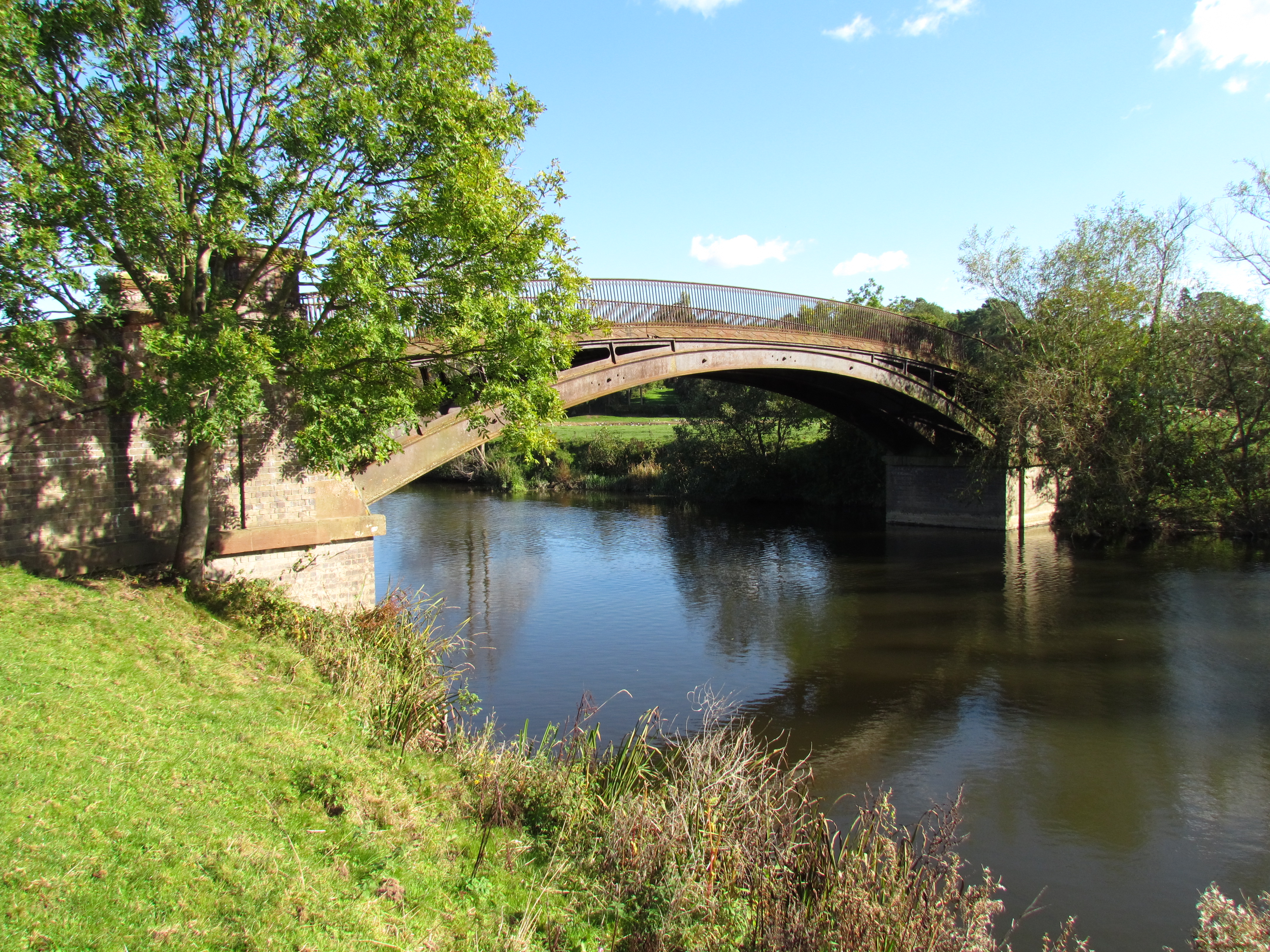
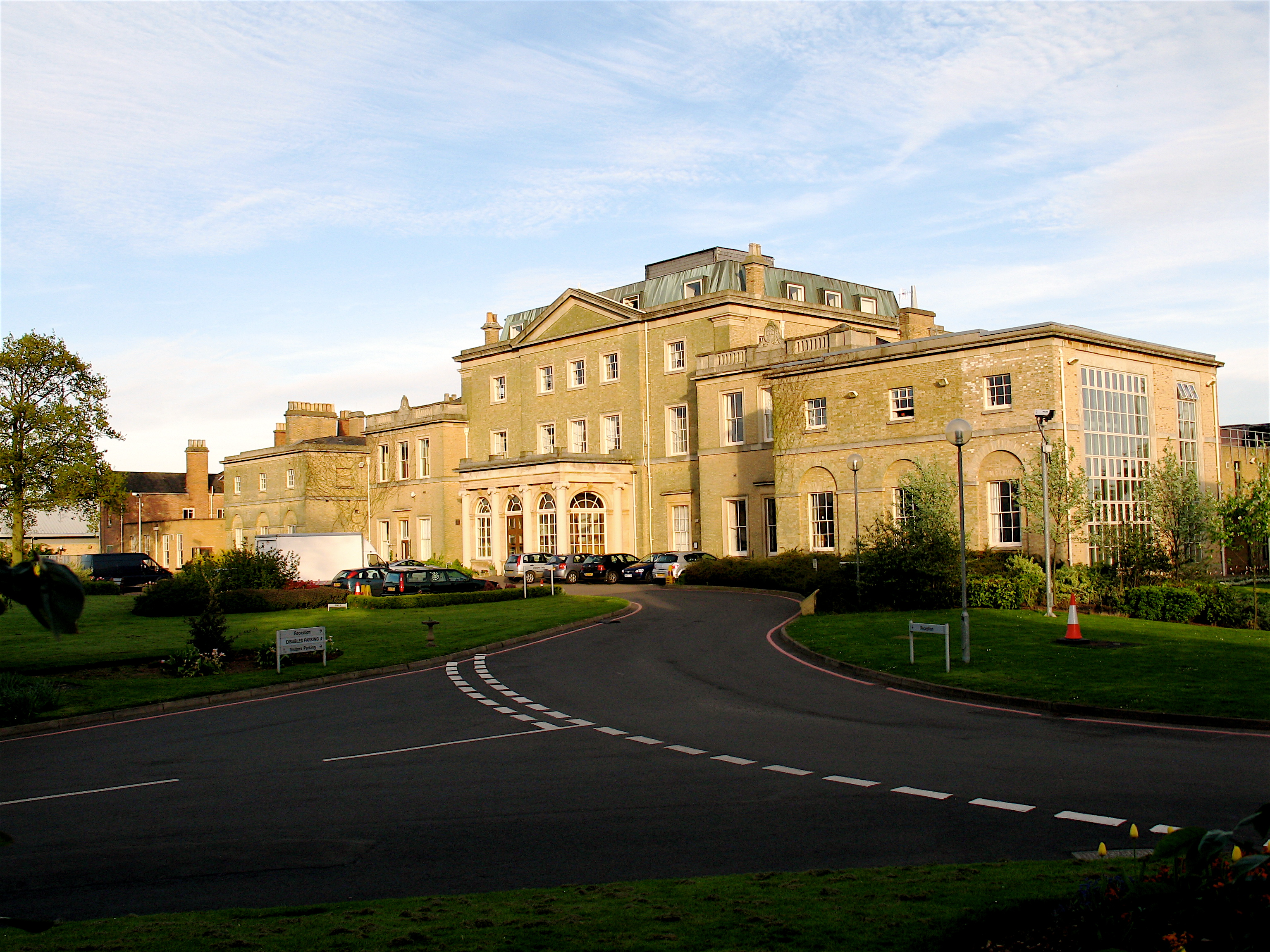
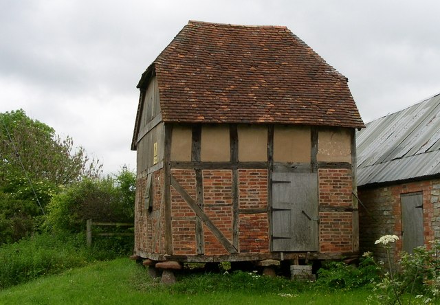
Hindlip or Hinlip is a village and civil parish north east of Worcester, in the Wychavon district, in the county of Worcestershire, England. In 2011 the parish had a population of 180. The parish touches Tibberton, Martin Hussingtree, Salwarpe, Oddingley, Warndon and North Claines. Features There are 15 listed buildings in Hindlip. Hindlip Hall, a stately home originally built in 1563, rebuilt in 1820 following its destruction by fire is the headquarters of the West Mercia Police. St James's Church is a 15th-century parish church which is no longer supported by the Church of England (since 1997), but is now the church for the constabulary.Genealogy and Heraldry accessed 7 July 2008 History The name "Hindlip" means 'Hind leap'. Hindlip was recorded in the |
Mid Worcestershire (UK Parliament Constituency)
Mid Worcestershire is a constituency represented in the House of Commons of the UK Parliament since 2015 by Nigel Huddleston, a Conservative. Members of Parliament Constituency profile Income levels are on average considerably higher than the national average and levels of rented and social housing are below the national average, particularly levels seen in cities. The constituency, which has 72,317 people aged 18 and over according to the 2001 census, plus 39,645 households includes the towns of Droitwich Spa and Evesham and the many semi-rural villages around the cathedral city of Worcester, sits across an undulating part of the West Midlands with good access to its central commercial, service sector and industrial areas. Boundaries The present Mid Worcestershire constituency, has existed almost intact since 1997, covers central and south-eastern parts of the county of Worcestershire. It covers most of the Wychavon district, including Broadway, Droitwich and Evesham, bu ... [...More Info...] [...Related Items...] OR: [Wikipedia] [Google] [Baidu] |
North Claines
North Claines is a civil parish in Wychavon district, Worcestershire, England, immediately north of the city of Worcester. It includes the settlements of Fernhill Heath, Bevere, Lower Town, and Hawford. It is bordered to the west and north west by the River Severn and the River Salwarpe, with the Droitwich Canal running parallel to the Salwarpe. The parish was formed in 1885 when the southern part of the parish of Claines was incorporated into Worcester under the Worcester Incorporation Act. At the 2021 census the parish had a population of 4,460. The area of the parish was stated as . The parish has a parish council, the lowest level of local government. It is part of Lovett and North Claines ward (which had a 2021 population of 7,647) for elections to Wychavon district council. there are 30 listed building In the United Kingdom, a listed building or listed structure is one that has been placed on one of the four statutory lists maintained by Historic England in Eng ... [...More Info...] [...Related Items...] OR: [Wikipedia] [Google] [Baidu] |
Villages In Worcestershire
A village is a clustered human settlement or community, larger than a hamlet but smaller than a town (although the word is often used to describe both hamlets and smaller towns), with a population typically ranging from a few hundred to a few thousand. Though villages are often located in rural areas, the term urban village is also applied to certain urban neighborhoods. Villages are normally permanent, with fixed dwellings; however, transient villages can occur. Further, the dwellings of a village are fairly close to one another, not scattered broadly over the landscape, as a dispersed settlement. In the past, villages were a usual form of community for societies that practice subsistence agriculture, and also for some non-agricultural societies. In Great Britain, a hamlet earned the right to be called a village when it built a church. [...More Info...] [...Related Items...] OR: [Wikipedia] [Google] [Baidu] |
Deserted Medieval Village
In the United Kingdom, a deserted medieval village (DMV) is a former settlement which was abandoned during the Middle Ages, typically leaving no trace apart from earthworks or cropmarks. If there are fewer than three inhabited houses the convention is to regard the site as deserted; if there are more than three houses, it is regarded as a shrunken medieval village. There are estimated to be more than 3,000 DMVs in England alone. Other deserted settlements Not all sites are medieval: villages reduced in size or disappeared over a long period, from as early as Anglo-Saxon times to as late as the 1960s, due to numerous different causes. Reasons for desertion Over the centuries, settlements have been deserted as a result of natural events, such as rivers changing course or silting up, flooding (especially during the wet 13th and 14th centuries) as well as coastal and estuarine erosion or being overwhelmed by windblown sand. Many were thought to have been abandoned due to the de ... [...More Info...] [...Related Items...] OR: [Wikipedia] [Google] [Baidu] |
Oswaldslow
The Oswaldslow (sometimes Oswaldslaw) was a hundred in the English county of Worcestershire, which was named in a supposed charter of 964 by King Edgar the Peaceful (died 975). It was actually a triple hundred, composed of three smaller hundreds.Mason ''St Wulfstan of Worcester'' p. 16 It was generally felt to be named after Bishop Oswald of Worcester (died 992), and created by the merging of Cuthburgelow, Winburgetreow and Wulfereslaw Hundreds. The name originally traced to Oslaf, a Bernician prince exiled from Northumbria, who along with his brother Oswudu allegedly helped King Penda of Mercia conquer the area in the mid-7th century. A local landmark was named after Oslaf, "Oslafeshlaw", or "the mound of Oslaf". The name of the mound was later changed to reflect Oswald's name when the location became the meeting place for the triple hundred.Mason ''St Wulfstan of Worcester'' p. 4 After the Norman Conquest of England, the forged charter of Edgar's was used as proof that the c ... [...More Info...] [...Related Items...] OR: [Wikipedia] [Google] [Baidu] |
Domesday Book
Domesday Book () – the Middle English spelling of "Doomsday Book" – is a manuscript record of the "Great Survey" of much of England and parts of Wales completed in 1086 by order of King William I, known as William the Conqueror. The manuscript was originally known by the Latin name ''Liber de Wintonia'', meaning "Book of Winchester", where it was originally kept in the royal treasury. The '' Anglo-Saxon Chronicle'' states that in 1085 the king sent his agents to survey every shire in England, to list his holdings and dues owed to him. Written in Medieval Latin, it was highly abbreviated and included some vernacular native terms without Latin equivalents. The survey's main purpose was to record the annual value of every piece of landed property to its lord, and the resources in land, manpower, and livestock from which the value derived. The name "Domesday Book" came into use in the 12th century. Richard FitzNeal wrote in the ''Dialogus de Scaccario'' ( 1179) that the book ... [...More Info...] [...Related Items...] OR: [Wikipedia] [Google] [Baidu] |
Church Of England
The Church of England (C of E) is the established Christian church in England and the mother church of the international Anglican Communion. It traces its history to the Christian church recorded as existing in the Roman province of Britain by the 3rd century and to the 6th-century Gregorian mission to Kent led by Augustine of Canterbury. The English church renounced papal authority in 1534 when Henry VIII failed to secure a papal annulment of his marriage to Catherine of Aragon. The English Reformation accelerated under Edward VI's regents, before a brief restoration of papal authority under Queen Mary I and King Philip. The Act of Supremacy 1558 renewed the breach, and the Elizabethan Settlement charted a course enabling the English church to describe itself as both Reformed and Catholic. In the earlier phase of the English Reformation there were both Roman Catholic martyrs and radical Protestant martyrs. The later phases saw the Penal Laws punish Ro ... [...More Info...] [...Related Items...] OR: [Wikipedia] [Google] [Baidu] |
West Mercia Police
West Mercia Police (), formerly the West Mercia Constabulary, is the territorial police force responsible for policing the counties of Herefordshire, Shropshire (including Telford and Wrekin) and Worcestershire in England. The force area covers making it the fourth largest police area in England and Wales. The resident population of the area is 1.19 million Its name comes from the ancient kingdom of Mercia. The force represents a diverse range of policing environments from densely populated urban areas on the edge of Birmingham as well as Telford, Shrewsbury, and Worcester, to sparsely populated rural areas, such as Herefordshire, which remains an important part of the force's responsibility. As of September 2017, the force has a workforce of 2,017 police officers, 223 police community support officers, 1541 police staff and 388 members of the special constabulary. The force has its headquarters in the historical manor house and grounds of Hindlip Hall on the outskirts of W ... [...More Info...] [...Related Items...] OR: [Wikipedia] [Google] [Baidu] |
Stately Home
An English country house is a large house or mansion in the English countryside. Such houses were often owned by individuals who also owned a town house. This allowed them to spend time in the country and in the city—hence, for these people, the term distinguished between town and country. However, the term also encompasses houses that were, and often still are, the full-time residence for the landed gentry who ruled rural Britain until the Reform Act 1832. Frequently, the formal business of the counties was transacted in these country houses, having functional antecedents in manor houses. With large numbers of indoor and outdoor staff, country houses were important as places of employment for many rural communities. In turn, until the agricultural depressions of the 1870s, the estates, of which country houses were the hub, provided their owners with incomes. However, the late 19th and early 20th centuries were the swansong of the traditional English country house lifesty ... [...More Info...] [...Related Items...] OR: [Wikipedia] [Google] [Baidu] |
Ordnance Survey
, nativename_a = , nativename_r = , logo = Ordnance Survey 2015 Logo.svg , logo_width = 240px , logo_caption = , seal = , seal_width = , seal_caption = , picture = , picture_width = , picture_caption = , formed = , preceding1 = , dissolved = , superseding = , jurisdiction = Great BritainThe Ordnance Survey deals only with maps of Great Britain, and, to an extent, the Isle of Man, but not Northern Ireland, which has its own, separate government agency, the Ordnance Survey of Northern Ireland. , headquarters = Southampton, England, UK , region_code = GB , coordinates = , employees = 1,244 , budget = , minister1_name = , minister1_pfo = , chief1_name = Steve Blair , chief1_position = CEO , agency_type = , parent_agency = , child1_agency = , keydocument1 = , website = , footnotes = , map = , map_width = , map_caption = Ordnance Survey (OS) is the national mapping agency for Great Britain. The agency's name indicates its original military purpose (se ... [...More Info...] [...Related Items...] OR: [Wikipedia] [Google] [Baidu] |
Warndon
Warndon is a suburb and civil parish of the City of Worcester in Worcestershire, England. The parish, which includes the villages of Trotshill and Warndon was part of Droitwich Rural District until 1974 when it was annexed to Worcester under the Local Government Act 1972. It had a population of 10,237 in 2001. Warndon Villages Warndon Villages is a housing development based on "village" themes on the eastern side of Worcester, situated between Warndon and the M5 motorway. There are four distinct "villages" in the development, the Harleys, the Lyppards, the Berkeleys and the Meadows, each with their own subdivisions. The first village opened in 1996. Warndon Villages is home to Lyppard Grange Primary School, four nurseries, a Tesco Tesco plc () is a British multinational groceries and general merchandise retailer headquartered in Welwyn Garden City, England. In 2011 it was the third-largest retailer in the world measured by gross revenues and the ninth-largest in th .. ... [...More Info...] [...Related Items...] OR: [Wikipedia] [Google] [Baidu] |
Wychavon
Wychavon is a local government district in Worcestershire, England, with a population size of 132,500 according to the 2021 census. Its council is based in the town of Pershore, and the other towns in the district are Droitwich Spa and Evesham. The district extends from the southeast corner of Worcestershire north and west. It borders all the other districts of Worcestershire, as well as the counties of Gloucestershire and Warwickshire. The district was created under the Local Government Act 1972, on 1 April 1974. It was a merger of the boroughs of Droitwich and Evesham along with Evesham Rural District and most of Droitwich Rural District and most of Pershore Rural District. The district's name, which was invented in 1973, contains two elements. "Wych" recalls the Saxon Kingdom of Hwicca, and "Avon" is for the River Avon. Wychavon District Council was a joint 'Council of the Year 2007', along with High Peak Borough Council. It was also featured as the 'Best Council to work ... [...More Info...] [...Related Items...] OR: [Wikipedia] [Google] [Baidu] |


.jpg)


.jpg)