|
Highways In The People's Republic Of China
The China National Highways (CNH/Guodao) () is a network of trunk roads across mainland China. Apart from the expressways of China that are planned and constructed later, most of the CNH are not controlled-access highways. History The building of highways is seen as key to accelerating infrastructure construction. In 2003, completed investment in highway construction was 350 billion yuan and 219 key highway projects progressed, focusing mainly on the five north–south and seven east–west national arterial highways as well as highways in western China and in rural areas. By the end of 2004, the total length of highways open to traffic reached 1.871 million km, including of expressways up to advanced modern transportation standard, ranking second in the world. The nation's highway density has now reached 19.5 km per 100 km2. With the completion in 2008 of the five north–south and the seven east–west national arterial highways, totaling , Beijing and Shangha ... [...More Info...] [...Related Items...] OR: [Wikipedia] [Google] [Baidu] |
National Development And Reform Commission
The National Development and Reform Commission of the People's Republic of China (NDRC), formerly State Planning Commission and State Development Planning Commission, is a macroeconomic management agency under the State Council, which has broad administrative and planning control over the economy of Mainland China. It has reputation of being the "mini-state council". The candidate for the chairperson of the NDRC is nominated by the Premier of the People's Republic of China and approved by the National People's Congress. Since February 2017 the commission has been headed by He Lifeng. Synopsis The NDRC's functions are to study and formulate policies for economic and social development, maintain the balance of economic development, and to guide restructuring of the economic system of Mainland China. The NDRC has twenty-six functional departments/bureaus/offices with an authorized staff size of 890 civil servants. Prior to 2018, it was also responsible for enforcing China's a ... [...More Info...] [...Related Items...] OR: [Wikipedia] [Google] [Baidu] |
Ruili
Ruili (; tdd, ᥛᥫᥒᥰ ᥛᥣᥝᥰ; shn, မိူင်းမၢဝ်း; th, เมืองมาว; my, ရွှေလီ) is a county-level city of Dehong Prefecture, in the west of Yunnan province, People's Republic of China. It is a major border crossing between China and Myanmar, with the town of Muse located across the border. Name The city is named after the Shweli River. 瑞 ''ruì'' means "auspicious", and 丽 ''lì'' means "beautiful". An older name of Ruili is Měngmǎo (), from Dai language "foggy place". Geography and climate Ruili is on the border with Myanmar. 64% of the population of Ruili are members of five highland and lowland ethnic minorities including Dai, Jingpo, Deang, Lisu, Achang. It is an important location for trade with Myanmar, in both legal and illegal goods and services. Prostitution and drug trade in the city are not uncommon. [...More Info...] [...Related Items...] OR: [Wikipedia] [Google] [Baidu] |
Guangxi
Guangxi (; ; Chinese postal romanization, alternately romanized as Kwanghsi; ; za, Gvangjsih, italics=yes), officially the Guangxi Zhuang Autonomous Region (GZAR), is an Autonomous regions of China, autonomous region of the People's Republic of China, located in South China and bordering Vietnam (Hà Giang Province, Hà Giang, Cao Bằng Province, Cao Bằng, Lạng Sơn Province, Lạng Sơn, and Quảng Ninh Provinces) and the Gulf of Tonkin. Formerly a Provinces of China, province, Guangxi became an autonomous region in 1958. Its current capital is Nanning. Guangxi's location, in mountainous terrain in the far south of China, has placed it on the frontier of Chinese civilization throughout much of History of China, Chinese history. The current name "Guang" means "expanse" and has been associated with the region since the creation of Guang Prefecture in 226 AD. It was given Administrative divisions of the Yuan dynasty, provincial level status during the Yuan dynasty, but ev ... [...More Info...] [...Related Items...] OR: [Wikipedia] [Google] [Baidu] |
Beihai
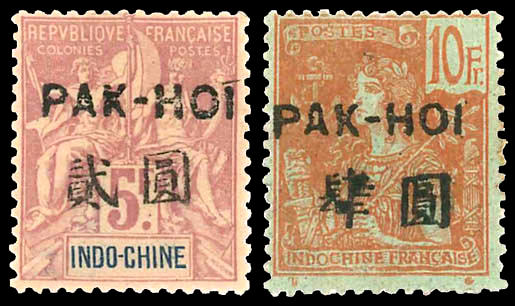
Beihai (; Postal romanization: Pakhoi) is a prefecture-level city in the south of Guangxi, People's Republic of China. Its status as a seaport on the north shore of the Gulf of Tonkin has granted it historical importance as a port of international trade for Guangxi, Hunan, Hubei, Sichuan, Guizhou, and Yunnan. Between the years 2006 and 2020, Beihai is predicted to be the world's fastest growing city. Beihai has a large shipyard, but most of the money generated in the city is derived from trade. In addition, it governs the small islands of Weizhou Island, Weizhou and Xieyang Island, Xieyang, and is directly west of Leizhou Peninsula. Subdivisions Beihai contains three districts and one county, which are subdivided into five urban sub-districts, 23 towns, 3 townships, 87 neighborhood committees, 343 village committees. (see also Administrative divisions of the People's Republic of China#Levels) * Haicheng District () * Yinhai District () * Tieshangang District () * Hepu County ( ... [...More Info...] [...Related Items...] OR: [Wikipedia] [Google] [Baidu] |
Inner Mongolia
Inner Mongolia, officially the Inner Mongolia Autonomous Region, is an autonomous region of the People's Republic of China. Its border includes most of the length of China's border with the country of Mongolia. Inner Mongolia also accounts for a small section of China's border with Russia (Zabaykalsky Krai). Its capital is Hohhot; other major cities include Baotou, Chifeng, Tongliao, and Ordos. The autonomous region was established in 1947, incorporating the areas of the former Republic of China provinces of Suiyuan, Chahar, Rehe, Liaobei, and Xing'an, along with the northern parts of Gansu and Ningxia. Its area makes it the third largest Chinese administrative subdivision, constituting approximately and 12% of China's total land area. Due to its long span from east to west, Inner Mongolia is geographically divided into eastern and western divisions. The eastern division is often included in Northeastern China (Dongbei) with major cities including Tongliao, Chifeng, Hai ... [...More Info...] [...Related Items...] OR: [Wikipedia] [Google] [Baidu] |
Hohhot
Hohhot,; abbreviated zh, c=呼市, p=Hūshì, labels=no formerly known as Kweisui, is the capital of Inner Mongolia in the north of the People's Republic of China, serving as the region's administrative, economic and cultural center.''The New Encyclopædia Britannica'', 15th Edition (1977), Vol. I, p. 275. Its population was 3,446,100 inhabitants as of the 2020 census, of whom 2,944,889 lived in the metropolitan area consisting of 4 urban districts (including Hohhot Economic and Development Zone) plus the Tümed Left Banner. The name of the city in Mongolian means "Blue City", although it is also wrongly referred to as the "Green City."Perkins (1999), p. 212. The color blue in Mongol culture is associated with the sky, eternity and purity. In Chinese, the name can be translated as ''Qīng Chéng'' () The name has also been variously romanized as Kokotan, Kokutan, Kuku-hoton, Huhohaot'e, Huhehot, Huhot, or Köke qota. The city is a seat of the Inner Mongolia University, th ... [...More Info...] [...Related Items...] OR: [Wikipedia] [Google] [Baidu] |
Jingjinji
The Jingjinji Metropolitan Region or Jing-Jin-Ji (JJJ),, sometimes rendered in historical context as King–Sin–Peh, also known as Beijing-Tianjin-Hebei (BJ-TJ-HB), Peking–Tientsin–Hopeh and the Capital Economic Zone, is the National Capital Region of the People's Republic of China. It is the biggest urbanized megalopolis region in North China, including an economic region surrounding the municipalities of Beijing and Tianjin, and along the coast of the Bohai Sea. This emerging region is rising as a northern metropolitan region rivaling the Pearl River Delta in the south and the Yangtze River Delta in the east. In 2020, Jingjinji had a total population of 110 million people, comparable to that of the Philippines. Economy In 2021, Jingjinji produced around 8% (US$1.5 trillion) of China's GDP or equivalent to Spain. GDP-2021 is a preliminary data It occupied an area about twice the size of the South Korea. Jingjinji had traditionally been involved in heavy industries ... [...More Info...] [...Related Items...] OR: [Wikipedia] [Google] [Baidu] |
Bazhou, Hebei
Bazhou (), formerly Ba County, is a county-level city in Hebei province, China. It is under the jurisdiction of Langfang prefecture-level city. As of 2002, it had a population of over 132,000. Administrative divisions Towns: *Bazhou Town (), Nanmeng, Bazhou, Hebei, Nanmeng (), Xin'an (), Tang'erli (), Jianchapu (), Shengfang (), Yangfengang () Townships: * Chaheji Township (), Kangxianzhuang Township (), Dongyangzhuang Township (), Wangzhuangzi Township (), Dongduan Township () Climate Transportation There are three railway stations in Bazhou. Bazhou railway station is the oldest and is an intermediate stop on the Beijing–Kowloon railway and the western terminus of the Tianjin–Bazhou railway. Bazhou West railway station is an intermediate stop on the Tianjin–Baoding intercity railway. Bazhou North railway station is an intermediate stop on the Beijing–Xiong'an intercity railway The Beijing–Xiong'an intercity railway or Jingxiong intercity railway () is a ... [...More Info...] [...Related Items...] OR: [Wikipedia] [Google] [Baidu] |
China National Highway 112
China National Highway 112 is a 1228 km ring road which runs outside Beijing (municipality). Route and distance See also * China National Highways {{Roads and Expressways of Beijing 112 112 may refer to: *112 (number), the natural number following 111 and preceding 113 *112 (band), an American R&B quartet from Atlanta, Georgia **112 (album), ''112'' (album), album from the band of the same name *112 (emergency telephone number), t ... Road transport in Beijing Transport in Hebei Road transport in Tianjin ... [...More Info...] [...Related Items...] OR: [Wikipedia] [Google] [Baidu] |
People's Republic Of China
China, officially the People's Republic of China (PRC), is a country in East Asia. It is the world's most populous country, with a population exceeding 1.4 billion, slightly ahead of India. China spans the equivalent of five time zones and borders fourteen countries by land, the most of any country in the world, tied with Russia. Covering an area of approximately , it is the world's third largest country by total land area. The country consists of 22 provinces, five autonomous regions, four municipalities, and two Special Administrative Regions (Hong Kong and Macau). The national capital is Beijing, and the most populous city and financial center is Shanghai. Modern Chinese trace their origins to a cradle of civilization in the fertile basin of the Yellow River in the North China Plain. The semi-legendary Xia dynasty in the 21st century BCE and the well-attested Shang and Zhou dynasties developed a bureaucratic political system to serve hereditary monarchies, or dyna ... [...More Info...] [...Related Items...] OR: [Wikipedia] [Google] [Baidu] |
Expressways Of China
The expressway network of China, with the national-level expressway system officially known as the National Trunk Highway System (; abbreviated as NTHS), is an integrated system of national and provincial-level expressways in China.Li, Si-ming and Shum, Yi-manImpacts of the National Trunk Highway System on accessibility in China. ''Journal of Transport Geography''. . 13 January 2005. With the construction of the Shenyang–Dalian Expressway beginning between the cities of and on ... [...More Info...] [...Related Items...] OR: [Wikipedia] [Google] [Baidu] |


.jpeg/1200px-Siège_de_Beijing_(1213-1214).jpeg)

.jpg)