|
Highway 83 (Wisconsin)
State Trunk Highway 83 (often called Highway 83, STH-83 or WIS 83) is a state highway in the U.S. state of Wisconsin. It runs north–south in southeast Wisconsin from Hartford to the Illinois border in the village of Salem Lakes. Most of the WIS 83 corridor consists of glacial formations and lakes. From the Washington County line south to the Illinois state line, WIS 83 runs within a few miles of at least 11 different small lakes. The rural nature of this routing results in WIS 83 being mostly two-lane undivided highway except for sections where it runs concurrent with other highways (WIS 50 and WIS 36), or where it approaches an Interstate (I-43 and I-94). Route description WIS 83 begins at the Wisconsin–Illinois state line, just north of Antioch, Illinois, at the northern terminus of Illinois Route 83 (IL 83). WIS 83 heads north through Salem through the Westosha region of Kenosha County as Antioch Road. On the western edge of Paddock Lake, WIS 8 ... [...More Info...] [...Related Items...] OR: [Wikipedia] [Google] [Baidu] |
Paddock Lake, Wisconsin
Paddock Lake is a village in Kenosha County, Wisconsin, United States. The population was 2,919 at the 2020 census. Geography Paddock Lake is located at (42.574094, -88.105210). According to the United States Census Bureau, the village has a total area of , of which, of it is land and is water. Demographics 2010 census As of the census of 2010, there were 2,992 people, 1,125 households, and 831 families living in the village. The population density was . There were 1,297 housing units at an average density of . The racial makeup of the village was 95.5% White, 0.5% African American, 0.5% Native American, 0.3% Asian, 0.1% Pacific Islander, 1.4% from other races, and 1.7% from two or more races. Hispanic or Latino of any race were 5.2% of the population. There were 1,125 households, of which 37.2% had children under the age of 18 living with them, 56.1% were married couples living together, 11.1% had a female householder with no husband present, 6.7% had a male householder w ... [...More Info...] [...Related Items...] OR: [Wikipedia] [Google] [Baidu] |
Interstate 94
Interstate 94 (I-94) is an east–west Interstate Highway connecting the Great Lakes and northern Great Plains regions of the United States. Its western terminus is just east of Billings, Montana, at a junction with I-90; its eastern terminus is in Port Huron, Michigan, where it meets with I-69 and crosses the Blue Water Bridge into Sarnia, Ontario, Canada, where the route becomes Ontario Highway 402. It thus lies along the primary overland route from Seattle (via I-90) to Toronto (via Ontario Highway 401) and is the only east–west Interstate Highway to have a direct connection to Canada. I-94 intersects with I-90 several times: at its western terminus; Tomah to Madison in Wisconsin; in Chicago, Illinois; and in Lake Station, Indiana. Major cities that I-94 connects to are Billings, Bismarck, Fargo, Minneapolis–Saint Paul, Madison, Milwaukee, Chicago, and Detroit. Route description , - , MT , , - , ND , , - , MN , , - , WI , , - , IL , , - , IN ... [...More Info...] [...Related Items...] OR: [Wikipedia] [Google] [Baidu] |
Wisconsin Highway 20
State Trunk Highway 20 (often called Highway 20, STH-20 or WIS 20) is a state highway in Walworth and Racine counties in southeastern Wisconsin, United States. The route is a short connector that bridges the city of Whitewater and points west via U.S. Highway 12 (US 12) with East Troy, Waterford and Racine. WIS 20 is a two-lane surface road with various four-lane roads within cities. Route description WIS 20 begins at the junction of US 12 and WIS 67 and proceeds east, going south around a junction with County Trunk Highway J (CTH-J) east of the terminus and bypassing the small community of Troy Center. WIS 20 connects with Interstate 43 (I-43) in East Troy, then meanders eastward into Racine County WIS 20 provides indirect access to Alpine Valley Music Theater which is south of the village just off WIS 120 WIS 20 merges with WIS 83 east on the west side of Waterford and both highways turn southeast into the village. WIS 83 splits to the south at WIS 20's junction w ... [...More Info...] [...Related Items...] OR: [Wikipedia] [Google] [Baidu] |
Wisconsin Highway 36
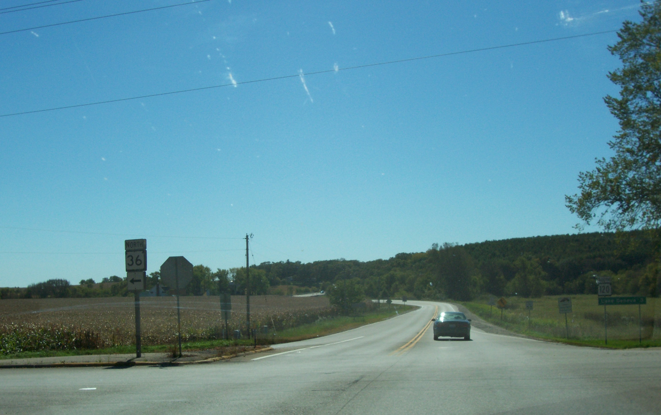
State Trunk Highway 36 (often called Highway 36, STH-36 or WIS 36) is a state highway in the U.S. state of Wisconsin. It runs in a diagonal southwest–northeast direction across southeastern Wisconsin from Springfield which is north of Lake Geneva to Milwaukee. Route description WIS 36 begins at its intersection with WIS 120 and travels in a general northeasterly direction to an intersection with WIS 11 in Burlington. The road continues northeast, passing through Waterford where it connects with WIS 164, then to Wind Lake and Muskego before heading to Franklin, where it runs concurrently with US Highway 45 (US 45) for a short distance, and crosses WIS 100. The highway then follows Loomis Road through Greendale and Greenfield, where it intersects with Interstate 43 (I-43) and I-894 before terminating at WIS 241 in Milwaukee. History WIS 36 is unusual in that its route has seen few changes since it was designated in ... [...More Info...] [...Related Items...] OR: [Wikipedia] [Google] [Baidu] |
Wisconsin Highway 11
State Trunk Highway 11 (often called Highway 11, STH-11 or WIS 11) is a state highway running east–west across southern Wisconsin. The highway connects Dubuque, Iowa with the cities of Janesville, Racine and Elkhorn. Most of the route is two-lane road with the exception of an expressway bypass of Monroe, a multilane bypass of Janesville, a section where it is concurrent with I-39 and I-90, a combined freeway/divided highway bypass of Burlington to the south, where it is partially concurrent with WI 36 and WI 83, and urban multilane highway in the greater Racine area. Route description WIS 11 begins in Grant County at the freeway carrying US 61 and US 151 and concurrent with WIS 35. WIS 35 turns south to Illinois a half of a mile into the route as WIS 11 meanders to the east to Hazel Green where it picks up WIS 80 north for before turning east again into Lafayette County while WIS 80 continues north along the county line. The highway passes through Benton and ... [...More Info...] [...Related Items...] OR: [Wikipedia] [Google] [Baidu] |
Wisconsin Highway 142
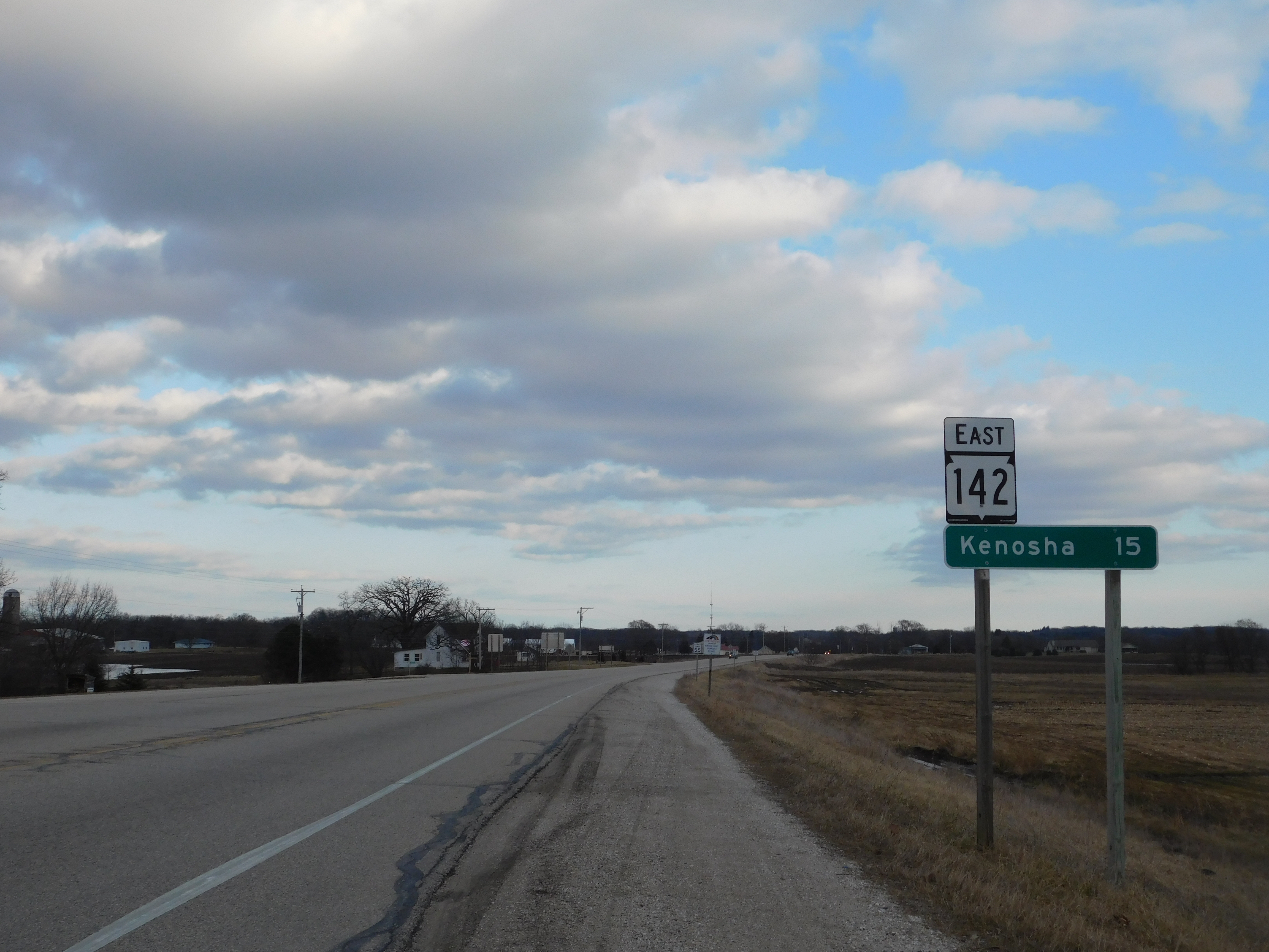
State Trunk Highway 142 (STH-142, commonly known as Highway 142 or WIS 142) is a mostly rural highway connecting Burlington, Wisconsin, Burlington with Kenosha, Wisconsin, Kenosha. Prior to the commissioning of Interstate 43 in the early 1970s, the current route of WIS 142 was designated as State Trunk Highway 43 (WIS 43). The route number was changed in accordance to then-Wisconsin Department of Transportation policy, which prohibits duplicate numbers between state and US/Interstate highways within Wisconsin. When the road was recently rebuilt, the state department of transportation incorporated a new feature they are testing called Rumble strips, centerline rumble strips. The highway's eastern terminus with Interstate 94 (Wisconsin), Interstate 94 has been called "Wisconsin's most visible cheese interchange" by the Milwaukee Journal Sentinel. The intersection had three cheese shops until 2009 and still has two; the oldest, Mars Cheese Castle, has been at the intersection since ... [...More Info...] [...Related Items...] OR: [Wikipedia] [Google] [Baidu] |
Burlington, Wisconsin
Burlington is a city in Racine and Walworth counties in the U.S. state of Wisconsin, with the majority of the city located in Racine County. The population of the city was 11,047 as of the 2020 census. History Prior to the arrival of Europeans in the area, Native American mounds were constructed near the present location of Burlington. For example, around 1830, a small Potawatomi village stood in what is now the Town of Burlington, though it wasn't larger than the present-day city. The earliest certain European presence in what is now Burlington was in the fall of 1799, when a group of French explorers and missionaries led by Francis Morgan de Vereceones made a portage from the Root River to the Fox River, reaching the Fox at approximately Burlington's present location. The first European settlers in Burlington were Moses Smith (the son of a Revolutionary War veteran) and William Whiting. Smith and Whiting had been in the area previously, making a so-called "jackknife c ... [...More Info...] [...Related Items...] OR: [Wikipedia] [Google] [Baidu] |
Wheatland, Kenosha County, Wisconsin
Wheatland is a town in Kenosha County, Wisconsin, United States. The population was 3,391 at the 2020 census. The census-designated place of Powers Lake is located partially in the town. The unincorporated communities of Lily Lake, New Munster, and Slades Corners are also located in the town. Settlement in the town is centered along 328th Avenue (Kenosha County Highway W) north of 60th Street (Kenosha County Highway K). The former Wisconsin Central Railway Chicago-Twin Cities main line (now the Canadian National Railway) also runs through the town; a passenger and freight station used was located here well into the 20th century. Geography According to the United States Census Bureau, the town has a total area of , of which are land and , or 1.36%, are water. History The first settlers in Wheatland were Schuyler Bonday in August 1837 and Adolph Reitbrook in September 1837. Wheatland was formed on May 7, 1842. Its name is derived from the wheat which was said to grow well i ... [...More Info...] [...Related Items...] OR: [Wikipedia] [Google] [Baidu] |
Kansasville, Wisconsin
Kansasville is an unincorporated community in Racine County, Wisconsin, United States. The area is a part of the Town of Dover. The area has also been referred to as Brighton or Eagle Lake, Wisconsin. History The origin for the name of the area is uncertain; some sources claim it was named after the Kansas-Nebraska Act, while others claim it was named in honor of area settlers from Kansas. Another belief is that it was named after the railroad system in town which used to operate from Wisconsin to Kansas. Education The community is served by the Dover School District, a district with only one school, Kansasville Grade School. After grade school, which covers Kindergarten to eighth grade, students are served by Union Grove Union High School, the sole school in the Union Grove Union High School District, or by Burlington High School, in the Burlington School District. Transportation Kansasville was a stop on the Racine & Southwestern branch line of the Chicago, Milwaukee, St ... [...More Info...] [...Related Items...] OR: [Wikipedia] [Google] [Baidu] |
Wisconsin Highway 75
State Trunk Highway 75 (often called Highway 75, STH-75 or WIS 75) is a state highway in the southeastern part of U.S. state of Wisconsin. The highway runs from Wisconsin Highway 50 and Wisconsin Highway 83 in Paddock Lake north to Wisconsin Highway 20 east of Waterford. WIS 75 serves Kenosha and Racine Counties. The highway is maintained by the Wisconsin Department of Transportation. Route description WIS 75 begins at an intersection with WIS 50 and WIS 83 in Paddock Lake. The highway heads north through the town of Salem before entering the town of Brighton. After crossing into Brighton, WIS 75 passes through the community of Klondike and skirts the eastern edge of the Richard Bong State Recreation Area. The route intersects WIS 142 northwest of the community of Brighton and continues northward into Racine County. Upon entering Racine County, WIS 75 enters the town of Dover. It passes through the community of Kansasville and crosses a Canadian Pacific Railway ... [...More Info...] [...Related Items...] OR: [Wikipedia] [Google] [Baidu] |
Wisconsin Highway 50
State Trunk Highway 50 (often called Highway 50, STH-50 or WIS 50) is a state highway in Walworth and Kenosha counties in Wisconsin, United States, that runs from Wisconsin Highway 11 (WIS 11) in Delavan east to Wisconsin Highway 32 (WIS 32) in Kenosha. The highway is maintained by the Wisconsin Department of Transportation. Route description Highway 50 begins at an intersection with Highway 11 in Delavan. The highway crosses Wisconsin and Southern Railroad tracks and heads east to a junction with Interstate 43 at Exit 21. Highway 50 continues southeast out of Delavan, crossing Delavan Lake at the city's eastern border, and intersects Highway 67 north of Williams Bay. Highway 50 heads east from this intersection toward Lake Geneva, where it intersects Highway 120. Shortly after this intersection, Highway 50 meets U.S. Route 12 at Exit 330. The highway continues eastward from Lake Geneva to the border of Kenosha County. After entering Kenosha County, Highway 50 pas ... [...More Info...] [...Related Items...] OR: [Wikipedia] [Google] [Baidu] |
Concurrency (road)
A concurrency in a road network is an instance of one physical roadway bearing two or more different route numbers. When two roadways share the same right-of-way, it is sometimes called a common section or commons. Other terminology for a concurrency includes overlap, coincidence, duplex (two concurrent routes), triplex (three concurrent routes), multiplex (any number of concurrent routes), dual routing or triple routing. Concurrent numbering can become very common in jurisdictions that allow it. Where multiple routes must pass between a single mountain crossing or over a bridge, or through a major city, it is often economically and practically advantageous for them all to be accommodated on a single physical roadway. In some jurisdictions, however, concurrent numbering is avoided by posting only one route number on highway signs; these routes disappear at the start of the concurrency and reappear when it ends. However, any route that becomes unsigned in the middle of the concurren ... [...More Info...] [...Related Items...] OR: [Wikipedia] [Google] [Baidu] |


