|
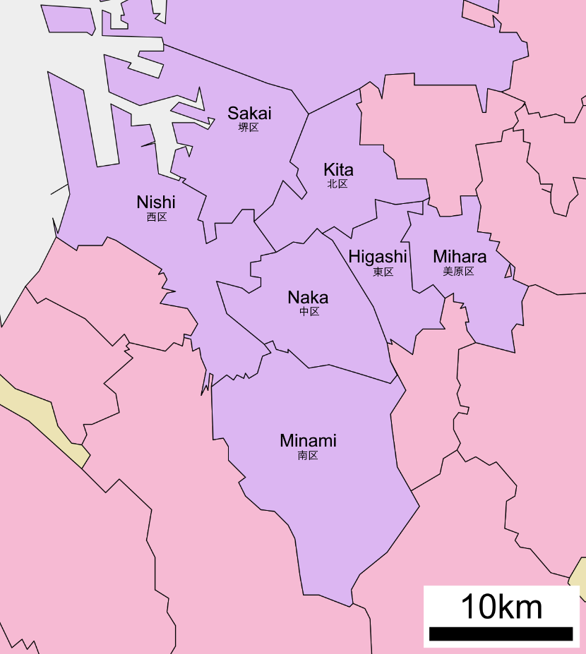
Higashi-ku, Sakai
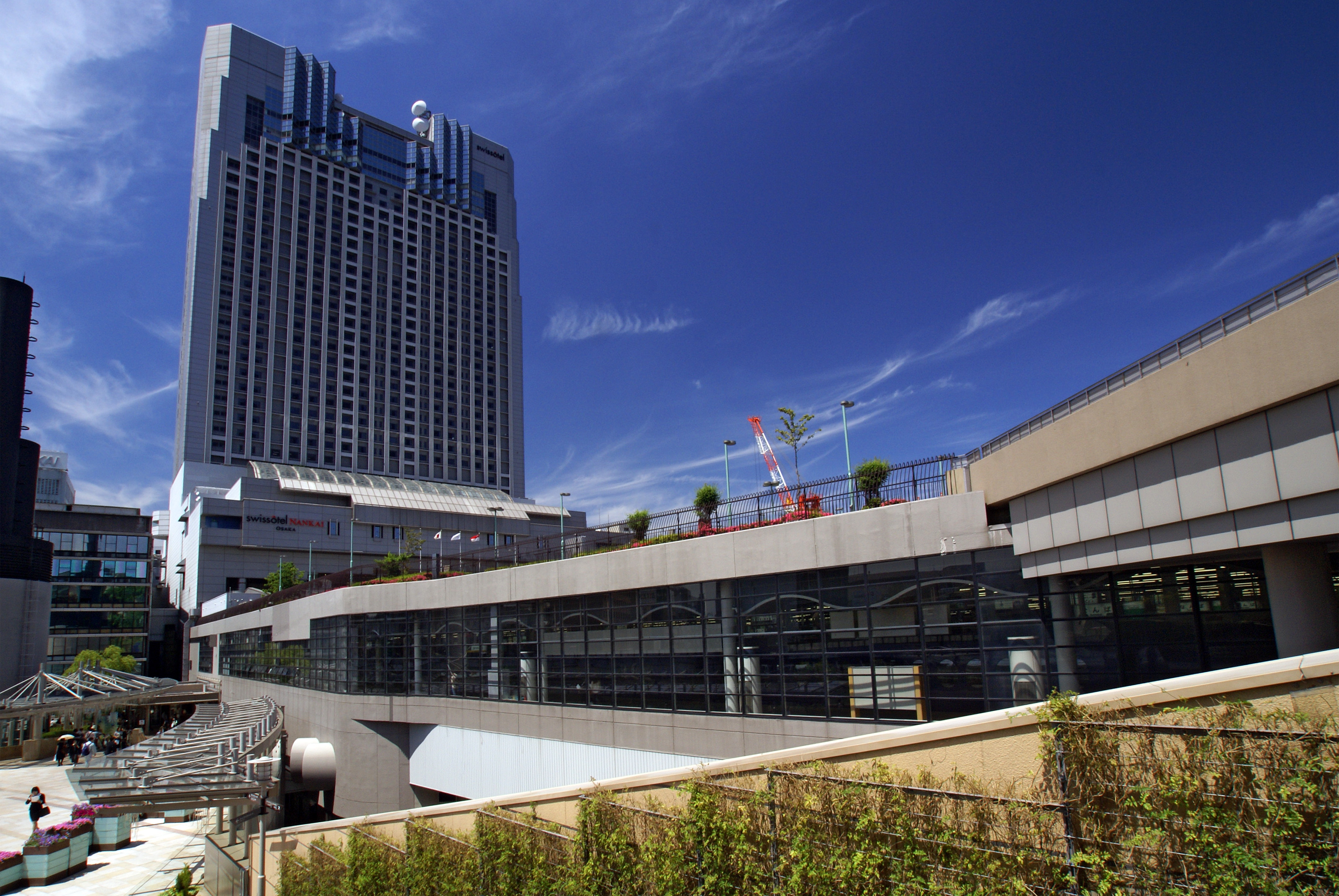
is a ward of the city of Sakai in Osaka Prefecture, Japan. The ward has an area of 10.48 km² and a population of 85,263. The population density is 8,136 per square kilometer. (Ward office official home page) (Retrieved on June 23, 2009) The name means "East Ward." The wards of Sakai were established when Sakai became a on April 1, 2006. Transportation Rail * |
Location Of Higashi Ward Sakai City Osaka Prefecture Japan
In geography, location or place are used to denote a region (point, line, or area) on Earth's surface or elsewhere. The term ''location'' generally implies a higher degree of certainty than ''place'', the latter often indicating an entity with an ambiguous boundary, relying more on human or social attributes of place identity and sense of place than on geometry. Types Locality A locality, settlement, or populated place is likely to have a well-defined name but a boundary that is not well defined varies by context. London, for instance, has a legal boundary, but this is unlikely to completely match with general usage. An area within a town, such as Covent Garden in London, also almost always has some ambiguity as to its extent. In geography, location is considered to be more precise than "place". Relative location A relative location, or situation, is described as a displacement from another site. An example is "3 miles northwest of Seattle". Absolute location An absolute locati ... [...More Info...] [...Related Items...] OR: [Wikipedia] [Google] [Baidu] |
Wards Of Japan
A is a subdivision of the cities of Japan that are large enough to have been City designated by government ordinance, designated by government ordinance. Chapter 17: Government System (Retrieved on July 4, 2009) Wards are used to subdivide each City designated by government ordinance (Japan), city designated by government ordinance ("designated city"). The Special wards of Tokyo, 23 special wards of Tokyo Metropolis have a municipality, municipal status, and are not the same as other entities referred to as ''ku'', although their Tokyo City, predecessors were. Wards are local government, local entities directly controlled by the municipal government. They handle administrative functions such as ''koseki'' regi ... [...More Info...] [...Related Items...] OR: [Wikipedia] [Google] [Baidu] |
Sakai, Osaka
is a city located in Osaka Prefecture, Japan. It has been one of the largest and most important seaports of Japan since the medieval era. Sakai is known for its keyhole-shaped burial mounds, or kofun, which date from the fifth century and include Daisen Kofun, the largest grave in the world by area. Once known for swords, Sakai is now famous for the quality of its cutlery. , the city had an estimated population of 819,965, making it the fourteenth most populous city in Japan (excluding Tokyo). Geography Sakai is located in southern Osaka Prefecture, on the edge of Osaka Bay and directly south of the city of Osaka. Neighboring municipalities Osaka Prefecture *Osaka * Matsubara *Habikino *Ōsakasayama *Kawachinagano * Izumi * Takaishi Climate Sakai has a Humid subtropical climate (Köppen ''Cfa'') characterized by warm summers and cool winters with light to no snowfall. The average annual temperature in Sakai is . The average annual rainfall is with June as the wettest month ... [...More Info...] [...Related Items...] OR: [Wikipedia] [Google] [Baidu] |
Osaka Prefecture
is a Prefectures of Japan, prefecture of Japan located in the Kansai region of Honshu. Osaka Prefecture has a population of 8,778,035 () and has a geographic area of . Osaka Prefecture borders Hyōgo Prefecture to the northwest, Kyoto Prefecture to the north, Nara Prefecture to the southeast, and Wakayama Prefecture to the south. Osaka is the capital and largest city of Osaka Prefecture, and the List of cities in Japan, third-largest city in Japan, with other major cities including Sakai, Higashiōsaka, and Hirakata. Osaka Prefecture is the third-most-populous prefecture, but by geographic area the second-smallest; at it is the second-most densely populated, below only Tokyo. Osaka Prefecture is one of Japan's two "Fu (country subdivision), urban prefectures" using the designation ''fu'' (府) rather than the standard ''Prefectures of Japan#Types of prefecture, ken'' for prefectures, along with Kyoto Prefecture. Osaka Prefecture forms the center of the Keihanshin metropolitan ar ... [...More Info...] [...Related Items...] OR: [Wikipedia] [Google] [Baidu] |
City Designated By Government Ordinance
A , also known as a or , is a Japanese city that has a population greater than 500,000 and has been designated as such by order of the Cabinet of Japan under Article 252, Section 19, of the Local Autonomy Law. Designated cities are delegated many of the functions normally performed by prefectural governments in fields such as public education, social welfare, sanitation, business licensing, and urban planning. The city government is generally delegated the various minor administrative functions in each area, and the prefectural government retains authority over major decisions. For instance, pharmaceutical retailers and small clinics can be licensed by designated city governments, but pharmacies and hospitals are licensed by prefectural governments. Designated cities are also required to subdivide themselves into (broadly equivalent to the boroughs of London or the boroughs of New York City), each of which has a ward office conducting various administrative functions for ... [...More Info...] [...Related Items...] OR: [Wikipedia] [Google] [Baidu] |
Nankai Electric Railway
is a private railway in Japan, founded in 1884. The name ''Nankai'' (which means "South Sea") comes from the company's routes along the Nankaidō, the old highway that ran south from the old capital, Kyoto, along the sea coast. Nankai predates all the electric railways in the Tokyo region. The Nankai network branches out in a generally southern direction from Namba Station in Osaka. The Nankai Main Line connects Osaka to Wakayama, with an important spur branching to Kansai International Airport. The '' rapi:t α'' express connects Kansai International Airport to Namba in 34 minutes, while the '' rapi:t β'' takes 39 minutes with two additional stops. The Koya Line connects Osaka to Mt. Koya, headquarters of the Buddhist Shingon sect and a popular pilgrimage site. IC cards (PiTaPa and ICOCA) are accepted. History The Nankai Railway Company was founded on June 16, 1884. In 1944 it was one of the companies that merged to form Kinki Nippon Railway Co., Ltd. (Kin-nichi, prese ... [...More Info...] [...Related Items...] OR: [Wikipedia] [Google] [Baidu] |
Koya Line
The is a railway line in Osaka Prefecture and Wakayama Prefecture, Japan, owned and operated by the Nankai Electric Railway, a private railway operator. It connects Osaka and Koyasan, the capital of the Japanese Buddhist sect Shingon, via the suburbs of Osaka, such as Sakai, Osakasayama, Tondabayashi and Kawachinagano in Osaka Prefecture and Hashimoto and Kōya in Wakayama Prefecture. To distinguish it from other Nankai Lines, the Kōya Line is indicated with pictograms of coniferous-like trees which bring to mind Mount Kōya, or with the line colour, green. For historical reasons, the line formally begins at Shiomibashi Station in Osaka and crosses the Nankai Main Line, the company's other main line, at Kishinosato-Tamade Station, though operationally it starts at Namba Station together with the Nankai Line, diverges at Kishinosato-Tamade Station and goes to Gokurakubashi Station, to connect to Koyasan through Nankai Cable Line. The section from Shiomibashi to Kishinosato- ... [...More Info...] [...Related Items...] OR: [Wikipedia] [Google] [Baidu] |
Hatsushiba Station
is a passenger railway station located in Higashi-ku, Sakai, Osaka Prefecture, Japan, operated by the private railway operator Nankai Electric Railway. It has the station number "NK61". Lines Hatsushiba Station is served by the Nankai Koya Line, and is 16.6 kilometers from the terminus of the line at and 15.9 kilometers from . Layout The station consists of two island platforms connected by an underground passage. Platforms Adjacent stations History Hatsushiba Station opened on January 30, 1898 as . It was renamed to its present name on August 1, 1935. Passenger statistics In fiscal 2019, the station was used by an average of 8256 passengers daily. Surrounding area * Osaka Prefectural Kanaoka High School * Sakai City Hiokiso Junior High School * Sakai City Hikisho Elementary School See also * List of railway stations in Japan The links below contain all of the 8579 railway stations in Japan. External links {{Portal bar, Japan, Trains * Railway st ... [...More Info...] [...Related Items...] OR: [Wikipedia] [Google] [Baidu] |
Hagiharatenjin Station
is a passenger railway station located in Higashi-ku, Sakai, Osaka Prefecture, Japan, operated by the private railway operator Nankai Electric Railway. It has the station number "NK62". Lines Hagiharatenjin Station is served by the Nankai Koya Line, and is 17.5 kilometers from the terminus of the line at and 16.8 kilometers from . Layout The station consists of two opposed side platforms connected by a footbridge. After an accident at the door of a local train in 2007, the platform display was reconstructed, and then the height of the platforms were raised in 2008 and elevators were installed in 2009. Platforms Adjacent stations History Hagiharatenjin Station opened on October 10, 1912. Passenger statistics In fiscal 2019, the station was used by an average of 7550 passengers daily. Surrounding area *Hagiwara Shrine *Higashi Ward Office, Sakai *Sakai City Fire Bureau Higashi Fire Station *the Church of God in Japan Minami-Sakai Church See also * List of ra ... [...More Info...] [...Related Items...] OR: [Wikipedia] [Google] [Baidu] |
Kitanoda Station
is a passenger railway station located in Higashi-ku, Sakai, Osaka Prefecture, Japan, operated by the private railway operator Nankai Electric Railway. It has the station number "NK63". Lines Kitanoda Station is served by the Nankai Koya Line, and is 19.3 kilometers from the terminus of the line at and 18.6 kilometers from . Layout The station consists of two island platforms with an elevated station building. Platforms Adjacent stations History Kitanoda Station opened on August 7, 1914. Passenger statistics In fiscal 2019, the station was used by an average of 33,659 passengers daily. Surrounding area * Sakai City East Cultural Center *Sakai City East Library *Sakai City Tomiokahigashi Elementary School * Sakai City Tomiokanishi Elementary School * Noda Castle ruins See also * List of railway stations in Japan The links below contain all of the 8579 railway stations in Japan. External links {{Portal bar, Japan, Trains * Railway stations Japan ... [...More Info...] [...Related Items...] OR: [Wikipedia] [Google] [Baidu] |


