|
Higashi-ku, Niigata
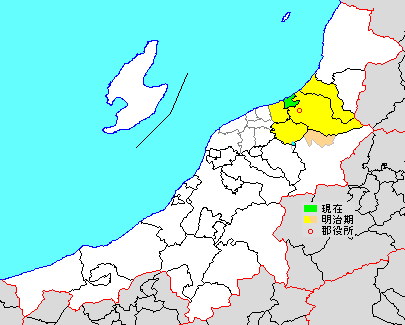
is one of the eight wards of Niigata City, Niigata Prefecture, in the Hokuriku region of Japan. , the ward had an estimated population of 136,224 in 60,830 households and a population density of 3500 persons per km². The total area of the ward was . After Chūō-ku, Higashi-ku is the second smallest ward in Niigata City, making up about 5% of the total land area. It ranks third for largest population, with about 17% of Niigata's residents living in the Higashi-ku. Geography Higashi-ku is located in north-east Niigata city, directly east of the central Chūō-ku and is bordered by the Sea of Japan to the north. The Shinano River is to the west. In the south is the Nihonkai-Tōhoku Expressway. The Agano River in the eastern part of the ward is on the border with neighboring Kita-ku. Most housing districts are located in the northern and southern parts of the ward, while the center consists mainly of business and manufacturing districts. Niigata Airport and Niigata Harbor ar ... [...More Info...] [...Related Items...] OR: [Wikipedia] [Google] [Baidu] |
Wards Of Japan
A is a subdivision of the cities of Japan that are large enough to have been City designated by government ordinance, designated by government ordinance. Chapter 17: Government System (Retrieved on July 4, 2009) Wards are used to subdivide each City designated by government ordinance (Japan), city designated by government ordinance ("designated city"). The Special wards of Tokyo, 23 special wards of Tokyo Metropolis have a municipality, municipal status, and are not the same as other entities referred to as ''ku'', although their Tokyo City, predecessors were. Wards are local government, local entities directly controlled by the municipal government. They handle administrative functions such as ''koseki'' regi ... [...More Info...] [...Related Items...] OR: [Wikipedia] [Google] [Baidu] |
Sea Of Japan
The Sea of Japan is the marginal sea between the Japanese archipelago, Sakhalin, the Korean Peninsula, and the mainland of the Russian Far East. The Japanese archipelago separates the sea from the Pacific Ocean. Like the Mediterranean Sea, it has almost no tides due to its nearly complete enclosure from the Pacific Ocean. This isolation also affects faunal diversity and salinity, both of which are lower than in the open ocean. The sea has no large islands, bays or capes. Its water balance is mostly determined by the inflow and outflow through the straits connecting it to the neighboring seas and the Pacific Ocean. Few rivers discharge into the sea and their total contribution to the water exchange is within 1%. The seawater has an elevated concentration of dissolved oxygen that results in high biological productivity. Therefore, fishing is the dominant economic activity in the region. The intensity of shipments across the sea has been moderate owing to political issues, but it ... [...More Info...] [...Related Items...] OR: [Wikipedia] [Google] [Baidu] |
Chosun Gakko
Joseon (; ; Middle Korean: 됴ᇢ〯션〮 Dyǒw syéon or 됴ᇢ〯션〯 Dyǒw syěon), officially the Great Joseon (; ), was the last dynastic kingdom of Korea, lasting just over 500 years. It was founded by Yi Seong-gye in July 1392 and replaced by the Korean Empire in October 1897. The kingdom was founded following the aftermath of the overthrow of Goryeo in what is today the city of Kaesong. Early on, Korea was retitled and the capital was relocated to modern-day Seoul. The kingdom's northernmost borders were expanded to the natural boundaries at the rivers of Amrok and Tuman through the subjugation of the Jurchens. During its 500-year duration, Joseon encouraged the entrenchment of Confucian ideals and doctrines in Korean society. Neo-Confucianism was installed as the new state's ideology. Buddhism was accordingly discouraged, and occasionally the practitioners faced persecutions. Joseon consolidated its effective rule over the territory of current Korea and saw the ... [...More Info...] [...Related Items...] OR: [Wikipedia] [Google] [Baidu] |
University Of Niigata Prefecture
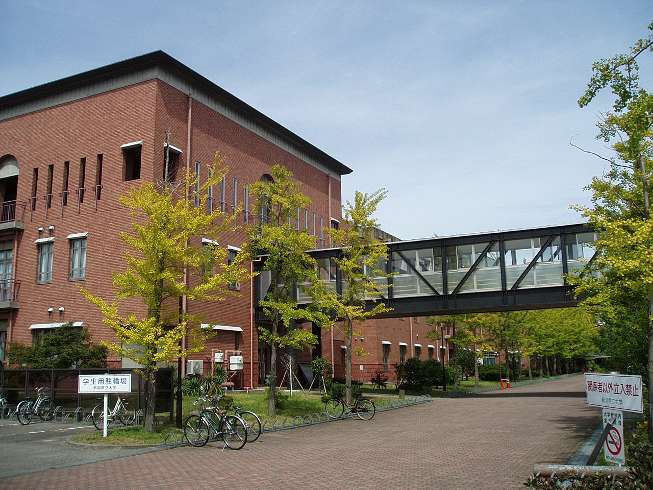
is a public university in Higashi-ku, Niigata, Niigata Prefecture is a Prefectures of Japan, prefecture in the Chūbu region of Honshu of Japan. Niigata Prefecture has a population of 2,227,496 (1 July 2019) and is the List of Japanese prefectures by area, fifth-largest prefecture of Japan by geographic area ..., Japan. It was established in 2009 by developing Niigata Women's College (closed in March 2012) into a co-educational four-year college. Organization Undergraduate schools * Faculty of International Studies and Regional Development ** Department of International Studies and Regional Development * Faculty of Human Life Studies ** Department of Child Studies ** Department of Health and Nutrition Graduate schools * Graduate School of International Studies and Regional Development (to be opened in April 2015) References External links * Public universities in Japan Universities and colleges in Niigata Prefecture Niigata (city) Educational i ... [...More Info...] [...Related Items...] OR: [Wikipedia] [Google] [Baidu] |
City Designated By Government Ordinance
A , also known as a or , is a Japanese city that has a population greater than 500,000 and has been designated as such by order of the Cabinet of Japan under Article 252, Section 19, of the Local Autonomy Law. Designated cities are delegated many of the functions normally performed by prefectural governments in fields such as public education, social welfare, sanitation, business licensing, and urban planning. The city government is generally delegated the various minor administrative functions in each area, and the prefectural government retains authority over major decisions. For instance, pharmaceutical retailers and small clinics can be licensed by designated city governments, but pharmacies and hospitals are licensed by prefectural governments. Designated cities are also required to subdivide themselves into (broadly equivalent to the boroughs of London or the boroughs of New York City), each of which has a ward office conducting various administrative functions for ... [...More Info...] [...Related Items...] OR: [Wikipedia] [Google] [Baidu] |
Kitakanbara District, Niigata
is a district located in Niigata Prefecture, Japan. As of July 1, 2019, the district has an estimated population of 14,025 with a density of 373 persons per km2. The total area is 37.58 km2. Municipalities The district consists of only one town: * Seirō ;Notes: History District Timeline * On January 1, 1947 - The town of Shibata became a city. * On March 1955 - After it gained city status, Shibata absorbed the villages of Izumino (Ijimino or Ijikuni), Kawahigashi, Sugaya (Sugatani), Matsuura, Yonekura and Akatani (Agaya). * On March 1956 - Some areas of the village of Kajikawa were absorbed into Shibata. * On April 1959 - The village of Sasaki was absorbed into Shibata. * On November 1, 1970 - The town of Toyosaka (part of Niigata as of March 21, 2005) gained city status. Recent mergers * On July 7, 2003 - The town of Toyoura was merged into the expanded city of Shibata. * On April 1, 2004 - The towns of Suibara and Yasuda, and the villages of Kyogase ... [...More Info...] [...Related Items...] OR: [Wikipedia] [Google] [Baidu] |
Echigo Province
was an old province in north-central Japan, on the shores of the Sea of Japan. It bordered on Uzen, Iwashiro, Kōzuke, Shinano, and Etchū Provinces. Nussbaum, Louis-Frédéric. (2005). "''Echigo''" in . It corresponds today to Niigata Prefecture, minus the island of Sado. Its abbreviated form name was , with Echizen and Etchū Provinces. Under the ''Engishiki'' classification system, Echigo was ranked as one of the 35 "superior countries" (上国) in terms of importance, and one of the 30 "far countries" (遠国) in terms of distance from the capital. Echigo and Kōzuke Province were known as the Jōetsu region. History In the late 7th century, during the reign of Emperor Monmu, the ancient province of was divided into three separate provinces: Echizen, Etchū, and Echigo. The new Echigo Province consisted of Iwafune and Nutari Districts, and was one of two border provinces of the Yamato state with the Emishi (the other being Mutsu). In 702, Echigo was give ... [...More Info...] [...Related Items...] OR: [Wikipedia] [Google] [Baidu] |
Kōnan-ku, Niigata
is one of the eight wards of Niigata City, Niigata Prefecture, in the Hokuriku region of Japan. , the ward had an estimated population of 68,413 in 27,027 households and a population density of 913 persons per km². The total area of the ward was . Geography Kōnan-ku is located in an inland region of north-central Niigata Prefecture, near the centre of Niigata City, directly south of the central Chūō-ku. The ward is bordered by Agano River, Koagano River, Shinano River, and the Nihonkai-Tōhoku Expressway. Neighboring municipalities/wards *Niigata Prefecture **Kita-ku, Niigata **Higashi-ku, Niigata **Chūō-ku, Niigata **Akiha-ku, Niigata **Minami-ku, Niigata **Nishi-ku, Niigata ** Agano History The area of present-day Kōnan-ku was part of ancient Echigo Province. The modern town of Kameda and the village of Yokogoshi were established on April 1, 1889 within Nakakanbara District, Niigata with the establishment of the municipalities system.. Yokogoshi was raised to town ... [...More Info...] [...Related Items...] OR: [Wikipedia] [Google] [Baidu] |
Niigata Harbor
{{disambiguation, geo ...
may refer to: * Niigata Prefecture, Japan **Niigata (city), the capital of the prefecture * Albirex Niigata, the city's professional football club * Niigata Transys, a Japanese railway vehicle manufacturer * Niigata Stadium, an athletic stadium in Niigata, Japan. * ''Niigata Shimbun'', 19th century newspaper, edited by Yukio Ozaki was a Japanese people, Japanese politician of Liberalism, liberal signature, born in modern-day Sagamihara, Kanagawa. Ozaki served in the House of Representatives of the Japanese Diet for 63 years (1890–1953). He is still revered in Japan as t ... [...More Info...] [...Related Items...] OR: [Wikipedia] [Google] [Baidu] |
Niigata Airport
is a second class airport located northeast of Niigata Station in Niigata, Japan. History The first airport on the Sea of Japan coast of Japan was opened on an island in the Shinano River in 1929. This airport was moved to what was then the village of Matsugazakahama in 1930, and was renamed Niigata Airport. It was requisitioned for use by the Imperial Japanese Army Air Force in 1941, and came under the control of the USAAF after the end of World War II. It was returned to Japanese civilian control on March 31, 1958, on which date commercial flight operations were resumed. International services were started in 1973, with scheduled service to Khabarovsk and Niigata Airport became historically an important gateway for traffic to and from Russia, which among other purposes were used to export Niigata-area agricultural products to Russia; however, flights were reduced from winter 2010 as more slots became available for Russia service at Narita International Airport near Tokyo. ... [...More Info...] [...Related Items...] OR: [Wikipedia] [Google] [Baidu] |
Kita-ku, Niigata
is one of the eight wards of Niigata City, Niigata Prefecture, in the Hokuriku region of Japan. , the ward had an estimated population of 74,559 in households and a population density of 690 persons per km². The total area of the ward was . Geography Kita-ku is located in north-east Niigata city, and is bordered by the Sea of Japan to the north. Surrounding municipalities *Niigata Prefecture ** Higashi-ku, Niigata **Kōnan-ku, Niigata ** Shibata ** Agano ** Seiro History The area of present-day Kita-ku was part of ancient Echigo Province. The village of Kuzudzuka was established on April 1, 1889 within Kitakanbara District, Niigata with the establishment of the modern municipalities system, and was raised to town status on November 1, 1901. It was renamed Toyosaka on March 31, 1955 and was elevated to city status on November 1, 1970. The city of Niigata annexed Toyosaka on March 21, 2005. Niigata became a government-designated city on April 1, 2007 and was divided into ... [...More Info...] [...Related Items...] OR: [Wikipedia] [Google] [Baidu] |


