|
Henbury Hundred
Henbury Hundred was a subdivision of the county of Gloucestershire, England. Hundreds originated in the late Saxon period and lasted as administrative divisions until the 19th century. It comprised the five ancient parishes of Henbury, Westbury-upon-Trym, Greenfield Compton, Stoke Gifford and Yate, except for the tithing of Kings Weston, in Henbury parish, which was included in the Hundred of Berkeley. In addition, the tithing of Itchington—part of Tytherington parish—was included in Henbury hundred, with the rest of the parish in Thornbury Hundred. The hundred was occasionally divided in Lower and Upper Divisions, the former comprising Westbury on Trym and part of Henbury and the latter the remainder of Henbury and the other parishes.The National Gazetteer of Great Britain and Ireland 186 ... [...More Info...] [...Related Items...] OR: [Wikipedia] [Google] [Baidu] |
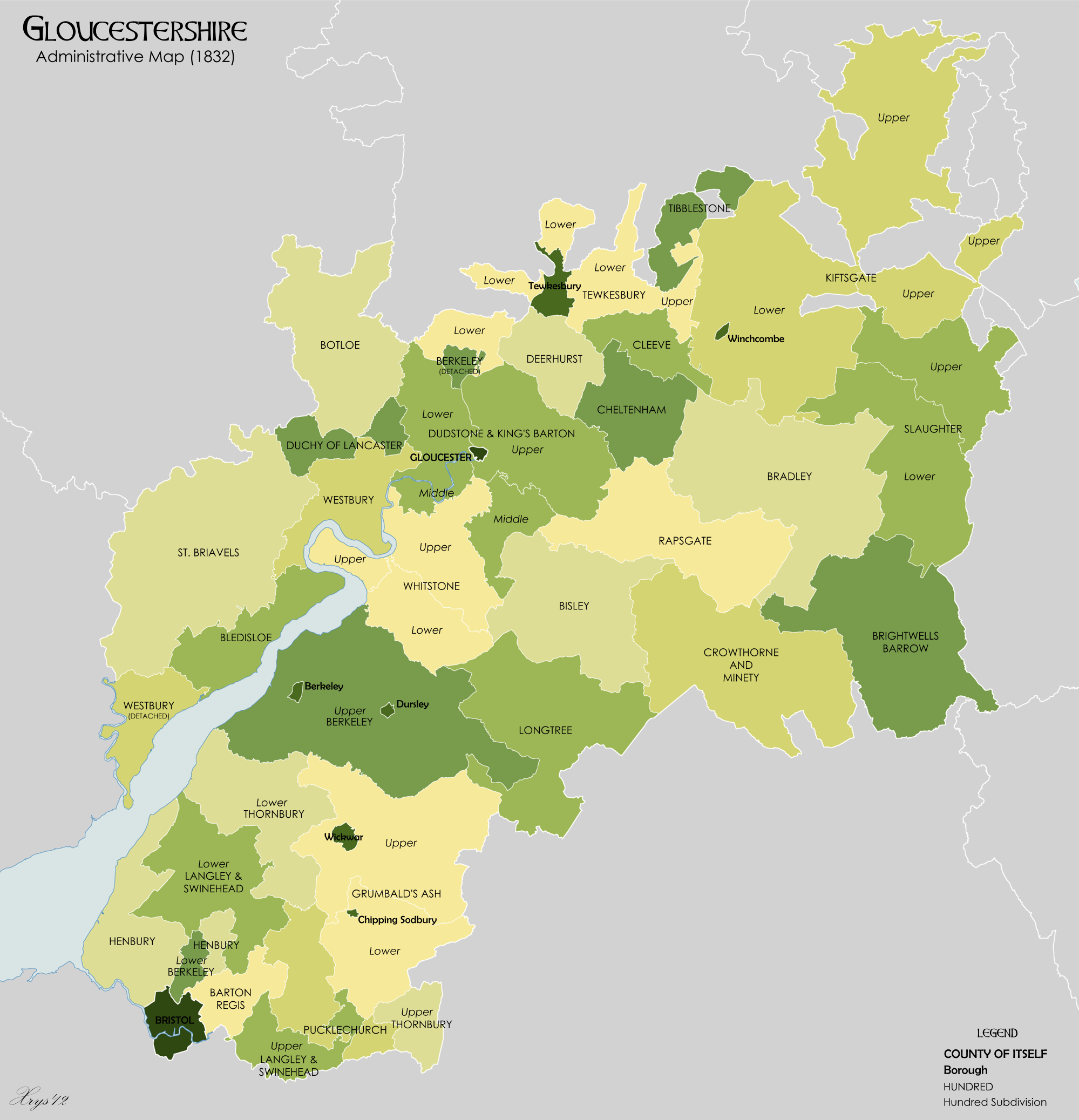
Gloucestershire 1832 Map
Gloucestershire ( abbreviated Glos) is a Counties of England, county in South West England. The county comprises part of the Cotswold Hills, part of the flat fertile valley of the River Severn and the entire Forest of Dean. The county town is the City status in the United Kingdom, city of Gloucester and other principal towns and villages include Cheltenham, Cirencester, Kingswood, South Gloucestershire, Kingswood, Bradley Stoke, Stroud, Thornbury, Gloucestershire, Thornbury, Yate, Tewkesbury, Bishop's Cleeve, Churchdown, Brockworth, Winchcombe, Dursley, Cam, Gloucestershire, Cam, Berkeley, Gloucestershire, Berkeley, Wotton-under-Edge, Tetbury, Moreton-in-Marsh, Fairford, Lechlade, Northleach, Stow-on-the-Wold, Chipping Campden, Bourton-on-the-Water, Stonehouse, Gloucestershire, Stonehouse, Nailsworth, Minchinhampton, Painswick, Winterbourne, Gloucestershire, Winterbourne, Frampton Cotterell, Coleford, Gloucestershire, Coleford, Cinderford, Lydney and Rodborough and Cainscros ... [...More Info...] [...Related Items...] OR: [Wikipedia] [Google] [Baidu] |
Kingsweston (ward)
Kingsweston was a ward of the city of Bristol. The three districts in the ward wer Coombe Dingle, Lawrence Weston and Sea Mills. The ward takes its name from the old district of Kings Weston (usually spelt in two words), now generally considered part of Lawrence Weston. Following a Local Government Boundary Commission review in 2015 ward boundaries were redrawn and Kingsweston ward is now split between the Stoke Bishop ward and the Avonmouth and Lawrence Weston ward. Coombe Dingle Coombe Dingle is a suburb of Bristol, centred on where the River Trym emerges from a gorge passing through the Blaise Castle Estate. A desirable area, the private housing was mainly built in the 1920s and 1930s. Further downstream is Sea Mills. There was a tin Methodist church which was demolished in the mid-1990s. There are still some photos of it on tiTabernacles It was a small gothic building of the 1890s. Lawrence Weston Lawrence Weston is a post war housing estate in north west Bristol between ... [...More Info...] [...Related Items...] OR: [Wikipedia] [Google] [Baidu] |
Hundreds Of Gloucestershire
A hundred is the natural number following 99 and preceding 101. Hundred may also refer to: Units and divisions * Hundred (word) formerly also equal to 120 or other values * Hundred (unit) sometimes equal to 120 or other values ** Hundredweight (cwt.), the most common of these units * Hundred (county division), a largely historical division of a county or similar larger administrative unit. Places * Hundred, West Virginia, US Other uses * ''Hundred'' (novel series), a Japanese light novel series * ''Hundreds'' (video game), a 2013 puzzle video game * "Hundred", a song by the Fray from ''How to Save a Life'' * "Hundred", a song by Khalid from '' Free Spirit'' * "Hundred", an episode of the TV series ''One Tree Hill'' * ''Hundred'' (TV series), an Indian series by Hotstar * The Hundred (cricket), a professional 100-ball cricket tournament in the UK, from summer 2021 * One Hundred Above the Park, a residential high-rise in St. Louis, Missouri, United States See also * 100 (disamb ... [...More Info...] [...Related Items...] OR: [Wikipedia] [Google] [Baidu] |
Stoke Bishop
Stoke Bishop is a medium-sized outer city suburb in the north-west of Bristol, located in between Westbury-on-Trym, Sneyd Park, and Sea Mills. Although relatively low, Stoke Bishop's population has increased due to substantial infilling on the ''Smelting Works'' sports ground and ''The Grove'' which used to belong to Clifton High school. The population of Stoke Bishop varies throughout the year because of the influx of students to the large campus of Bristol University halls of residence situated on the edge of the suburb and the Downs during term time. Stoke Bishop is also the name of a council ward, which also includes Sneyd Park, The Downs open green space, much of the Avon Gorge. and a small area of Sea Mills along the River Trym. The suburb is concentrated around a small village hall and a row of shops on Druid Hill, with a number of small local businesses. The association with Druids arose from a megalithic monument, apparently the remains of a burial chamber, discov ... [...More Info...] [...Related Items...] OR: [Wikipedia] [Google] [Baidu] |
Redland, Bristol
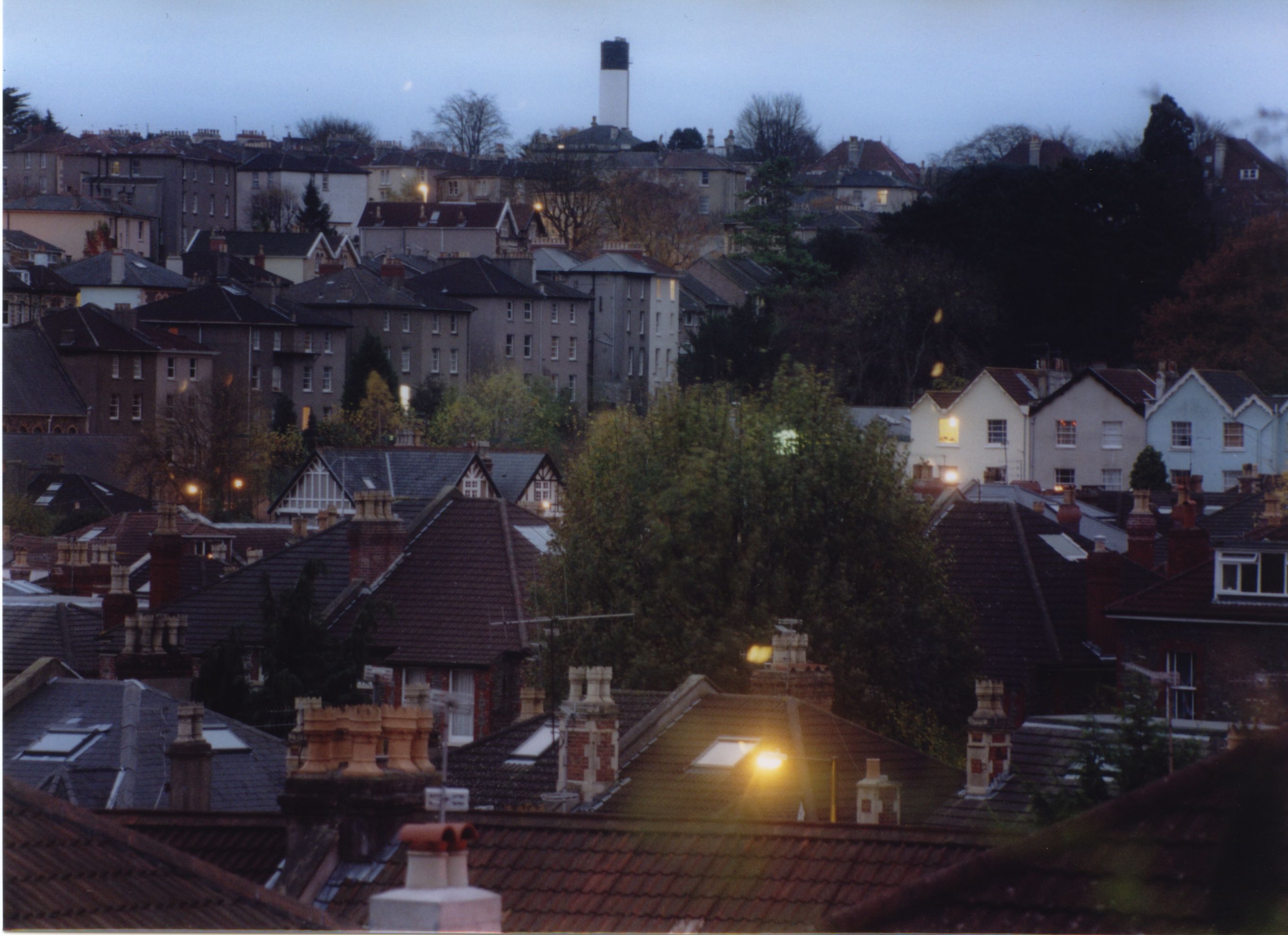
Redland is a neighbourhood in Bristol, England. The neighbourhood is situated between Clifton, Bristol, Clifton, Cotham, Bristol, Cotham, Bishopston, Bristol, Bishopston and Westbury Park, Bristol, Westbury Park. The boundaries of the district are not precisely defined, but are generally taken to be Whiteladies Road in the west, the Severn Beach Line, Severn Beach railway line in the south and Cranbrook Road in the east. Redland is also the name of a wards of the United Kingdom, council ward, which covers a slightly different area. Redland ward extends to the southern part of Bishopston, and does not include the part of Redland south of Redland Road, which is in Cotham ward. Redland is primarily residential, and is known as a popular student accommodation area, particularly with second and third year students from the city's Bristol University, university. Compared to Bristol averages, Redland ward has lower levels of deprivation, relative child poverty, premature mortality and ... [...More Info...] [...Related Items...] OR: [Wikipedia] [Google] [Baidu] |
Redwick, South Gloucestershire
Redwick is a village in South Gloucestershire, England. It is part of the parish of Pilning and Severn Beach, and is bounded by the River Severn to the north and the Chessell Pill Rhine to the east. To the south is the village of Pilning, at the end of Redwick Road near Pilning Stores and the village war memorial. Immediately to the west, the South Wales Main Line railway enters the Severn Tunnel. Historically Redwick was, with Northwick, a tything of the parish of Henbury. The village was first mentioned in 955 under the name ''Hreodwican'', meaning "place of reeds". The village is also mentioned in the Domesday Book Domesday Book () – the Middle English spelling of "Doomsday Book" – is a manuscript record of the "Great Survey" of much of England and parts of Wales completed in 1086 by order of King William I, known as William the Conqueror. The manusc ... in 1086. References External links Villages in South Gloucestershire District {{SouthGloucestershi ... [...More Info...] [...Related Items...] OR: [Wikipedia] [Google] [Baidu] |
Aust
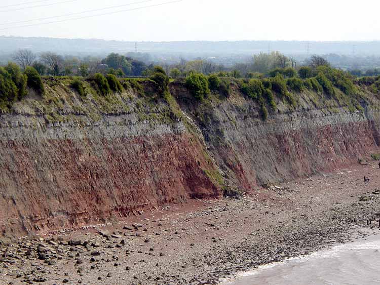
Aust is a small village in South Gloucestershire, England, about north of Bristol and about south west of Gloucester. It is located on the eastern side of the Severn estuary, close to the eastern end of the Severn Bridge which carries the M48 motorway. The village has a chapel, a church and a public house. There is a large area of farmland on the river bank, which is sometimes flooded due to the high tidal range of the Severn. Aust Cliff, above the Severn, is located about from the village. The civil parish of Aust includes the villages of Elberton and Littleton-upon-Severn. History Overview Aust, on the River Severn, was at one end of an ancient Roman road that let to Cirencester. Its name, Aust, may be one of the very few English place-names to be derived from the Latin ''Augusta''. The name of Aust is recorded in 793 or 794 as ''Austan'' (''terram aet Austan v manentes'') when it was returned to the Church of Worcester after having been taken by King Offa's earl, Bynna ... [...More Info...] [...Related Items...] OR: [Wikipedia] [Google] [Baidu] |
Charlton, Bristol
Charlton was the name of a small village or large hamlet in Gloucestershire, England with a Bethel Chapel and Sunday School. It was demolished in the late 1940s. Its site is (in 2020) occupied by part of the derelict runway and safety margins of the former Bristol Filton Airport. The village was located between Filton and what is today the Cribbs Causeway out-of-town commercial and retail area immediately north of Bristol. To the north of the village lay fields and Over, South Gloucestershire, Over Court Deer Park. which is today Bristol Golf Club. History Charlton was a tything in the ancient parish, and later Civil parishes in England, civil parish, of Henbury which still ecclesiastically covers more than . In 1870 Charlton had a population of 425, living in 88 houses. From 1910 to 1915 the place was served by Charlton Halt railway station (Bristol), Charlton Halt, on the Henbury Loop railway just south of the village. In 1935 the civil parish of Henbury was abolished, an ... [...More Info...] [...Related Items...] OR: [Wikipedia] [Google] [Baidu] |
Brentry
Brentry is a suburb of north Bristol, England, between Henbury and Southmead which is spread along the southern edge of the Filton to Avonmouth railway line. Description The boundaries of Brentry are not well defined. The settlement grew around the junction of two roads, where a public house, the Old Crow, has long been established. The north-south road, Passage Road (now the A4018), was a turnpike road from Bristol to South Wales via New Passage or the Old Passage at Aust Ferry. When the new Filton By-Pass (now part of the M5 motorway) was opened in 1962, the route became an arterial road linking the new road to the centre of Bristol. The east-west route (B4057) is now of only local importance, but in the 1930s it carried A38 traffic by-passing Bristol. The through route was cut by the runway for the giant Bristol Brabazon aircraft built in 1949. The area east of the junction was developed in the 20th century, and Brentry is now sometimes considered to extend as far as the ... [...More Info...] [...Related Items...] OR: [Wikipedia] [Google] [Baidu] |
Tytherington, Gloucestershire
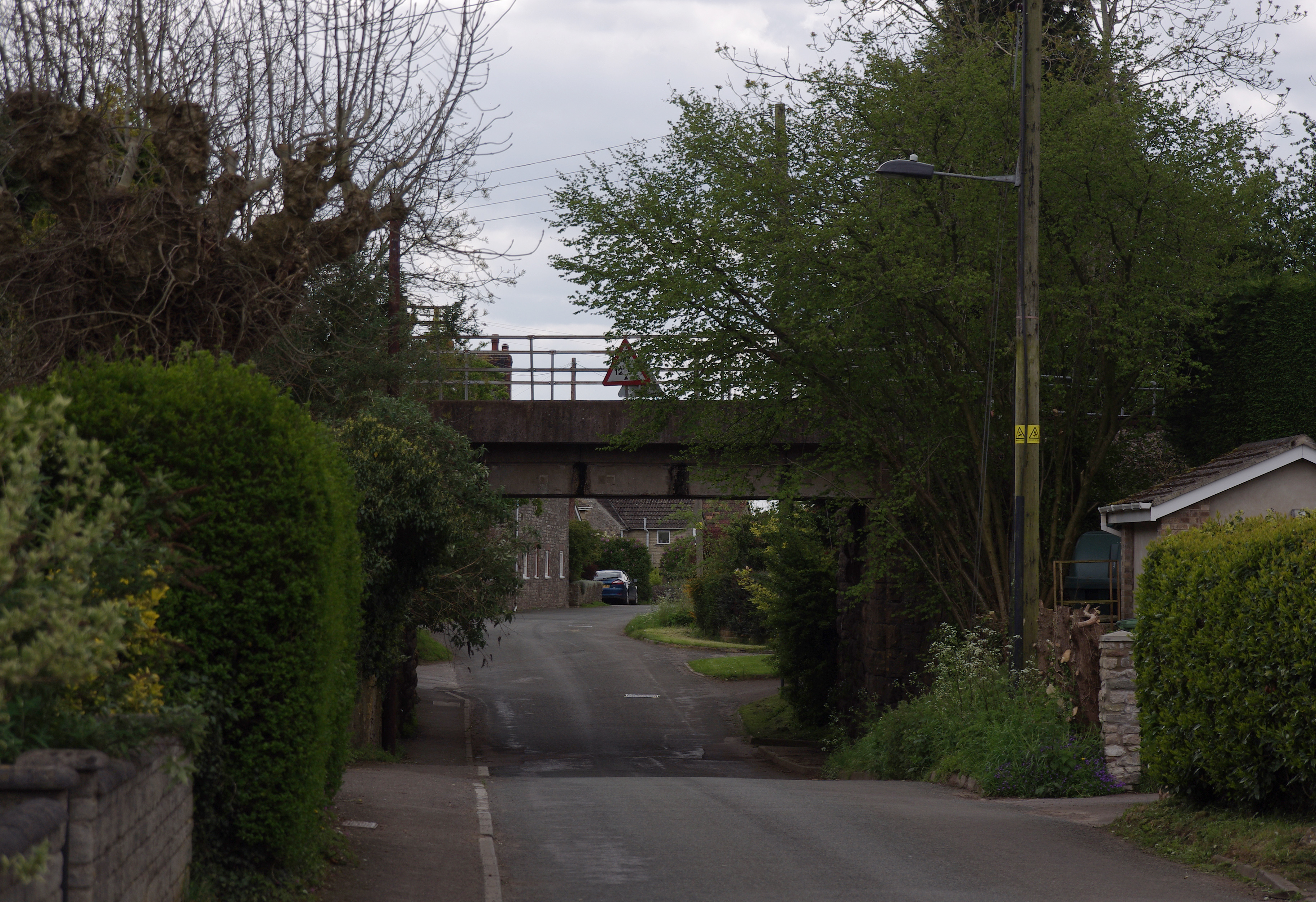
Tytherington is a village in South Gloucestershire, England, situated south east of Thornbury. The parish population taken at the 2011 census was 666. To the west of the village is Tytherington Quarry, a limestone quarry incorporating 2 active workings, operated by Hanson plc, and a disused working now designated as a Site of Special Scientific Interest. The former Yate to Thornbury railway branch line passes through the south of the village, with two bridges in the village and a tank engine near the quarry entrance as reminders of the railway. The line now ends at the quarry and is used for the transport of stone, but used to continue through a tunnel under the A38, to Thornbury. Tytherington had its own small station on the single track line: it opened in 1872 and closed to passengers in 1944. The M5 motorway runs along the north west fringe of the village. In the village there is a park, a former primary school (now used as the village hall), the Swan public house, ... [...More Info...] [...Related Items...] OR: [Wikipedia] [Google] [Baidu] |
Hundred Of Berkeley
The hundred of Berkeley was one of the ancient hundreds of Gloucestershire, England. Hundreds originated in the late Saxon period as a subdivision of a county and lasted as administrative divisions until the 19th century. Berkeley Hundred was divided into two separate parts, the Lower Division and the Upper Division. The Lower Division consisted of several detached parts, including the ancient parishes of * Elberton *Filton *Hill *Horfield *Almondsbury (part) *Henbury (part) The Upper Division consisted of the parishes of *Arlingham (a detached part of the hundred, separated from the rest of the hundred by the hundred of Whitstone) * Ashleworth *Berkeley *Beverston *Cam *Coaley * Cromhall Abbotts *Dursley * Kingscote *Newington Bagpath *North Nibley *Nympsfield *Owlpen *Ozleworth *Slimbridge *Stinchcombe *Uley *Wotton-under-Edge * Rockhampton (part) The meeting place was at Berkeley. References National Gazetteer of Great Britain and Ireland (1868){{Hundreds of Gloucestersh ... [...More Info...] [...Related Items...] OR: [Wikipedia] [Google] [Baidu] |
Tithing
A tithing or tything was a historic English legal, administrative or territorial unit, originally ten hides (and hence, one tenth of a hundred). Tithings later came to be seen as subdivisions of a manor or civil parish. The tithing's leader or spokesman was known as a ''tithingman''. Etymology The noun ''tithing'' breaks down as ''ten'' + ''thing'', which is to say, a thing (an assembly) of the households who live in an area that comprises ten hides. Comparable words are Danish ''herredthing'' for a hundred, and English ''husting'' for a single household. Sound changes in the prehistory of English are responsible for the first part of the word looking so different from the word ''ten''. In the West Germanic dialects which became Old English, ''n'' had a tendency to elide when positioned immediately before a ''th''. The noun is not to be confused with the verb ''to tithe'', its present participle ''tithing'', nor the act of ''tithing'', though they partly share the same origin. ... [...More Info...] [...Related Items...] OR: [Wikipedia] [Google] [Baidu] |


