|
Helsinki Tram Network
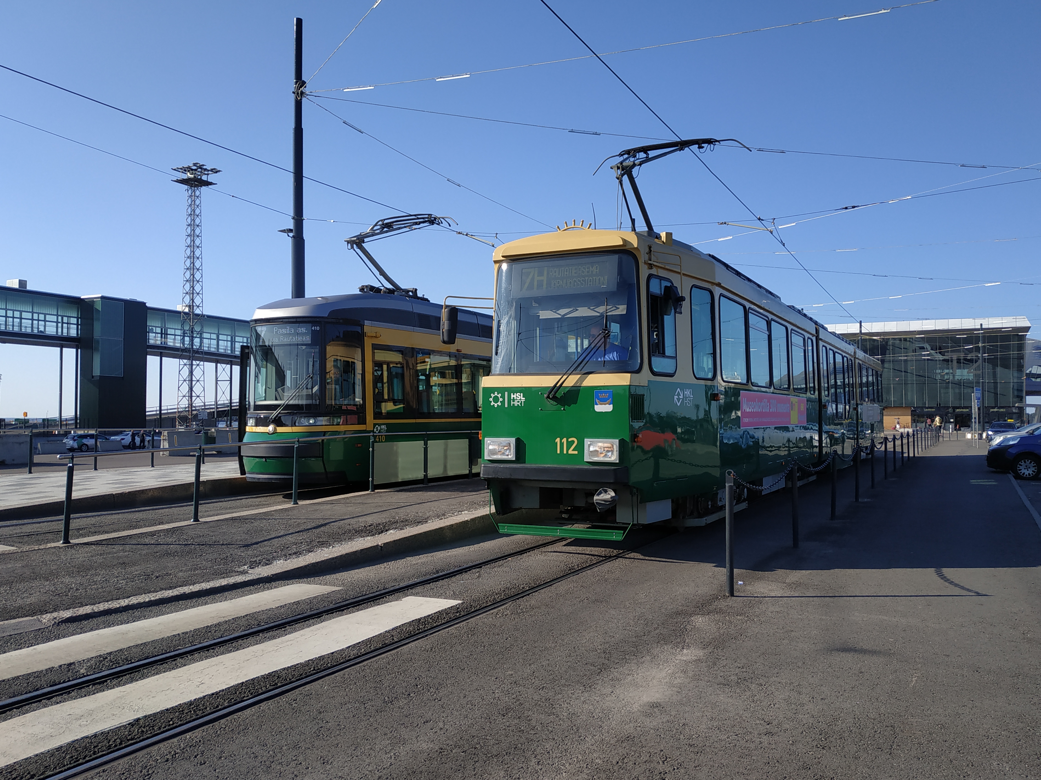
The Helsinki tram network forms part of the Helsinki public transport system organised by Helsinki Regional Transport Authority and operated by Metropolitan Area Transport Ltd (Finnish: Pääkaupunkiseudun Kaupunkiliikenne Oy, Swedish: Huvudstadsregionens Stadstrafik Ab) in the Finnish capital city of Helsinki. The trams are the main means of transport in the city centre. 56.7 million trips were made in 2013. Helsingin kaupungin liikennelaitos The Helsinki system is one of the oldest electrified tram networks in the world. Lines In 2017, approximately of double track was in operation with 11 routes. Additional lines In addition to the 10 regular lines two special ones exist: the museum line operated by Helsinki City Transport in collaboration with Oy Stadin Ratikat Ab Stadin Ratikat and the Spårakoff pub tram, both of which run during the summer months. These lines do not appear in the route map included with this article. * Approximate week day figures in 24-hou ... [...More Info...] [...Related Items...] OR: [Wikipedia] [Google] [Baidu] |
Hakaniemi
Hakaniemi (; sv, Hagnäs) is an unofficial district of Helsinki, the Finnish capital. It covers most of the neighbourhood of Siltasaari in the district of Kallio. Hakaniemi is located at the sea shore and is separated from the city centre by the Siltavuorensalmi strait and from the district of Linjat by the street Hämeentie. Historically, Hakaniemi was often associated with the working class and workers' associations. However, the cost of living has risen considerably in recent years and is now on par with that of the rest of central Helsinki. The main office of the Central Organisation of Finnish Trade Unions (SAK), the party offices of the Social Democratic Party of Finland (SDP) and the Left Alliance, as well as the Helsinki workers' house Paasitorni are located in Hakaniemi. The May Day march of the working class in Helsinki usually starts at the Hakaniemi market square. The best-known features of Hakaniemi include a large and lively marketplace, Oriental food stores with ... [...More Info...] [...Related Items...] OR: [Wikipedia] [Google] [Baidu] |
Käpylä
Käpylä (; sv, Kottby) is a neighbourhood of Helsinki with 7,600 inhabitants. Administratively speaking, Käpylä is a part of the Vanhakaupunki district. It is located between Kumpula, Oulunkylä and Koskela. Käpylä has a terminus for route-1 of the Helsinki tram network. Additionally, the Olympic Village built for the 1952 Summer Olympics and another village for the cancelled 1940 Summer Olympics are located in Käpylä. The Park Hotel, located in Käpylä, became known for being the shooting location of the popular Finnish satirical TV series ''Hyvät herrat''. One of the two lyceum schools situated in Käpylä has a specific orientation towards students with an interest in the natural sciences. The tram lines 1 and 1A as well as the Tuusulanväylä freeway bus lines travel to Käpylä. The I- N- and T-trains of the Helsinki commuter rail system stop at Käpylä railway station. There are smaller regions inside Käpylä, Puu-Käpylä (''wood-Käpylä'') and Taivaskallio ... [...More Info...] [...Related Items...] OR: [Wikipedia] [Google] [Baidu] |
Länsi-Pasila
Länsi-Pasila ( sv, Västra Böle) is a subdivision of Pasila, Helsinki, Finland Finland ( fi, Suomi ; sv, Finland ), officially the Republic of Finland (; ), is a Nordic country in Northern Europe. It shares land borders with Sweden to the northwest, Norway to the north, and Russia to the east, with the Gulf of B .... External links * Pasila {{SouthernFinland-geo-stub ... [...More Info...] [...Related Items...] OR: [Wikipedia] [Google] [Baidu] |
Kruununhaka
Kruununhaka (; ) is a neighbourhood of Helsinki, the capital of Finland. Kruununhaka became the area next to the harbour and the center, when Helsinki was moved from the earlier location in the mid-1660s. From the very beginning, the residents included city and state officials. Many buildings of the University of Helsinki are also situated in Kruununhaka. The area has become known for its vintage shops. Notable people *Kirka Babitzin, singer *Harri Holkeri, politician *Magnus Lindberg, composer *Johannes Virolainen, politician *Bror-Erik Wallenius, sports commentator *Valtteri Bottas, racing driver Gallery Image:Helsinki Cathedral in July 2004.jpg, Helsinki Cathedral Image:Presidentinlinna.jpg, Presidential Palace Image:Collegium of Advanced Studies, University of Helsinki.JPG, Aleksanteri Institute Image:Kruununhaka-Helsinki-As-Seen-From-Katajanokka.JPG, Pohjoisranta waterfront in Kruununhaka as seen from nearby Katajanokka Image:Mariankatu in December 2021.jpg, Mariankat ... [...More Info...] [...Related Items...] OR: [Wikipedia] [Google] [Baidu] |
West Harbour, Helsinki
West Harbour ( fi, Länsisatama, sv, Västra hamnen) is a passenger and cargo harbour in the Jätkäsaari district of Helsinki, Finland, in the southwestern part of the Helsinginniemi peninsula. The Länsisatama harbour area also includes the Munkkisaaren laituri pier on the west side of Munkkisaari, used by cruiseliners. The harbour is operated by the Port of Helsinki. It has two passenger terminals: West Terminal 1 ( fi, Länsiterminaali 1, sv, Västra terminalen 1) and West Terminal 2, which opened in February 2017. West Terminal 1 is used mainly by passenger ships from Helsinki to Saint Petersburg. West Terminal 2 is specialised in fast scheduled traffic to Tallinn, Estonia. As of 2013, Tallink and Eckerö Line operate routes to Tallinn, and St. Peter Line to Saint Petersburg. The construction of a new residential area for 15 thousand inhabitants in Jätkäsaari continues , using land freed up after the container traffic in West Harbour was moved to Vuosaari Harbour i ... [...More Info...] [...Related Items...] OR: [Wikipedia] [Google] [Baidu] |
Arabianranta
Arabianranta (; sv, Arabiastranden; literally meaning the "shore of Arabia"), sometimes simply Arabia, is a residential part of Helsinki, Finland. It is bound by Vanhankaupunginlahti bay from east, and connects to neighboring boroughs of Vanhakaupunki in north, Hermanni in south and Toukola and Kumpula in west. It is part of the greater Toukola region. The City of Helsinki requires all developers in the Arabianranta area to use 1-2% of the building investments of individual sites for works of art. This rule has been followed since the launching of development in the area 2000. Therefore, works of arts are visible around the district. Artists, designers and craftsmen put their stamp on buildings, objects and a communal spirit that gives energy. The district is mainly divided into three hubs. The Hämeentie Factory District is the heart of the Arabia region where you can find an unbroken tradition of design. At the southern end of Arabia, there is the Toukolanranta (swe. ''Ma ... [...More Info...] [...Related Items...] OR: [Wikipedia] [Google] [Baidu] |
Helsinki Central Railway Station
Helsinki Central Station ( fi, Helsingin päärautatieasema, sv, Helsingfors centralstation) ( HEC) is the main station for commuter rail and long-distance trains departing from Helsinki, Finland. The station is used by approximately 400,000 people per day, of whom about 200,000 are passengers. It serves as the terminus for all trains in the Helsinki commuter rail network, as well as for all Helsinki-bound long-distance trains in Finland. The Rautatientori (Central Railway Station) metro station is located in the same building. All trains from Finland to Saint Petersburg and Moscow in Russia also depart from Helsinki Central Station. The railway tracks in Helsinki were built in the 1860s. The station building, clad in granite, was designed by Eliel Saarinen and inaugurated in 1919. The building is known for its clock tower and the '' Lyhdynkantajat'' ("The Lantern Bearers") statues by Emil Wikström. Helsinki Central was chosen as one of the world's most beautiful railway stati ... [...More Info...] [...Related Items...] OR: [Wikipedia] [Google] [Baidu] |
Aleksanterinkatu
Aleksanterinkatu ( sv, Alexandersgatan; "Alexander Street") is a street in Kluuvi, the commercial centre of Helsinki, Finland. In the city plan by Carl Ludvig Engel, it was the ''Decumanus Maximus'', the main east–west street in the city, crossing the ''Cardo'', Unioninkatu ''(Union Street)'' at the corner of the Senate Square. The street begins near the Presidential Palace and continues to meet with Mannerheimintie, the longest street in Helsinki. It runs past several famous buildings, such as Ritarihuone (the seat of Finnish nobility), the Helsinki Cathedral, the former Finnish main office of the Nordea bank, the main building of the University of Helsinki, and the Stockmann department store. The street, colloquially known in Helsinki as "Aleksi" (Swedish: "Alexen"), was named for Emperor Alexander I of Russia in 1833. It was originally named Suurkatu ( sv, Storgatan), meaning "Grand Street", but was renamed after the Emperor's death in his honour. The streets crossing Al ... [...More Info...] [...Related Items...] OR: [Wikipedia] [Google] [Baidu] |
Munkkiniemi
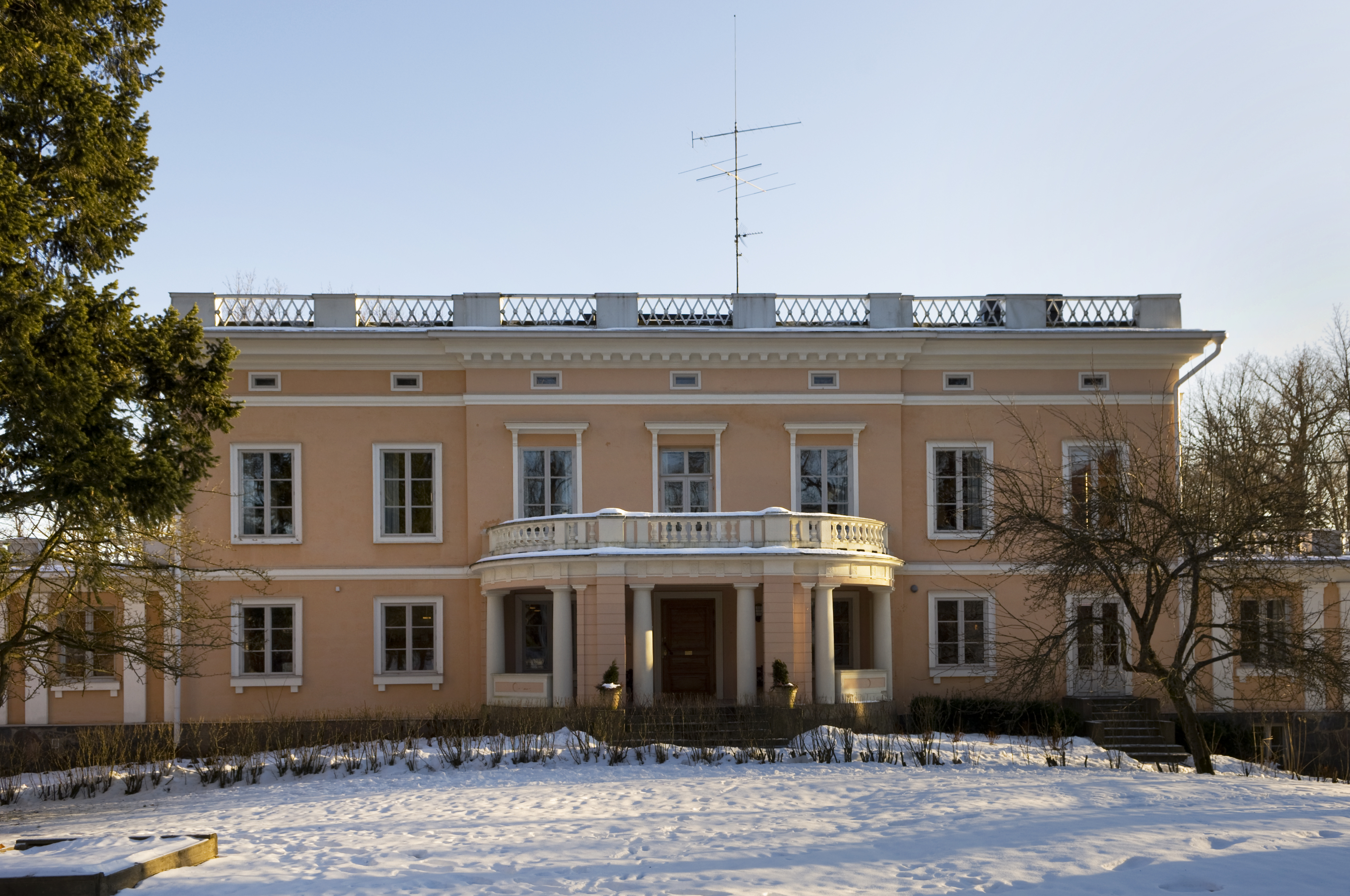
Munkkiniemi ( sv, Munksnäs, Helsinki slang: ''Munkka'') is a neighbourhood in Helsinki. Subdivisions within the district are Vanha Munkkiniemi, Kuusisaari, Lehtisaari, Munkkivuori, Niemenmäki and Talinranta. The land in Munkkiniemi was from the 17th century a part of Munksnäs manor. In the 1910s grandiose plans were made to expand all of western Helsinki with tens of thousands of new inhabitants, the so-called Munkkiniemi–Haaga Plan by Eliel Saarinen. The construction of the new areas started slowly and it wasn't until the 1930s that a more extensive construction phase began in Munkkiniemi. From 1920 to 1946 Munkkiniemi was part of Huopalahti municipality. Huopalahti including Munkkiniemi was incorporated with Helsinki in 1946. Munkkiniemi is one of the more affluent areas of Helsinki. Characterized by the relatively high proportion of Swedish speakers, around twelve percent, and a socioeconomic structure heavy on upper management and professionals, the district is apprecia ... [...More Info...] [...Related Items...] OR: [Wikipedia] [Google] [Baidu] |
Mannerheimintie
Mannerheimintie ( sv, Mannerheimvägen), named after the Finnish military leader and statesman Carl Gustaf Emil Mannerheim, is the main street and boulevard of Helsinki, Finland. It was originally named Heikinkatu ( sv, Henriksgatan), after Robert Henrik Rehbinder, but was renamed after the Winter War. The change of name was also suitable due to Mannerheim having paraded in along that road during the Finnish Civil War (1918), after German forces allied with Mannerheim's Finnish forces had retaken the city. That event is also portrayed in the landmark statue of Mannerheim sitting horseback. The statue is located along the Mannerheimintie just outside the modern arts museum Kiasma. The street starts at Erottaja in the city centre, near the Swedish Theatre and continues in a northernly direction past the Stockmann department store. It then continues as a main thoroughfare past the districts of Kamppi, Töölö, Meilahti, Laakso and Ruskeasuo, until it finally merges into a busy ... [...More Info...] [...Related Items...] OR: [Wikipedia] [Google] [Baidu] |
Katajanokka
Katajanokka ( sv, Skatudden) is a neighbourhood of Helsinki, Finland, with around 4000 inhabitants in 2005. The district is located adjacent to the immediate downtown area, though in the first major town plan for Helsinki from the mid-18th century, the area fell outside the fortifications planned to encircle the city. Originally, Katajanokka was a headland of the Helsinki peninsula but is now technically an island, as a small canal was dug across the base of the headland in the 19th century. There are four bridges across the canal connecting Katajanokka with mainland Helsinki. Buildings in Katajanokka include the former Katajanokka prison (now a Tribute Portfolio hotel by Marriott), the Uspenski Cathedral, the Katajanokka Casino, Wanha Satama, the Stora Enso head office designed by Alvar Aalto, the building of the Ministry for Foreign Affairs and the Katajanokka Terminal used by Viking Line. Katajanokka is one of the most distinguished neighbourhoods in Helsinki. Katajanokka' ... [...More Info...] [...Related Items...] OR: [Wikipedia] [Google] [Baidu] |
Kallio
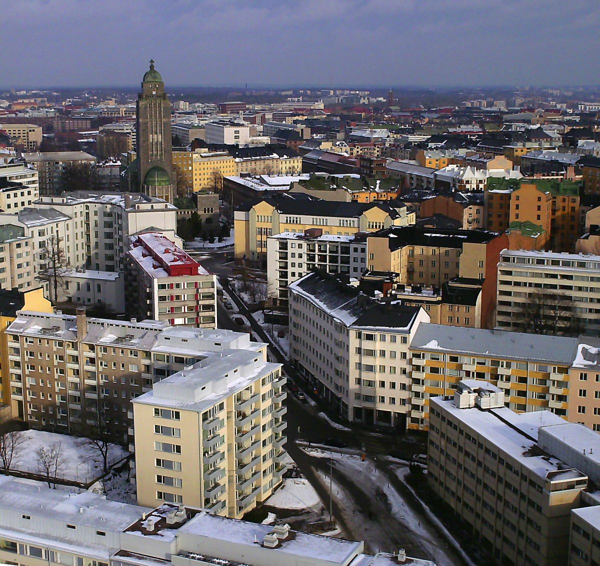
Kallio (; sv, Berghäll; literally " the rock") is a district and a neighbourhood in Helsinki, the capital of Finland, located on the eastern side of the Helsinki peninsula about one kilometre north from the city centre. It is one of the most densely populated areas in Finland. Kallio is separated from the city centre by the Siltasaarensalmi strait, over which is a bridge called Pitkäsilta ("long bridge"). Traditionally, the bridge symbolizes the divide between the affluent centre and the more working class areas around Kallio. After the forming of the new centre in the 19th century, the city expanded northward. The intense industrialization which began in the 1860s in Helsinki saw the construction of the industrial areas around Sörnäinen harbour and to the workers' district of Kallio, with the area becoming inhabited mostly by factory workers. However, most of the working-class families have long ago been replaced as the most typical Kallio residents by young adults and ... [...More Info...] [...Related Items...] OR: [Wikipedia] [Google] [Baidu] |


.jpg)

