|
Hell Hole Reservoir
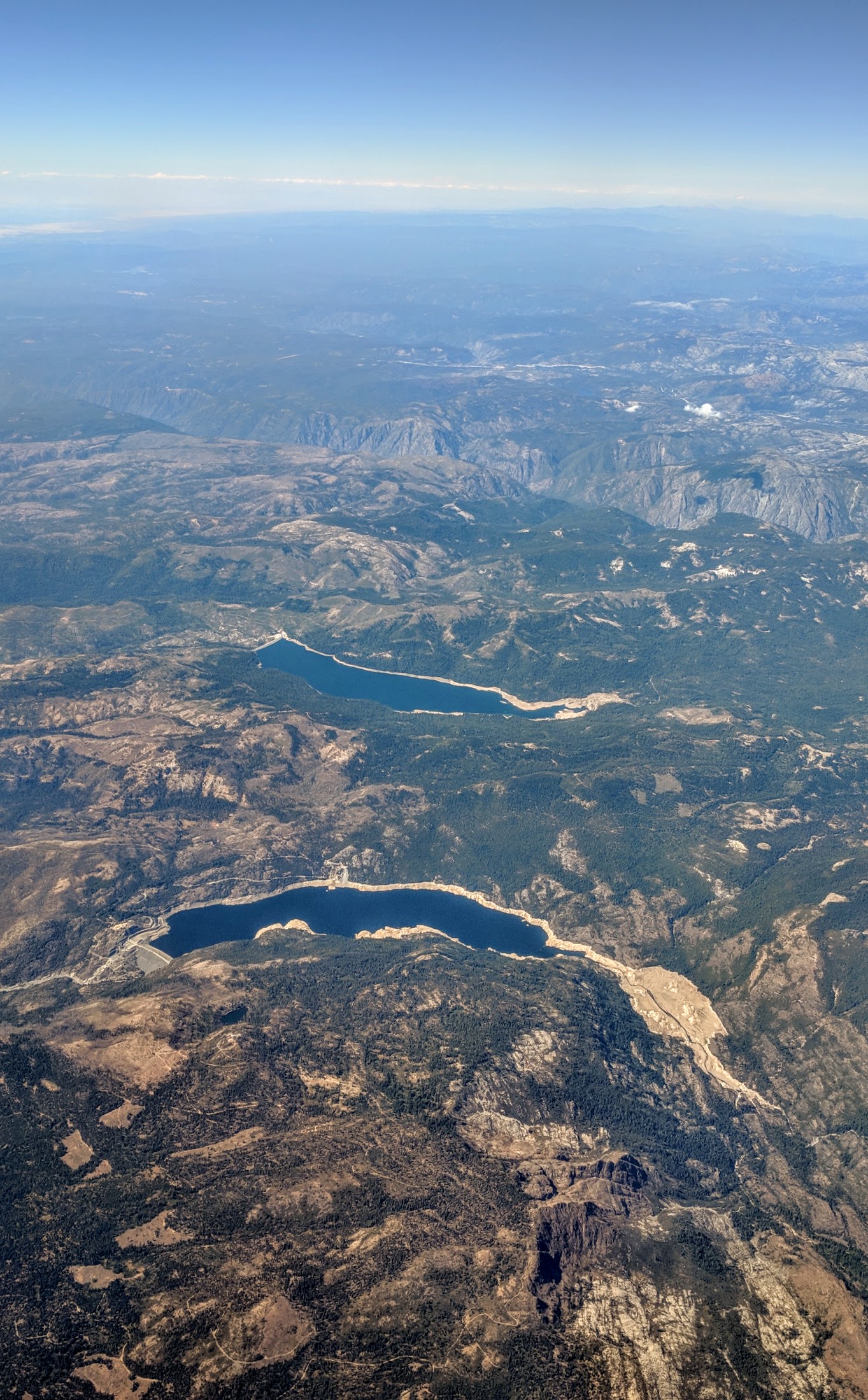
Hell Hole Reservoir is an artificial, crescent-shaped lake in the Sierra Nevada mountain range west of Lake Tahoe in California, United States. The lake is about long when at full capacity. The lake was created in 1966 with the completion of Lower Hell Hole Dam across the Rubicon River, which is a major tributary of the Middle Fork of the American River. Hell Hole is named for a deep canyon which is now under the waters of the lake. How the canyon came to be named Hell Hole is a combination of folklore and speculation. An early author, George Wharton James (1858–1923), visited the canyon in 1913. He attributed the name to an unidentified miner seeking riches during the Squaw Valley mining excitement of 1862. It was "a hell of hole to get out of," James wrote, but admitted his source for the place name was more speculative than the anonymous miner's chances for riches at Squaw Valley. James' guide for the 1913 camping expedition to Hell Hole was Bob Watson, a well-known c ... [...More Info...] [...Related Items...] OR: [Wikipedia] [Google] [Baidu] |
Placer County, California
Placer County ( ; Spanish for "sand deposit"), officially the County of Placer, is a county in the U.S. state of California. As of the 2020 census, the population was 404,739. The county seat is Auburn. Placer County is included in the Greater Sacramento metropolitan area. It is in both the Sacramento Valley and Sierra Nevada regions, in what is known as the Gold Country. The county stretches roughly 65 miles (105 km) from Sacramento's suburbs at Roseville to the Nevada border and the shore of Lake Tahoe. Etymology The discovery of gold in 1848 brought tens of thousands of miners from around the world during the California Gold Rush. In addition, many more thousands came to provide goods and services to the miners. On April 25, 1851, the fast-growing county was formed from parts of Sutter and Yuba Counties with Auburn as the county seat. Placer County took its name from the Spanish word for sand or gravel deposits containing gold. Miners washed away the gravel, leaving ... [...More Info...] [...Related Items...] OR: [Wikipedia] [Google] [Baidu] |
Sierra Club
The Sierra Club is an environmental organization with chapters in all 50 United States, Washington D.C., and Puerto Rico. The club was founded on May 28, 1892, in San Francisco, California, by Scottish-American preservationist John Muir, who became the first president as well as the longest-serving president, at approximately 20 years in this leadership position. The Sierra Club operates only in the United States and holds the legal status of 501(c)(4) nonprofit social welfare organization. Sierra Club Canada is a separate entity. Traditionally associated with the progressive movement, the club was one of the first large-scale environmental preservation organizations in the world, and currently engages in lobbying politicians to promote environmentalist policies. Recent focuses of the club include promoting sustainable energy and mitigating global warming, as well as opposition to the use of coal, hydropower and nuclear power. The club is known for its political endorsements, w ... [...More Info...] [...Related Items...] OR: [Wikipedia] [Google] [Baidu] |
Comstock Lode
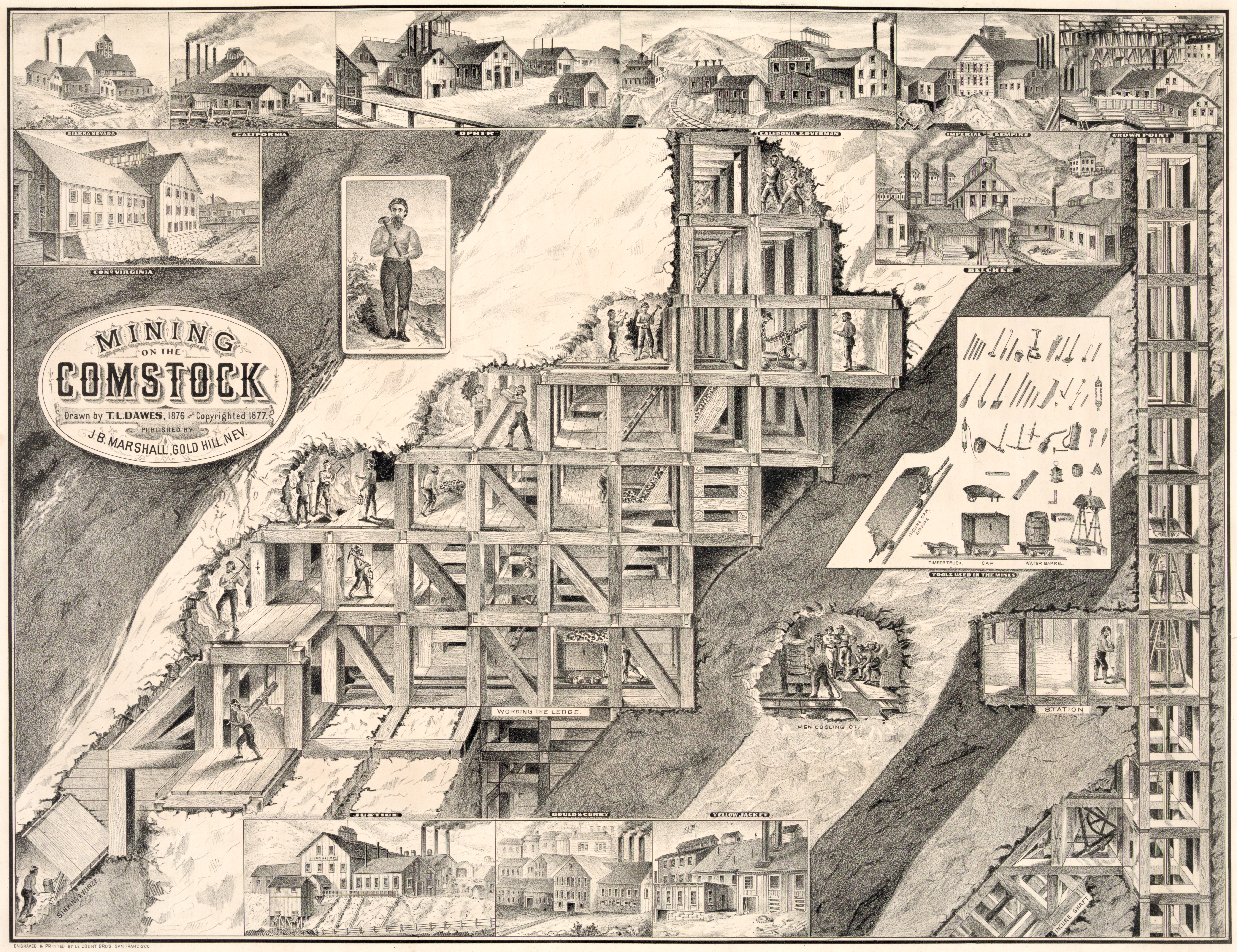
The Comstock Lode is a lode of silver ore located under the eastern slope of Mount Davidson, a peak in the Virginia Range in Virginia City, Nevada (then western Utah Territory), which was the first major discovery of silver ore in the United States and named after American miner Henry Comstock. After the discovery was made public in 1859, it sparked a silver rush of prospectors to the area, scrambling to stake their claims. The discovery caused considerable excitement in California and throughout the United States, the greatest since the California Gold Rush in 1849. Mining camps soon thrived in the vicinity, which became bustling commercial centers, including Virginia City and Gold Hill. The Comstock Lode is notable not just for the immense fortunes it generated and the large role those fortunes had in the growth of Nevada and San Francisco, but also for the advances in mining technology that it spurred, such as square set timbering and the Washoe process for extracting silv ... [...More Info...] [...Related Items...] OR: [Wikipedia] [Google] [Baidu] |
Loon Lake (California)
Loon Lake is a reservoir in the Eldorado National Forest of El Dorado County, California, United States. The lake is formed by Loon Lake Dam, completed in 1963 as part of the Upper American River Project by Sacramento Municipal Utility District to conserve spring snow melt runoff for use during the summer and autumn for hydroelectric power production. Loon Lake Dam impounds water at the headwaters of Gerle Creek which, prior to the dam, flowed intermittently through (natural) Loon and Pleasant Lakes. But most of the water now stored in Loon Lake arrives from Buck Island Reservoir in the adjacent Rubicon River watershed by way of the Buck-Loon Tunnel. Nearby is Loon Lake Chalet, a popular winter recreation destination. In summer, a boat ramp for water sports and camping are available, but the area is less popular than nearby Union Valley Reservoir and Rubicon Trail. It is also known as Loon Lake Reservoir. Boaters refer to the northeast portion of the reservoir as the Pleasant La ... [...More Info...] [...Related Items...] OR: [Wikipedia] [Google] [Baidu] |
Georgetown, California
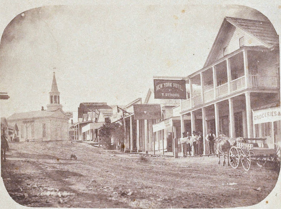
Georgetown (formerly Growlersburg) is a census-designated place (CDP) in El Dorado County, California. It is the northeasternmost town in the California Mother Lode. The population was 2,367 at the 2010 census, up from 962 in 2000. The town is registered as California Historical Landmark #484. History Founded August 7, 1849, by George Phipps and party, Georgetown was nicknamed "Growlersburg" due to the heavy, gold-laden quartz rocks that "growled" in the miners' pants as they walked around town. Georgetown is named for George Phipps. The first post office was established in 1851. After a disastrous fire in 1852, the old town was moved from the canyon in lower Main Street to its present site, and, unique in early-day planning, Main Street was laid out wide, with side streets . After this new reconstruction, the residents of the city proclaimed their town as the "Pride of the Mountains". The hub of an immensely rich gold mining area, Georgetown had a population of about three thous ... [...More Info...] [...Related Items...] OR: [Wikipedia] [Google] [Baidu] |
Nevada City, California
Nevada City (originally, ''Ustumah'', a Nisenan village; later, Nevada, Deer Creek Dry Diggins, and Caldwell's Upper Store) is the county seat of Nevada County, California, United States, northeast of Sacramento, southwest of Reno and northeast of San Francisco. The population was 3,068 as of the 2010 Census. History European-Americans first settled Nevada City in 1849, during the California Gold Rush, as Nevada (Spanish for "snow-covered", a reference to the snow-topped mountains in the area). The ''Gold Tunnel'' on the north side of Deer Creek was the city's first mine, built in 1850. The first sawmill in Nevada City was built on Deer Creek, just above town, in August 1850, by Lewis & Son, with a water wheel. In 1850–51, Nevada City was the state's most important mining town, and Nevada County the state's leading gold-mining county. In 1851, '' The Nevada Journal'' became the first newspaper published in the town and county. The first cemetery in town, the Pioneer Cemeter ... [...More Info...] [...Related Items...] OR: [Wikipedia] [Google] [Baidu] |
Placerville, California
Placerville (, ; formerly Old Dry Diggings, Dry Diggings, and Hangtown) is a city in and the county seat of El Dorado County, California. The population was 10,747 as of the 2020 census, up from 10,389 as of the 2010 census. It is part of the Sacramento–Arden-Arcade– Roseville Metropolitan Statistical Area. History A former Maidu settlement called Indak was located at the site of the town. After the discovery of gold at Sutter's Mill in nearby Coloma, California, by James W. Marshall in 1848 sparked the California Gold Rush, the small town now known as Placerville was known as Dry Diggin's after the manner in which the miners moved cartloads of dry soil to run water to separate the gold from the soil. Later in 1849, the town earned its most common historical name, "Hangtown", because of the numerous hangings that had occurred there. However, there is debate on exactly how many lynchings occurred in the town. The town had no police force (in 1849) and five immigra ... [...More Info...] [...Related Items...] OR: [Wikipedia] [Google] [Baidu] |
CATARACT
A cataract is a cloudy area in the lens of the eye that leads to a decrease in vision. Cataracts often develop slowly and can affect one or both eyes. Symptoms may include faded colors, blurry or double vision, halos around light, trouble with bright lights, and trouble seeing at night. This may result in trouble driving, reading, or recognizing faces. Poor vision caused by cataracts may also result in an increased risk of falling and depression. Cataracts cause 51% of all cases of blindness and 33% of visual impairment worldwide. Cataracts are most commonly due to aging but may also occur due to trauma or radiation exposure, be present from birth, or occur following eye surgery for other problems. Risk factors include diabetes, longstanding use of corticosteroid medication, smoking tobacco, prolonged exposure to sunlight, and alcohol. The underlying mechanism involves accumulation of clumps of protein or yellow-brown pigment in the lens that reduces transmission of li ... [...More Info...] [...Related Items...] OR: [Wikipedia] [Google] [Baidu] |
Sacramento, California
) , image_map = Sacramento County California Incorporated and Unincorporated areas Sacramento Highlighted.svg , mapsize = 250x200px , map_caption = Location within Sacramento County in California , pushpin_map = California#USA , pushpin_label = Sacramento , pushpin_map_caption = Location within California##Location in the United States , pushpin_relief = yes , coordinates = , coordinates_footnotes = , subdivision_type = Country , subdivision_name = United States , subdivision_type1 = U.S. state, State , subdivision_name1 = California , subdivision_type2 = List of counties in California, County , subdivision_name2 = Sacramento County, California, Sacramento ---- , subdivision_type3 = List of regions of California, Region ... [...More Info...] [...Related Items...] OR: [Wikipedia] [Google] [Baidu] |
Folsom Lake
Folsom Lake is a reservoir on the American River in the Sierra Nevada foothills of California, United States. It is located within Placer, El Dorado, and Sacramento Counties. It is about northeast of Sacramento. The lake surface area is , its elevation is , and it has of undulated shoreline. Folsom Lake with its surrounding Folsom Lake State Recreation Area is one of the most visited parks in the California park system. The California Office of Environmental Health Hazard Assessment has developed a safe eatinadvisoryfor Folsom Lake based on levels of mercury found in fish caught here. History The Folsom Lake reservoir is formed by Folsom Dam, built in 1955 to control and retain the American River. The dam and reservoir are part of the Folsom Project, which also includes the Nimbus afterbay reservoir and dam facilities. The Folsom Project, operated by the United States Bureau of Reclamation, is part of the Central Valley Project, a multipurpose project that provides flood co ... [...More Info...] [...Related Items...] OR: [Wikipedia] [Google] [Baidu] |
French Meadows Reservoir
French Meadows Reservoir is a manmade lake northeast of Foresthill, California, United States on the Middle Fork of the American River. The reservoir is long, wide, with of shoreline. Tahoe National Forest manages the recreational facilities which include five campgrounds, two group campgrounds and two paved boat launch ramps. Activities at the lake include powerboating, kayaking, canoeing, fishing, picnicking and hiking. The reservoir is entirely within a state game refuge so no firearms, pellet guns or archery weapons are allowed. The elevation of the lake is , and it is nine miles (14 km) from the crest of the Sierra Nevada Mountain Range. The California Office of Environmental Health Hazard Assessment (OEHHA) has developed a safe eatinadvisoryfor French Meadows Reservoir based on levels of mercury found in fish caught here. History The reservoir was built in with the construction on the Middle Fork of the American River of the L.L. Anderson Dam. The dam i ... [...More Info...] [...Related Items...] OR: [Wikipedia] [Google] [Baidu] |
Rubicon River Flowing Through Cataract To Hell Hole Reservoir
The Rubicon ( la, Rubico; it, Rubicone ; rgn, Rubicôn ) is a shallow river in northeastern Italy, just north of Rimini. It was known as Fiumicino until 1933, when it was identified with the ancient river Rubicon, famously crossed by Julius Caesar in 49 BC. The river flows for around from the Apennine Mountains to the Adriatic Sea through the south of the Emilia-Romagna region, between the towns of Rimini and Cesena. History The Latin word comes from the adjective , meaning "red". The river was so named because its waters are colored red by iron deposits in the riverbed. During the Roman Republic, the Rubicon marked the boundary between the Roman province of Cisalpine Gaul and Italy proper, controlled directly by Rome and its (allies), to the south. On the north-western side, the border was marked by the river Arno, a much wider and more important waterway, which flows westward from the Apennine Mountains (the Arno and the Rubicon rise not far from each other) into the ... [...More Info...] [...Related Items...] OR: [Wikipedia] [Google] [Baidu] |


_PHIL_4284_lores.jpg)
.jpg)
