|
Havel–Oder–Wasserstraße
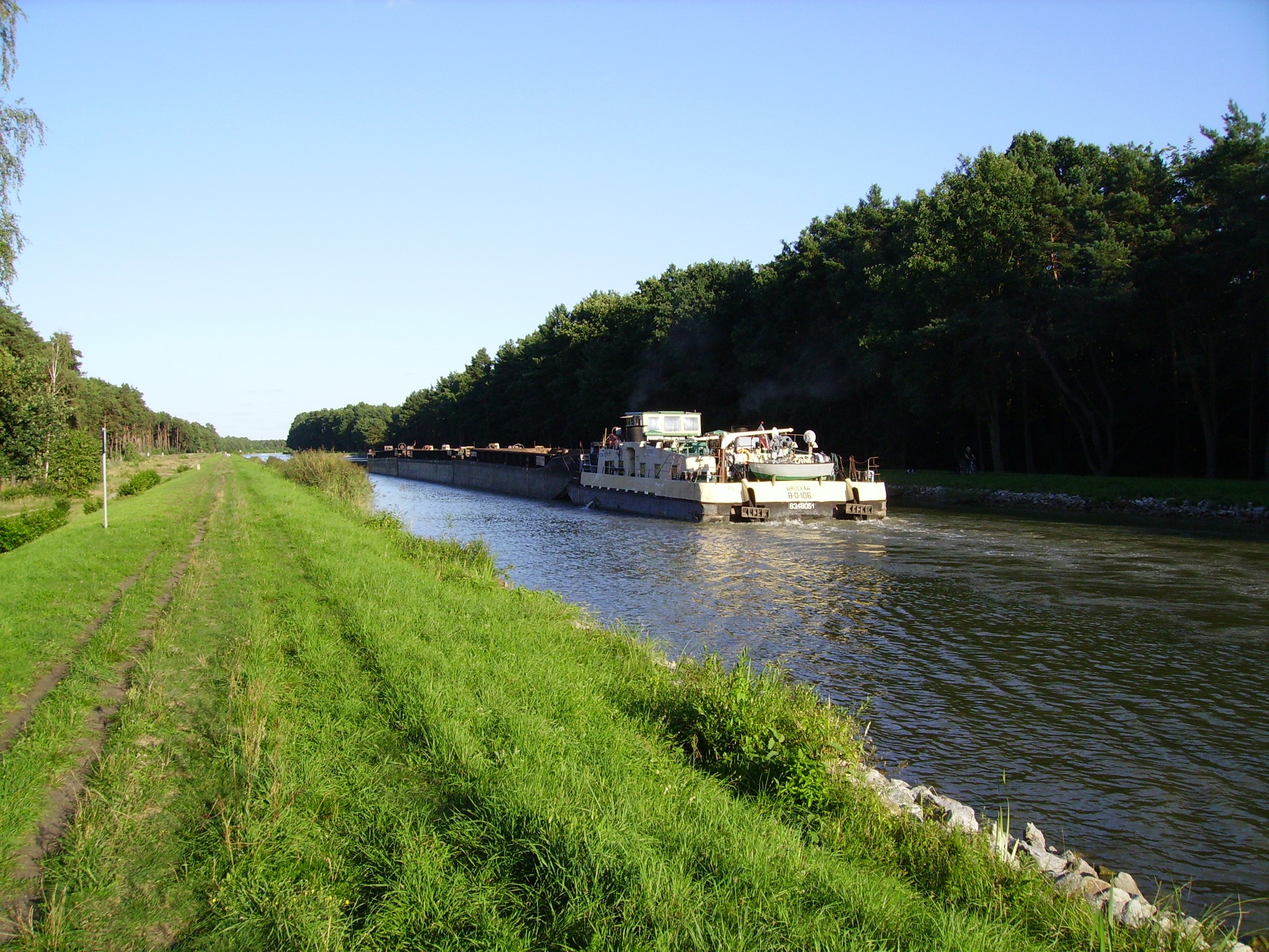
The Havel–Oder–Wasserstraße (HOW) is a navigable waterway connecting Berlin (Havel and Spree) and the German-Polish border at the West Oder River at Friedrichsthal north of Schwedt. Approximately 135 km long, it is composed of the following sections: * Havel-, Scheital-, Oderhaltung and the Hohensaaten-Friedrichsthaler Wasserstraße (HFW), which are connected by the Lehnitz lock, * the ship's lift Niederfinow and * the West Schleuse Hohensaaten. The route between the Havel and Lehnitz lock and the peak position are together called Oder-Havel-Kanal for the Oderhaltung (Wriezener Alte Oder) section of the river, also known as the Oderberger Gewässer. The German-Polish border forms part of the west or north Mescherin (enlargement of the total length by about 14 km) and the Berlin-Spandau shipping canal, the Berlin Westhafen on a short route with the Havelhaltung (by Spandau Spandau () is the westernmost of the 12 boroughs () of Berlin, situated at the confluence of ... [...More Info...] [...Related Items...] OR: [Wikipedia] [Google] [Baidu] |
Berlin
Berlin ( , ) is the capital and largest city of Germany by both area and population. Its 3.7 million inhabitants make it the European Union's most populous city, according to population within city limits. One of Germany's sixteen constituent states, Berlin is surrounded by the State of Brandenburg and contiguous with Potsdam, Brandenburg's capital. Berlin's urban area, which has a population of around 4.5 million, is the second most populous urban area in Germany after the Ruhr. The Berlin-Brandenburg capital region has around 6.2 million inhabitants and is Germany's third-largest metropolitan region after the Rhine-Ruhr and Rhine-Main regions. Berlin straddles the banks of the Spree, which flows into the Havel (a tributary of the Elbe) in the western borough of Spandau. Among the city's main topographical features are the many lakes in the western and southeastern boroughs formed by the Spree, Havel and Dahme, the largest of which is Lake Müggelsee. Due to its l ... [...More Info...] [...Related Items...] OR: [Wikipedia] [Google] [Baidu] |
Germany–Poland Border
The Germany–Poland border (german: Grenze zwischen Deutschland und Polen, pl, Granica polsko-niemiecka), the state border between Poland and Germany, is currently the Oder–Neisse line. It has a total length of (Downloadable pdf file) and has been in place since 1945. It stretches from the Baltic Sea in the north to the Czech Republic in the south. History Germany–Poland border traces its origins to the beginnings of the Polish state, with the Oder (Odra) and Lusatian Neisse (Nysa) rivers (the Oder–Neisse line) being one of the earliest natural boundaries between Germany and the Slavic tribes. Over several centuries, it has moved eastwards, stabilized in the 14th century, and disappeared in the late 18th century with the partitions of Poland, in which Poland's neighbors, including the Kingdom of Prussia, annexed all of its territory. In 1871 Prussia became part of the German Empire. After Poland regained independence following World War I and the 123 years of partit ... [...More Info...] [...Related Items...] OR: [Wikipedia] [Google] [Baidu] |
West Oder
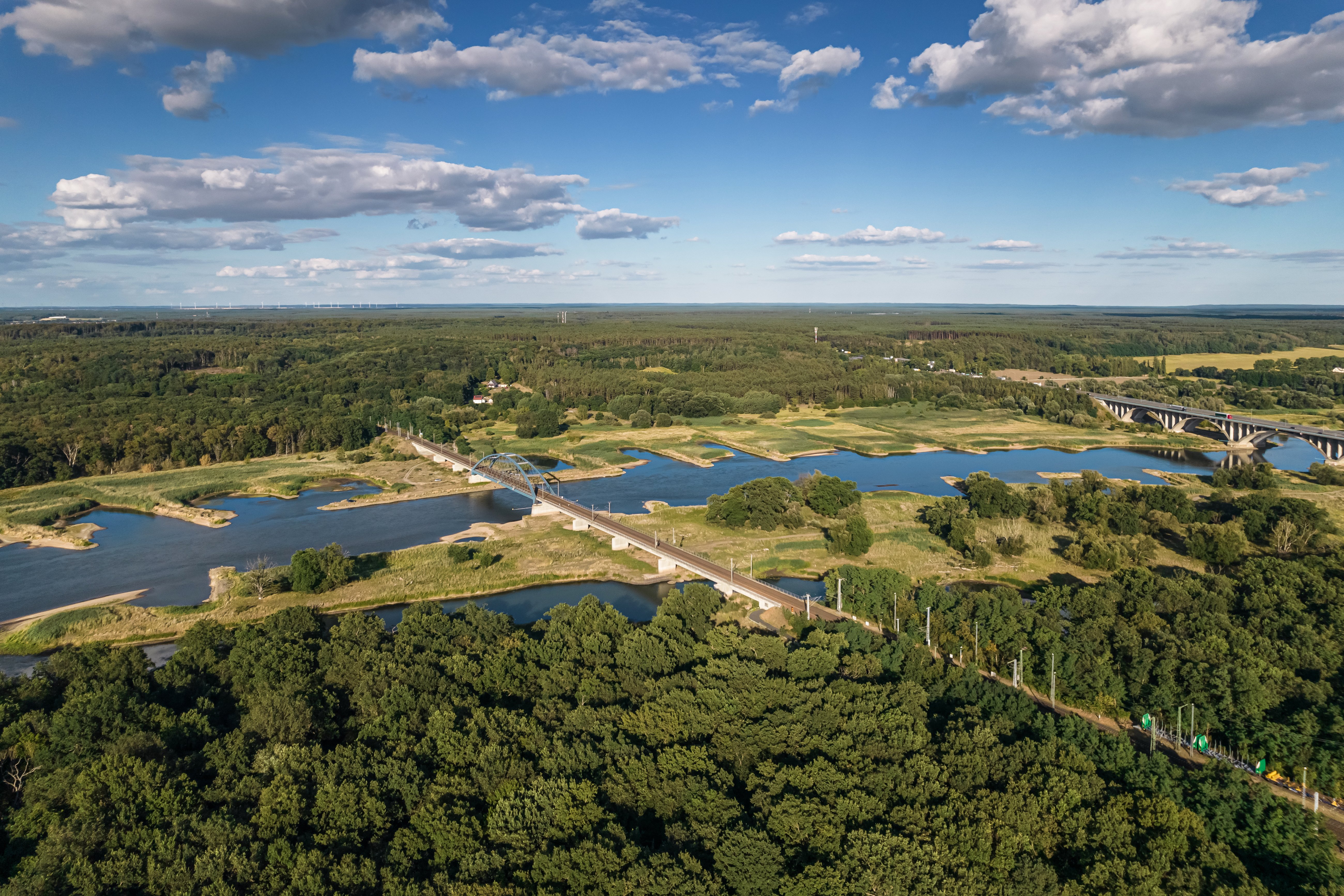
West Oder ( pl, Odra Zachodnia) is the western arm of the lower Oder near Szczecin, Poland along the border with Germany. It flows into the Oder Lagoon. The river flows through the Lower Oder Valley forming, along with the Eastern Oder ( pl, Odra Wschodnia), an area called Międzyodrze, part of the Lower Odra Valley Landscape Park. Międzyodrze area is traversed by a network of canals and old riverbeds, linked with West Oder. Between the split of Odra arms to the Regalica, East Oder runs through the Gryfino County. See also * East Oder East Oder ( pl, Odra Wschodnia) is the eastern arm of the lower Oder near Szczecin, Poland. It flows through Skośnica canal into West Oder and through Regalica into Dąbie Lake in the delta of the Oder river. The river flows through the Lowe ..., or Regalica References Opis Odrzańskiej Drogi Wodnej Zawartej w granicach RZGW Szczecin.Regionalny Zarząd Gospodarki Wodnej w Szczecinie. Rivers of Poland Rivers of West Pomeranian Voivodesh ... [...More Info...] [...Related Items...] OR: [Wikipedia] [Google] [Baidu] |
Friedrichsthal
Friedrichsthal is a town and a municipality in the district of Saarbrücken, of Saarland, Germany. It is situated approximately 13 km northeast of Saarbrücken. Friedrichsthal (Saar) station is located on the Bingen (Rhein)–Saarbrücken railway. History In 1723 the place was founded with a glass foundry by Frederick Louis, Count of Nassau-Ottweiler Frederick Louis of Nassau-Ottweiler (13 November 1651 – 25 May 1728) was a member of the House of Nassau. Biography He was born in Ottweiler, the son of John Louis, Count of Nassau-Ottweiler and Countess Palatine Dorothea Catherine of Birken .... Sons and daughters of the city * Johannes Driessler (1921-1998), composer * Manfred Römbell (1941-2010), writer References Saarbrücken (district) {{Saarland-geo-stub ... [...More Info...] [...Related Items...] OR: [Wikipedia] [Google] [Baidu] |
Schwedt
Schwedt (or Schwedt/Oder; ) is a town in Brandenburg, in northeastern Germany. With the official status of a '' Große kreisangehörige Stadt'' (major district town), it is the largest town of the Uckermark district, located near the river Oder, which forms the border with Poland. Overview The formerly agrarian town today has one of the largest oil refineries (''PCK Raffinerie GmbH'') in Germany, established in 1958 and connected to the Russian Druzhba pipeline network. The refinery uses 20 million cubic meters of water per year for the process. A large paper factory (''UPM'') is located near Schwedt. Most industries were located in the remote area during communist rule in the 1960s and 1970s. Large residential areas were built for the workers moving to Schwedt. About 9% of the town's flats are in prefab concrete buildings (''Plattenbau'') dating from the era. As many jobs were lost after German reunification and the return to market economy, Schwedt has lost a quarter of its p ... [...More Info...] [...Related Items...] OR: [Wikipedia] [Google] [Baidu] |
Lehnitz
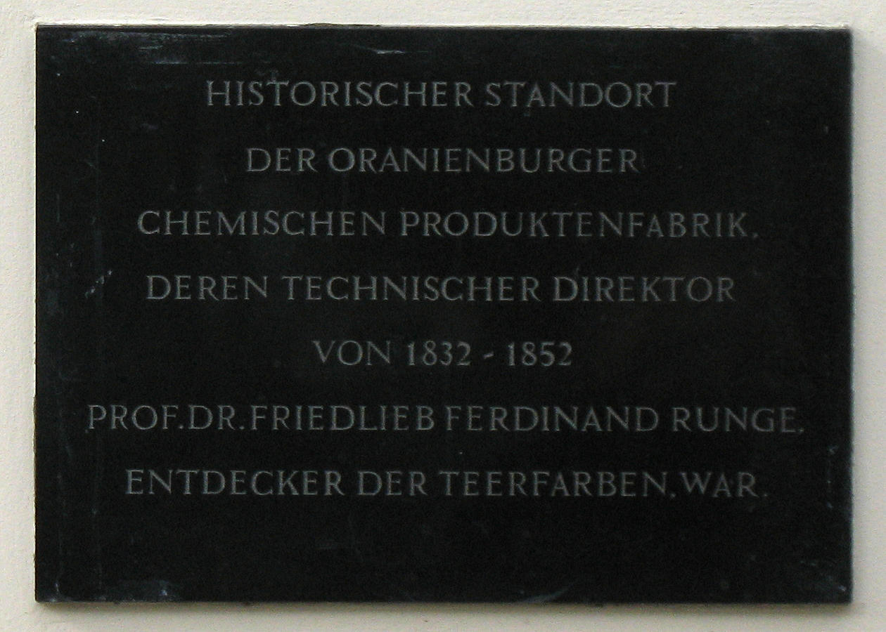
Oranienburg () is a town in Brandenburg, Germany. It is the capital of the district of Oberhavel. Geography Oranienburg is a town located on the banks of the Havel river, 35 km north of the centre of Berlin. Division of the town Oranienburg consists of nine districts: * Friedrichsthal * Germendorf * Lehnitz * Malz * Oranienburg * Sachsenhausen * Schmachtenhagen * Wensickendorf * Zehlendorf History Originally named Bötzow, the town of Oranienburg dates from the 12th century and was first mentioned in 1216. Margrave Albert the Bear (ruled 1157–1170) allegedly ordered the construction of a castle on the banks of the Havel. Around the castle stood a settlement of traders and craftsmen. In 1646, Friedrich Wilhelm I of Brandenburg married Louise Henriette of Orange-Nassau (German: ''Oranien-Nassau''). She was so attracted by the town of Bötzow that her husband presented the entire region to her. The princess ordered the construction of a new castle in the Dutch style and ... [...More Info...] [...Related Items...] OR: [Wikipedia] [Google] [Baidu] |
Sluice
Sluice ( ) is a word for a channel controlled at its head by a movable gate which is called a sluice gate. A sluice gate is traditionally a wood or metal barrier sliding in grooves that are set in the sides of the waterway and can be considered as a bottom opening in a wall. Sluice gates are one of the most common hydraulic structures in controlling flow rate and water level in open channels such as rivers and canals. They also could be used to measure the flow. A water channel containing a sluice gate forms a type of lock to manage the water flow and water level. It can also be an open channel which processes material, such as a River Sluice used in gold prospecting or fossicking. A mill race, leet, flume, penstock or lade is a sluice channeling water toward a water mill. The terms sluice, sluice gate, knife gate, and slide gate are used interchangeably in the water and wastewater control industry. They are also used in wastewater treatment plants and to recover minerals in minin ... [...More Info...] [...Related Items...] OR: [Wikipedia] [Google] [Baidu] |
Oder–Havel Canal
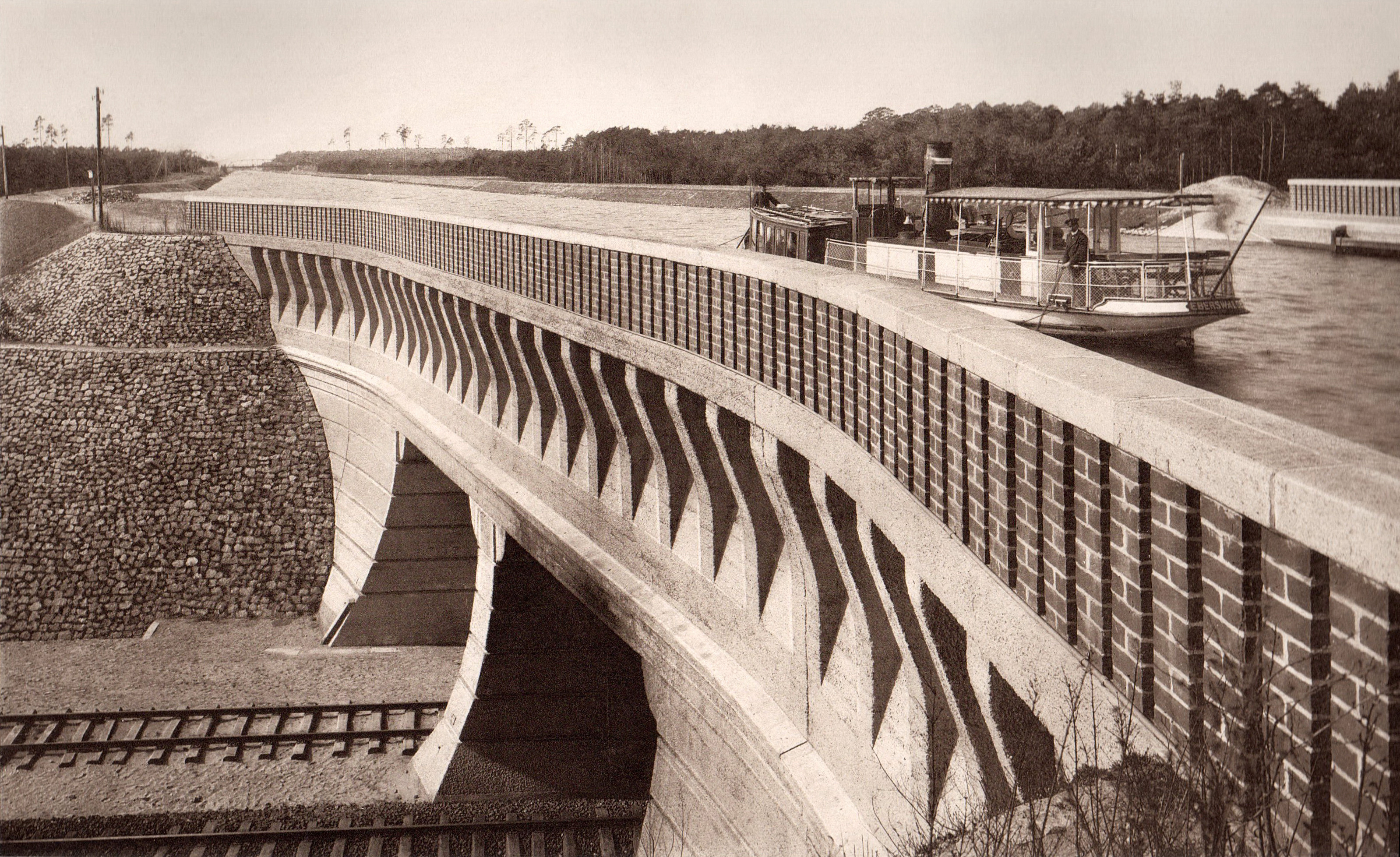
The Oder–Havel Canal is a German canal built between 1908 and 1914, originally known as the Hohenzollern Canal, mostly replacing the Finow Canal. Together with Hohensaaten-Friedrichsthaler Wasserstraße, the ''Oderhaltung'' and the ''Schwedter Querfahrt'' it forms the ''Havel-Oder-Wasserstraße''. It runs from the town of Cedynia near the city of Szczecin on the Oder River between Germany and Poland to the Havel, a tributary of the Elbe, near Berlin. It is long, and wide. In 1934 a ship lift was built on the canal, near Niederfinow. It vertical lift was . The dimensions of the caisson are 85 x 12 x 2.5 m. It could lift vessels of up to 1000 tonnes displacement. History The assumed start of the actual Oder–Havel Canal is the current mouth of the Oranienburger Havel. It leads through the Lehnitzsee, which previously did not belong to the Havel, and reaches the Lehnitzschleuse. Most of the canal follows the former Malz Canal and then replaces the older Finow Cana ... [...More Info...] [...Related Items...] OR: [Wikipedia] [Google] [Baidu] |
Oderberg
Oderberg () is a town in the district of Barnim, in Brandenburg in northeastern Germany. It is situated 16 km east of Eberswalde, and 27 km southwest of Schwedt, close to the border with Poland, and in close vicinity of Berlin. Overview The territory has many lakes, remnants from the ice age. The area is widely used for outdoor recreation, such as biking, walking and boating. As Biosphere region it is home to many species of wildlife. Oderberg is closest to the Oder river crossing leading directly to Cedynia, Poland. Demography Gallery Oderberg town hall.jpg, Town hall Neuendorf church SW.jpg, Church in Neuendorf Oderberg 04 17 02 jiw.jpg, Saint Nicholas church Oderberg 10 14 06 jiw.jpg, Museum References Localities in Barnim {{Brandenburg-geo-stub ... [...More Info...] [...Related Items...] OR: [Wikipedia] [Google] [Baidu] |
Spandau
Spandau () is the westernmost of the 12 boroughs () of Berlin, situated at the confluence of the Havel and Spree rivers and extending along the western bank of the Havel. It is the smallest borough by population, but the fourth largest by land area. Overview Modern industries in Spandau include metalworking, and chemical and electrical factories. BMW Motorrad's Spandau factory made all BMW's motorcycles from 1969 until final assembly plants were added in Rayong, Thailand in 2000, and Manaus, Brazil in 2016. , Spandau's seat of government, was built in 1913. Other landmarks include the Renaissance-era Spandau Citadel, the 1848 St. Marien am Behnitz Catholic church designed by August Soller, and Spandau arsenal. That arsenal's Spandau machine gun inspired the slang ''Spandau Ballet'' to describe dying soldiers on barbed wire during the First World War, and later was applied to the appearance of Nazi war criminals at Spandau Prison. In 1979, the English New Romantic band Spa ... [...More Info...] [...Related Items...] OR: [Wikipedia] [Google] [Baidu] |
Canals In Germany
Canals or artificial waterways are waterways or engineered channels built for drainage management (e.g. flood control and irrigation) or for conveyancing water transport vehicles (e.g. water taxi). They carry free, calm surface flow under atmospheric pressure, and can be thought of as artificial rivers. In most cases, a canal has a series of dams and locks that create reservoirs of low speed current flow. These reservoirs are referred to as ''slack water levels'', often just called ''levels''. A canal can be called a ''navigation canal'' when it parallels a natural river and shares part of the latter's discharges and drainage basin, and leverages its resources by building dams and locks to increase and lengthen its stretches of slack water levels while staying in its valley. A canal can cut across a drainage divide atop a ridge, generally requiring an external water source above the highest elevation. The best-known example of such a canal is the Panama Canal. Many ca ... [...More Info...] [...Related Items...] OR: [Wikipedia] [Google] [Baidu] |


