|
Hauraki Rift
The Hauraki Rift is an active NeS-to NWeSE-striking rift valley system in the North Island of New Zealand that has produced the Firth of Thames and the Hauraki Plains. It is approximately wide and long. Geology The rift valley in the north appears to be delimited in the west by the line of the Firth of Thames Fault and to the east by the Hauraki Fault. The mountains of the Coromandel (which include andesitic and basaltic back arc volcanoes) and Kaimai Range to the east and the Hunua Range to the west give it the appearance of a full graben although it has also been described as a simple structure of 2 to 3 half-grabens so the term Hauraki Graben for the low lying portions would be incorrect. However the apparent line in the south of the Firth of Thames Fault no longer follows the apparent horst structure to the west and some believe the line of the Waikato River after it leaves the old Taupō Rift gives a better guide to the western line of the rift as structures have been ... [...More Info...] [...Related Items...] OR: [Wikipedia] [Google] [Baidu] |
Hauraki Gulf
The Hauraki Gulf / Tīkapa Moana is a coastal feature of the North Island of New Zealand. It has an area of 4000 km2, Zeldisl, J. R. et al. (1995) Salp grazing: effects on phytoplankton abundance, vertical distribution and taxonomic composition in a coastal habitat. Marine Ecology Progress Series, Vol. 126, p 267-283 and lies between, in anticlockwise order, the , the Hauraki Plains, the , and [...More Info...] [...Related Items...] OR: [Wikipedia] [Google] [Baidu] |
Hunua Ranges
The Hunua Ranges is a mountain range and regional park to the southeast of Auckland city, in the Auckland and Waikato regions of New Zealand's North Island. The ranges cover some and rise to 688 metres (2255 ft) at Kohukohunui.Hunua Ranges , ''An Encyclopaedia of New Zealand'', edited by A. H. McLintock, originally published in 1966. Te Ara - The Encyclopedia of New Zealand, updated 26 September 2006. Accessed 15 March 2007. owns and manages of the ranges, including part located in the Waikato region, as a regional park open to the public. Geography The ranges are located approximately 50 kilometres (30 mi) southeast of ...[...More Info...] [...Related Items...] OR: [Wikipedia] [Google] [Baidu] |
Coromandel Peninsula
The Coromandel Peninsula ( mi, Te Tara-O-Te-Ika-A-Māui) on the North Island of New Zealand extends north from the western end of the Bay of Plenty, forming a natural barrier protecting the Hauraki Gulf and the Firth of Thames in the west from the Pacific Ocean to the east. It is wide at its broadest point. Almost its entire population lives on the narrow coastal strips fronting the Hauraki Gulf and the Bay of Plenty. In clear weather the peninsula is clearly visible from Auckland, the country's biggest city, which lies on the far shore of the Hauraki Gulf, to the west. The peninsula is part of the Thames-Coromandel District of the Waikato region. Origin of the name The Māori name for the Coromandel comes from the Māori legend of Māui and the Fish, in which the demigod uses his hook to catch a great fish from the depths of te Moana-Nui-a-Kiwa (The Pacific Ocean). ''Te Tara-O-Te-Ika-A-Māui'' means 'The spine of Māui's fish'. The spine can be understood to be the C ... [...More Info...] [...Related Items...] OR: [Wikipedia] [Google] [Baidu] |
Rotorua Caldera
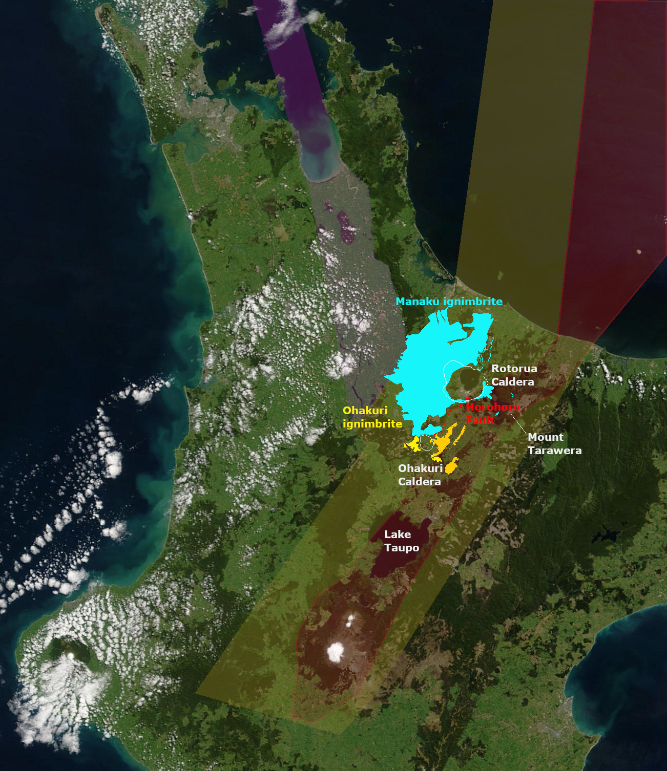
The Rotorua Caldera, now in filled with Lake Rotorua, is a large rhyolitic caldera. It is one of several large volcanoes located in the Taupō Volcanic Zone on the North Island of New Zealand. Geography The major regional settlement of Rotorua is located in the caldera. There is geothermal activity in the city of Rotorua and the geothermal areas of Tikitere and Whakarewarewa are associated with the caldera. These areas are still associated with small hydrothermal eruptions. Geology Eruption history The caldera was formed in a single event paired List of large volcanic eruptions, major eruption, that lasted only weeks, is now dated about 240,000 years ago, and which ejected more than of rhyolitic Mamaku ignimbrite giving it a Volcanic Explosivity Index of 7. The eruption has been reinterpreted as a paired eruption with a very slightly later, slightly smaller southerly eruption from the same mush body feeding the Ohakuri Caldera. Ignimbrite, up to thick covering about , was depo ... [...More Info...] [...Related Items...] OR: [Wikipedia] [Google] [Baidu] |
Taupō Volcanic Zone
The Taupō Volcanic Zone (TVZ) is a volcanic area in the North Island of New Zealand that has been active for the past two million years and is still highly active. Mount Ruapehu marks its south-western end and the zone runs north-eastward through the Taupō and Rotorua areas and offshore into the Bay of Plenty. It is part of the larger Central Volcanic Region that extends further westward through the western Bay of Plenty to the eastern side of the Coromandel Peninsula and has been active for four million years. At Taupō the rift volcanic zone is widening east–west at the rate of about 8 mm per year while at Mount Ruapehu it is only 2–4 mm per year but this increases at the north eastern end at the Bay of Plenty coast to 10–15 mm per year. It is named after Lake Taupō, the flooded caldera of the largest volcano in the zone, the Taupō Volcano and contains a large central volcanic plateau as well as other landforms associated with its containing tectonic i ... [...More Info...] [...Related Items...] OR: [Wikipedia] [Google] [Baidu] |
Te Poi
Te Poi is a small village in rural Waikato, New Zealand, established in 1912 at the base of the Kaimai Range. Te Poi is part of a thriving farming area, particularly for dairying, thoroughbred horse breeding and cropping. The village is serviced by a garage, a cafe, a pub/restaurant and many other small businesses, and has a public tennis court. There are trout fishing spots nearby. From Te Poi, it is 40 minutes to Tauranga, 35 minutes to Rotorua, 45 minutes to Hamilton, two hours to skiing at Mount Ruapehu on the Central Plateau and two hours to Auckland. History and culture Te Poi built a memorial hall in 1922 to commemorate fallen soldiers from World War I. It built another memorial hall to commemorate its fallen sons from World War II. Te Poi was the site of the Sunny Park-Hinuera Cooperative Dairy Company, known for its casein production. In 1983 Sunny Park buildings were auctioned off after the merger with the Waikato Dairy Company. The village has weathered the loss o ... [...More Info...] [...Related Items...] OR: [Wikipedia] [Google] [Baidu] |
Mangakino Caldera Complex
The Mangakino caldera complex (other names are Mangakino volcanic center, Mangakino Caldera) is the westernmost and one of oldest extinct rhyolitic caldera volcanoes in the Taupō Volcanic Zone of New Zealand's North Island The North Island, also officially named Te Ika-a-Māui, is one of the two main islands of New Zealand, separated from the larger but much less populous South Island by the Cook Strait. The island's area is , making it the world's 14th-largest .... It produced about a million years ago (1 Ma) in the Kidnappers eruption of , the most widespread ignimbrite deposits on Earth being over and was closely followed in time by the smaller Rocky Hill eruption. The Kidnappers eruption had a estimated VEI of 8 and has been assigned a total eruption volume (not just tephra) of . However this was only in its most recent caldera forming phase from 1.21 to 0.91 million years ago as it had a previous caldera generating phase from 1.62 to 1.51 million years ago. There a ... [...More Info...] [...Related Items...] OR: [Wikipedia] [Google] [Baidu] |
Whangārei
Whangārei () is the northernmost city in New Zealand and the regional capital of Northland Region. It is part of the Whangarei District, Whangārei District, a local body created in 1989 from the former Whangārei City, Whangārei County and Hikurangi Town councils, to administer both the city proper and its hinterland. The city population was estimated to be an increase from 47,000 in 2001. The wider Whangarei District had a population of Etymology The origin of the name Whangārei is unclear, as a number of pūrākau (traditional stories) are associated with the harbour. One major tradition involves the sisters Reitū and Reipae of the ''Tainui (canoe), Tainui'' migratory waka, who either flew from the Waikato north on the backs of birds, or in the form of birds. Other traditions describe the meaning of Whangārei as "lying in wait to ambush", referring to warriors watching over the harbour from Te Tihi-o-Kahukura / Castle Rock, or Whangārei meaning "to gather", referri ... [...More Info...] [...Related Items...] OR: [Wikipedia] [Google] [Baidu] |
Waiheke Island
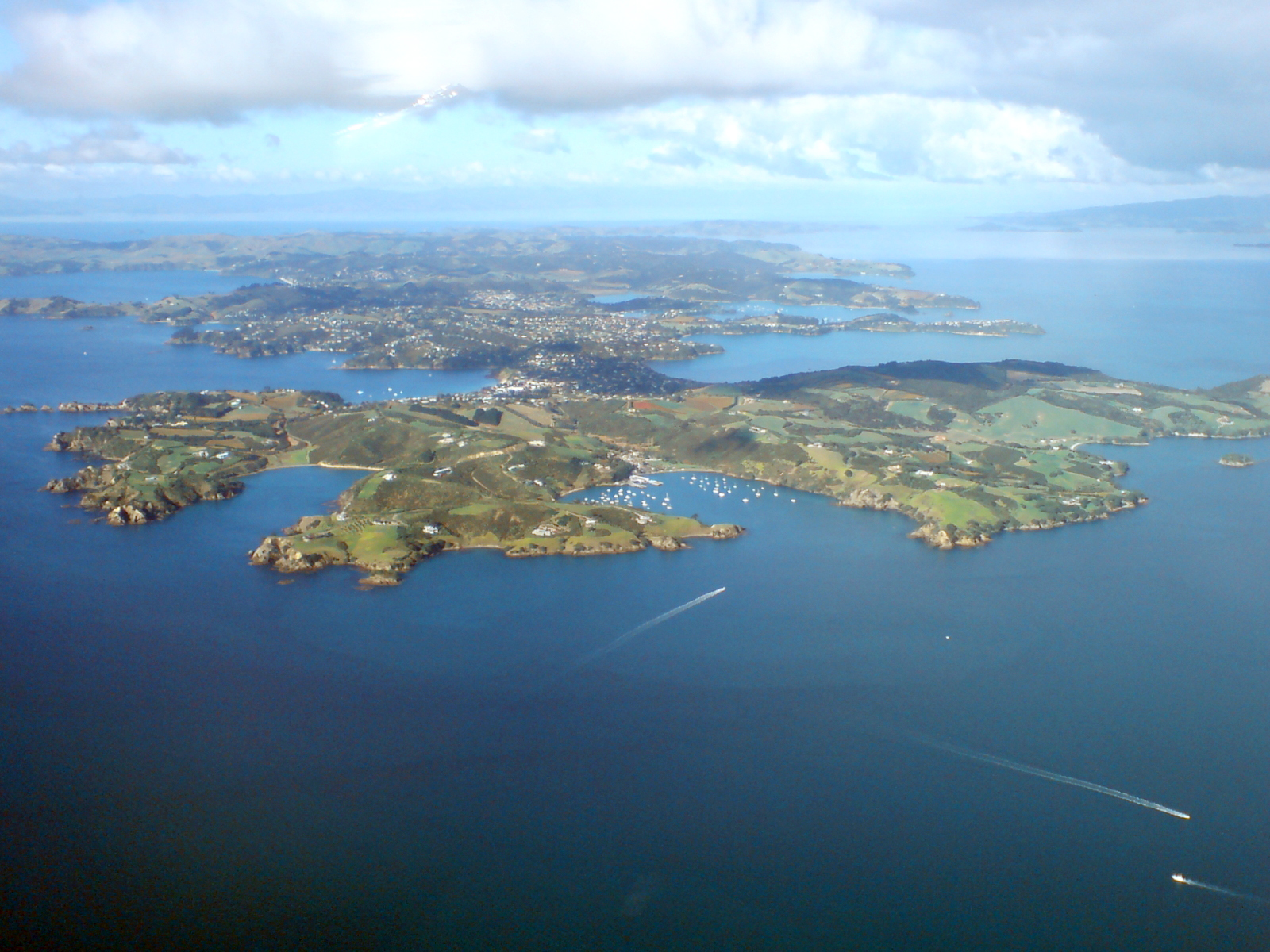
Waiheke Island (; Māori: ) is the second-largest island (after Great Barrier Island) in the Hauraki Gulf of New Zealand. Its ferry terminal in Matiatia Bay at the western end is from the central-city terminal in Auckland. It is the most populated island in the gulf, with permanent residents. Another estimated 3,400 have second homes or holiday homes on the island. It is New Zealand's most densely populated island, and the third most populated after the North and South Islands. It is the most accessible island in the gulf, with regular passenger and car-ferry services, a helicopter operator based on the island, and other air links. In November 2015, Lonely Planet rated Waiheke Island the fifth-best region in the world to visit in 2016. Geography Overview The island is off the coast of the North Island. It is in length from west to east, varies in width from , and has a surface area of . The coastline is , including of beaches. The port of Matiatia at the western end is ... [...More Info...] [...Related Items...] OR: [Wikipedia] [Google] [Baidu] |
Volcano
A volcano is a rupture in the crust of a planetary-mass object, such as Earth, that allows hot lava, volcanic ash, and gases to escape from a magma chamber below the surface. On Earth, volcanoes are most often found where tectonic plates are diverging or converging, and most are found underwater. For example, a mid-ocean ridge, such as the Mid-Atlantic Ridge, has volcanoes caused by divergent tectonic plates whereas the Pacific Ring of Fire has volcanoes caused by convergent tectonic plates. Volcanoes can also form where there is stretching and thinning of the crust's plates, such as in the East African Rift and the Wells Gray-Clearwater volcanic field and Rio Grande rift in North America. Volcanism away from plate boundaries has been postulated to arise from upwelling diapirs from the core–mantle boundary, deep in the Earth. This results in hotspot volcanism, of which the Hawaiian hotspot is an example. Volcanoes are usually not created where two tectonic plates slide ... [...More Info...] [...Related Items...] OR: [Wikipedia] [Google] [Baidu] |
Argillite
:''"Argillite" may also refer to Argillite, Kentucky.'' Argillite () is a fine-grained sedimentary rock composed predominantly of indurated clay particles. Argillaceous rocks are basically lithified muds and oozes. They contain variable amounts of silt-sized particles. The argillites grade into shale when the fissile layering typical of shale is developed. Another name for poorly lithified argillites is ''mudstone''. These rocks, although variable in composition, are typically high in aluminium and silica with variable alkali and alkaline earth cations. The term ''pelitic'' or ''pelite'' is often applied to these sediments and rocks. Metamorphism of argillites produces slate, phyllite, and pelitic schist. Belt Supergroup The Belt Supergroup, an assemblage of rocks of late Precambrian (Mesoproterozoic) age, includes thick sequences of argillite, as well as other metamorphosed or semi-metamorphosed mudstones.Schieber, J. 1990. Significance of styles of epicontinental shale sedime ... [...More Info...] [...Related Items...] OR: [Wikipedia] [Google] [Baidu] |
Greywacke
Greywacke or graywacke (German ''grauwacke'', signifying a grey, earthy rock) is a variety of sandstone generally characterized by its hardness, dark color, and poorly sorted angular grains of quartz, feldspar, and small rock fragments or lithic fragments set in a compact, clay-fine matrix. It is a texturally immature sedimentary rock generally found in Paleozoic strata. The larger grains can be sand- to gravel-sized, and matrix materials generally constitute more than 15% of the rock by volume. The term "greywacke" can be confusing, since it can refer to either the immature (rock fragment) aspect of the rock or its fine-grained (clay) component. The origin of greywacke was unknown until turbidity currents and turbidites were understood, since, according to the normal laws of sedimentation, gravel, sand and mud should not be laid down together. Geologists now attribute its formation to submarine avalanches or strong turbidity currents. These actions churn sediment and cause mi ... [...More Info...] [...Related Items...] OR: [Wikipedia] [Google] [Baidu] |


