|
Haskell County, Oklahoma
Haskell County is a county located in the southeast quadrant of the U.S. state of Oklahoma. As of the 2020 census, its population was 11,561. Its county seat is Stigler. The county is named in honor of Charles N. Haskell, the first governor of Oklahoma. History The area now comprising Haskell County was created at statehood primarily from the former Sans Bois County of the Choctaw Nation in Indian Territory. Sans Bois County was part of the Moshulatubbee District, one of three administrative super-regions comprising the Choctaw Nation. Small portions of present-day Haskell County fell within Gaines County and Skullyville County, Choctaw Nation. In 1908, county voters picked Stigler over Keota and Whitefield as the county seat.Larry O'Dell, "Haskell County." ''Encyclopedia of Oklahoma Hi ... [...More Info...] [...Related Items...] OR: [Wikipedia] [Google] [Baidu] |
Charles N
Charles is a masculine given name predominantly found in English and French speaking countries. It is from the French form ''Charles'' of the Proto-Germanic name (in runic alphabet) or ''*karilaz'' (in Latin alphabet), whose meaning was "free man". The Old English descendant of this word was '' Ċearl'' or ''Ċeorl'', as the name of King Cearl of Mercia, that disappeared after the Norman conquest of England. The name was notably borne by Charlemagne (Charles the Great), and was at the time Latinized as ''Karolus'' (as in ''Vita Karoli Magni''), later also as '' Carolus''. Etymology The name's etymology is a Common Germanic noun ''*karilaz'' meaning "free man", which survives in English as churl (James (wikt:Appendix:Proto-Indo-European/ǵerh₂-">ĝer-, where the ĝ is a palatal consonant, meaning "to rub; to be old; grain." An old man has been worn away and is now grey with age. In some Slavic languages, the name ''Drago (given name), Drago'' (and variants: ''Dragom ... [...More Info...] [...Related Items...] OR: [Wikipedia] [Google] [Baidu] |
Great Depression
The Great Depression was a severe global economic downturn from 1929 to 1939. The period was characterized by high rates of unemployment and poverty, drastic reductions in industrial production and international trade, and widespread bank and business failures around the world. The economic contagion began in 1929 in the United States, the largest economy in the world, with the devastating Wall Street stock market crash of October 1929 often considered the beginning of the Depression. Among the countries with the most unemployed were the U.S., the United Kingdom, and Weimar Republic, Germany. The Depression was preceded by a period of industrial growth and social development known as the "Roaring Twenties". Much of the profit generated by the boom was invested in speculation, such as on the stock market, contributing to growing Wealth inequality in the United States, wealth inequality. Banks were subject to laissez-faire, minimal regulation, resulting in loose lending and wides ... [...More Info...] [...Related Items...] OR: [Wikipedia] [Google] [Baidu] |
Oklahoma State Highway 71
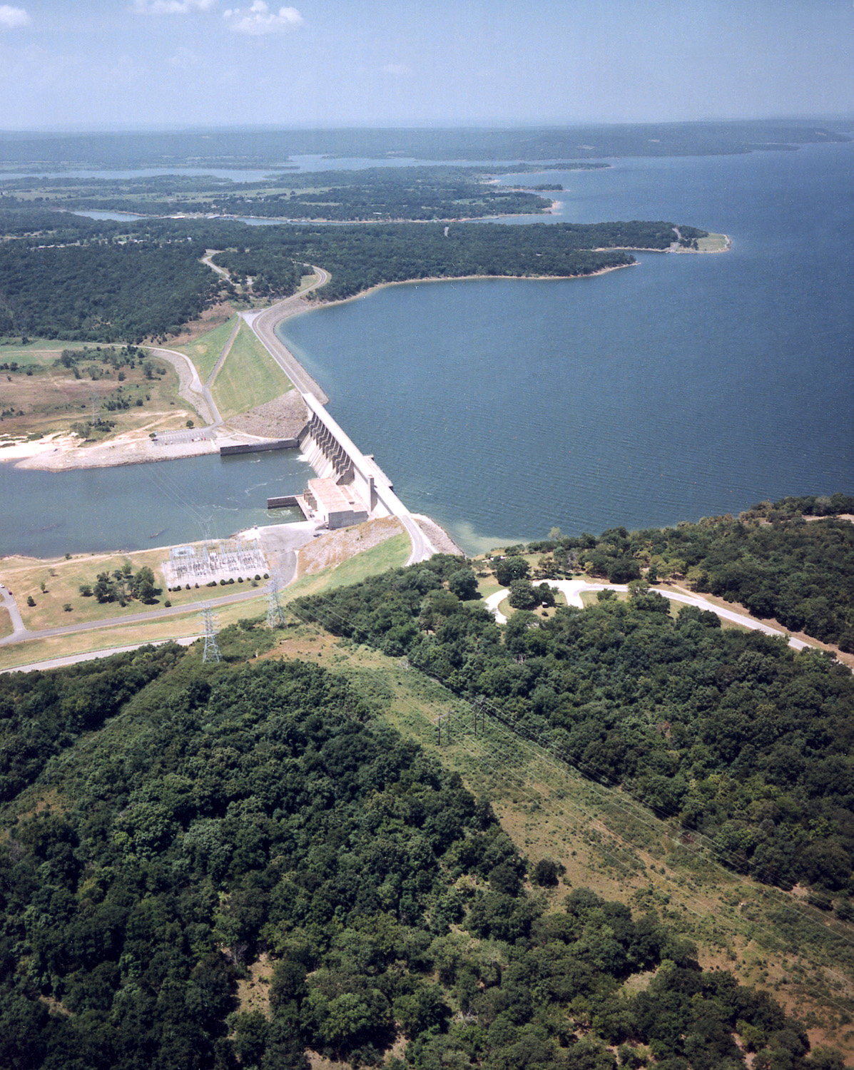
State Highway 71 (abbreviated as SH-71 or OK-71) is a state highway in eastern Oklahoma. It runs from State Highway 31 in Quinton north to intersect State Highway 9 near Enterprise. It then continues north to Lake Eufaula Dam, and then turns east to end at State Highway 2. It has no lettered spur routes. Route description State Highway 71 begins at SH-31 on the west side of Quinton in northeast Pittsburg County. The highway initially follows the Quinton street grid, which takes it in a north-northwest direction. As the grid peters out on the outskirts of town, SH-71 breaks away to the west and then to the northwest to avoid Beaver Mountain, gradually curving around to a northerly heading as it approaches the county line. The route crosses into Haskell County about three miles north of Quinton. The road continues north in Haskell County until it veers northeast and crosses Longtown Creek. The road then turns back north, passing through rural parts of the county. SH-71 i ... [...More Info...] [...Related Items...] OR: [Wikipedia] [Google] [Baidu] |
State Highway 31 (Oklahoma)
State Highway 31 (abbreviated SH-31) is a state highway in Oklahoma. It runs 132.6 miles in an irregular west-to-east pattern in the southeastern part of the state. There are two spur highways branching from SH-31, SH-31A and SH-31B. Route description SH-31 begins at SH-48 south of Tupelo. east of here, SH-31B branches off, connecting the main highway with the town of Olney. SH-31 then continues for to Coalgate, the seat of Coal County, where it intersects US-75/ SH-3. Leaving Coalgate, SH-31 turns north at SH-131, traveling to its junction with SH-31A, which connects with US-270 at Stuart. At SH-31A, SH-31 turns to the east, following the northern edge of the McAlester Army Ammunition Plant, arriving in McAlester, seat of Pittsburg County, later. In McAlester, SH-31 forms a five-mile (8 km) concurrency with US-270 and SH-1, splitting up just east of the US-69 interchange on the east side of the city. SH-31 then sets off to the northeast, passing throu ... [...More Info...] [...Related Items...] OR: [Wikipedia] [Google] [Baidu] |
State Highway 9 (Oklahoma)
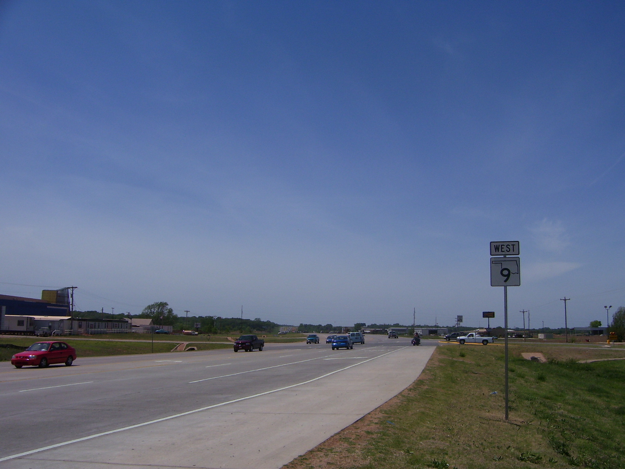
State Highway 9, abbreviated as SH-9, OK-9, or simply Highway 9, is a major east–west highway in the U.S. state of Oklahoma. Spanning across the central part of the state, SH-9 begins at the Texas state line west of Vinson, Oklahoma, and ends at the Arkansas state line near Fort Smith, Arkansas. State Highway 9 is a major highway around the Norman area. At , SH-9 is Oklahoma's second-longest state highway (second to State Highway 3). Route description West of Interstate 35 From the western terminus at State Highway 203 along the Texas border, the highway travels due east for and intersects with SH-30 between Madge and Vinson. SH-9 continues east for without intersecting another highway until meeting US-283 and SH-34 north of Mangum. The highway overlaps the other two routes for , going north, before splitting off and heading east again through Granite and Lone Wolf. East of Lone Wolf, the highway forms a concurrency with SH-44. Near Hobart, SH-9 overlaps US-183 ... [...More Info...] [...Related Items...] OR: [Wikipedia] [Google] [Baidu] |
State Highway 2 (Oklahoma)
State Highway 2, abbreviated SH-2 or OK-2, is a designation for two distinct highways maintained by the U.S. state of Oklahoma. Though they were once connected, the middle section of highway was concurrent with three different U.S. highways, so the middle section was decommissioned for reasons of redundancy. The southern section of highway runs from Antlers to U.S. Highway 64 near Warner, covering through the southeastern part of the state. The northern SH-2 runs for through Craig County in northeastern Oklahoma. Route descriptions Southern section The southern section of SH-2 begins at SH-3 in Antlers. It travels north-northwest from here, roughly parallelling the Kiamichi River, until reaching Clayton and US-271. North of Clayton, Highway 2 and US-271 overlap for . Immediately after this, SH-2 meets SH-43's eastern terminus southeast of Sardis Lake. SH-2 then crosses over the lake and meets SH-1/ SH-63, and the three form a six-mile (10 km) concurrency. This ... [...More Info...] [...Related Items...] OR: [Wikipedia] [Google] [Baidu] |
Oklahoma State Highway 2
State Highway 2, abbreviated SH-2 or OK-2, is a designation for two distinct highways maintained by the United States, U.S. state of Oklahoma. Though they were once connected, the middle section of highway was Concurrency (road), concurrent with three different U.S. highways, so the middle section was decommissioned for reasons of redundancy. The southern section of highway runs from Antlers, Oklahoma, Antlers to U.S. Highway 64 (Oklahoma), U.S. Highway 64 near Warner, Oklahoma, Warner, covering through the southeastern part of the state. The northern SH-2 runs for through Craig County, Oklahoma, Craig County in northeastern Oklahoma. Route descriptions Southern section The southern section of SH-2 begins at State Highway 3 (Oklahoma), SH-3 in Antlers. It travels north-northwest from here, roughly parallelling the Kiamichi River, until reaching Clayton, Oklahoma, Clayton and U.S. Highway 271 (Oklahoma), US-271. North of Clayton, Highway 2 and US-271 Concurrency (road), overl ... [...More Info...] [...Related Items...] OR: [Wikipedia] [Google] [Baidu] |
Arkansas River
The Arkansas River is a major tributary of the Mississippi River. It generally flows to the east and southeast as it traverses the U.S. states of Colorado, Kansas, Oklahoma, and Arkansas. The river's source basin lies in Colorado, specifically the Arkansas River Valley. The headwaters derive from the snowpack in the Sawatch Range, Sawatch and Mosquito Range, Mosquito mountain ranges. It flows east into Kansas and finally through Oklahoma and Arkansas, where it meets the Mississippi River. At , it is the sixth-longest river in the United States, the second-longest tributary in the Mississippi–Missouri River, Missouri system, and the List of river systems by length, 47th longest river in the world. Its origin is in the Rocky Mountains in Lake County, Colorado, near Leadville, Colorado, Leadville. In 1859, Placer mining, placer gold discovered in the Leadville area brought thousands seeking to strike it rich, but the easily recovered placer gold was quickly exhausted. The Arkansa ... [...More Info...] [...Related Items...] OR: [Wikipedia] [Google] [Baidu] |
South Canadian River
The Canadian River is the longest tributary of the Arkansas River in the United States. It is about long, starting in Colorado and traveling through New Mexico, the Texas Panhandle, and Oklahoma. The drainage area is about .Dianna Everett, "Canadian River." ''Encyclopedia of Oklahoma History and Culture''. Retrieved October 7, 2013. The Canadian is sometimes referred to as the South Canadian River to differentiate it from the that flows into it. Etymology On |
Robert S
The name Robert is an ancient Germanic given name, from Proto-Germanic "fame" and "bright" (''Hrōþiberhtaz''). Compare Old Dutch ''Robrecht'' and Old High German ''Hrodebert'' (a compound of '' Hruod'' () "fame, glory, honour, praise, renown, godlike" and ''berht'' "bright, light, shining"). It is the second most frequently used given name of ancient Germanic origin.Reaney & Wilson, 1997. ''Dictionary of English Surnames''. Oxford University Press. It is also in use as a surname. Another commonly used form of the name is Rupert. After becoming widely used in Continental Europe, the name entered England in its Old French form ''Robert'', where an Old English cognate form (''Hrēodbēorht'', ''Hrodberht'', ''Hrēodbēorð'', ''Hrœdbœrð'', ''Hrœdberð'', ''Hrōðberχtŕ'') had existed before the Norman Conquest. The feminine version is Roberta. The Italian, Portuguese, and Spanish form is Roberto. Robert is also a common name in many Germanic languages, including En ... [...More Info...] [...Related Items...] OR: [Wikipedia] [Google] [Baidu] |


