|
Harvard Park, Los Angeles
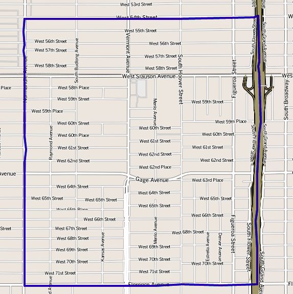
Harvard Park is a 0.64-square-mile neighborhood in the South Los Angeles region of Los Angeles, California. It is centered on a municipal park by that name. Population A total of 10,297 residents lived in Harvard Park's 0.64 square miles, according to the 2000 U.S. census — averaging 16.072 people per square mile, among the highest population densities in both the city and the county. Its population has grown to 10,888, the city estimated in 2008. The median age was 28, young for the city and the county, and the percentages of residents younger than age 18 were among the county's highest. There were 504 families headed by single parents; the rate of 24.1% was considered high for both the city and the county. Within the neighborhood, African Americans made up 48.4% of the population, while Latinos were 48,2%. Other ethnicities were white, 1.8%; Asian, 0.6%; and other, 1.7%. Mexico and El Salvador were the most common places of birth for the 31.2% of the residents who were bo ... [...More Info...] [...Related Items...] OR: [Wikipedia] [Google] [Baidu] |
Neighborhoods Of Los Angeles
This is a list of notable districts and neighborhoods within the city of Los Angeles, California, present and past. It includes residential and commercial areas and business-improvement districts, but does not include sales subdivisions or sales tracts. The guiding precept is Wikipedia:Notability (geographic features)#Geographic regions, areas and places. AE * Adams-Normandie * Alsace * Angelino Heights''The Thomas Guide: Los Angeles County'', Rand McNally (2004), pages N and O * Angeles Mesa * Angelus Vista * ArletaNeighborhoods , Mapping L.A., ''Los Angeles Times'' * Arlington Heights * [...More Info...] [...Related Items...] OR: [Wikipedia] [Google] [Baidu] |
Hispanic And Latino Americans
Hispanic and Latino Americans ( es, Estadounidenses hispanos y latinos; pt, Estadunidenses hispânicos e latinos) are Americans of Spanish and/or Latin American ancestry. More broadly, these demographics include all Americans who identify as Hispanic or Latino regardless of ancestry.Mark Hugo Lopez, Jens Manuel Krogstad and Jeffrey S. PasselWho Is Hispanic? Pew Research Center (November 11, 2019). As of 2020, the Census Bureau estimated that there were almost 65.3 million Hispanics and Latinos living in the United States and its territories (which include Puerto Rico). "Origin" can be viewed as the ancestry, nationality group, lineage or country of birth of the person or the person's parents or ancestors before their arrival in the United States of America. People who identify as Hispanic or Latino may be of any race. As one of the only two specifically designated categories of ethnicity in the United States (the other being "Not Hispanic or Latino"), Hispanics and Latinos f ... [...More Info...] [...Related Items...] OR: [Wikipedia] [Google] [Baidu] |
List Of Districts And Neighborhoods In Los Angeles
This is a list of notable districts and neighborhoods within the city of Los Angeles, California, present and past. It includes residential and commercial areas and business-improvement districts, but does not include sales subdivisions or sales tracts. The guiding precept is Wikipedia:Notability (geographic features)#Geographic regions, areas and places. AE * Adams-Normandie * Alsace * Angelino Heights''The Thomas Guide: Los Angeles County'', Rand McNally (2004), pages N and O * Angeles Mesa * Angelus Vista * ArletaNeighborhoods , Mapping L.A., ''Los Angeles Times'' * Arlington Heights * [...More Info...] [...Related Items...] OR: [Wikipedia] [Google] [Baidu] |
Western Avenue (Los Angeles)
Western Avenue is a major four-lane street in the city of Los Angeles (west of Downtown) and through the center portion of Los Angeles County, California. It is one of the longest north–south streets in Los Angeles city and county, apart from Sepulveda Boulevard. It is about long. Description Western Avenue passes through a large diversity of residential neighborhoods in Los Angeles County. From the south, where it transitions into Paseo Del Mar near White Point and the Pacific Ocean, it begins in San Pedro, then passes through Rancho Palos Verdes, Harbor City, Gardena and South Los Angeles. It is also the easternmost border of Torrance. Around the Pico Boulevard, Olympic Boulevard, and Wilshire Boulevard intersections, Western Avenue passes through Koreatown. Further north, Western Avenue passes through the East Hollywood district. Around the Santa Monica Boulevard, Sunset Boulevard, and Hollywood Boulevard intersections, it passes through the East Hollywood neighborho ... [...More Info...] [...Related Items...] OR: [Wikipedia] [Google] [Baidu] |
Florence Avenue
Florence Avenue is a major east–west street in central Los Angeles County and South Los Angeles, in Southern California. 150px, The oldest operating McDonald's is on Florence Ave at Lakewood, in Downey, California. Route It is bounded in the east by Mills Avenue at Janine Drive in Whittier. At Telegraph Road, it changes to Florence. West of La Cienega Boulevard, it swerves into Aviation Boulevard, which is a north–south street, in the City of Inglewood. Florence Avenue runs through the cities of Inglewood, Los Angeles, Huntington Park (where it intersects Pacific Boulevard), Bell, Bell Gardens, Downey, Santa Fe Springs, and unincorporated Los Angeles County bordering the City of Whittier. Florence Avenue also crosses the San Diego Freeway (Interstate 405), Harbor Freeway (Interstate 110), Long Beach Freeway (Interstate 710), San Gabriel River Freeway (Interstate 605), and Santa Ana Freeway (Interstate 5). An unconnected portion of Florence Avenue is located ... [...More Info...] [...Related Items...] OR: [Wikipedia] [Google] [Baidu] |
Normandie Avenue
Normandie Avenue is one of Los Angeles County's longest north–south streets, with a stretch of about . It lies between Western Avenue to the west and Vermont Avenue to the east. The avenue begins in the south by branching off from Vermont Avenue south of Pacific Coast Highway in Harbor City. Through traffic on Normandie is directed onto Irolo Street between just north of Olympic Boulevard and Wilshire Boulevard; in this section, Normandie exists as a small residential street. After crossing Franklin Avenue, Normandie resumes as a residential street before reaching its northern terminus at Ambrose Avenue in the Los Feliz district of Los Angeles. History Normandie was originally named Rosedale Avenue until 1900. The intersection of Florence and Normandie is noted for 1992 Los Angeles riots. The street has since been redeveloped. Transportation Metro Local line: 206 and Gardena Transit line 2 operate on Normandie Avenue: Metro Local Line 206 runs between Hollywood Boulevard ... [...More Info...] [...Related Items...] OR: [Wikipedia] [Google] [Baidu] |
Chesterfield Square, Los Angeles
Chesterfield Square is a 0.63-square-mile neighborhood in Los Angeles, California, located within the South Los Angeles region. It contains its namesake park, along with the Van Ness Recreation Center. History The neighborhood is a mix of low-density commercial, industrial, and residential development with characteristic bungalow houses. Chesterfield Square was once known as the site of the worst incident of gang violence in L.A. history, in which 5 people were left dead in a gang-related mass murder called the "54th St. Massacre" in 1984. The neighborhood has since bounced back through redevelopment. Geography The Chesterfield Square neighborhood touches Vermont Square on the north, Harvard Park on the east, Manchester Square on the south, and Hyde Park on the west. "South Los Angeles," Mapping L.A., ''Los Angeles T ... [...More Info...] [...Related Items...] OR: [Wikipedia] [Google] [Baidu] |
Manchester Square, Los Angeles
Manchester Square is a neighborhood in Los Angeles, California, within the South Los Angeles region. Geography By City Council action of October 2001 (C.F. #01-1874), Manchester Square was officially designated as being bounded by the following streets: West Florence Avenue on the north, South Normandie Avenue Avenue on the east, West Manchester Avenue on the south and South Western Avenue on the west. The City Council expanded the neighborhood on February 26, 2002, to include the following area: West 83rd Street on the north, South Vermont Avenue on the east, Manchester Avenue on the south and Normandie Avenue on the west. The Department of Transportation was instructed to install signage at the following intersections: Western Avenue at 85th Street, Normandie Avenue at 73rd Street, Florence Avenue at Hobart Boulevard Manchester Avenue at Normandie Avenue, 83rd Street at South Normandie Avenue and westbound Manchester Avenue at South Normandie Avenue. According to the ' ... [...More Info...] [...Related Items...] OR: [Wikipedia] [Google] [Baidu] |
Vermont-Slauson, Los Angeles
Vermont-Slauson is a 1.44-square-mile neighborhood within the South Los Angeles region of Los Angeles, California. Geography The Vermont-Slauson neighborhood touches Vermont Square, Los Angeles, Vermont Square on the north, Florence, Los Angeles, Florence on the east, Vermont Knolls, Los Angeles, Vermont Knolls on the south and Harvard Park, Los Angeles, Harvard Park on the west. "South Los Angeles," Mapping L.A., ''Los Angeles Times'' It is bounded by 54th Street on the north, the Harbor Freeway, Interstate 110 Freeway on the east, Florence Avenue on the south and Western Avenue (Los Angeles), Western Avenue on the west. Demographics It is notable within the city for its high density of population, its relatively mid to low household income, its youthful po ...[...More Info...] [...Related Items...] OR: [Wikipedia] [Google] [Baidu] |
Vermont Square, Los Angeles
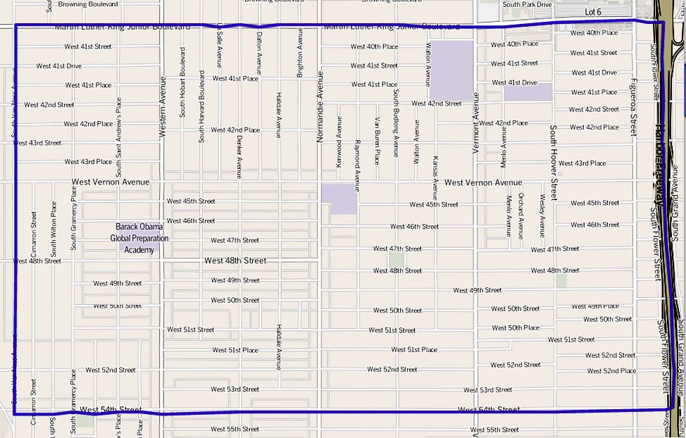
Vermont Square is a neighborhood in Los Angeles, California, within the South Los Angeles region. The Vermont Square Branch library, a designated Historic–Cultural Monument, is located in the community. Geography The name "Vermont Square" was attempted to be revived in the 1990s in an effort to distinguish the area from South Central Los Angeles. Advocates sought to have the 3-mile area, approximately bounded by Martin Luther King Jr. Boulevard, Hoover Street, and Arlington Avenue and Slauson Avenue, recognized with the original tract name. Vermont Square is a neighborhood of 2.54 square miles whose street boundaries are Martin Luther King Jr. Boulevard on the north, the Harbor Freeway on the east, West 54th Street on the south and South Van Ness Avenue on the west.''The Thomas Guide,'' 2006, pages 673 and 674 [...More Info...] [...Related Items...] OR: [Wikipedia] [Google] [Baidu] |
Asian American
Asian Americans are Americans of Asian ancestry (including naturalized Americans who are immigrants from specific regions in Asia and descendants of such immigrants). Although this term had historically been used for all the indigenous peoples of the continent of Asia, the usage of the term "Asian" by the United States Census Bureau only includes people with origins or ancestry from the Far East, Southeast Asia, and the Indian subcontinent and excludes people with ethnic origins in certain parts of Asia, including West Asia who are now categorized as Middle Eastern Americans. The "Asian" census category includes people who indicate their race(s) on the census as "Asian" or reported entries such as "Chinese, Indian, Filipino, Vietnamese, Indonesian, Korean, Japanese, Pakistani, Malaysian, and Other Asian". In 2020, Americans who identified as Asian alone (19,886,049) or in combination with other races (4,114,949) made up 7.2% of the U.S. population. Chinese, Indian, and Filip ... [...More Info...] [...Related Items...] OR: [Wikipedia] [Google] [Baidu] |
African American
African Americans (also referred to as Black Americans and Afro-Americans) are an ethnic group consisting of Americans with partial or total ancestry from sub-Saharan Africa. The term "African American" generally denotes descendants of enslaved Africans who are from the United States. While some Black immigrants or their children may also come to identify as African-American, the majority of first generation immigrants do not, preferring to identify with their nation of origin. African Americans constitute the second largest racial group in the U.S. after White Americans, as well as the third largest ethnic group after Hispanic and Latino Americans. Most African Americans are descendants of enslaved people within the boundaries of the present United States. On average, African Americans are of West/ Central African with some European descent; some also have Native American and other ancestry. According to U.S. Census Bureau data, African immigrants generally do not s ... [...More Info...] [...Related Items...] OR: [Wikipedia] [Google] [Baidu] |


