|
Harrow Bus Station
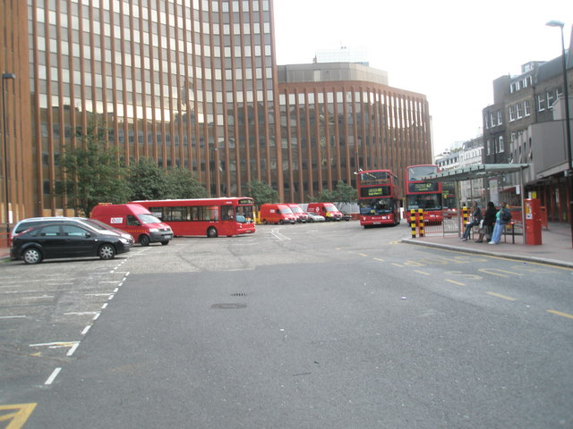
Harrow bus station serves the town of Harrow in the London Borough of Harrow, Greater London, England. The station is owned and maintained by Transport for London. The bus station is on College Road situated approximately 100 metres away from Harrow-on-the-Hill rail and tube stations. The bus station is also across the road from the St Ann's Shopping Centre. There are five stands within the bus station. The main operators at the bus station are London Sovereign, Metroline and Arriva London. Buses go from Harrow as far afield as Watford, Ealing, Edgware, Brent Cross, Golders Green, Wembley, Heathrow Airport, Ruislip, Northolt, Greenford, Charing Cross (Night Bus), Bushey Heath and Northwood. History An official opening ceremony was held on 27 May 1981, attended by the chairman of London Transport and the Mayor of Harrow. It was built at a cost of £865,000. The bus station opened to the public on 30 May. Vandalism was a major problem for the bus station. In April 1988, L ... [...More Info...] [...Related Items...] OR: [Wikipedia] [Google] [Baidu] |
Harrow, London
Harrow () is a large town in Greater London, England, and serves as the principal settlement of the London Borough of Harrow. Lying about north-west of Charing Cross and south of Watford, the entire town including its localities had a population of 149,246 at the 2011 census, whereas the wider borough (which also contains Pinner and Stanmore) had a population of 250,149. The historic centre of Harrow was atop the Harrow Hill. The modern town of Harrow grew out at the foot of the settlement, in what was historically called Greenhill. With the arrival of the Metropolitan Railway in the 19th century, the centre of Harrow moved to Greenhill and it grew as the unofficial "capital" of the Metroland suburbia in the early 20th century; Harrow-on-the-Hill station is on one of the railway corridors between London and the Chilterns. Meanwhile, Harrow & Wealdstone station is on the West Coast Main Line and is the eighth oldest railway station, having opened in 1837 one and a half ... [...More Info...] [...Related Items...] OR: [Wikipedia] [Google] [Baidu] |
Brent Cross
Brent Cross is originally the name of a crossroads that today forms a major interchange for traffic in the London Borough of Barnet, England. Located a mile from the centres of Hendon and Golders Green, the area also contains the Brent Cross Shopping Centre, a major retail facility which opened in 1976, as well as Brent South Shopping Park opposite of it. The "Brent Cross Flyover" A41 runs to the east of the shopping centre over the A406 North Circular Road, while the M1 motorway and A5 Edgware Road are to the west at Staples Corner interchange. In addition, the Northern line (Edgware branch) and Thameslink rail routes run on viaducts. The River Brent passes through the area, flowing from east to west in a man-made channel. The Shopping Centre falls within the NW4 postcode district; the Brent South Retail Park falls within NW2; and the Brent Cross tube station is within NW11. History "Brent Cross" was originally the name of a crossroads in the vicinity of the current B ... [...More Info...] [...Related Items...] OR: [Wikipedia] [Google] [Baidu] |
List Of Bus And Coach Stations In London ...
This is an alphabetical list of bus and coach stations in London. , Wimbledon Bus Station , Wimbledon, London See also * List of bus garages in London *List of bus stations in Scotland *List of bus stations in Wales References {{reflist London bus and coach stations Bus and coach stations * Bus stations A bus station or a bus interchange is a structure where city or intercity buses stop to pick up and drop off passengers. While the term bus depot can also be used to refer to a bus station, it generally refers to a bus garage. A bus station is la ... [...More Info...] [...Related Items...] OR: [Wikipedia] [Google] [Baidu] |
London Regional Transport
London Regional Transport (LRT) was the organisation responsible for most of the public transport network in London, England, between 1984 and 2000. In common with all London transport authorities from 1933 to 2000, the public name and operational brand of the organisation was London Transport from 1989, but until then it traded as LRT. This policy was reversed after the appointment of Sir Wilfred Newton in 1989, who also abolished the recently devised LRT logo and restored the traditional roundel. History The LRT was created by the London Regional Transport Act 1984 and was under direct state control, reporting to the Secretary of State for Transport. It took over responsibility from the Greater London Council on 29 June 1984, two years before the GLC was formally abolished. Because the Act only received the Royal assent three days earlier, its assets were temporarily frozen by the banks as they had not received mandates to transfer. The headquarters of the new organisation r ... [...More Info...] [...Related Items...] OR: [Wikipedia] [Google] [Baidu] |
Northwood, London
Northwood is an affluent area in northwest London, England. It is located within the London Borough of Hillingdon on the border with Hertfordshire and from Charing Cross. Northwood was part of the ancient parish of Ruislip, Middlesex and has formed part of Greater London since 1965. The area consists of the elevated settlement of Northwood and Northwood Hills, both of which are served by stations on the Metropolitan line of the London Underground. At the 2011 census, the population of Northwood was 10,949, down from 11,068 in 2008, while the population of Northwood Hills was 11,578, up from 10,833 in 2001. Northwood adjoins Ruislip Woods National Nature Reserve. It was also used for location filming of the Goods' and Leadbetters' houses and surrounding streets in the BBC TV sitcom '' The Good Life'' acting as Surbiton. History Toponymy Northwood was first recorded in 1435 as ''Northwode'', formed from the Old English 'north' and 'wode', meaning 'the northern wood', in r ... [...More Info...] [...Related Items...] OR: [Wikipedia] [Google] [Baidu] |
Bushey Heath
Bushey is a town in the Hertsmere borough of Hertfordshire in the East of England. It has a population of over 25,000 inhabitants. Bushey Heath is a large neighbourhood south east of Bushey on the boundary with the London Borough of Harrow reaching elevations of above sea level. History The first written record of Bushey is its entry in the Domesday Book of 1086, which describes a small agricultural village named 'Bissei' (which later became 'Biss(h)e' and then 'Bisheye' during the 12th century). However, chance archaeological findings of Stone Age tools provide evidence that the area was inhabited as far back as the Palaeolithic period. The town also has links to the Roman Britain, Roman occupation of Great Britain, Britain, with the main road running through it being Roman; sites of possible Roman villas being unearthed in the area; and a Roman tessellated pavement was discovered near Chiltern Avenue. The origin of the town's name is not fully known. In terms of the origi ... [...More Info...] [...Related Items...] OR: [Wikipedia] [Google] [Baidu] |
Charing Cross
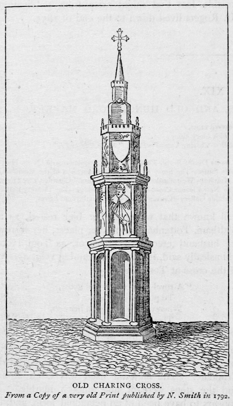
Charing Cross ( ) is a junction in Westminster, London, England, where six routes meet. Clockwise from north these are: the east side of Trafalgar Square leading to St Martin's Place and then Charing Cross Road; the Strand leading to the City; Northumberland Avenue leading to the Thames Embankment; Whitehall leading to Parliament Square; The Mall leading to Admiralty Arch and Buckingham Palace; and two short roads leading to Pall Mall. The name also commonly refers to the Queen Eleanor Memorial Cross at Charing Cross station. A bronze equestrian statue of Charles I, erected in 1675, stands on a high plinth, situated roughly where a medieval monumental cross had previously stood for 353 years (since its construction in 1294) until destroyed in 1647 by Cromwell and his revolutionary government. The famously beheaded King, appearing ascendant, is the work of French sculptor Hubert Le Sueur. The aforementioned eponymous monument, the "Charing Cross", was the largest and most o ... [...More Info...] [...Related Items...] OR: [Wikipedia] [Google] [Baidu] |
Greenford
Greenford () is a suburb in the London Borough of Ealing in west London, England, lying west from Charing Cross. It has a population of 46,787 inhabitants, or 62,126 with the inclusion of Perivale. Greenford is served by Greenford Station (London Underground Central Line and Greenford branch of the Great Western Railway mainline service). South Greenford mainline station (on the A40 Western Avenue, also on the Greenford branch of the GWR) is actually in Perivale. Neither station is in Greenford Town Centre (Greenford Broadway), which instead is served by many local buses. Nearby places include Yeading, Hanwell, Perivale, Southall, Northolt, Ealing, Sudbury and Sudbury Hill. The most prominent landmark in the suburb is Horsenden Hill, above sea level. Greenford covers a large area, including the two miles of Greenford Road, giving it three localities: North Greenford, Greenford Green, and Greenford Broadway – this is also reflected in the names of the electoral wards ... [...More Info...] [...Related Items...] OR: [Wikipedia] [Google] [Baidu] |
Northolt
Northolt is a town in West London, England, spread across both sides of the A40 trunk road. It is west-northwest of Charing Cross and is one of the seven major towns that make up the London Borough of Ealing. It had a population of 30,304 at the 2011 UK census. History The earliest record of Northolt is in 872 as the Anglo Saxon ''norð healum'', where norð is North and healum (or hale) is ''a nook, corner, or retreat'',. By 1610, the Name Northolt appears, with in this case, holt having no relationship with 'wood', but an evolution of hala, hale, hal, hall, halle and holt. Archaeological evidence suggests that the settlement's origin was an 8th-century Saxon village close to Northolt Manor behind the present Court Farm Road. It is mentioned in the ''Domesday Book'' as Northala, part of the Elthorne Hundred in the historic county of Middlesex, England. In 1066 the lord was Esger the constable, and in 1086 was Geoffrey de Mandeville. Northolt Manor itself was built in the ... [...More Info...] [...Related Items...] OR: [Wikipedia] [Google] [Baidu] |
Ruislip
Ruislip ( ) is an area in the London Borough of Hillingdon in West London, and in the historic county of Middlesex. Ruislip lies west-north-west of Charing Cross, London. The manor of Ruislip appears in the Domesday Book, and some of the earliest settlements still exist today, designated as local heritage sites. The parish church, St Martin's, dates back to the 13th century and remains in use. The buildings at the northern end of Ruislip High Street form the core of the original village square and are now Grade II listed. It originally featured a central water pump, but this was moved out of the road in the 1970s as a result of increased traffic. The expansion of the Metropolitan Railway from Harrow in the early 20th century acted as a catalyst for development in the area. Ruislip station opened in 1904, and a new Urban district (Great Britain and Ireland), urban district was created to reflect the forthcoming population growth; the Ruislip-Northwood Urban District split fr ... [...More Info...] [...Related Items...] OR: [Wikipedia] [Google] [Baidu] |
Heathrow Airport
Heathrow Airport (), called ''London Airport'' until 1966 and now known as London Heathrow , is a major international airport in London, England. It is the largest of the six international airports in the London airport system (the others being Gatwick, City, Luton, Stansted and Southend). The airport facility is owned and operated by Heathrow Airport Holdings. In 2021, it was the seventh-busiest airport in the world by international passenger traffic and eighth-busiest in Europe by total passenger traffic. Heathrow was founded as a small airfield in 1929 but was developed into a much larger airport after World War II. The airport lies west of Central London on a site that covers . It was gradually expanded over seventy-five years and now has two parallel east-west runways, four operational passengers terminals and one cargo terminal. The airport is the primary hub for both British Airways and Virgin Atlantic. Location Heathrow is west of central London. It is locate ... [...More Info...] [...Related Items...] OR: [Wikipedia] [Google] [Baidu] |
Wembley
Wembley () is a large suburbIn British English, "suburb" often refers to the secondary urban centres of a city. Wembley is not a suburb in the American sense, i.e. a single-family residential area outside of the city itself. in north-west London, England, northwest of Charing Cross. It includes the neighbourhoods of Alperton, North Wembley, Preston, London, Preston, Sudbury, London, Sudbury, Tokyngton and Wembley Park. The population was 102,856 in 2011. Wembley was for over 800 years part of the Civil parish, parish of Harrow on the Hill#History, Harrow on the Hill in Middlesex. Its heart, Wembley Green, was surrounded by agricultural manorialism, manors and their hamlets. The small, narrow, Wembley High Street is a conservation area (United Kingdom), conservation area. The railways of the London & Birmingham Railway reached Wembley in the mid-19th century, when the place gained its first church. Slightly south-west of the old core, the main station was originally called Sudbu ... [...More Info...] [...Related Items...] OR: [Wikipedia] [Google] [Baidu] |


