|
Harker Canyon (Tooele County, Utah)
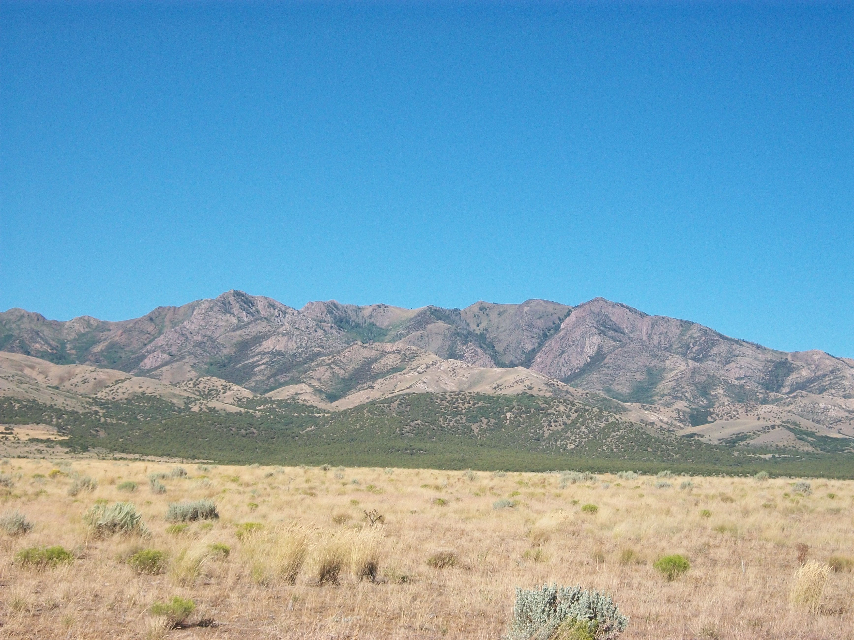
Harker Canyon is a canyon in southeastern Tooele County, Utah, United States, about south of the town of Vernon. Description The canyon is oriented east-west on the southern side of the Sheeprock Mountains, a small mountain group in the larger Wasatch Range. The canyon is entirely encompassed by the boundaries of the Uinta-Wasatch-Cache National Forest, and is accessible from Harker Road by a forest road designated NF 586. There are many abandoned mines in the canyon. Bird watching and horseback riding are popular recreational activities in the canyon. History Harker Canyon has been extensively mined for hard minerals. Artifacts of a ghost town and abandoned mining operations below a natural spring remain. Management of the old mines is assigned to the Vernon Sheeprocks Project, a joint project managed by the United States Forest Service, the United States Department of Agriculture, the United States Department of the Interior, and the Utah Department of Natural Resources. ... [...More Info...] [...Related Items...] OR: [Wikipedia] [Google] [Baidu] |
United States Forest Service
The United States Forest Service (USFS) is an agency of the U.S. Department of Agriculture that administers the nation's 154 national forests and 20 national grasslands. The Forest Service manages of land. Major divisions of the agency include the Chief's Office, National Forest System, State and Private Forestry, Business Operations, and Research and Development. The agency manages about 25% of federal lands and is the only major national land management agency not part of the U.S. Department of the Interior, which manages the National Park Service, the U.S. Fish and Wildlife Service, and the Bureau of Land Management. History The concept of national forests was born from Theodore Roosevelt's conservation group, Boone and Crockett Club, due to concerns regarding Yellowstone National Park beginning as early as 1875. In 1876, Congress formed the office of Special Agent in the Department of Agriculture to assess the quality and conditions of forests in the United States. ... [...More Info...] [...Related Items...] OR: [Wikipedia] [Google] [Baidu] |
Landforms Of Tooele County, Utah
A landform is a natural or anthropogenic land feature on the solid surface of the Earth or other planetary body. Landforms together make up a given terrain, and their arrangement in the landscape is known as topography. Landforms include hills, mountains, canyons, and valleys, as well as shoreline features such as bays, peninsulas, and seas, including submerged features such as mid-ocean ridges, volcanoes, and the great ocean basins. Physical characteristics Landforms are categorized by characteristic physical attributes such as elevation, slope, orientation, stratification, rock exposure and soil type. Gross physical features or landforms include intuitive elements such as berms, mounds, hills, ridges, cliffs, valleys, rivers, peninsulas, volcanoes, and numerous other structural and size-scaled (e.g. ponds vs. lakes, hills vs. mountains) elements including various kinds of inland and oceanic waterbodies and sub-surface features. Mountains, hills, plateaux, and plains are the fou ... [...More Info...] [...Related Items...] OR: [Wikipedia] [Google] [Baidu] |
Canyons And Gorges Of Utah
A canyon (from ; archaic British English spelling: ''cañon''), or gorge, is a deep cleft between escarpments or cliffs resulting from weathering and the erosion, erosive activity of a river over geologic time scales. Rivers have a natural tendency to cut through underlying surfaces, eventually wearing away rock layers as sediments are removed downstream. A river bed will gradually reach a baseline elevation, which is the same elevation as the body of water into which the river drains. The processes of weathering and erosion will form canyons when the river's River source, headwaters and estuary are at significantly different elevations, particularly through regions where softer rock layers are intermingled with harder layers more resistant to weathering. A canyon may also refer to a rift between two mountain peaks, such as those in ranges including the Rocky Mountains, the Alps, the Himalayas or the Andes. Usually, a river or stream carves out such splits between mountains. Examp ... [...More Info...] [...Related Items...] OR: [Wikipedia] [Google] [Baidu] |
List Of Canyons And Gorges In Utah ...
This is a partial list of canyons in the U.S. state of Utah along with any rivers, roads, and other features (such as rail lines) that pass through them. See also External links {{Utah Canyons Utah Utah ( , ) is a state in the Mountain West subregion of the Western United States. Utah is a landlocked U.S. state bordered to its east by Colorado, to its northeast by Wyoming, to its north by Idaho, to its south by Arizona, and to it ... [...More Info...] [...Related Items...] OR: [Wikipedia] [Google] [Baidu] |
Juniper
Junipers are coniferous trees and shrubs in the genus ''Juniperus'' () of the cypress family Cupressaceae. Depending on the taxonomy, between 50 and 67 species of junipers are widely distributed throughout the Northern Hemisphere, from the Arctic, south to tropical Africa, throughout parts of West Asia, western, Central Asia, central and South Asia, southern Asia, east to eastern Tibet in the Old World, and in the mountains of Central America. The highest-known juniper forest occurs at an altitude of in southeastern Tibet and the northern Himalayas, creating one of the highest tree lines on earth. Description Junipers vary in size and shape from tall trees, tall, to columnar or low-spreading shrubs with long, trailing branches. They are evergreen with needle-like and/or scale-like leaves. They can be either monoecious or dioecious. The female Conifer cone, seed cones are very distinctive, with fleshy, fruit-like coalescing scales which fuse together to form Juniper berry, a&n ... [...More Info...] [...Related Items...] OR: [Wikipedia] [Google] [Baidu] |
Pinyon Pine
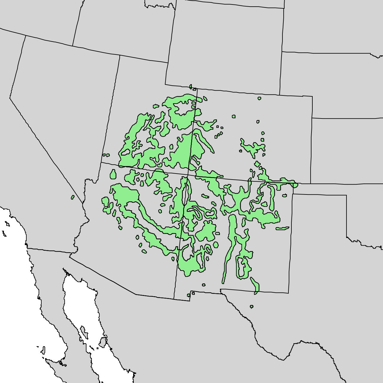
The pinyon or piñon pine group grows in southwestern North America, especially in New Mexico, Arizona, and Utah. The trees yield edible nuts, which are a staple food of Native Americans, and widely eaten as a snack and as an ingredient in New Mexican cuisine. The name comes from the Spanish ''pino piñonero'', a name used for both the American varieties and the stone pine common in Spain, which also produces edible nuts typical of Mediterranean cuisine. Harvesting techniques of the prehistoric American Indians are still used today to collect the pinyon seeds for personal use or for commercialization. The pinyon nut or seed is high in fats and calories. Pinyon wood, especially when burned, has a distinctive fragrance, making it a common wood to burn in chimeneas. Pinyon pine trees are also known to influence the soil in which they grow by increasing concentrations of both macronutrients and micronutrients. Some of the species are known to hybridize, the most notable ones being ... [...More Info...] [...Related Items...] OR: [Wikipedia] [Google] [Baidu] |
Harker Creek (Utah)
Harker Creek is a stream located in Tooele County, Utah, United States. The upper portion of the creek forms Harker Canyon, and drains from west to east on the southern side of the Sheeprock Mountains, a small mountain group in the larger Wasatch Range. The lower portion of the creek drains from south to north into Rush Valley, where it enters the watershed of Faust Creek. The point where the creek flows out of the canyon is located south of the town of Vernon. The creek is approximately in total length. It drains into the Rush Valley at its northern end at 1762 m (5780 ft) above sea level. At its highest point, the creek is at approximately 1900 m (6300 ft) elevation. See also *List of rivers of Utah This is a list of rivers in the U.S. state of Utah in the United States, sorted by drainage basin, watershed. Colorado River The Colorado River is a major river in the Western United States, emptying into the Gulf of California. Rivers are list .. ... [...More Info...] [...Related Items...] OR: [Wikipedia] [Google] [Baidu] |
Spring (hydrosphere)
A spring is a point of exit at which groundwater from an aquifer flows out on top of Earth's crust (pedosphere) and becomes surface water. It is a component of the hydrosphere. Springs have long been important for humans as a source of fresh water, especially in arid regions which have relatively little annual rainfall. Springs are driven out onto the surface by various natural forces, such as gravity and hydrostatic pressure. Their yield varies widely from a volumetric flow rate of nearly zero to more than for the biggest springs. Formation Springs are formed when groundwater flows onto the surface. This typically happens when the groundwater table reaches above the surface level. Springs may also be formed as a result of karst topography, aquifers, or volcanic activity. Springs also have been observed on the ocean floor, spewing hot water directly into the ocean. Springs formed as a result of karst topography create karst springs, in which ground water travels throu ... [...More Info...] [...Related Items...] OR: [Wikipedia] [Google] [Baidu] |
Utah Division Of Wildlife Resources
The Utah Division of Wildlife Resources is part of the Utah Department of Natural Resources for the state of Utah in the United States. The mission of the Division of Wildlife Resources is to serve the people of Utah as trustee and guardian of the state's wildlife. In addition to managing and protecting Utah's wildlife, UDWR manages hunting and fishing opportunities within the state. Regions and operations The division operates five regions headquartered in Ogden (Northern Region), Vernal (Northeastern Region), Springville (Central Region), Price (Southeastern Region), and Cedar City (Southern Region). The division operates two hunter safety centers Salt Lake City (Lee Kay Shooting Center) and in Logan (Cache Valley Shooting Range). The division is also responsible for Hardware Ranch near Hyrum, The Eccles Wildlife Education Center in Farmington, the Fisheries Experiment Station in Logan, and the Great Basin Research Center in Ephraim. Fish Hatcheries The division maintains ... [...More Info...] [...Related Items...] OR: [Wikipedia] [Google] [Baidu] |
Utah Department Of Natural Resources
Utah ( , ) is a state in the Mountain West subregion of the Western United States. Utah is a landlocked U.S. state bordered to its east by Colorado, to its northeast by Wyoming, to its north by Idaho, to its south by Arizona, and to its west by Nevada. Utah also touches a corner of New Mexico in the southeast. Of the fifty U.S. states, Utah is the 13th-largest by area; with a population over three million, it is the 30th-most-populous and 11th-least-densely populated. Urban development is mostly concentrated in two areas: the Wasatch Front in the north-central part of the state, which is home to roughly two-thirds of the population and includes the capital city, Salt Lake City; and Washington County in the southwest, with more than 180,000 residents. Most of the western half of Utah lies in the Great Basin. Utah has been inhabited for thousands of years by various indigenous groups such as the ancient Puebloans, Navajo and Ute. The Spanish were the first Europeans ... [...More Info...] [...Related Items...] OR: [Wikipedia] [Google] [Baidu] |
United States Department Of The Interior
The United States Department of the Interior (DOI) is one of the executive departments of the U.S. federal government headquartered at the Main Interior Building, located at 1849 C Street NW in Washington, D.C. It is responsible for the management and conservation of most federal lands and natural resources, and the administration of programs relating to Native Americans, Alaska Natives, Native Hawaiians, territorial affairs, and insular areas of the United States, as well as programs related to historic preservation. About 75% of federal public land is managed by the department, with most of the remainder managed by the Department of Agriculture's Forest Service. The department was created on March 3, 1849. The department is headed by the secretary of the interior, who reports directly to the president of the United States and is a member of the president's Cabinet. The current secretary is Deb Haaland. Despite its name, the Department of the Interior has a different ro ... [...More Info...] [...Related Items...] OR: [Wikipedia] [Google] [Baidu] |

.jpg)


.jpg)