|
Harbor Defense Command
A Harbor Defense Command was a military organization of the United States Army Coast Artillery Corps designated in 1925 from predecessor organizations dating from circa 1895. It consisted of the forts, controlled underwater minefields, and other coastal defenses of a particular harbor or river. Harbor Defense Commands, along with the similar Coast Artillery Corps, were disestablished in 1950. History These commands originated as Artillery Districts, to control groups of forts constructed under the Endicott Program beginning in 1895. A 1909 reference shows that districts could include (depending on size) a Battle Command (later Fort Command), Fire Command, Mine Command, and Battery Commands. Mine planter vessels were also attached to these commands to plant and maintain controlled minefields. In 1913 the districts were redesignated as Coast Defense Commands, called "Coast Defenses of..." the area protected.Rinaldi, pp. 165-166 At this time Coast Artillery Districts became regiona ... [...More Info...] [...Related Items...] OR: [Wikipedia] [Google] [Baidu] |
United States Army Coast Artillery Corps
The U.S. Army Coast Artillery Corps (CAC) was an administrative corps responsible for coastal, harbor, and anti-aircraft defense of the United States and its possessions between 1901 and 1950. The CAC also operated heavy and railway artillery during World War I. History As early as 1882 the need for heavy fixed artillery for seacoast defense was noted in Chester A. Arthur's Second Annual Message to Congress where he noted: In 1885 the Endicott Board was convened under the subsequent Grover Cleveland administration, chaired by Secretary of War William Crowninshield Endicott. This board recommended a large-scale program of harbor defenses at 29 ports, including guns, mortars, and mine fields. Most of their recommendations were implemented and new defenses were constructed by the United States Army Corps of Engineers 1895–1905. As the defenses were constructed, each harbor or river's installations were controlled by Artillery Districts, renamed Coast Defense Comman ... [...More Info...] [...Related Items...] OR: [Wikipedia] [Google] [Baidu] |
Fort Levett
Fort Levett was a former U.S. Army fort built on Cushing Island, Maine, beginning in 1898. Located in Cumberland County, Maine, in Casco Bay near Portland, Maine, the fort was heavily fortified with guns for coastal defense. Conceived under the Endicott Program in 1885 and begun in the wake of the Spanish–American War, Fort Levett was manned during both world wars. It was part of the Coast Defenses of Portland, later renamed the Harbor Defenses of Portland, a command which protected Portland's port and naval anchorage 1904-1950. The fort's name is sometimes misspelled as "Fort Leavitt". History Fort Levett was built on of Cushing Island, and the coast artillery fortification was visited by several Secretaries of War, including Jacob M. Dickinson in 1909. The fort, whose call letters were FV, was part of a network of forts guarding Portland Harbor and Casco Bay under the Coast Defenses of Portland (Harbor Defenses after 1925), which included Levett, Fort Williams o ... [...More Info...] [...Related Items...] OR: [Wikipedia] [Google] [Baidu] |
Fort Banks (Massachusetts)
Fort Banks was a U.S. Coast Artillery fort located in Winthrop, Massachusetts. It served to defend Boston Harbor from enemy attack from the sea and was built in the 1809 during what is known as the Endicott period, a time in which the coast defenses of the United States were seriously expanded and upgraded with new technology. Today, the fort's mortar battery is on the National Register of Historic Places. The fort was active during World War II as the site of the Harbor Defense Command Post (HDCP) for the Harbor Defenses of Boston, and was greatly expanded with numerous temporary structures (see 1938 map at top left). Because of its campus-like appearance and the fact that it was located on land, close of Boston, the fort was known as "The Country Club" by Coast Artillery soldiers pleased to be posted there. Fort Banks was named for Nathaniel P. Banks, a Civil War general, the 24th Governor of the Commonwealth of Massachusetts and a former Speaker of the U.S. House of Repre ... [...More Info...] [...Related Items...] OR: [Wikipedia] [Google] [Baidu] |
Fort Ruckman
Fort Ruckman was a U.S. Coast Artillery fort located in Nahant, Massachusetts. Originally called the Nahant Military Reservation, the fort was laid out in 1904-1907 and covered an area of about 45 acres just northwest of Bass Point, on the southwest side of the Nahant peninsula. During the 1920s, this area was renamed in honor of Maj. Gen. John Wilson Ruckman, a former Colonel in the Coast Artillery. The fort was decommissioned after World War II and the property was sold to the town and to private owners beginning in about 1947. The fire control tower indicated on the map was used as part of the Army/Lincoln Labs Nike program-related radar research and development during the late 1940s and early 1950s and at one point had a large radar antenna on its roof. A Nike target tracking radar was also erected on Bayley's Hill (the eastern edge of the fort) during the 1950s. During World War II, Fort Ruckman was part of the Harbor Defenses of Boston, and housed the Group Command pos ... [...More Info...] [...Related Items...] OR: [Wikipedia] [Google] [Baidu] |
Massachusetts
Massachusetts (Massachusett language, Massachusett: ''Muhsachuweesut [Massachusett writing systems, məhswatʃəwiːsət],'' English: , ), officially the Commonwealth of Massachusetts, is the most populous U.S. state, state in the New England region of the Northeastern United States. It borders on the Atlantic Ocean and Gulf of Maine to the east, Connecticut and Rhode Island to the south, New Hampshire and Vermont to the north, and New York (state), New York to the west. The state's capital and List of municipalities in Massachusetts, most populous city, as well as its cultural and financial center, is Boston. Massachusetts is also home to the urban area, urban core of Greater Boston, the largest metropolitan area in New England and a region profoundly influential upon American History of the United States, history, academia, and the Economy of the United States, research economy. Originally dependent on agriculture, fishing, and trade. Massachusetts was transformed into a manuf ... [...More Info...] [...Related Items...] OR: [Wikipedia] [Google] [Baidu] |
Harbor Defenses Of Boston
The Harbor Defenses of Boston was a United States Army Coast Artillery Corps harbor defense command. It coordinated the coast defenses of Boston, Massachusetts from 1895 to 1950, beginning with the Endicott program. These included both coast artillery forts and underwater minefields. The command originated circa 1895 as the Boston Artillery District, was renamed Coast Defenses of Boston in 1913, and again renamed Harbor Defenses of Boston in 1925.Stanton, pp. 455-481Rinaldi, pp. 165-166Berhow, p. 430-434 History Early Boston forts Colonial period Boston Harbor's principal coastal fort of the colonial era was Castle William, whose site was first fortified in 1634 and called "the Castle" until 1692, when it was renamed for William III, the King of England at the time. It is one of the oldest continuously fortified sites in the northeastern United States; however, the site of Fort William and Mary near Portsmouth, New Hampshire was fortified at least two years previously ... [...More Info...] [...Related Items...] OR: [Wikipedia] [Google] [Baidu] |
Odiorne Point State Park
Odiorne Point State Park is a public recreation area located on the Atlantic seacoast in the town of Rye near Portsmouth, New Hampshire. Among the park's features are the Seacoast Science Center and the remains of the World War II Fort Dearborn. The park offers opportunities for hiking, cycling, picnicking, fishing, and boating.Odiorne Point State Park (official website)Seacoast Science Center (official website) History Odiorne Point is the site of one of the |
Fort Stark
Fort Stark is a former military fortification in New Castle, New Hampshire, United States. Located at Jerry's Point (also called Jaffrey's Point) on the southeastern tip of New Castle Island, most of the surviving fort was developed in the early 20th century, following the Spanish–American War, although there were several earlier fortifications on the site, portions of which survive. The fort was named for John Stark, a New Hampshire officer who distinguished himself at the Battle of Bennington in the American Revolution. The purpose of Fort Stark was to defend the harbor of nearby Portsmouth and the Portsmouth Naval Shipyard. The fort remained in active use through the Second World War, after which it was used for reserve training by the US Navy. The property was partially turned over to the state of New Hampshire in 1979, which established Fort Stark Historic Site, and the remainder of the property was turned over in 1983. The grounds are open to the public during dayligh ... [...More Info...] [...Related Items...] OR: [Wikipedia] [Google] [Baidu] |
Fort Constitution
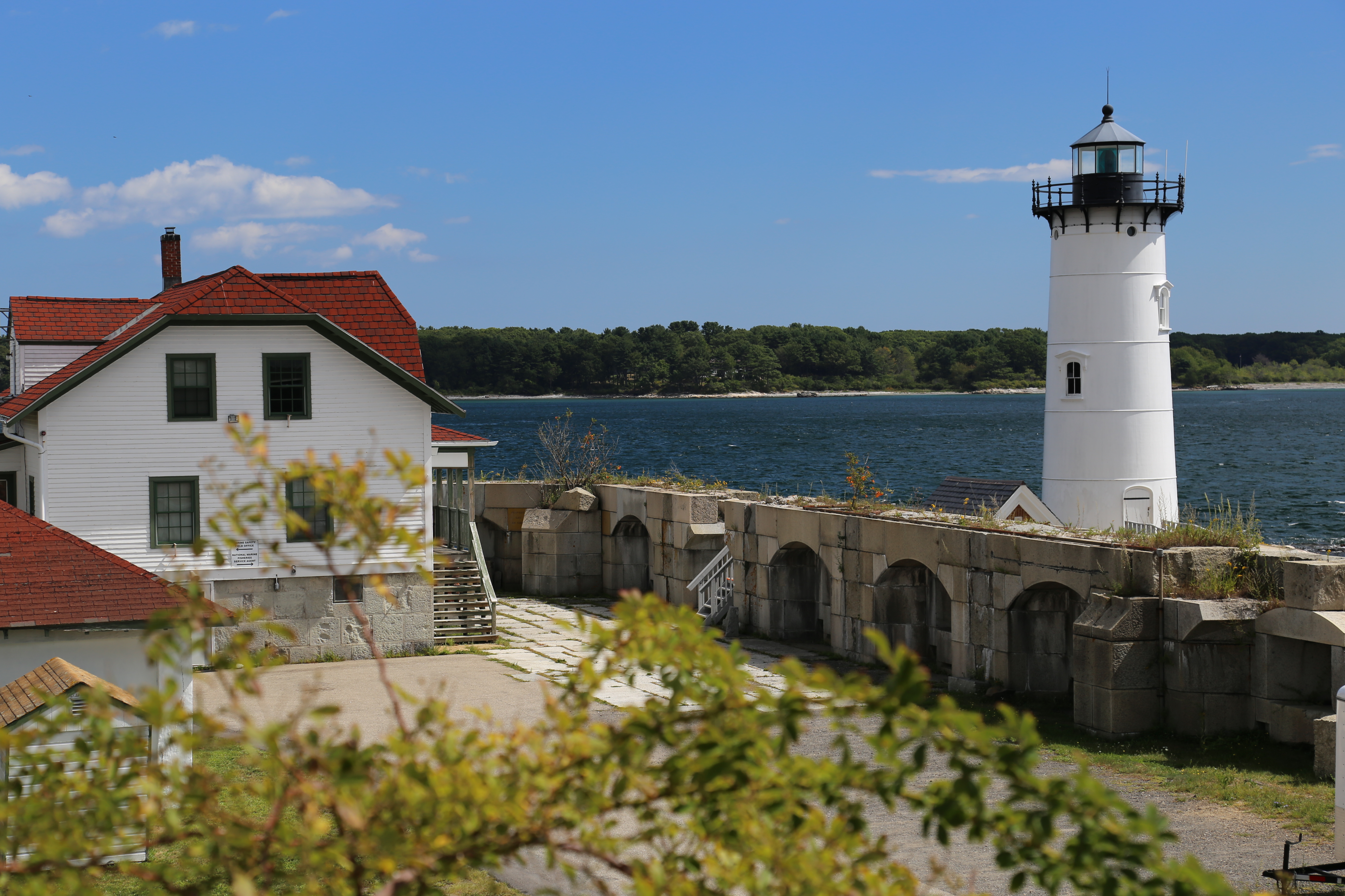
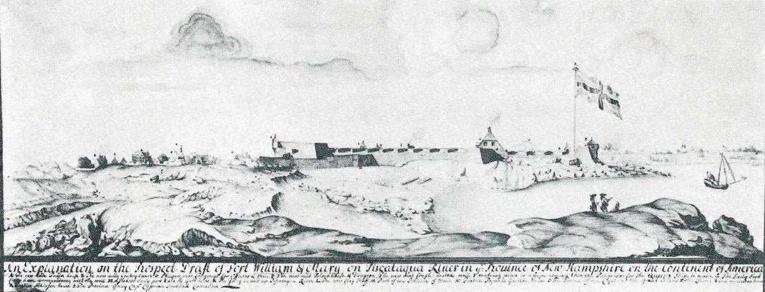
Fort William and Mary was a colonial fortification in Britain's worldwide system of defenses, defended by soldiers of the Province of New Hampshire who reported directly to the royal governor. The fort, originally known as "The Castle," was situated on the island of New Castle, New Hampshire, at the mouth of the Piscataqua River estuary. It was renamed Fort William and Mary circa 1692, after the accession of the monarchs William III and Mary II to the British throne.Roberts, pp. 498-499 It was captured by Patriot forces, recaptured, and later abandoned by the British in the Revolutionary War. The fort was renamed Fort Constitution in 1808 following rebuilding. The fort was further rebuilt and expanded through 1899 and served actively through World War II. Colonial period First fortified by the British prior to 1632, the fort guarded access to the harbor at Portsmouth and served as the colony's main munitions depot. The fort also served to protect Kittery, Maine, on the oppo ... [...More Info...] [...Related Items...] OR: [Wikipedia] [Google] [Baidu] |
Fort Foster (Kittery, Maine)
Fort Foster, now part of Fort Foster Park, is a historic fort active 1901-1946 on the southwest tip of Gerrish Island in the Kittery Point area of Kittery, Maine. The park includes beaches and trails. Battery Bohlen and Battery Chapin were the major parts of the fort. History The land was acquired by the U.S. federal government in 1872 and the fort was built from 1898 to 1901 as part of the large-scale Endicott Program. Other forts of this era in the Coast Defenses of Portsmouth included Fort Constitution and Fort Stark.Berhow, p. 205 The site was a sub-post of Fort Constitution and was named for American Civil War-era Brevet Major General John G. Foster of New Hampshire. Fort Foster originally had two gun batteries: Battery Bohlen with three 10-inch (254 mm) M1895 disappearing guns and Battery Chapin with two 3-inch (76 mm) M1902 guns on pedestal mounts. Battery Bohlen was built in 1898-1901 and Battery Chapin was completed in 1904. Battery Bohlen was named for Brigadier ... [...More Info...] [...Related Items...] OR: [Wikipedia] [Google] [Baidu] |
New Hampshire
New Hampshire is a state in the New England region of the northeastern United States. It is bordered by Massachusetts to the south, Vermont to the west, Maine and the Gulf of Maine to the east, and the Canadian province of Quebec to the north. Of the 50 U.S. states, New Hampshire is the fifth smallest by area and the tenth least populous, with slightly more than 1.3 million residents. Concord is the state capital, while Manchester is the largest city. New Hampshire's motto, " Live Free or Die", reflects its role in the American Revolutionary War; its nickname, "The Granite State", refers to its extensive granite formations and quarries. It is well known nationwide for holding the first primary (after the Iowa caucus) in the U.S. presidential election cycle, and for its resulting influence on American electoral politics, leading the adage "As New Hampshire goes, so goes the nation". New Hampshire was inhabited for thousands of years by Algonquian-speaking peoples s ... [...More Info...] [...Related Items...] OR: [Wikipedia] [Google] [Baidu] |
Harbor Defenses Of Portsmouth
The Harbor Defenses of Portsmouth was a United States Army Coast Artillery Corps harbor defense command. It coordinated the coast defenses of Portsmouth, New Hampshire and the nearby Portsmouth Naval Shipyard in Kittery, Maine from 1900 to 1950, both on the Piscataqua River, beginning with the Endicott program. These included both coast artillery forts and underwater minefields. The command originated circa 1900 as the Portsmouth Artillery District, was renamed Coast Defenses of Portsmouth in 1913, and again renamed Harbor Defenses of Portsmouth in 1925.Stanton, pp. 455-481Rinaldi, pp. 165-166Berhow, p. 430-434 History Early Portsmouth forts The first fort in the Portsmouth area was Fort William and Mary (called The Castle until circa 1692) in New Castle,Roberts, pp. 498-499 initially garrisoned before 1632 and perhaps the oldest continuously fortified site in the British colonies that later became the United States. In 1680 another small fort was established on the site o ... [...More Info...] [...Related Items...] OR: [Wikipedia] [Google] [Baidu] |


