|
Harbecke
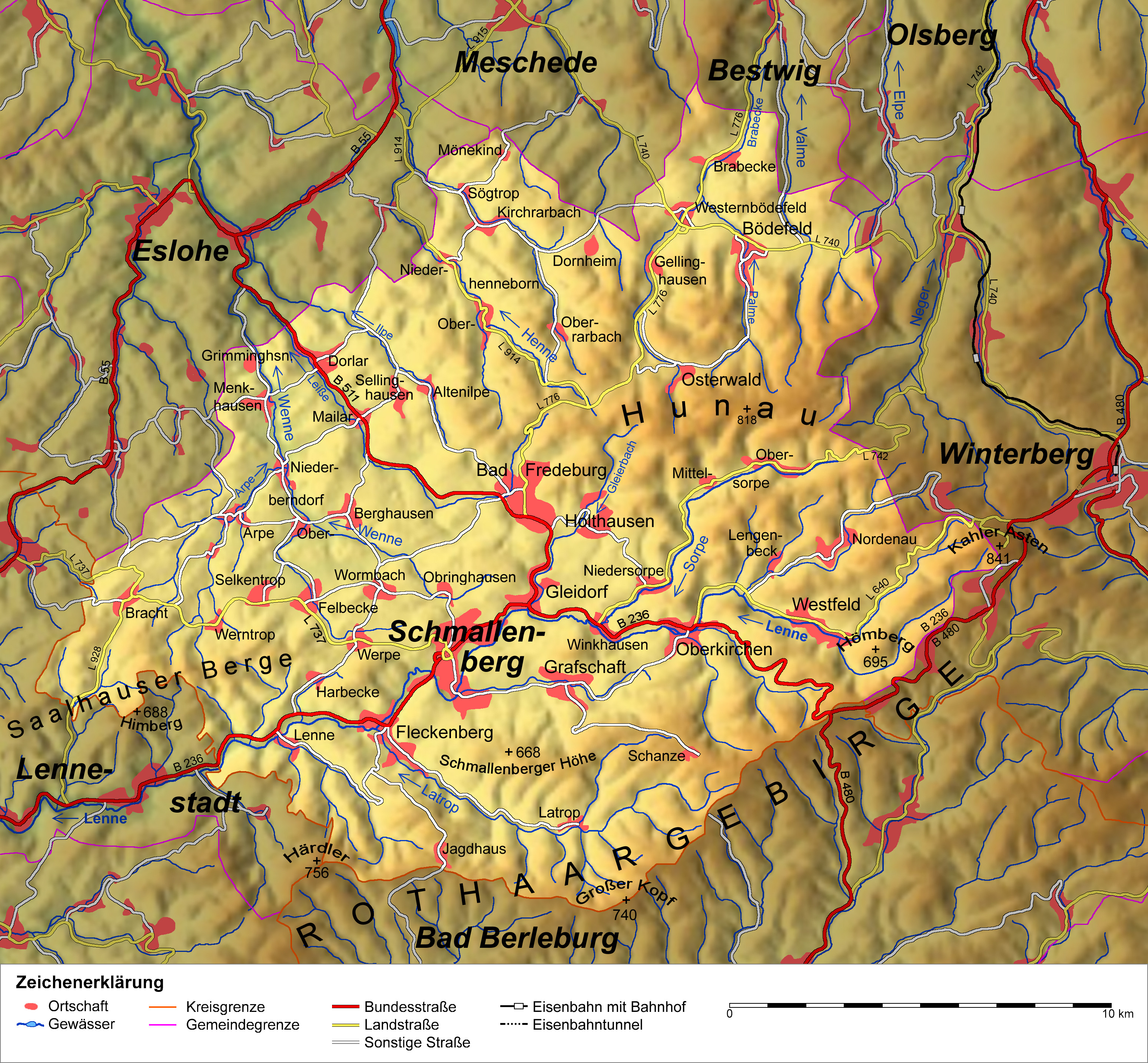
Harbecke is a locality in the municipality Schmallenberg in the district Hochsauerlandkreis in North Rhine-Westphalia, Germany. The village has 123 inhabitants and lies in the west of the municipality of Schmallenberg at a height of around 395 m on the Kreisstraße 25. The river Harbecke flows through the village. Harbecke borders on the villages of Felbecke, Fleckenberg, Lenne, Selkentrop, Werpe and Werntrop. "Hartbeke" was first mentioned in 1361 in a document from Grafschaft Abbey. The village used to belong to the municipality of Wormbach in Amt Schmallenberg until the end of 1974.Statistisches Bundesamt (Hrsg.): Historisches Gemeindeverzeichnis für die Bundesrepublik Deutschland. Namens-, Grenz- und Schlüsselnummernänderungen bei Gemeinden, Kreisen und Regierungsbezirken vom 27.5.1970 bis 31.12.1982. W. Kohlhammer W. Kohlhammer Verlag GmbH, or Kohlhammer Verlag, is a German publishing house headquartered in Stuttgart. History Kohlhammer Verlag was founded in St ... [...More Info...] [...Related Items...] OR: [Wikipedia] [Google] [Baidu] |
Fleckenberg
Fleckenberg is a locality in the municipality Schmallenberg in the district Hochsauerlandkreis in North Rhine-Westphalia, Germany. The village has 1544 inhabitants and lies in the west of the municipality of Schmallenberg at a height of around 354 m on the 236. The river flows in Fleckenberg in the river Lenne. Fleckenberg borders on the villages of Schmallenberg, Jagdhaus, Waidmannsruh, Wulwesort, |
Schmallenberg
Schmallenberg ( Westphalian: ''Smalmereg'') is a town and a climatic health resort in the High Sauerland District, Germany. By area, it is the third biggest of all cities and towns of the state of North Rhine-Westphalia and the second biggest of the region of Westphalia. With small Schmallenberg central town and the rural Bad Fredeburg Kneipp health resort the town has two urban settlements. Additionally, 82 villages and hamlets belong to the town's territory. Also being called “the Schmallenberg Sauerland”, the Town of Schmallenberg is famous for its total of fiveStadt Schmallenberg: Kurort health resorts and nineSchmallenberger Sauerland: Golddörfer Schmallenberg und Esloh villages which have been awarded gold for their beauty in the nationwide “” contest. Geography Schmallenberg is located in the southeast of the Sauerland mountainous landscape. The Rothaar Mountains make up a part of the town's territory. Through the central town flows the river Lenne. It is s ... [...More Info...] [...Related Items...] OR: [Wikipedia] [Google] [Baidu] |
Lenne (Schmallenberg)
Lenne is a locality in the municipality Schmallenberg in the High Sauerland District in North Rhine-Westphalia, Germany. The village has 371 inhabitants and lies in the west of the municipality of Schmallenberg at a height of around 350 m. Through the village leads the 236. In the village flows the stream Uentrop coming from the Uentroptal in the river . Lenne borders on the villages of |
Werpe
Werpe is a locality in the municipality Schmallenberg in the district Hochsauerlandkreis in North Rhine-Westphalia, Germany. The Werpe has 203 inhabitants and lies in the west of the municipality of Schmallenberg at a height of around 430 m. The river Wehrsiepen flows through the village. Werpe borders on the villages of Harbecke, Felbecke, Wormbach, Schmallenberg and Fleckenberg. Schmallenberg's aerodrome (Motorsport- und Segelflugplatz Rennefeld) is between the villages of Werpe and Wormbach. In the village centre the Landesstraße 737 meets the Kreisstraße A Kreisstraße (literally: "district road" or "county road") is a class of road in Germany. It carries traffic between the towns and villages within a '' Kreis'' or district or between two neighbouring districts. In importance, the ''Kreisstraße ... 25. Werpe was first mentioned in 1221 in a document. The village used to belong to the municipality of Wormbach in Amt Schmallenberg until the end of 1974. Gallery File ... [...More Info...] [...Related Items...] OR: [Wikipedia] [Google] [Baidu] |
Arnsberg (region)
Arnsberg () is one of the five Regierungsbezirke of North Rhine-Westphalia, Germany, located in the west-central part of the country. It covers the Sauerland hills as well as the east part of the Ruhr area. The region was founded in 1815 as a subdivision of the Prussian Province of Westphalia. ''Kreise''(counties) # Ennepe-Ruhr # Hochsauerland # Märkischer Kreis # Olpe # Siegen-Wittgenstein # Soest # Unna ''Kreisfreie Städte''(independent cities) # Bochum # Dortmund # Hagen # Hamm Hamm (, Latin: ''Hammona'') is a city in North Rhine-Westphalia, Germany. It is located in the northeastern part of the Ruhr area. As of 2016 its population was 179,397. The city is situated between the A1 motorway and A2 motorway. Hamm railwa ... # Herne Economy The Gross domestic product (GDP) of the region was 124.8 billion € in 2018, accounting for 3.7% of German economic output. GDP per capita adjusted for purchasing power was 32,000 € or 106% of the EU27 average in th ... [...More Info...] [...Related Items...] OR: [Wikipedia] [Google] [Baidu] |
Hochsauerlandkreis
Hochsauerlandkreis (meaning “High Sauerland District” in German) is a Kreis (district) in the east of North Rhine-Westphalia, Germany. Neighboring districts are Soest, Paderborn, Höxter, Waldeck-Frankenberg, Siegen-Wittgenstein, Olpe, Märkischer Kreis. The district is named “High Sauerland” because two of the highest mountains of the Sauerland mountainous landscape, Langenberg and Kahler Asten are in its territory. With 2,766 ft / 843 m (Langenberg) and 2,762 ft / 842 m (Kahler Asten) these are also the highest mountains of North Rhine-Westphalia. History The district was established in 1975 in the reorganization of the districts in North Rhine-Westphalia by merging the previous districts Arnsberg, Brilon and Meschede. Geography Geographically the district covers a big part of the Sauerland mountains, including the highest and third highest elevation – the Langenberg near Olsberg with 2,766 ft / 843 m, and the better known Kahler Asten wi ... [...More Info...] [...Related Items...] OR: [Wikipedia] [Google] [Baidu] |
North Rhine-Westphalia
North Rhine-Westphalia (german: Nordrhein-Westfalen, ; li, Noordrien-Wesfale ; nds, Noordrhien-Westfalen; ksh, Noodrhing-Wäßßfaale), commonly shortened to NRW (), is a state (''Land'') in Western Germany. With more than 18 million inhabitants, it is the most populous state of Germany. Apart from the city-states, it is also the most densely populated state in Germany. Covering an area of , it is the fourth-largest German state by size. North Rhine-Westphalia features 30 of the 81 German municipalities with over 100,000 inhabitants, including Cologne (over 1 million), the state capital Düsseldorf, Dortmund and Essen (all about 600,000 inhabitants) and other cities predominantly located in the Rhine-Ruhr metropolitan area, the largest urban area in Germany and the fourth-largest on the European continent. The location of the Rhine-Ruhr at the heart of the European Blue Banana makes it well connected to other major European cities and metropolitan areas like the R ... [...More Info...] [...Related Items...] OR: [Wikipedia] [Google] [Baidu] |
Kreisstraße
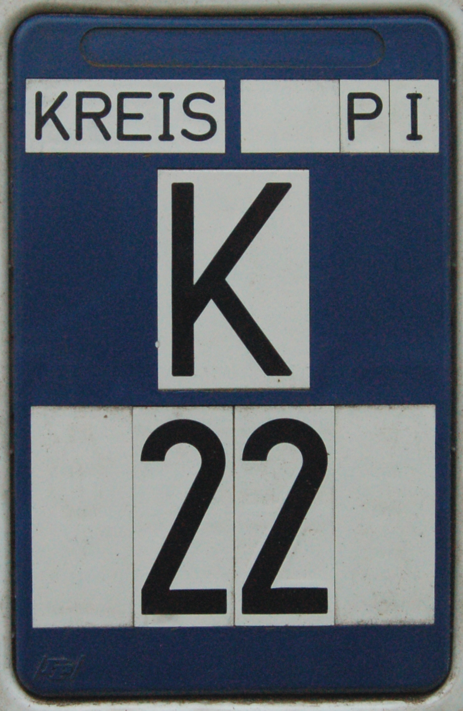
A Kreisstraße (literally: "district road" or "county road") is a class of road in Germany. It carries traffic between the towns and villages within a '' Kreis'' or district or between two neighbouring districts. In importance, the ''Kreisstraße'' ranks below a '' Landesstraße'' (or, in Bavaria and Saxony, a ''Staatstraße'', i.e. a state road), but above a '' Gemeindestraße'' or "local road". ''Kreisstraßen'' are usually the responsibility of the respective rural district ('' Landkreis'') or urban district ('' Kreisfreie Stadt''), with the exception of high streets through larger towns and villages. Kreisstraßen are usually dual-lane roads but, in a few cases, can be built as limited-access dual carriageways in densely populated areas. Numbering Unlike local roads (''Gemeindestraßen'') the ''Kreisstraßen'' are invariably numbered, but their numbering is not shown on signs. The abbreviation is a prefixed capital letter K followed by a serial number. In most states the c ... [...More Info...] [...Related Items...] OR: [Wikipedia] [Google] [Baidu] |
Felbecke
Felbecke is a locality in the municipality Schmallenberg in the district Hochsauerlandkreis in North Rhine-Westphalia, Germany. The locality Felbecke has 150 inhabitants and lies in the west of the municipality of Schmallenberg at a height of around 391 m. The river Werde flows through the village. In the village centre the 737 meets the 31. Felbecke borders on the villages of Selkentrop, Oberberndorf, |
Grafschaft Abbey
Grafschaft Abbey (german: Kloster Grafschaft) is a community of the Sisters of Mercy of Saint Charles Borromeo, formerly a Benedictine monastery, in Schmallenberg- Grafschaft in the Sauerland, North Rhine-Westphalia, Germany. First foundation The Benedictine monastery was founded in 1072 on a site at the foot of the Wilzenberg mountain, by Saint Anno, Archbishop of Cologne, whose statue still stands at the west gate. The monastery was dedicated between 1079 and 1089. The original buildings burned down in 1270. From 1729 the premises were gradually replaced by completely new buildings in the Baroque style; the rebuild was finished in 1742 and the new abbey church dedicated in 1747. The abbey was dissolved in 1804 as a consequence of secularisation. In 1827 the premises were bought by the Princes von Fürstenberg, but by that time the church was in such a bad condition that it had to be demolished, despite its high architectural quality. Second foundation In 1947 the buildi ... [...More Info...] [...Related Items...] OR: [Wikipedia] [Google] [Baidu] |

.jpg)
