|
Halswell Quarry
Halswell Quarry operated between 1861 and 1990 before becoming the Halswell Quarry Park, one of many Christchurch City Council reserves. It offers a combination of walking and mountain biking tracks, historic sites, picnic areas, botanical collections, and six sister city gardens. Location Halswell Quarry Park is located in the suburb of Kennedys Bush at 185 Kennedy's Bush Road in Christchurch, New Zealand. History of Halswell Quarry Halswell Quarry provided crushed stone for roading and cut stone for significant works including the Canterbury Provincial Council Buildings, Durham Street Methodist Church, Cranmer Court formerly Christchurch Normal School and the Sign of the Takahe. The stone was a distinctive blue-grey colour. Between 1861 and 1925 the quarry had several owners and was finally bought, in 1925 by the Christchurch City Council who managed it until 1990 when it became commercially unviable due to reduced stone reserves. It is thought to have been the oldes ... [...More Info...] [...Related Items...] OR: [Wikipedia] [Google] [Baidu] |
Christchurch City Council
The Christchurch City Council is the local government authority for Christchurch in New Zealand. It is a territorial authority elected to represent the people of Christchurch. Since October 2022, the Mayor of Christchurch is Phil Mauger, who succeeded after the retirement of Lianne Dalziel. The council currently consists of 16 councillors elected from sixteen wards, and is presided over by the mayor, who is elected at large. The number of elected members and ward boundaries changed prior during the 2016 election. History As a result of the 1989 local government reforms, on 1 November 1989 Christchurch City Council took over the functions of the former Christchurch City Council, Heathcote County Council, Riccarton Borough Council, Waimairi District Council, part of Paparua County Council, and the Christchurch Drainage Board. On 6 March 2006, Banks Peninsula District Council merged with Christchurch City Council. Councillor Yani Johanson campaigned since 2010 to live-strea ... [...More Info...] [...Related Items...] OR: [Wikipedia] [Google] [Baidu] |
Christchurch
Christchurch ( ; mi, Ōtautahi) is the largest city in the South Island of New Zealand and the seat of the Canterbury Region. Christchurch lies on the South Island's east coast, just north of Banks Peninsula on Pegasus Bay. The Avon River / Ōtākaro flows through the centre of the city, with an urban park along its banks. The city's territorial authority population is people, and includes a number of smaller urban areas as well as rural areas. The population of the urban area is people. Christchurch is the second-largest city by urban area population in New Zealand, after Auckland. It is the major urban area of an emerging sub-region known informally as Greater Christchurch. Notable smaller urban areas within this sub-region include Rangiora and Kaiapoi in Waimakariri District, north of the Waimakariri River, and Rolleston and Lincoln in Selwyn District to the south. The first inhabitants migrated to the area sometime between 1000 and 1250 AD. They hunted moa, which led ... [...More Info...] [...Related Items...] OR: [Wikipedia] [Google] [Baidu] |
Kennedys Bush
Kennedys Bush is a south-western suburb of Christchurch, New Zealand. Thomas Kennedy purchased of native bush in the Port Hills in 1856. In the late 1850s, Kennedys Bush Road up a spur towards the bush was surveyed, and constructed in 1863. Halswell Quarry Park is located within Kennedys Bush. The rock formations were first noted by the Deans brothers, who named the outcrop Rock Hill. James Feather and James Forgan opened the quarry in c. 1861. They sold it to Guise Brittan, who took Grosvenor Miles and William White Sr (father of politician of the same name). Brittan sold to the Lincoln Road Tramway Company, and White and William Wilson managed the quarry operations. Wilson took over the quarry, and many important Christchurch buildings were constructed from its stone, including the Canterbury Provincial Council Buildings, Sunnyside Hospital, Durham Street Methodist Church, Canterbury Museum, Normal School, Teachers' College Building, Sign of the Takahe, and the Robert M ... [...More Info...] [...Related Items...] OR: [Wikipedia] [Google] [Baidu] |
Canterbury Provincial Council Buildings
The Canterbury Provincial Council Buildings were the buildings of the Canterbury Provincial Council that administered the Canterbury Province from 1853 until the abolition of provincial government in 1876. The buildings are the only purpose-built provincial government buildings in New Zealand still in existence. The buildings were substantially damaged in the February 2011 Christchurch earthquake, and partially demolished by the Christchurch City Council. Location The buildings are located in Christchurch Central City. They occupy the block surrounded by Armagh Street, Durham Street, Gloucester Street and the Avon River. Historical context The New Zealand Constitution Act 1852, passed by the Parliament of the United Kingdom, established a bicameral New Zealand Parliament, with the lower house (the House of Representatives) being elected by popular vote, and the upper house (the Legislative Council) being appointed. Votes were to be cast under a simple FPP system by telling ... [...More Info...] [...Related Items...] OR: [Wikipedia] [Google] [Baidu] |
Durham Street Methodist Church
The Durham Street Methodist Church in Christchurch was the earliest stone church constructed in the Canterbury region of New Zealand. It is registered as a "Historic Place – Category I" by Heritage New Zealand. The church was severely damaged by an earthquake on 4 September 2010, but collapsed during a following earthquake on 22 February 2011, killing three workers who were removing the organ. History Christchurch was mainly an Anglican settlement. The congregation of Methodists was small, but active. The first Methodist Chapel, which was located in High Street, was sold in 1864. An architectural competition was held for a new church in Durham Street. The winning architectural firm, Crouch and Wilson from Melbourne, had entered a design in the Gothic Revival style in the 1863 competition. Local architect Samuel Farr, who had come to Akaroa in early 1850, came second in the competition and was engaged to for the construction supervision. In early 1864, the foundation ston ... [...More Info...] [...Related Items...] OR: [Wikipedia] [Google] [Baidu] |
Cranmer Court
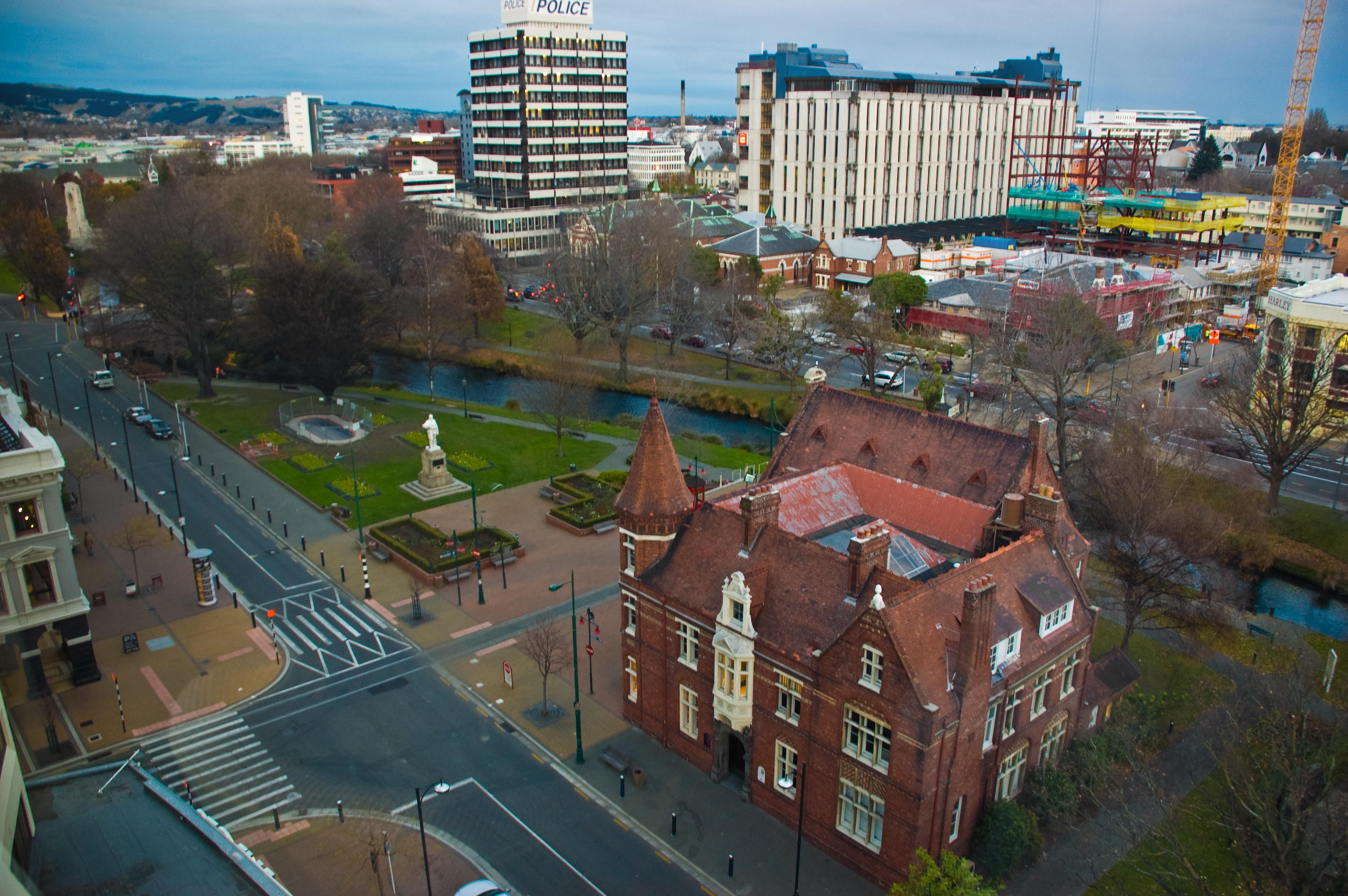
Cranmer Court, the former Christchurch Normal School, was one of the most significant heritage buildings in Christchurch, New Zealand. Its demolition, due to some damage in the 2011 Christchurch earthquake, was controversial. History The Canterbury Board of Education held an architectural competition in 1873 for the design of the Christchurch Normal School. At the time, education was still the responsibility of provincial government. The competition was announced in ''The Press'' by advertisement on 18 April of that year, rewarding the two best entries with £50 and £25, respectively. The Board received 12 entries, with Christchurch architect Samuel Farr winning the competition, and Dunedin-based Robert Lawson coming second. Construction began later in 1873, with Sir Charles Fergusson, the Governor of New Zealand, laying the foundation stone. The builder was Daniel Reese, who completed construction after three years. The school was opened on 3 April 1876 and was one of New Z ... [...More Info...] [...Related Items...] OR: [Wikipedia] [Google] [Baidu] |
Sign Of The Takahe
The Sign of the Takahe is a neo-Gothic style historic building in Christchurch, New Zealand. It is currently leased from Christchurch City Council and run as a cafe, bar, and function centre. History Construction began on the building in 1918, spearheaded by Christchurch City councillor and New Zealand Member of Parliament, Henry George (Harry) Ell. Ell envisioned the building as the entrance rest house of Summit Road, one of four planned rest houses in the area for those walking the reserves of Port Hills that overlook Christchurch and Lyttelton harbour. The other rest houses are Sign of the Kiwi, Sign of the Bellbird, and Sign of the Packhorse. While part of the building opened to the public as the Tram Terminus Rest House in 1920, which featured a tram terminus and tearoom, it would take decades for construction of the Sign of the Takahe to be completed. Ell died suddenly in 1934, having never seen the building completed. Construction of the building continued under th ... [...More Info...] [...Related Items...] OR: [Wikipedia] [Google] [Baidu] |
Heritage New Zealand
Heritage New Zealand Pouhere Taonga (initially the National Historic Places Trust and then, from 1963 to 2014, the New Zealand Historic Places Trust) ( mi, Pouhere Taonga) is a Crown entity with a membership of around 20,000 people that advocates for the protection of ancestral sites and heritage buildings in New Zealand. It was set up through the Historic Places Act 1954 with a mission to "...promote the identification, protection, preservation and conservation of the historical and cultural heritage of New Zealand" and is an autonomous Crown entity. Its current enabling legislation is the Heritage New Zealand Pouhere Taonga Act 2014. History Charles Bathurst, 1st Viscount Bledisloe gifted the site where the Treaty of Waitangi was signed to the nation in 1932. The subsequent administration through the Waitangi Trust is sometimes seen as the beginning of formal heritage protection in New Zealand. Public discussion about heritage protection occurred in 1940 in conjunction with t ... [...More Info...] [...Related Items...] OR: [Wikipedia] [Google] [Baidu] |
2011 Christchurch Earthquake
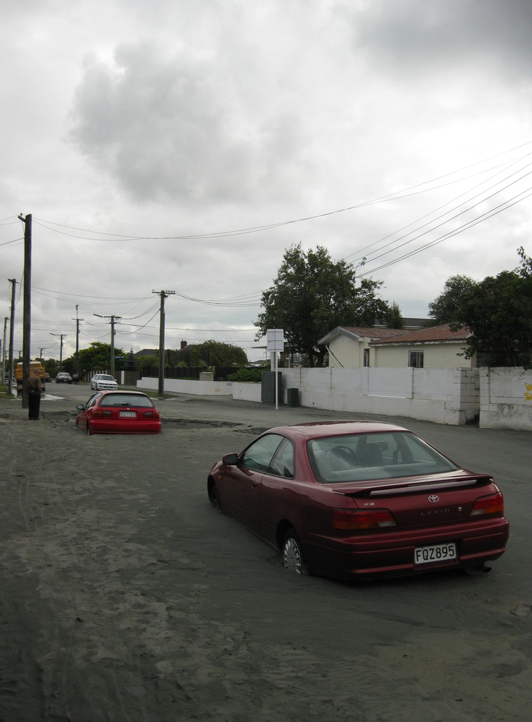
A major earthquake occurred in Christchurch on Tuesday 22 February 2011 at 12:51 p.m. local time (23:51 UTC, 21 February). The () earthquake struck the entire of the Canterbury region in the South Island, centred south-east of the central business district. It caused widespread damage across Christchurch, killing 185 people, in New Zealand's fifth-deadliest disaster. Christchurch's central city and eastern suburbs were badly affected, with damage to buildings and infrastructure already weakened by the magnitude 7.1 Canterbury earthquake of 4 September 2010 and its aftershocks. Significant liquefaction affected the eastern suburbs, producing around 400,000 tonnes of silt. The earthquake was felt across the South Island and parts of the lower and central North Island. While the initial quake only lasted for approximately 10 seconds, the damage was severe because of the location and shallowness of the earthquake's focus in relation to Christchurch as well as ... [...More Info...] [...Related Items...] OR: [Wikipedia] [Google] [Baidu] |
Parks In Christchurch
A park is an area of natural, semi-natural or planted space set aside for human enjoyment and recreation or for the protection of wildlife or natural habitats. Urban parks are green spaces set aside for recreation inside towns and cities. National parks and country parks are green spaces used for recreation in the countryside. State parks and provincial parks are administered by sub-national government states and agencies. Parks may consist of grassy areas, rocks, soil and trees, but may also contain buildings and other artifacts such as monuments, fountains or playground structures. Many parks have fields for playing sports such as baseball and football, and paved areas for games such as basketball. Many parks have trails for walking, biking and other activities. Some parks are built adjacent to bodies of water or watercourses and may comprise a beach or boat dock area. Urban parks often have benches for sitting and may contain picnic tables and barbecue grills. The ... [...More Info...] [...Related Items...] OR: [Wikipedia] [Google] [Baidu] |


