|
Halfmoon Bay, British Columbia
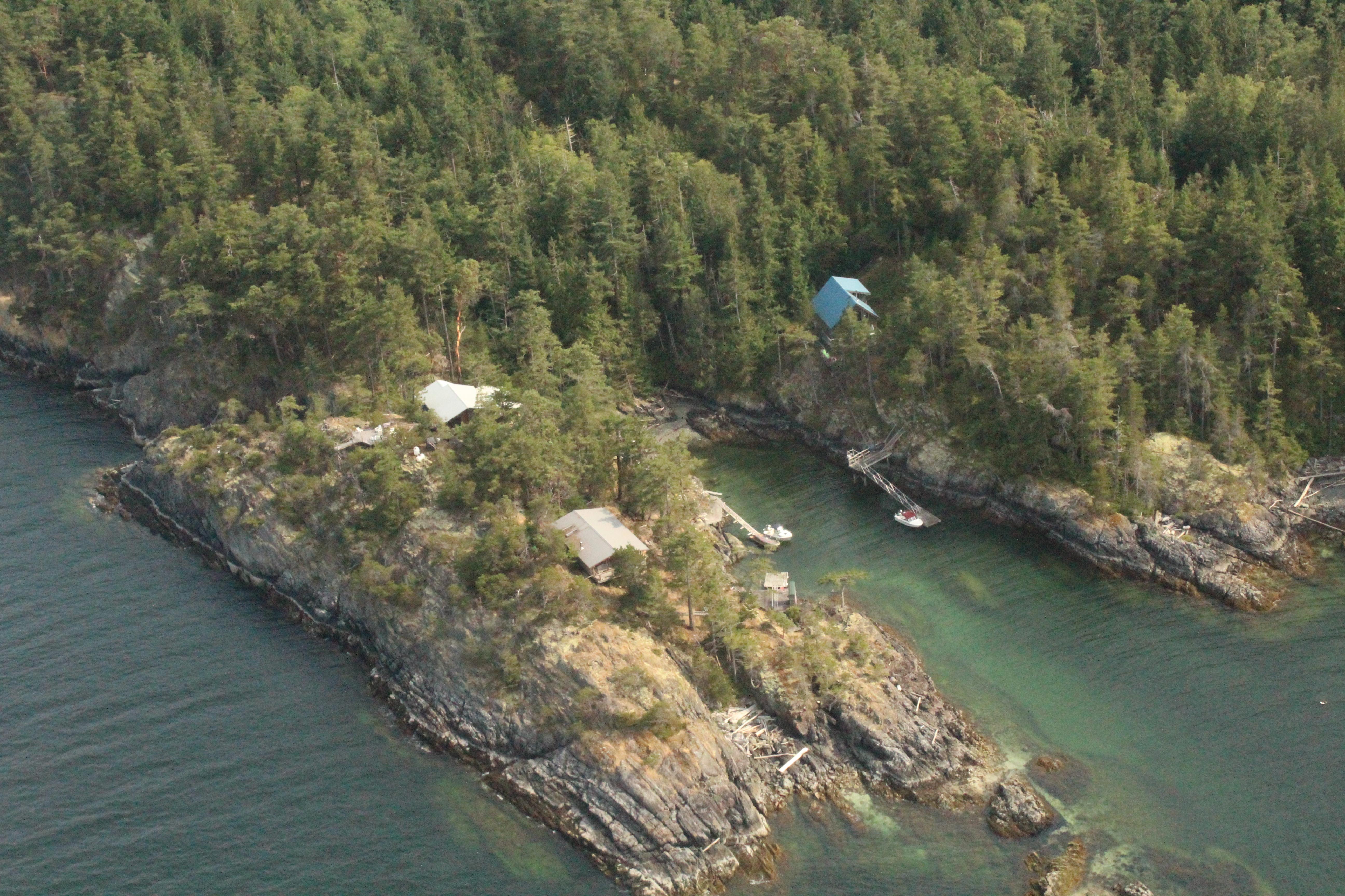
Halfmoon Bay (xwilkway in ''she shashishalhem'', the Sechelt language) is a small community of about 2,800 people, many of whom are only summer residents. It is a large scalloped bay protected from the open sea by South Thormanby Island and Vancouver Island. It encompasses a small village of permanent homes, summer cottages and five regional parks on the Sunshine Coast (British Columbia), Sunshine Coast of British Columbia. It belongs to Electoral Area B in the Sunshine Coast Regional District. The community can be reached by the uniquely named Redrooffs Road, so-called because a popular local resort once featured a cluster of tourist cabins, all with red roofs. Some homes are also located off British Columbia Highway 101, Highway 101. Halfmoon Bay Elementary School, the community's only elementary school, has 200–300 students ranging from kindergarten to grade seven. This school has performed extremely well for one of its size, achieving BC / Foundation Skills Assessment (FS ... [...More Info...] [...Related Items...] OR: [Wikipedia] [Google] [Baidu] |
Sechelt Language
The Sechelt language, ''Sháshíshálh'' or ''Shashishalhem'' (), is a Coast Salish language spoken by the Shishalh (Sechelt) people of the Pacific Northwest Coast. It is spoken in the area now called southwestern British Columbia, Canada, centred on their reserve communities in the Sechelt Peninsula area of the Sunshine Coast. In 1999, the language was spoken by fewer than 40 elderly people. A grammar of the language by linguist Ron Beaumont was published in 1985. They now only have 7 elderly/fluent speakers, but have many teachers that teach children from preschool all the way through till high school. UBC, Vancouver and Okanagan offers language courses, that give students the opportunity to learn various languages, Shashishalhem being one of the few In 2014, the Coastal Corridor Consortium, "an entity made up of board members from First Nations and educational partners to improve aboriginal access to and performance in postsecondary education and training", created a Se ... [...More Info...] [...Related Items...] OR: [Wikipedia] [Google] [Baidu] |
Coast Salish Peoples
The Coast Salish is a group of ethnically and linguistically related Indigenous peoples of the Pacific Northwest Coast, living in the Canadian province of British Columbia and the U.S. states of Washington and Oregon. They speak one of the Coast Salish languages. The Nuxalk (Bella Coola) nation are usually included in the group, although their language is more closely related to Interior Salish languages. The Coast Salish are a large, loose grouping of many nations with numerous distinct cultures and languages. Territory claimed by Coast Salish peoples span from the northern limit of the Salish Sea on the inside of Vancouver Island and covers most of southern Vancouver Island, all of the Lower Mainland and most of Puget Sound and the Olympic Peninsula (except for territories of now-extinct Chemakum people). Their traditional territories coincide with modern major metropolitan areas, namely Victoria, Vancouver, and Seattle. The Tillamook or Nehalem around Tillamook, Oregon ar ... [...More Info...] [...Related Items...] OR: [Wikipedia] [Google] [Baidu] |
Designated Places In British Columbia
A designated place is a type of geographic unit used by Statistics Canada to disseminate census data. It is usually "a small community that does not meet the criteria used to define incorporated municipalities or Statistics Canada population centres (areas with a population of at least 1,000 and no fewer than 400 persons per square kilometre)." Provincial and territorial authorities collaborate with Statistics Canada in the creation of designated places so that data can be published for sub-areas within municipalities. Starting in 2016, Statistics Canada allowed the overlapping of designated places with population centres. In the 2021 Census of Population, British Columbia had 332 designated places, an increase from 326 in 2016. Designated place types in British Columbia include 55 Indian reserves, 13 island trusts, 5 Nisga'a villages, 5 retired population centres, and 254 unincorporated places. In 2021, the 332 designated places had a cumulative population of 258,060 and an ... [...More Info...] [...Related Items...] OR: [Wikipedia] [Google] [Baidu] |
Environment Canada
Environment and Climate Change Canada (ECCC; french: Environnement et Changement climatique Canada),Environment and Climate Change Canada is the applied title under the Federal Identity Program; the legal title is Department of the Environment (). is the department of the Government of Canada responsible for coordinating environmental policies and programs, as well as preserving and enhancing the natural environment and renewable resources. It is also colloquially known by its former name, Environment Canada (EC; french: Environnement Canada, links=no). The minister of environment and climate change has been Steven Guilbeault since October 26, 2021; Environment and Climate Change Canada supports the minister's mandate to: "preserve and enhance the quality of the natural environment, including water, air, soil, flora and fauna; conserve Canada's renewable resources; conserve and protect Canada's water resources; forecast daily weather conditions and warnings, and provide detaile ... [...More Info...] [...Related Items...] OR: [Wikipedia] [Google] [Baidu] |
Oceanic Climate
An oceanic climate, also known as a marine climate, is the humid temperate climate sub-type in Köppen classification ''Cfb'', typical of west coasts in higher middle latitudes of continents, generally featuring cool summers and mild winters (for their latitude), with a relatively narrow annual temperature range and few extremes of temperature. Oceanic climates can be found in both hemispheres generally between 45 and 63 latitude, most notably in northwestern Europe, northwestern America, as well as New Zealand. Precipitation Locations with oceanic climates tend to feature frequent cloudy conditions with precipitation, low hanging clouds, and frequent fronts and storms. Thunderstorms are normally few, since strong daytime heating and hot and cold air masses meet infrequently in the region. In most areas with an oceanic climate, precipitation comes in the form of rain for the majority of the year. However, some areas with this climate see some snowfall annually during winter. M ... [...More Info...] [...Related Items...] OR: [Wikipedia] [Google] [Baidu] |
Mediterranean Climate
A Mediterranean climate (also called a dry summer temperate climate ''Cs'') is a temperate climate sub-type, generally characterized by warm, dry summers and mild, fairly wet winters; these weather conditions are typically experienced in the majority of Mediterranean-climate regions and countries, but remain highly dependent on proximity to the ocean, altitude and geographical location. This climate type's name is in reference to the coastal regions of the Mediterranean Sea within the Mediterranean Basin, where this climate type is most prevalent. The "original" Mediterranean zone is a massive area, its western region beginning with the Iberian Peninsula in southwestern Europe and coastal regions of northern Morocco, extending eastwards across southern Europe, the Balkans, and coastal Northern Africa, before reaching a dead-end at the Levant region's coastline. Mediterranean climate zones are typically located along the western coasts of landmasses, between roughly 30 and 45 ... [...More Info...] [...Related Items...] OR: [Wikipedia] [Google] [Baidu] |
Squamish People
The Squamish people (Squamish language, Squamish: ''Skwxwú7mesh'' , historically transliterated as Sko-ko-mish) are an Indigenous peoples of the Pacific Northwest Coast, indigenous people of the Pacific Northwest Coast. Archaeological evidence shows they have lived in the area for more than a thousand years. In 2012, there was population of 3,893 band members registered with the Squamish Nation. Their language is the Squamish language or ''Sḵwx̱wú7mesh snichim'', considered a part of the Coast Salish languages, and is categorized as Language extinction, nearly extinct with just 10 fluent speakers as of 2010. The traditional territory is in the area now in southwestern British Columbia, Canada, and covers Point Grey as the southern border. From here, it continues northward to Roberts Creek, British Columbia, Roberts Creek on the Sunshine Coast (British Columbia), Sunshine Coast, up the Howe Sound. The northern part includes the Squamish River, Squamish, Cheakamus River, Cheaka ... [...More Info...] [...Related Items...] OR: [Wikipedia] [Google] [Baidu] |
Sechelt
Sechelt (, Shishalh language chat'lich) is a district municipality located on the lower Sunshine Coast of British Columbia. Approximately 50 km northwest of Vancouver, it is accessible from mainland British Columbia by a 40-minute ferry trip between Horseshoe Bay and Langdale, and a 25-minute drive from Langdale along Highway 101, also known as the Sunshine Coast Highway. The name ''Sechelt'' is derived from the Sechelt language word, ''shishalh,'' the name of the First Nations people who first settled the area thousands of years ago. The original Village of Sechelt was incorporated on February 15, 1956. Sechelt later expanded its boundaries in 1986 with the inclusion of a number of adjacent unincorporated areas. The District of Sechelt, as it is known today, encompasses some 39.71 km² (15.33 sq mi) at the isthmus of the Sechelt Peninsula, between the southern tip of Sechelt Inlet (Porpoise Bay) and the Strait of Georgia that separates the provincial mainland from V ... [...More Info...] [...Related Items...] OR: [Wikipedia] [Google] [Baidu] |
Roberts Creek, British Columbia
Roberts Creek is a community in the Sunshine Coast region of British Columbia, Canada. It is located in Area "D" of the Sunshine Coast Regional District. Roberts Creek sits roughly halfway between the Town of Gibsons and the District of Sechelt, the two main population centres on the southern Sunshine Coast. History To the Indigenous peoples of both the Squamish and Shishalh, Roberts Creek served as the border between the two peoples. Due to the several creeks that drain into the Strait of Georgia which offer seasonal runs of salmon, the native peoples chose to settle in Roberts Creek many centuries prior to European settlers. Roberts Creek is named for William Roberts, the first European settler in the area. During the 1960s many draft evaders from the U.S. settled in Roberts Creek. It is also well known for several communes formed during this time period. Infrastructure "Downtown" Roberts Creek is located at the beach, where Lower Road, Roberts Creek Road and Beach Av ... [...More Info...] [...Related Items...] OR: [Wikipedia] [Google] [Baidu] |
South Thormanby Island
South Thormanby Island (''sx̱welap'' in she shashishalhem) is an island off the Sunshine Coast of British Columbia, Canada, located 17 km west of Sechelt, and within the shared territories of the Tla'amin Nation and the shíshálh Nation. Simson Provincial Park, established in 1986 and named after pioneer Calvert Simson, occupies the majority of the southern part of South Thormanby Island. The northern half of the island is predominately private property, with a concentration of seasonal cottages along Buccaneer Bay and Water Bay. Geography South Thormanby Island forms part of the Gulf Islands, and is separated from the mainland of the Sunshine Coast by Welcome Passage. At low tide, the island is connected to its neighbour, North Thormanby Island, by a sand bridge. There are two main hills on the island: Mount Seafield in the south and Spy Glass Hill in the north. South of Mount Seafield, there is a large lake in an area known locally as "The Farm". The south island ... [...More Info...] [...Related Items...] OR: [Wikipedia] [Google] [Baidu] |
Elphinstone Secondary School
School District 46 Sunshine Coast is a school district in British Columbia, Canada. It covers an area in the Sunshine Coast region northwest of Greater Vancouver, including the communities of Gibsons, and Sechelt. The school district has a significant number of students with First Nations, Métis, and Inuit ancestry. It operates within the traditional territories of the shíshálh (Sechelt) Nation and the Skwxwu7mesh uxwumixw (Squamish Nation) and works with these First Nations to provide Aboriginal Programs and Services, including the sháshishálhem (shíshálh) Language and Culture Program. In partnership with the Sechelt Indian Band Education Department, these are offered at both elementary and secondary schools. Schools School board The current school board was elected in October 2022 for a four-year term. * Amanda Amaral (Board Chair) * Sue Giraard * Samantha Haines (BCSTA Provincial Councillor) * Maria Hampvent * Stacia Leech (Vice-chair) * Pammila Ruth (BCPSEA ... [...More Info...] [...Related Items...] OR: [Wikipedia] [Google] [Baidu] |


