|
Half Moon Bay, California
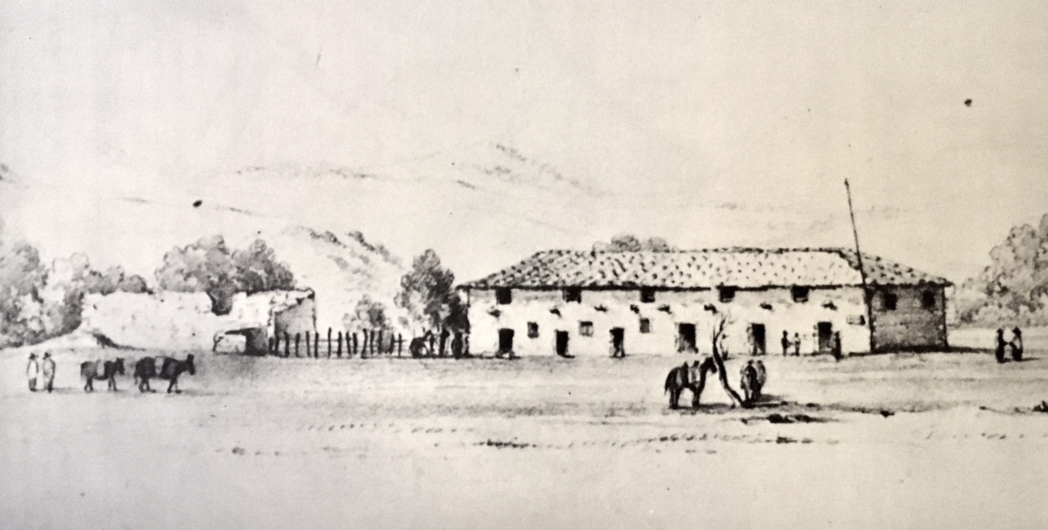
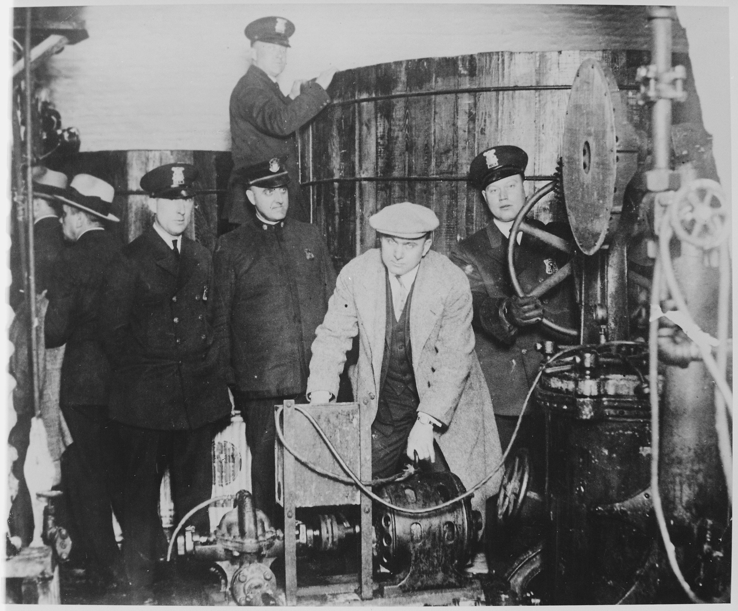
Half Moon Bay is a coastal city in San Mateo County, California, United States, approximately south of San Francisco. Its population was 11,795 2020 census. Immediately north of Half Moon Bay is Pillar Point Harbor and the unincorporated community of Princeton-by-the-Sea. Half Moon Bay is known for Mavericks, a big-wave surf location. It is called Half Moon Bay because of its crescent shape. Originally an agricultural outpost to Mission San Francisco de Asís, the town was founded in the 1840s first as San Benito, and then as its Anglo fishing community grew, it was renamed Spanishtown. In 1874, it was again renamed Half Moon Bay. After rail and road connections in the early 1900s, the town grew. The foggy weather of the coast made the town a popular destination for booze-running during Prohibition. The city's infrastructure is heavily integrated with the coast, including the Pillar Point Harbor, major roads, and the fire department. The economy of Half Moon Bay is domin ... [...More Info...] [...Related Items...] OR: [Wikipedia] [Google] [Baidu] |
List Of Municipalities In California
California is a U.S. state, state located in the Western United States. It is the List of U.S. states and territories by population, most populous state and the List of U.S. states and territories by area, third largest by area after Alaska and Texas. According to the 2020 United States Census, California has 39,538,223 inhabitants and of land. California has been inhabited by numerous Indigenous peoples of California, Native American peoples for thousands of years. The Spanish colonization of the Americas, Spanish, the Russian colonization of the Americas, Russians, and other Europeans began exploring and colonizing the area in the 16th and 17th centuries, with the Spanish establishing its first California Spanish missions in California, mission at what is now Presidio of San Diego, San Diego in 1769. After the Mexican Cession of 1848, the California Gold Rush brought worldwide attention to the area. The growth of the Cinema of the United States, movie industry in Los Angeles ... [...More Info...] [...Related Items...] OR: [Wikipedia] [Google] [Baidu] |
San Francisco
San Francisco, officially the City and County of San Francisco, is a commercial, Financial District, San Francisco, financial, and Culture of San Francisco, cultural center of Northern California. With a population of 827,526 residents as of 2024, San Francisco is the List of California cities by population, fourth-most populous city in the U.S. state of California and the List of United States cities by population, 17th-most populous in the United States. San Francisco has a land area of at the upper end of the San Francisco Peninsula and is the County statistics of the United States, fifth-most densely populated U.S. county. Among U.S. cities proper with over 250,000 residents, San Francisco is ranked first by per capita income and sixth by aggregate income as of 2023. San Francisco anchors the Metropolitan statistical area#United States, 13th-most populous metropolitan statistical area in the U.S., with almost 4.6 million residents in 2023. The larger San Francisco Bay Area ... [...More Info...] [...Related Items...] OR: [Wikipedia] [Google] [Baidu] |
Purissima
Purissima is a ghost town in southwestern San Mateo County, California, United States, near the junction of California State Route 1, State Route 1 and Verde Road. ''Purísima'' means "purest" in Spanish and is most commonly used in Spanish to refer to ''La Purísima Concepción'' (the Immaculate Conception) of the Virgin Mary (note historical misspelling in English resulting in double "s", or the result of the Holstein pronunciation with use of the "ẝ" being mistaken as ß "ss", or perhaps spelling comes from the local Portuguese influence, where the spelling from ''A Puríssima Conceição'' would be correct). Purissima is the name of the town used as the setting for Ross Macdonald's 1958 crime fiction novel 'The Doomsters'. History Located on José María Alviso's Rancho Cañada de Verde y Arroyo de la Purisima in a rural area four miles (6 km) south of Half Moon Bay, California, Half Moon Bay, the village was one of the earliest settlements on the San Mateo Count ... [...More Info...] [...Related Items...] OR: [Wikipedia] [Google] [Baidu] |
San Mateo, California
San Mateo ( ) is the most populous city in San Mateo County, California, United States, on the San Francisco Peninsula. It is part of the San Francisco Bay Area metropolitan region, and is located about south of San Francisco. San Mateo borders Burlingame, California, Burlingame to the north, Hillsborough, California, Hillsborough to the west, San Francisco Bay and Foster City, California, Foster City to the east and Belmont, California, Belmont to the south. The population was 105,661 at the 2020 United States census, 2020 census. Some of the biggest economic drivers for the city include technology, health care and education. History The earliest known settlers of the Bay Area were the Ramaytush people, since at least 10000 BC. Spanish era In 1789, the Spanish missionaries had named a Native Americans in the United States, Native American village along Laurel Creek as ''Los Laureles'' or the Laurels (Mission San Mateo, Mission Dolores, 1789). At the time of Mexican War of ... [...More Info...] [...Related Items...] OR: [Wikipedia] [Google] [Baidu] |
Rancho Miramontes
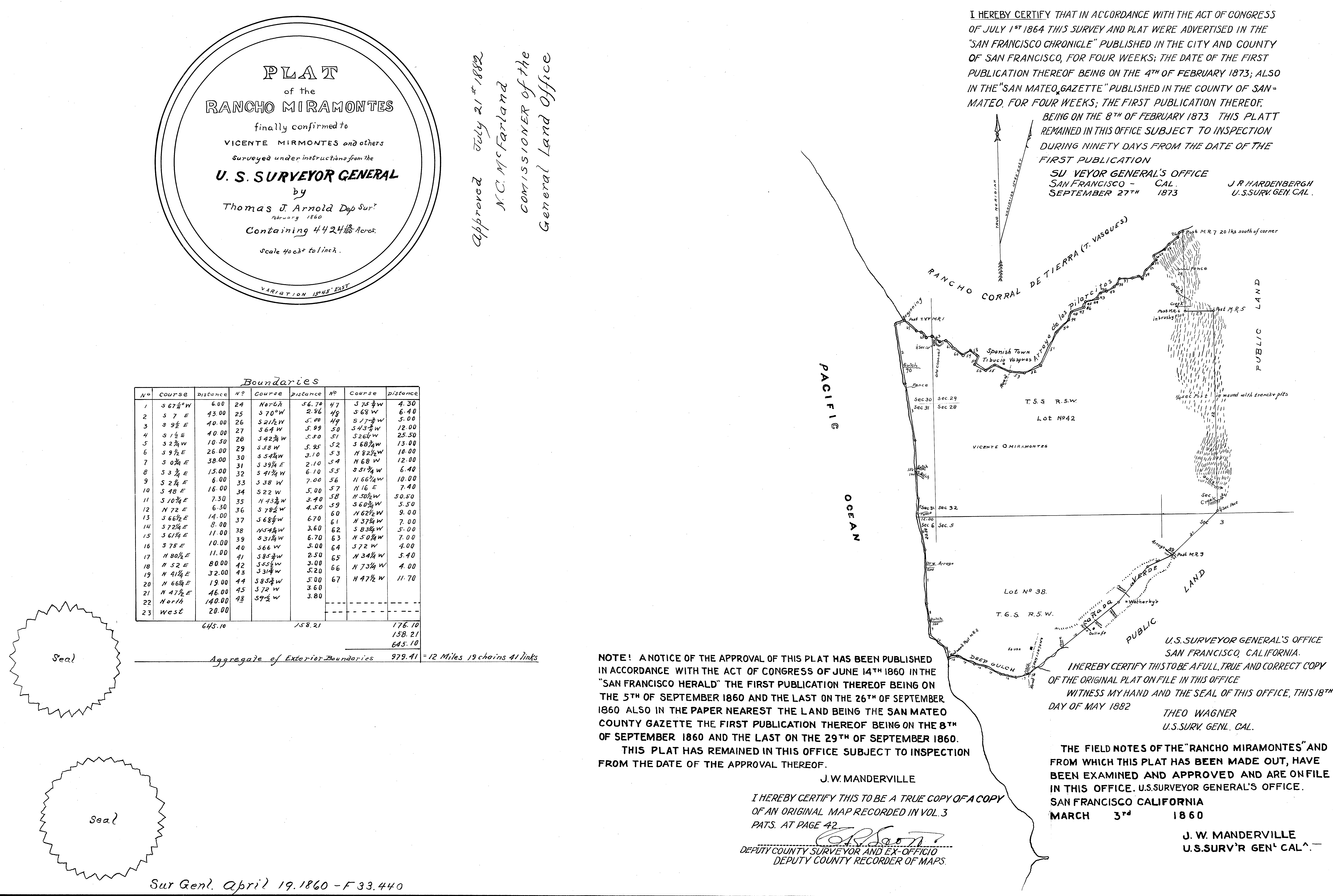
Rancho Miramontes (also called Arroyo de los Pilarcitos, Miramontes Rancho de San Benito, and Rancho San Benito) was a Mexican land grant in present-day San Mateo County, California, given in 1841 by Governor Juan B. Alvarado to Juan Jose Candelario Miramontes. Arroyo de los Pilarcitos means "creek of little pillars." The grant extended along the Pacific coast from Pilarcitos Creek and present day Half Moon Bay south past Miramontes Point to Canada Verdes. History Juan Jose Candelario Miramontes (1789–1846), came to Monterey with his parents in 1797 as part of the first settlers in Branciforte at Santa Cruz. Candelario Miramontes was a military officer at the Presidio of San Francisco, and he married Maria Guadalupe Briones (1793–1895) in 1808. In 1841 Governor Alvarado granted the one square league Rancho Arroyo de Los Pilarcitos (later called Rancho San Benito) to Juan Jose Candelario Miramontes. Candelario Miramontes remained in San Francisco and died the ... [...More Info...] [...Related Items...] OR: [Wikipedia] [Google] [Baidu] |
Ranchos Of California
In Alta California (now known as California) and Baja California, ranchos were concessions and land grants made by the Viceroyalty of New Spain, Spanish and History of Mexico, Mexican governments from 1775 to 1846. The Spanish concessions of land were made to retired soldiers as an inducement for them to settle in the frontier. These concessions reverted to the Spanish crown upon the death of the recipient. After independence, the Mexican government encouraged settlement in these areas by issuing much larger land grants to both native-born and naturalized Mexican citizens. The grants were usually two or more square league (unit), leagues, or in size. Unlike Spanish Concessions, Mexican land grants provided permanent, unencumbered ownership rights. Most ranchos granted by Mexico were located along the California coast around San Francisco Bay, inland along the Sacramento River, and within the San Joaquin Valley. When the Missions were secularized per the Mexican Secularizatio ... [...More Info...] [...Related Items...] OR: [Wikipedia] [Google] [Baidu] |
Rancho Corral De Tierra (Vasquez)
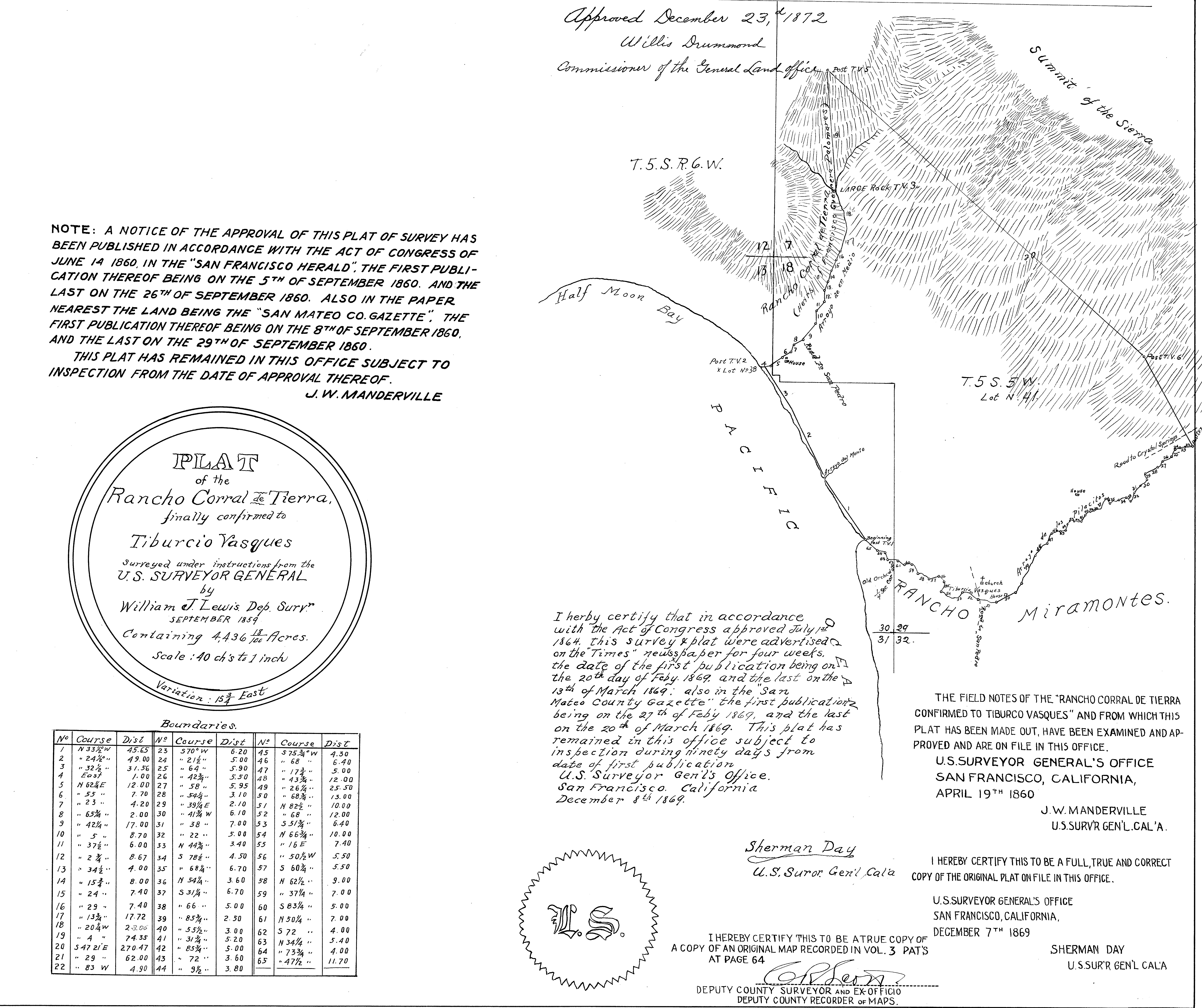
Rancho Corral de Tierra was a Mexican land grant in present-day coastal western San Mateo County, northern California. It was given in 1839 by Governor Pro-Tem Manuel Jimeno to José Tiburcio Vásquez. The name means “earthen corral” in Spanish. Jimeno granted Vasquez the smaller southern part of Rancho Corral de Tierra and the larger northern Rancho Corral de Tierra (Palomares) part to Francisco Guerrero y Palomares. The dividing line between the two grants was the Arroyo de en Medio just south of El Granada. The Vasquez portion extended along the Pacific coast south from El Granada to Pilarcitos Creek, and encompassed what is now the northern section of the city of Half Moon Bay. History José Tiburcio Vásquez (1795–1862), son of Jose Tiburcio Vásquez and Maria Antonia Bojorquez was born in the Pueblo of San José in Alta California. He served as a soldier at San Francisco Presidio and was administrator and major domo of Mission Dolores in Yerba Buena ... [...More Info...] [...Related Items...] OR: [Wikipedia] [Google] [Baidu] |
Sea Level Rise
The sea level has been rising from the end of the last ice age, which was around 20,000 years ago. Between 1901 and 2018, the average sea level rose by , with an increase of per year since the 1970s. This was faster than the sea level had ever risen over at least the past 3,000 years. The rate accelerated to /yr for the decade 2013–2022. Climate change due to human activities is the main cause. Between 1993 and 2018, melting ice sheets and glaciers accounted for 44% of sea level rise, with another 42% resulting from thermal expansion of water. Sea level rise lags behind changes in the Earth's temperature by decades, and sea level rise will therefore continue to accelerate between now and 2050 in response to warming that has already happened. What happens after that depends on future human greenhouse gas emissions. If there are very deep cuts in emissions, sea level rise would slow between 2050 and 2100. The reported factors of increase in flood hazard potential are often e ... [...More Info...] [...Related Items...] OR: [Wikipedia] [Google] [Baidu] |
Ritz-Carlton Half Moon Bay
The Ritz-Carlton Half Moon Bay is a luxury hotel and golf resort in Half Moon Bay northern California. The hotel is a Forbes Travel Guide, Forbes Five Star hotel, and was featured on the travel channel series Great Hotels. The hotel has 261 rooms, that in 2019, started at US$920 a night. The hotel began construction in 1998, and finished in 2001. The hotel is the biggest employer for the town of Half Moon Bay, California, with approximately 550 jobs. The hotel was purchased by Anbang Insurance Group in 2015, and after its bankruptcy has had repeated offers from other buyers, but as of September 2021 there were no buyers. The hotel sits on a point in the bay, that allows for views along a long section of the coast. Parts of the hotel services are themed around the Scottish Highlands. One of the two golf courses was designed by Arnold Palmer. The hotel services also include a spa and three tennis courts. Issues The hotel contributes most of the tourism income for the local Hal ... [...More Info...] [...Related Items...] OR: [Wikipedia] [Google] [Baidu] |
Prohibition In The United States
The Prohibition era was the period from 1920 to 1933 when the United States prohibited the production, importation, transportation, and sale of alcoholic beverages. The alcohol industry was curtailed by a succession of state legislatures, and Prohibition was formally introduced nationwide under the Eighteenth Amendment to the United States Constitution, ratified on January 16, 1919. Prohibition ended with the ratification of the Twenty-first Amendment to the United States Constitution, Twenty-first Amendment, which repealed the Eighteenth Amendment on December 5, 1933. Led by Pietism, Pietistic Protestantism in the United States, Protestants, prohibitionists first attempted to end the trade in alcoholic drinks during the 19th century. They aimed to heal what they saw as an ill society beset by alcohol-related problems such as alcoholism, domestic violence, and Saloon bar, saloon-based political corruption. Many communities introduced alcohol bans in the late 19th and early 20 ... [...More Info...] [...Related Items...] OR: [Wikipedia] [Google] [Baidu] |
Mission San Francisco De Asís
The Mission San Francisco de Asís (), also known as Mission Dolores, is a historic Catholic Church, Catholic church complex in San Francisco, San Francisco, California. Operated by the Archdiocese of San Francisco, the complex was founded in the 18th century by Catholic Church in Spain, Spanish Catholic missionaries. The mission contains two historic buildings: * The Mission Dolores adobe chapel was constructed in 1780s. It is the oldest structure in San Francisco. * The Mission Dolores Basilica was constructed in 1918. It was designated a minor basilica by Pope Pius XII in 1952. Located in the Mission District, the mission was founded on October 9, 1776, by Frs Francisco Palóu and Pedro Benito Cambón. The Franciscans, Franciscan Order sent the two priests to the then Spanish Province of Alta California to bring in Spanish people, Spanish settlers and evangelism, evangelize the indigenous Ohlone, Ohlone people. The Ohlone provided most the labor which built the adobe chapel ... [...More Info...] [...Related Items...] OR: [Wikipedia] [Google] [Baidu] |


