|
Hakone Turnpike
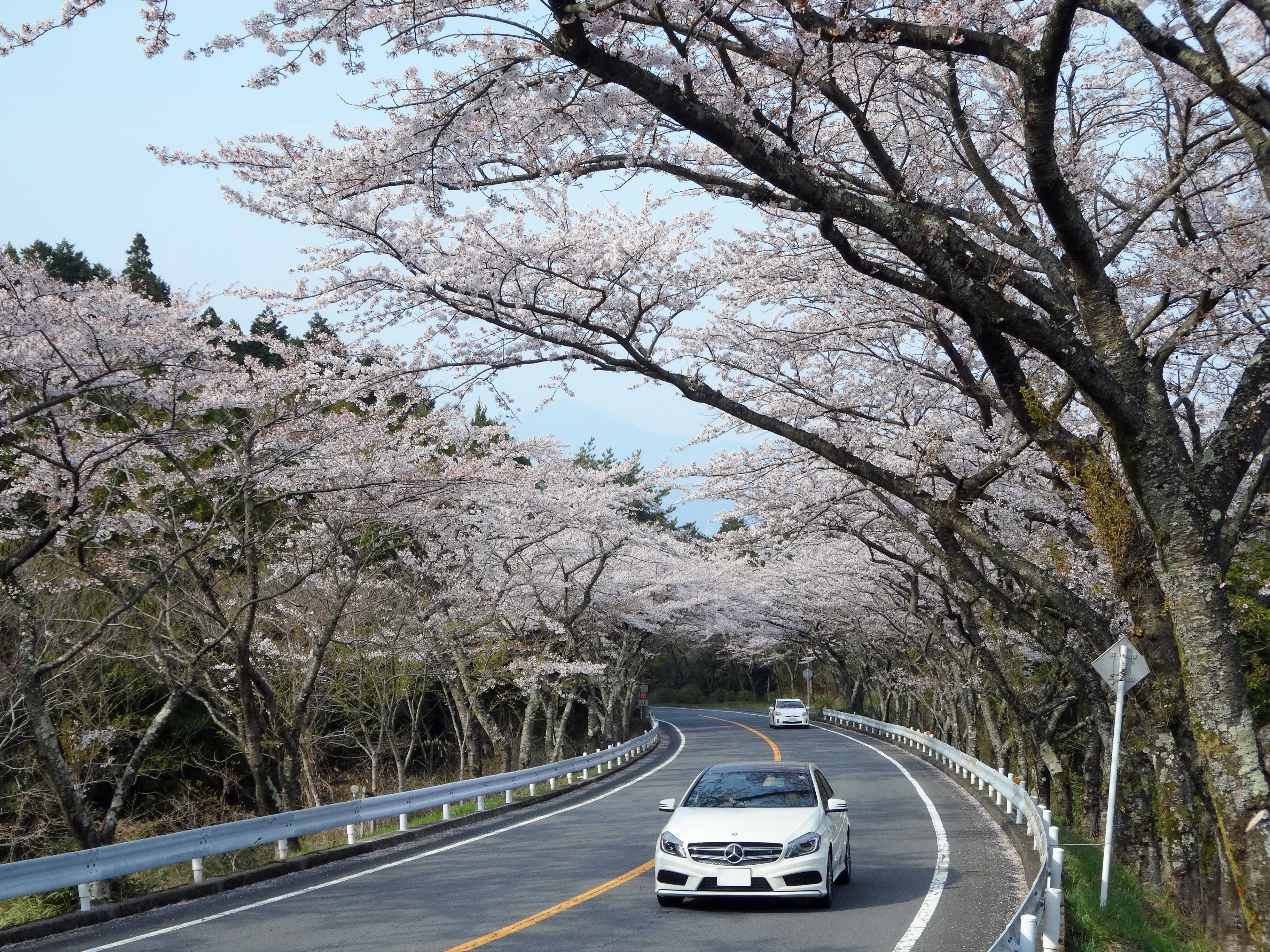
Hakone Turnpike (), is a 15.752 km toll road in Kanagawa Prefecture, Japan, connecting Odawara with Yugawara, via Hakone. Hakone Turnpike opened as an important bypass road of Hakone Shindō, the busy, mountainous part of National Route 1, on February 16, 1955. It is now owned by Central Nippon Expressway Company's Hakone Turnpike subsidiary. See also *Ashinoko Skyline Ashinoko Skyline () or Lake Ashi Skyline, is a 10.75 km toll road in Kanagawa, Japan, connecting National Route 1 near Hakone Pass, with Kojiri on the northern shores of Lake Ashi. The entire length of Ashinoko Skyline opened in 1972, an ..., another toll road in the Hakone area References External links {{Commons category, Hakone Turnpike Hakone Turnpikein Japanese Hakone, Kanagawa Yugawara, Kanagawa Roads in Kanagawa Prefecture ... [...More Info...] [...Related Items...] OR: [Wikipedia] [Google] [Baidu] |
Hakone Turnpike 20140412-1
is a town in Kanagawa Prefecture, Japan. , the town had a population of 11,293 and a population density of 122 persons per km². The total area of the town is . The town is a popular tourist destination due to its many hot springs and views of Mount Fuji. Geography Hakone is located in the mountains in the far west of the prefecture, on the eastern side of Hakone Pass. Most of the town is within the borders of the volcanically active Fuji-Hakone-Izu National Park, centered on Lake Ashi. Surrounding municipalities Kanagawa Prefecture *Odawara *Yugawara * Minami-ashigara Shizuoka Prefecture' *Gotemba *Susono *Mishima * Oyama *Kannami Climate Hakone has a Humid subtropical climate (Köppen ''Cfa'') characterized by warm summers and cool winters with light to no snowfall. The average annual temperature in Hakone is 13.3 °C. The average annual rainfall is 2221 mm with September as the wettest month. The temperatures are highest on average in August, at around 24.0 � ... [...More Info...] [...Related Items...] OR: [Wikipedia] [Google] [Baidu] |
Toll Road
A toll road, also known as a turnpike or tollway, is a public or private road (almost always a controlled-access highway in the present day) for which a fee (or ''toll'') is assessed for passage. It is a form of road pricing typically implemented to help recoup the costs of road construction and maintenance. Toll roads have existed in some form since antiquity, with tolls levied on passing travelers on foot, wagon, or horseback; a practice that continued with the automobile, and many modern tollways charge fees for motor vehicles exclusively. The amount of the toll usually varies by vehicle type, weight, or number of axles, with freight trucks often charged higher rates than cars. Tolls are often collected at toll plazas, toll booths, toll houses, toll stations, toll bars, toll barriers, or toll gates. Some toll collection points are automatic, and the user deposits money in a machine which opens the gate once the correct toll has been paid. To cut costs and minimise time delay, ... [...More Info...] [...Related Items...] OR: [Wikipedia] [Google] [Baidu] |
Kanagawa, Japan
is a Prefectures of Japan, prefecture of Japan located in the Kantō region of Honshu. Kanagawa Prefecture is the List of Japanese prefectures by population, second-most populous prefecture of Japan at 9,221,129 (1 April 2022) and third-densest at . Its geographic area of makes it fifth-smallest. Kanagawa Prefecture borders Tokyo to the north, Yamanashi Prefecture to the northwest and Shizuoka Prefecture to the west. Yokohama is the capital and largest city of Kanagawa Prefecture and the List of cities in Japan, second-largest city in Japan, with other major cities including Kawasaki, Kanagawa, Kawasaki, Sagamihara, and Fujisawa, Kanagawa, Fujisawa. Kanagawa Prefecture is located on Japan's eastern Pacific coast on Tokyo Bay and Sagami Bay, separated by the Miura Peninsula, across from Chiba Prefecture on the Bōsō Peninsula. Kanagawa Prefecture is part of the Greater Tokyo Area, the most populous metropolitan area in the world, with Yokohama and many of its cities being ma ... [...More Info...] [...Related Items...] OR: [Wikipedia] [Google] [Baidu] |
Japan
Japan ( ja, 日本, or , and formally , ''Nihonkoku'') is an island country in East Asia. It is situated in the northwest Pacific Ocean, and is bordered on the west by the Sea of Japan, while extending from the Sea of Okhotsk in the north toward the East China Sea, Philippine Sea, and Taiwan in the south. Japan is a part of the Ring of Fire, and spans Japanese archipelago, an archipelago of List of islands of Japan, 6852 islands covering ; the five main islands are Hokkaido, Honshu (the "mainland"), Shikoku, Kyushu, and Okinawa Island, Okinawa. Tokyo is the Capital of Japan, nation's capital and largest city, followed by Yokohama, Osaka, Nagoya, Sapporo, Fukuoka, Kobe, and Kyoto. Japan is the List of countries and dependencies by population, eleventh most populous country in the world, as well as one of the List of countries and dependencies by population density, most densely populated and Urbanization by country, urbanized. About three-fourths of Geography of Japan, the c ... [...More Info...] [...Related Items...] OR: [Wikipedia] [Google] [Baidu] |
Odawara, Kanagawa
is a city in Kanagawa Prefecture, Japan. , the city had an estimated population of 188,482 and a population density of 1,700 persons per km2. The total area of the city is . Geography Odawara lies in the Ashigara Plains, in the far western portion of Kanagawa Prefecture at the southwestern tip of the Kantō region. It is bordered by the Hakone Mountains to the north and west, the Sakawa River to the east, and Sagami Bay of the Pacific Ocean to the south. Surrounding municipalities Kanagawa Prefecture * Minamiashigara * Ninomiya * Ōi, Kaisei, Nakai *Hakone, Hakone, Manazuru, Yugawara Climate Odawara has a humid subtropical climate (Köppen ''Cfa'') characterized by warm summers and cool winters with light to no snowfall. The average annual temperature in Odawara is 13.4 °C. The average annual rainfall is 2,144 mm with September as the wettest month. The temperatures are highest on average in August, at around 24.2 °C, and lowest in January, at around 2.9& ... [...More Info...] [...Related Items...] OR: [Wikipedia] [Google] [Baidu] |
Yugawara
is a town located in Ashigarashimo District, Kanagawa Prefecture, Japan. , the town had an estimated population of 23,267 and a population density of 570 persons per km2. The total area of the town is . Geography Yugawara is located in the far southwestern corner of the prefecture. The center of the town is located in the lowlands between the southern foot of Mount Hakone and the Sagami Bay. Much of the terrain formed by an eroded Quaternary volcano. In the northeast, bordering Manazuru Town, are gentle foothills where residential areas and mandarin orange fields coexist. In the south, hot spring resorts and residential areas are clustered along the north side of the Chitose River. The coastline has a sandy beach with a length of about 700 meters, which is crowded with swimmers in the summer. Surrounding municipalities Kanagawa Prefecture * Odawara * Manazuru * Hakone Shizuoka Prefecture * Atami * Kannami Climate Yugawara has a Humid subtropical climate (Köppen ''Cfa'') c ... [...More Info...] [...Related Items...] OR: [Wikipedia] [Google] [Baidu] |
Hakone
is a town in Kanagawa Prefecture, Japan. , the town had a population of 11,293 and a population density of 122 persons per km². The total area of the town is . The town is a popular tourist destination due to its many hot springs and views of Mount Fuji. Geography Hakone is located in the mountains in the far west of the prefecture, on the eastern side of Hakone Pass. Most of the town is within the borders of the volcanically active Fuji-Hakone-Izu National Park, centered on Lake Ashi. Surrounding municipalities Kanagawa Prefecture *Odawara *Yugawara * Minami-ashigara Shizuoka Prefecture' *Gotemba * Susono *Mishima * Oyama *Kannami Climate Hakone has a Humid subtropical climate (Köppen ''Cfa'') characterized by warm summers and cool winters with light to no snowfall. The average annual temperature in Hakone is 13.3 °C. The average annual rainfall is 2221 mm with September as the wettest month. The temperatures are highest on average in August, at around 24.0 ... [...More Info...] [...Related Items...] OR: [Wikipedia] [Google] [Baidu] |
Bypass Road
A bypass is a road or highway that avoids or "bypasses" a built-up area, town, or village, to let through traffic flow without interference from local traffic, to reduce congestion in the built-up area, and to improve road safety. A bypass specifically designated for trucks may be called a truck route. If there are no strong land use controls, buildings are often built in town along a bypass, converting it into an ordinary town road, and the bypass may eventually become as congested as the local streets it was intended to avoid. Petrol stations, shopping centres and some other businesses are often built there for ease of access, while homes are often avoided for noise and pollution reasons. Bypass routes are often controversial, as they require the building of a road carrying heavy traffic where no road previously existed. This creates a conflict between those who support a bypass to reduce congestion in a built up area, and those who oppose the development of (often rural) und ... [...More Info...] [...Related Items...] OR: [Wikipedia] [Google] [Baidu] |
Hakone Shindō
The (lit. New Hakone Road) is a 2-laned toll road in Hakone, Kanagawa, Japan. It is owned and managed by Central Nippon Expressway Company. Overview Officially the road is designated as a bypass for National Route 1. It is also classified as a road for and access is controlled with interchanges in a similar manner to national expressways in Japan. However unlike most other roads operated by Central Nippon Expressway Company, the Hakone Shindō is not designed for high speeds due to the steep gradient and sharp turns. The road originates in the town of Hakone and follows a westerly course, ascending into mountainous areas. The road terminates at Hakone Pass, where the road meets the old Tōkaidō Highway and which serves as the boundary separating Kanagawa and Shizuoka Prefectures. Beyond Hakone Pass National Route 1 descends from the mountains into the city of Mishima to the west. Tolls are collected at a toll plaza near the eastern terminus. The toll for a regular passenger ... [...More Info...] [...Related Items...] OR: [Wikipedia] [Google] [Baidu] |
National Route 1 (Japan)
is a major highway on the island of Honshū in Japan. It connects Chūō, Tokyo in the Kantō region with the city of Osaka, Osaka Prefecture in the Kansai region, passing through the Chūbu region en route. It follows the old Tōkaidō westward from Tokyo to Kyoto, and the old Kyo Kaidō from there to Osaka. Between Tokyo and Aichi Prefecture it parallels the Tomei Expressway; from there to Mie Prefecture, the Higashi-Meihan Expressway, and from Shiga Prefecture to Osaka, the Meishin Expressway. It has a total length of . At its eastern terminus in Nihonbashi, Chūō, Tokyo, it meets National Routes 4, 6, 14, 15, 17, and 20. At its western terminus in Umeda, Kita-ku, Osaka, it links with Routes 2, 25, 26 and other highways. National Route 1 links Tokyo to the important prefectural capitals of Yokohama (Kanagawa Prefecture), Shizuoka, Nagoya (Aichi Prefecture), Otsu (Shiga Prefecture), Kyoto, and Osaka. It is the modern incarnation of the pre-modern Tōkaidō. Rou ... [...More Info...] [...Related Items...] OR: [Wikipedia] [Google] [Baidu] |
Central Nippon Expressway Company
The , abbreviated as , is one of the main operators of expressways and toll roads in Japan. It is headquartered in Nagoya, Aichi Prefecture. The company was established on October 1, 2005 as a result of the privatization of Japan Highway Public Corporation. The company manages roadways mainly in the Tōkai and Hokuriku regions. Roadways in other regions of Japan are managed by East Nippon Expressway Company and West Nippon Expressway Company The , abbreviated as , is one of the main operators of expressways and toll roads in Japan. It is headquartered on the 19th floor of Dojima Avanza in Kita-ku, Osaka. The company was established on October 1, 2005, as a result of the privatization o .... References External links * - In Japanese * - In English Expressway companies of Japan Companies based in Nagoya Transport in Aichi Prefecture Government-owned companies of Japan Transport companies established in 2005 Japanese companies established in 2005 {{japan-com ... [...More Info...] [...Related Items...] OR: [Wikipedia] [Google] [Baidu] |
Ashinoko Skyline
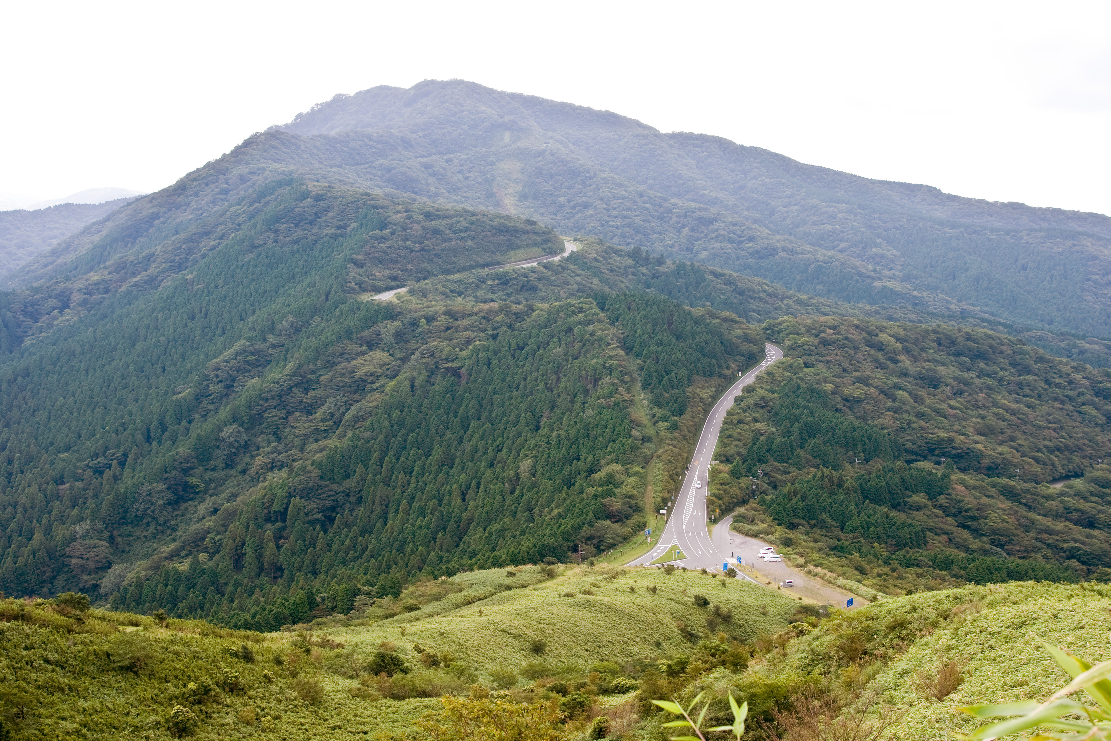
Ashinoko Skyline () or Lake Ashi Skyline, is a 10.75 km toll road in Kanagawa, Japan, connecting National Route 1 near Hakone Pass, with Kojiri on the northern shores of Lake Ashi. The entire length of Ashinoko Skyline opened in 1972, and goes over the scenic route of the outer volcanic ridge of Mount Hakone, with the views of Mount Fuji in the west, and Lake Ashi in the east. It is one of the first of the 50 or so scenic "Skyline" roads that followed in Japan, named after Skyline Drive in Shenandoah National Park over the Blue Ridge Mountains of Virginia, U.S. See also *Hakone Turnpike Hakone Turnpike (), is a 15.752 km toll road in Kanagawa Prefecture, Japan, connecting Odawara with Yugawara, via Hakone. Hakone Turnpike opened as an important bypass road of Hakone Shindō, the busy, mountainous part of National Route 1, ... References External links {{Commons category, Ashinoko SkylineOfficial sitein JapaneseAshinoko Skylinein English and other languages ... [...More Info...] [...Related Items...] OR: [Wikipedia] [Google] [Baidu] |


