|
Hafelekarspitze
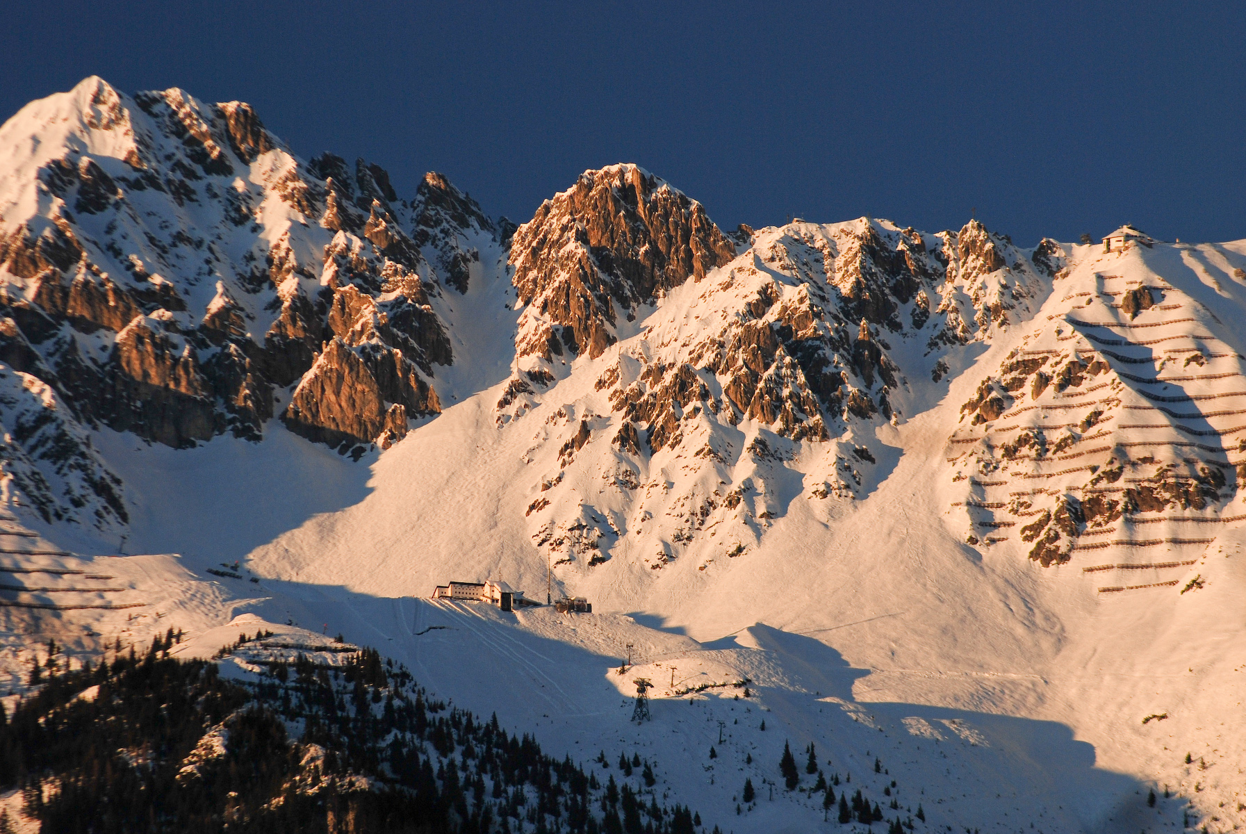
The Hafelekarspitze is a mountain in the so-called North Chain (''Nordkette'') north of Innsbruck in Austria. Location and landscape Below and west of the summit is the top station of ''Hafelekar'', the second section of the Nordkette Cable Car at a height of , from where the Hafelekarspitze may be reached in a few minutes by foot on a metalled path. Not far from there is the Hafelekar Survey Station, a cosmic radiation observatory of the University of Innsbruck, the only one of its kind in Austria. It was here in 1937 that physicists Marietta Blau and Hertha Wambacher using Nuclear emulsion plates, made the first ever observation of nuclear disintegration 'stars' (Zertrümmerungsterne) caused by cosmic rays striking nuclei in the emulsion.Marietta Blau and Hertha Wambacher: ''Disintegration Processes by Cosmic Rays with the Simultaneou Emission of Several Heavy Particles'', Nature 140: 585 (1937). File:Gipfelkreuz Hafelekar.JPG, Summit cross on the Hafelekarspitze File:Bergs ... [...More Info...] [...Related Items...] OR: [Wikipedia] [Google] [Baidu] |
Nordkette Cable Car
The Nordkette Cable Car (german: Nordkettenbahn) in the Austrian state of Tyrol is a gondola lift from Innsbruck to the Nordkette, the southernmost mountain chain of the Karwendel. It runs in two sections from the Innsbruck quarter of Hungerburg via Seegrube Station () to the top station, Hafelekar (). The cableway is the heart of the ''Innsbrucker Nordkettenbahnen'' ski area. [Baidu] |
Nuclear Emulsion
A nuclear emulsion plate is a type of particle detector first used in nuclear and particle physics experiments in the early decades of the 20th century. https://cds.cern.ch/record/1728791/files/vol6-issue5-p083-e.pdf''The Study of Elementary Particles by the Photographic Method'', C.F.Powell, P.H.Fowler, D.H.Perkins: Pergamon Press, New York, 1959.Walter H. Barkas, ''Nuclear Research Emulsions I. Techniques and Theory'', in ''Pure and Applied Physics: A Series of Monographs and Textbooks, Vol. 15'', Academic Press, New York and London, 1963. http://becquerel.jinr.ru/text/books/Barkas_NUCL_RES_EMULSIONS.pdf It is a modified form of photographic plate that can be used to record and investigate fast charged particles like alpha-particles, nucleons, leptons or mesons. After exposing and developing the emulsion, single particle tracks can be observed and measured using a microscope. Description The nuclear emulsion plate is a modified form of photographic plate, coated with a thick ... [...More Info...] [...Related Items...] OR: [Wikipedia] [Google] [Baidu] |
North Chain
The Nordkette, also variously called the North Chain, Northern Range, rarely the Inn Valley Range or Inn Valley Chain (''Inntalkette''), is a range of mountains just north of the city of Innsbruck in Austria. It is the southernmost of the four great mountain chains in the Karwendel. To the west it is linked by the Erl Saddle to the Erlspitze Group, to the east via the ''Stempeljoch'' saddle () to the Gleirsch-Halltal Range. To the south it is bounded by the Inn valley. Its highest summit is the Kleiner Solstein () in the west of the range. The Nordkette is served by the Nordkette Cable Car, which offers easy access to the ski area and the Innsbruck Klettersteig. The latter starts in the east, near ''Hafelekar'' station () on the Nordkette Cable Car, and runs via the Seegrubenspitze, the Kemacher and the ''Langen Sattel'' to Frau Hitt and the Frau Hitt Saddle in the west. In addition, the Goethe Way (''Goetheweg'') runs from Hafelekar Station along the arête eastwards to the Pfe ... [...More Info...] [...Related Items...] OR: [Wikipedia] [Google] [Baidu] |
Innsbruck
Innsbruck (; bar, Innschbruck, label=Bavarian language, Austro-Bavarian ) is the capital of Tyrol (state), Tyrol and the List of cities and towns in Austria, fifth-largest city in Austria. On the Inn (river), River Inn, at its junction with the Wipptal, Wipp Valley, which provides access to the Brenner Pass to the south, it had a population of 132,493 in 2018. In the broad valley between high mountains, the so-called North Chain in the Karwendel Alps (Hafelekarspitze, ) to the north and Patscherkofel () and Serles () to the south, Innsbruck is an internationally renowned winter sports centre; it hosted the 1964 Winter Olympics, 1964 and 1976 Winter Olympics as well as the 1984 Winter Paralympics, 1984 and 1988 Winter Paralympics. It also hosted the first 2012 Winter Youth Olympics, Winter Youth Olympics in 2012. The name means "bridge over the Inn". History Antiquity The earliest traces suggest initial inhabitation in the early Stone Age. Surviving Ancient Rome, pre-Roman pla ... [...More Info...] [...Related Items...] OR: [Wikipedia] [Google] [Baidu] |
Karwendel
The Karwendel is the largest mountain range of the Northern Limestone Alps. The major part belongs to the Austrian federal state of Tyrol (state), Tyrol, while the adjacent area in the north is part of Bavaria, Germany. Four mountain chain, chains stretch from west to east; in addition, there are a number of fringe ranges and an extensive promontory (''Vorkarwendel'') in the north. Geography The term Karwendel describes the part of the Alps between the Isar river and the Seefeld Saddle mountain pass in the west and Achen Lake in the east. In the north it stretches to the Bavarian Prealps. In the south the Lower Inn Valley with the city of Innsbruck separates the Karwendel from the Central Eastern Alps. Other major settlements include Seefeld in Tirol and Mittenwald in the west, as well as Eben am Achensee in the east. Neighbouring ranges are the Wetterstein and Mieming Range, Mieming Mountains in the west and the Brandenberg Alps in the east. The mountaineer Hermann von Barth cre ... [...More Info...] [...Related Items...] OR: [Wikipedia] [Google] [Baidu] |
Inn Valley Chain
Inns are generally establishments or buildings where travelers can seek lodging, and usually, food and drink. Inns are typically located in the country or along a highway; before the advent of motorized transportation they also provided accommodation for horses. History Inns in Europe were possibly first established when the Romans built their system of Roman roads two millennia ago. Many inns in Europe are several centuries old. In addition to providing for the needs of travelers, inns traditionally acted as community gathering places. Historically, inns provided not only food and lodging, but stabling and fodder for the travelers' horses, as well. Famous London examples of inns include The George Inn, Southwark, The George and The Tabard. However, there is no longer a formal distinction between an inn and several other kinds of establishments: many pubs use the name "inn", either because they are long established and may have been formerly coaching inns, or to summon up ... [...More Info...] [...Related Items...] OR: [Wikipedia] [Google] [Baidu] |
Two-thousanders Of Austria
Two-thousanders are mountains that have a height of at least 2,000 metres above sea level, but less than 3,000 metres. The term is used in Alpine circles, especially in Europe (e.g. German: ''Zweitausender''). The two photographs show two typical two-thousanders in the Alps that illustrate different types of mountain. The Säuling (top) is a prominent, individual peak, whereas the Schneeberg (bottom) is an elongated limestone massif. In ranges like the Allgäu Alps, the Gesäuse or the Styrian-Lower Austrian Limestone Alps the mountain tour descriptions for mountaineers or hikers commonly include the two-thousanders, especially in areas where only a few summits exceed this level. Examples from these regions of the Eastern Alps are: * the striking Nebelhorn (2,224 m) near Oberstdorf or the Säuling (2,047 m) near Neuschwanstein, * the Admonter Reichenstein (2,251 m), Eisenerzer Reichenstein (2,165 m), Großer Pyhrgas (2,244 m) or Hochtor (2,369&nbs ... [...More Info...] [...Related Items...] OR: [Wikipedia] [Google] [Baidu] |
Klettersteig
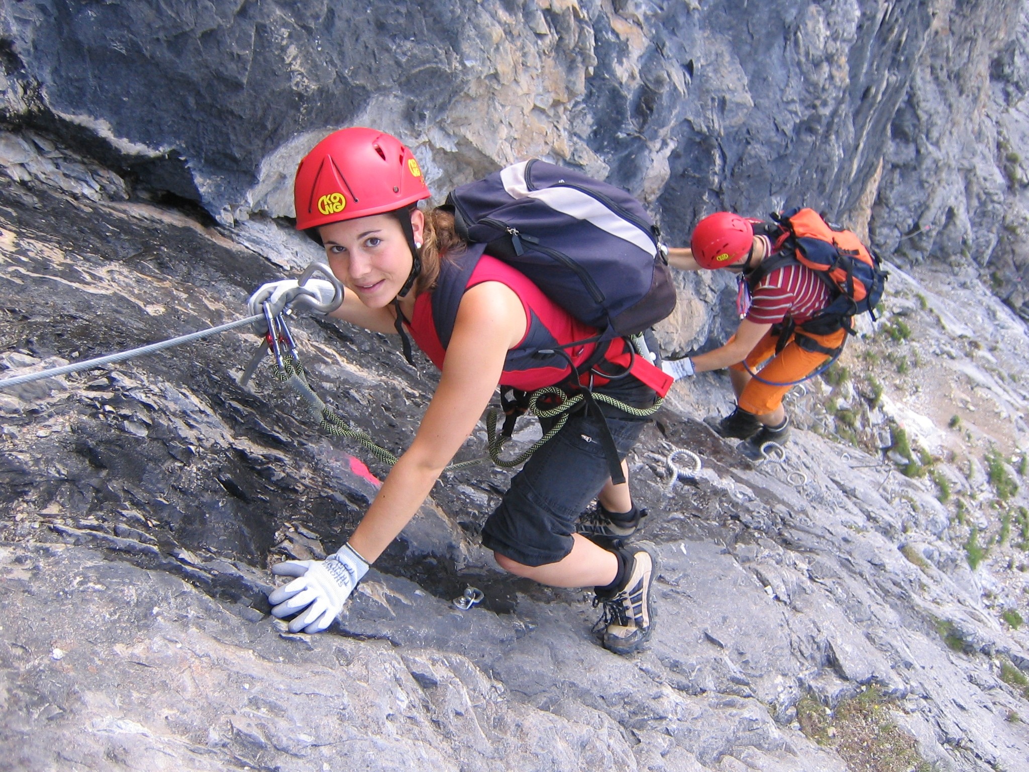
A via ferrata (Italian language, Italian for "iron path", plural ''vie ferrate'' or in English ''via ferratas'') is a protected climbing route found in the Alps and certain other locations. The term "via ferrata" is used in most countries and languages except notably in German-speaking regions, which use ''Klettersteig''—"climbing path" (plural ''Klettersteige''). Infrastructure A via ferrata is a climbing route that employs steel cables, rungs or ladders, fixed to the rock to which the climbers affix #Safety and equipment, a harness with two leashes, which allows the climbers to secure themselves to the metal fixture and limit any fall. The cable and other fixtures, such as iron rungs (stemples), pegs, carved steps, and ladders and bridges, provide both footings and handholds, as well. This allows climbing on otherwise dangerous routes without the risks of unprotected scrambling and climbing or the need for technical climbing equipment. They expand the opportunities for acce ... [...More Info...] [...Related Items...] OR: [Wikipedia] [Google] [Baidu] |
Gleirsch-Halltal Chain
The Gleirsch-Halltal Chain (german: Gleirsch-Halltal-Kette) or Gleirsch-Halltal Range is a mountain chain in the Karwendel in the Northern Limestone Alps. It follows to the south of the Hinterautal-Vomper Chain, the longest mountain chain in the Karwendel, and is almost as big as it. South of the Stempeljochspitze on the other side of the ''Stempeljoch'' saddle () it is joined to the Nordkette. The name of the range is derived from the two valleys: the ''Gleirschtal'' to the west and southwest and the Halltal to the southeast. Its highest summit is the Großer Bettelwurf (), which towers 2,200 metres over the Inn valley. Other well known peaks are its two "cornerstones". First, the ''Lafatscher Joch'' (), which forms the only crossing from the Hinterau valley to the Halltal: the Speckkarspitze, the Kleiner Lafatscher with the famous Verschneidung and the Großer Lafatscher. From Scharnitz the western cornerstone of the chain, the Hoher Gleirsch, may easily be climbed ... [...More Info...] [...Related Items...] OR: [Wikipedia] [Google] [Baidu] |
Ski Route
{{globalize, date=March 2018 A ski route (german: Skiroute) is a signed but unpisted and otherwise unmanaged downhill ski run. As a rule, ski routes allow off-piste skiing in deep powder snow without significant risk from avalanche An avalanche is a rapid flow of snow down a slope, such as a hill or mountain. Avalanches can be set off spontaneously, by such factors as increased precipitation or snowpack weakening, or by external means such as humans, animals, and earth ...s or natural obstacles. Ski routes may also include mogul routes. As well as being unprepared, ski routes generally follow a challenging course. ! Ski mountaineering ... [...More Info...] [...Related Items...] OR: [Wikipedia] [Google] [Baidu] |


