|
Haddon County, Queensland
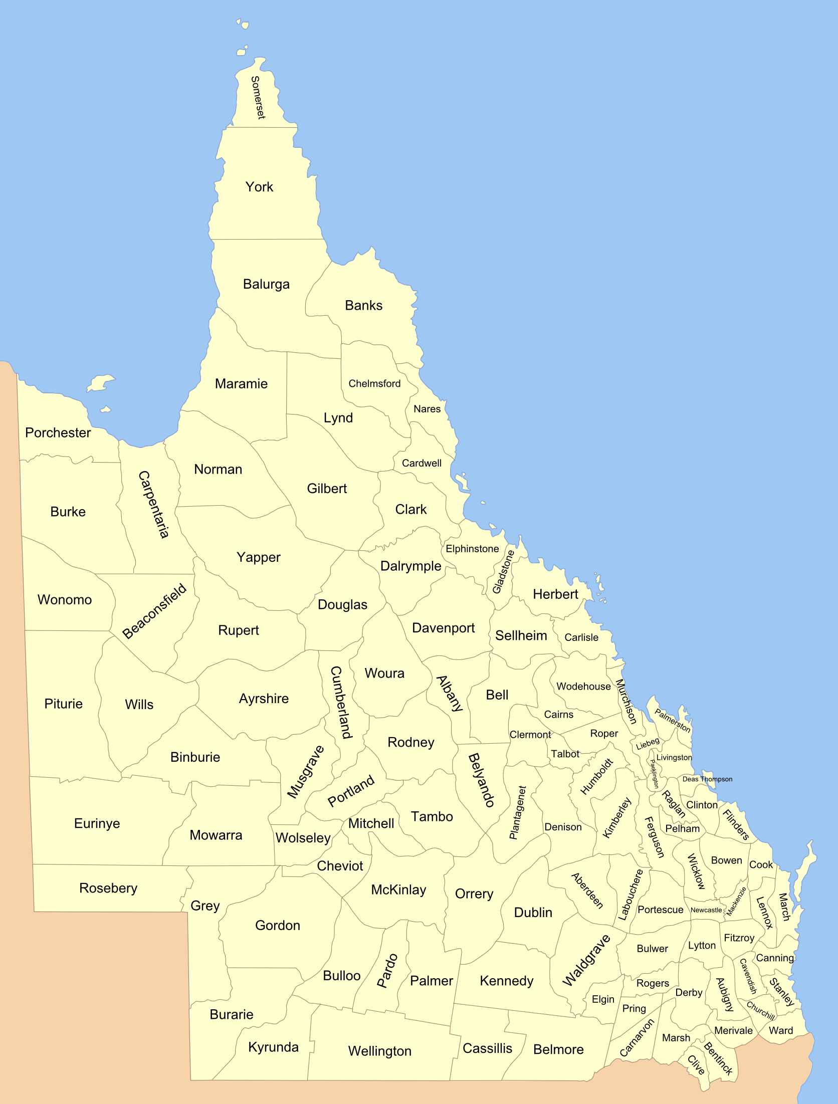
country in Haddon County. Haddon County, Queensland is a cadastral division of Queensland, Australia. It is a county of the South Gregory District of far western Queensland (). The county is divided into civil parishes. History The county has been in its current form since 8 March 1901, when the Governor of Queensland issued a proclamation legally dividing Queensland into counties under the Land Act 1897. Like all counties in Queensland, it is a non-functional administrative unit, that is used mainly for the purpose of registering land titles. From 30 November 2015, the government no longer referenced counties and parishes in land information systems but the Museum of Lands, Mapping and Surveying retains a record for historical purposes. Geography The county is known for Haddon Corner and is part of the Channel Country, a flat, arid area of broad acre agriculture. The center of local government is Thargomindah Thargomindah (frequently shortened to Thargo) is a rural town ... [...More Info...] [...Related Items...] OR: [Wikipedia] [Google] [Baidu] |
Lands Administrative Divisions Of Queensland
Lands administrative divisions of Queensland refers to the divisions of Queensland used for the registration of land titles. There are 322 counties, and 5,319 parishes within the state. They are part of the Lands administrative divisions of Australia. Queensland had been divided into 109 counties in the nineteenth century, before the Land Act of 1897 subdivided many of these counties to 319. Some of the eastern counties remained the same, with most of the subdivisions occurring in the west and north. The current counties were named and bounded by the Governor in Council on 7 March 1901. In 2006, the government sought advice about a plan to abolish the counties and parishes within the state. From 30 November 2015, the government no longer referenced counties and parishes in land information systems however the Museum of Lands, Mapping and Surveying retains a record for historical purposes. Land districts Queensland was divided into districts in the mid-nineteenth century. The d ... [...More Info...] [...Related Items...] OR: [Wikipedia] [Google] [Baidu] |
Queensland
) , nickname = Sunshine State , image_map = Queensland in Australia.svg , map_caption = Location of Queensland in Australia , subdivision_type = Country , subdivision_name = Australia , established_title = Before federation , established_date = Colony of Queensland , established_title2 = Separation from New South Wales , established_date2 = 6 June 1859 , established_title3 = Federation of Australia, Federation , established_date3 = 1 January 1901 , named_for = Queen Victoria , demonym = , capital = Brisbane , largest_city = capital , coordinates = , admin_center_type = Administration , admin_center = Local government areas of Queensland, 77 local government areas , leader_title1 = Monarchy of Australia, Monarch , leader_name1 = Charles III , leader_title2 = Governor of Queensland, Governor , leader_name2 = Jeannette Young , leader_title3 = Premier of Queensland, Premier , leader_name3 = Annastacia Palaszczuk (Australian Labor Party (Queensland Branch), AL ... [...More Info...] [...Related Items...] OR: [Wikipedia] [Google] [Baidu] |
South Gregory District
Lands administrative divisions of Queensland refers to the divisions of Queensland used for the registration of land titles. There are 322 counties, and 5,319 parishes within the state. They are part of the Lands administrative divisions of Australia. Queensland had been divided into 109 counties in the nineteenth century, before the Land Act of 1897 subdivided many of these counties to 319. Some of the eastern counties remained the same, with most of the subdivisions occurring in the west and north. The current counties were named and bounded by the Governor in Council on 7 March 1901. In 2006, the government sought advice about a plan to abolish the counties and parishes within the state. From 30 November 2015, the government no longer referenced counties and parishes in land information systems however the Museum of Lands, Mapping and Surveying retains a record for historical purposes. Land districts Queensland was divided into districts in the mid-nineteenth century. The d ... [...More Info...] [...Related Items...] OR: [Wikipedia] [Google] [Baidu] |
Parish (administrative Division)
A parish is an administrative division used by several countries. To distinguish it from an '' ecclesiastical parish'', the term ''civil parish'' is used in some jurisdictions, as noted below. The table below lists countries which use this administrative division: See also * Muban Muban ( th, หมู่บ้าน; , ) is the lowest administrative sub-division of Thailand. Usually translated as 'village' and sometimes as ' hamlet', they are a subdivision of a tambon (subdistrict). , there were 74,944 administrative m ... References {{Terms for types of country subdivisions Types of administrative division ... [...More Info...] [...Related Items...] OR: [Wikipedia] [Google] [Baidu] |
Governor Of Queensland
The governor of Queensland is the representative in the state of Queensland of the monarch of Australia. In an analogous way to the governor-general of Australia at the national level, the governor performs constitutional and ceremonial functions at the state level. In particular the governor has the power to appoint and dismiss the premier of Queensland and all other ministers in the cabinet, and issue writs for the election of the state parliament. The current governor of Queensland, former Chief Health Officer of Queensland Jeannette Young, was sworn in on 1 November 2021. The chief justice of the Supreme Court of Queensland, currently Helen Bowskill, acts in the position of governor in the governor’s absence. As from June 2014, Queen Elizabeth II, upon the recommendation of then-Premier Campbell Newman, accorded all current, future and living former governors the title 'The Honourable' in perpetuity. Official residence The governor of Queensland has resided at Go ... [...More Info...] [...Related Items...] OR: [Wikipedia] [Google] [Baidu] |
Land Titles
Land registration is any of various systems by which matters concerning ownership, possession, or other rights in land are formally recorded (usually with a government agency or department) to provide evidence of title, facilitate transactions, and prevent unlawful disposal. The information recorded and the protection provided by land registration varies widely by jurisdiction. In common law countries, particularly in jurisdictions in the Commonwealth of Nations, when replacing the deeds registration system, title registrations are broadly classified into two basic types: the Torrens title system and the English system, a modified version of the Torrens system.Lyall, Andrew. ''Land Law in Ireland''. ; Ch. 24 Cadastral systems and land registration are both types of land recording and complement each other.Jo Henssen, BASIC PRINCIPLES OF THE MAIN CADASTRAL SYSTEMS IN THE WORLD, Implementations Americas Canada Falkland Islands The Falkland Islands registry holds copies ... [...More Info...] [...Related Items...] OR: [Wikipedia] [Google] [Baidu] |
Museum Of Lands, Mapping And Surveying
The Museum of Lands, Mapping and Surveying is a museum at 317 Edward Street, Brisbane, Queensland, Australia. It collects and exhibits material relating to the surveying of Queensland and the maps created. It is a sub-branch of the Queensland Museum. It actively digitises and makes available historic maps and aerial imagery under open licences. Collections Land exploration and surveying has played a crucial role in the development of Queensland. Surveyors and cartographers played an active part in establishing Queensland's borders, physically surveying the land as well as creating maps, survey plans and registers. The historical input of the surveying and mapping industry to the development of Queensland is an important factor in the role the department plays in providing a valuable resource for a wide range of community interests and government. In its short history the museum has established a comprehensive collection, housing many important maps, survey plans and artefacts ... [...More Info...] [...Related Items...] OR: [Wikipedia] [Google] [Baidu] |
Haddon Corner
Haddon Corner is a heritage-listed site in Tanbar, Shire of Barcoo, Queensland, Australia. It is in outback Channel Country at South-West Queensland, on the border corner with South Australia. It was added to the Queensland Heritage Register on 9 November 2012. It was first surveyed by Augustus Poeppel in 1880. Haddon Corner lies at the intersection of the 26th parallel south circle of latitude and the 141st meridian. History Karuwali (also known as Garuwali, Dieri) is a language of far western Queensland. The Karuwali language region includes the landscape within the local government boundaries of the Diamantina Shire Council, including the localities of Betoota and Haddon Corner. Haddon Corner, marked in 1880 during the official survey of the western section of the border between Queensland and South Australia undertaken in 1879-1880, defines the north-eastern corner between Queensland and South Australia. Its marking was a surveying feat of its time. Letters pat ... [...More Info...] [...Related Items...] OR: [Wikipedia] [Google] [Baidu] |
Channel Country
The Channel Country is a region of outback Australia mostly in the state of Queensland but also in parts of South Australia, Northern Territory and New South Wales. The name comes from the numerous intertwined rivulets that cross the region, which cover 150,000 km². The Channel Country is over the Cooper and Eromanga geological basins and the Lake Eyre Basin drainage basin. Further to the east is the less arid Maranoa district. Geography Birdsville and Windorah are the most prominent towns in the area. Other settlements include Betoota and Bedourie. Haddon Corner is also located in the Channel Country. The Channel Country is the location for a majority of Min Min light sightings. It is also home to at least two important bird areas, Lake Yamma Yamma and the Lake Machattie Area. The Channel Country features an arid landscape with a series of ancient flood plains from rivers which only flow intermittently. The principal rivers are Georgina River, Cooper Cree ... [...More Info...] [...Related Items...] OR: [Wikipedia] [Google] [Baidu] |
Thargomindah
Thargomindah (frequently shortened to Thargo) is a rural town and locality in the Shire of Bulloo, Queensland, Australia. The town of Thargomindah is the administrative centre for the Shire of Bulloo. In the , Thargomindah had a population of 270 people. It was founded on Wongkumara and Kalali territory. On 17 April 2020, the Queensland Government decided to reorganise the nine localities in the Shire of Bullo, resulting in six localities. Thargomindah, previously being of the area immediately surrounding the town of Thargomindah, was enlarged through the incorporation of all of Bullawarra (except for a small portion in the south of Bullawarra which was absorbed into Bulloo Downs), all of Dynevor and all of Norley, creating a locality of . Geography Thargominah is located in South West Queensland on the Adventure Way, approximately west of the state capital, Brisbane, and west of the town of Cunnamulla. The town of Thargomindah is the administrative centre for t ... [...More Info...] [...Related Items...] OR: [Wikipedia] [Google] [Baidu] |
Bulloo Shire Council
The Shire of Bulloo ( ) is a local government area in South West Queensland, Australia. On 17 April 2020 the Queensland Government reorganised the nine localities in the Shire, resulting in six localities by making the following changes: *Thargomindah, previously being the surrounding area around the town of Thargomindah, was enlarged through the incorporation of most of Bullawarra (except for a small portion in the south of Bullawarra), all of Dynevor and all of Norley. * Bulloo Downs gained the small portion from the south of Bullawarra (the rest being incorporated into Thargomindah) and lost a small portion of its western land to the locality of Cameron Corner. * Cameron Corner gained a small portion of land from the west of the Bulloo Downs. * Nockatunga was renamed ''Noccundra'' after the only town in the locality. There were no changes to the localities of Durham and Hungerford. Geography Bulloo Shire is located in south-west Queensland, about 1,100 kilometres we ... [...More Info...] [...Related Items...] OR: [Wikipedia] [Google] [Baidu] |


