|
Haanwijk
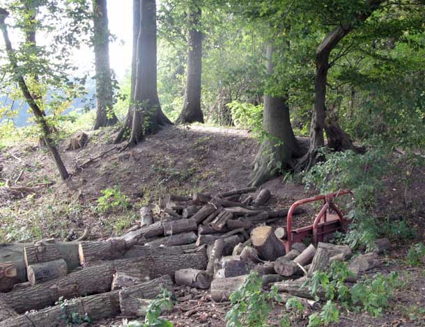
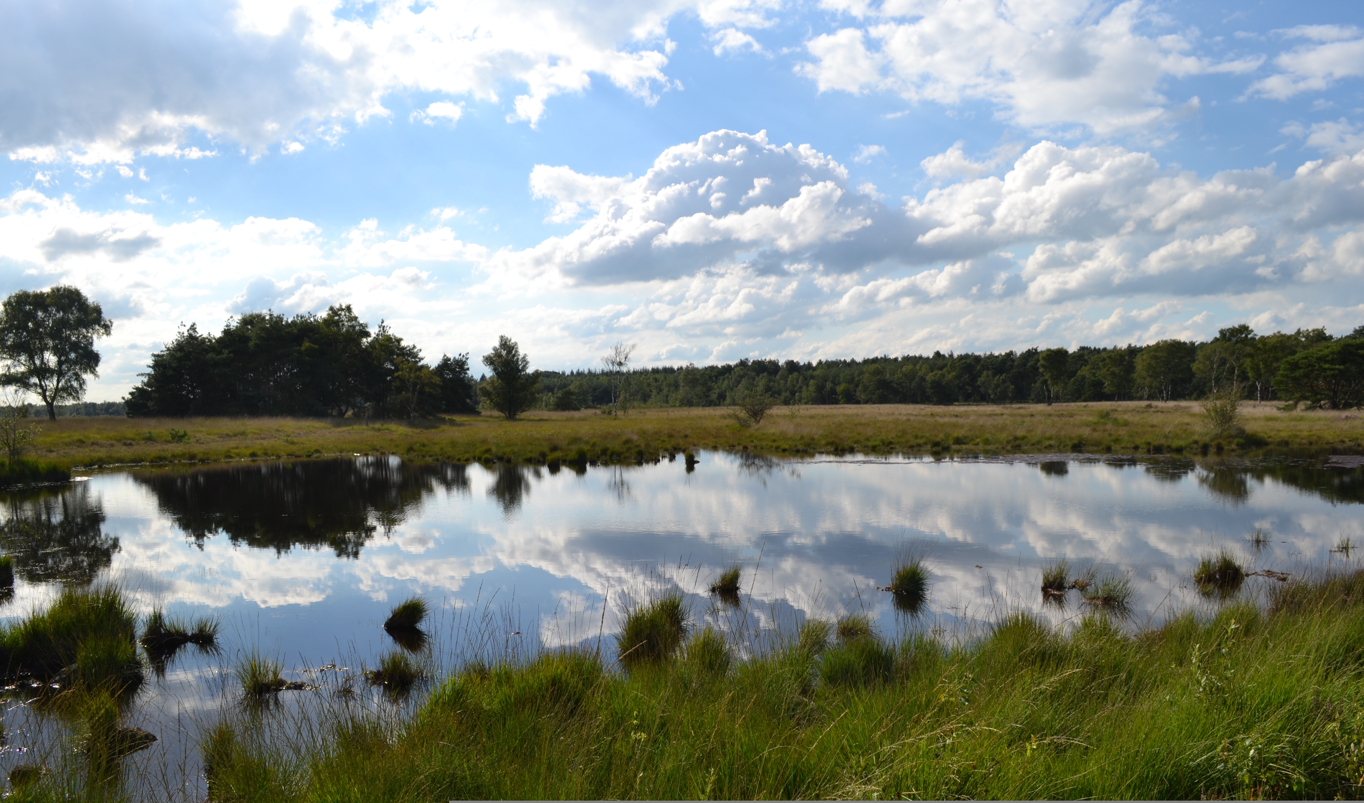
Haanwijk is an Estate (land), estate and nature reserve with a manor house near Sint-Michielsgestel in North-Brabant, Netherlands. Nature Reserve The Haanwijk nature reserve that is now owned by Brabants Landschap measures 431 hectares. It is situated near the confluence of the Dommel and the Esschestroom. Haanwijk is connected to the nature reserves Sterrenbos, Pettelaar and Dooibroek. The Sterrenbos of 80 hectares is home to the European badger and the Lily of the valley. The lane from Haanwijk to Halder is lined with Platanus, planes. Here the Veronica_longifolia, longleaf speedwell is found. Pettelaar and Dooibroek sport 'donks' with mixed forest and lower lying sand and mires. The mires are used as grassland and are cut up in long parcels. The forests are connected by lanes, and the area still features many hedge, hedgerows () The area is open to visitors, and a recreational walk is indicated by signs. Buildings The most prominent building at Haanwijk is the ma ... [...More Info...] [...Related Items...] OR: [Wikipedia] [Google] [Baidu] |
Nieuw-Herlaer Castle
Nieuw-Herlaer Castle is a manor in Sint-Michielsgestel, the Netherlands. It contains a tower which was part of the preceding castle. Location Nieuw-Herlaar Castle is on the east bank of the Dommel, about a hundred meters from the hamlet Halder, Netherlands, Halder, to which it is connected by a bridge. Nieuw-Herlaer Castle was a loan from the Lordship Herlaer, which centered on Oud Herlaer Castle. Oud Herlaer Castle is only about one kilometer to the north and is very close to Maurick Castle in Vught. Haanwijk manor is only 400 meters to the north. Haanwijk Manor is not a true castle, but it has the medieval tower 't Vaantje on the estate grounds. The castle density in the area seems remarkable. In the past the proximity between Nieuw-Herlaar Castle and Oud Herlaer Castle was more logical than it now seems to be. Nieuw-Herlaer was on the west bank of the Dommel, and Oud Herlaer on the east bank. That is, the Dommel flowed just north of Nieuw-Herlaar Castle. Thus from a militar ... [...More Info...] [...Related Items...] OR: [Wikipedia] [Google] [Baidu] |
Sint-Michielsgestel
Sint-Michielsgestel () is a village in the municipality of Sint-Michielsgestel, Netherlands. Geography The 120 km long river Dommel flows north from a well near Peer in Belgium. Just north of 's-Hertogenbosch it is joined by the Aa and joins the Meuse as Dieze. It currently divides Sint-Michielsgestel in two parts. In the past the Dommel was important as a transport axis and had crucial influence on the village's history. Contemporary Sint-Michielsgestel Sint-Michielsgestel is located near the central transport axis in the Netherlands, between 's-Hertogenbosch and Eindhoven. Nowadays this axis is dominated by the A2 motorway, but towards 's-Hertogenbosch the village has an even more direct access via the N617. No wonder that the village grew when the suburbanization process started, and it still does. A major employer in Sint-Michielsgestel is Kentalis (nl), a resource center for sensory and communicative disabled people formerly known as ''Institute for the deaf ... [...More Info...] [...Related Items...] OR: [Wikipedia] [Google] [Baidu] |
Brabants Landschap
Brabants Landschap, officially Stichting het Noordbrabants Landschap, is one of the 12 provincial landscape foundations in the Netherlands. History Foundation Modern nature conservation in North Brabant province started with the acquisition of the Oisterwijk forests and fens by the society Vereniging Natuurmonumenten in 1913. While Natuurmonumenten was a very successful organization, it felt that many aspects of nature conservation could more effectively by handled at a provincial level. Indeed North Brabant had special worries, like the enormous drive to turn the last rough terrains into agricultural land. In June 1931 the provincial executive of North Brabant then made a proposal to the provincial council to create a foundation called 'Het Noordbrabantsch Landschap'. It was to be modelled on the Utrechts Landschap (1927) and Geldersch Landschap (1929). The goal of the foundation was to promote nature and a beautiful landscape. The means to achieve this were to acquire, ... [...More Info...] [...Related Items...] OR: [Wikipedia] [Google] [Baidu] |
Oirschot
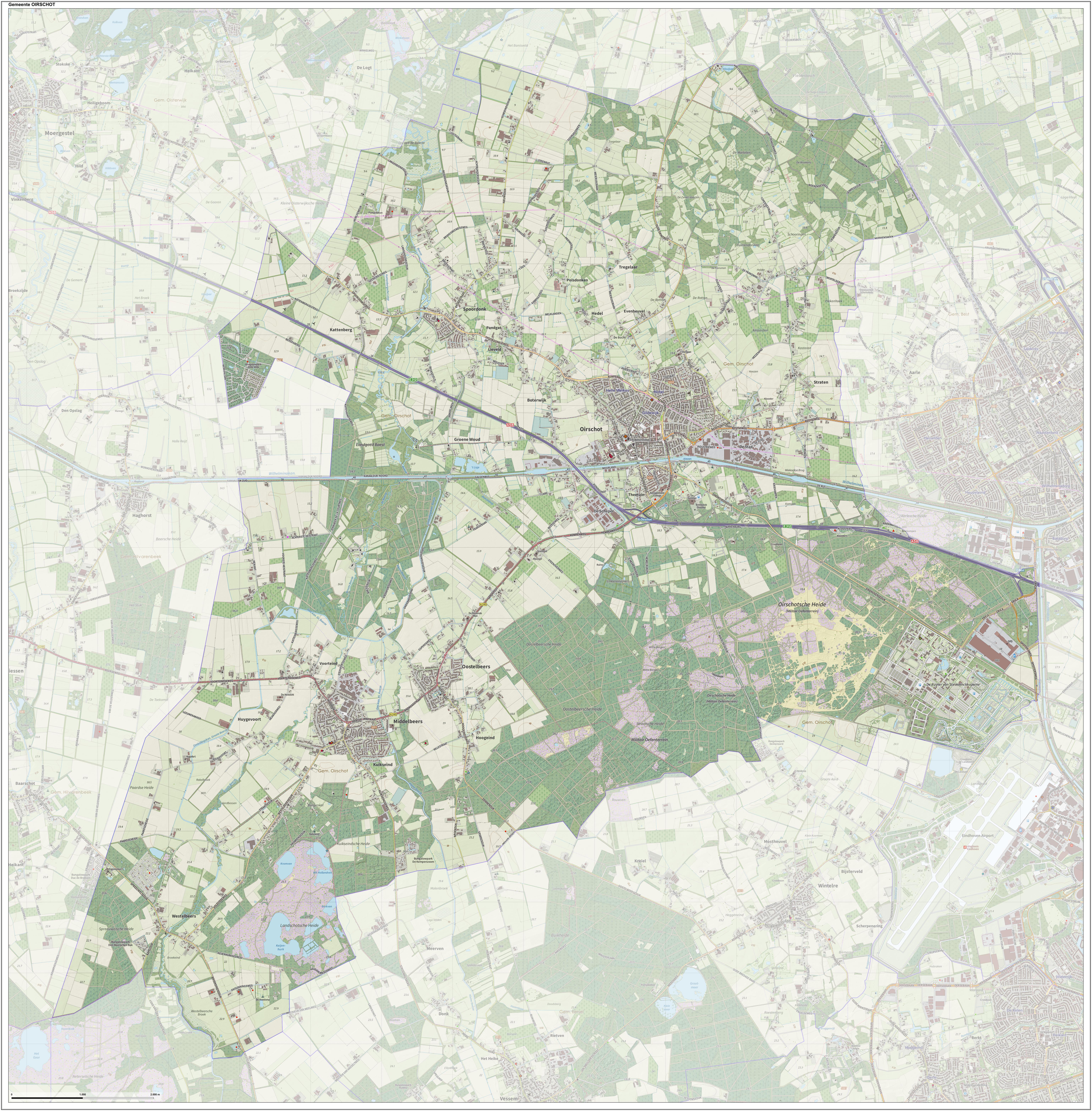
Oirschot (; ''Orskot'' in the Brabantian dialect, local dialect) is a Municipalities of the Netherlands, municipality and a town in the southern Netherlands. It is situated from the city of Eindhoven and from the city of Tilburg in the province North Brabant (Noord-Brabant). The municipality had a population of in . Population centres Sights There are more than 300 monuments in the municipality Oirschot. Some of the monuments are: * The Roman Catholic Church named Sint-Petrus’-Bandenkerk. This 15th- and 16th-century Gothic church is the biggest building in the town of Oirschot and the tower of the church is 73 meters high. * The old town hall built in 1513 in the centre of town (Oirschot) * Maria-church (Maria-kerk). A 12th-century Romanesque church in the centre of the town of Oirschot. * Monastery Nazareth (Klooster Nazareth) with a chapel in Neoromanesque style (1910). * Former Brewery De Kroon (Brouwerij de Kroon) built in 1773 * Hof van Solms, palace of Arn ... [...More Info...] [...Related Items...] OR: [Wikipedia] [Google] [Baidu] |
Siege Of 's-Hertogenbosch
The siege of 's-Hertogenbosch also known as the ''siege of Bois-Le-Duc''Markham pp. 435-38 was an action in 1629, during the Eighty Years' War and the Anglo–Spanish War in which a Dutch and English army captured the city of 's-Hertogenbosch. The city had been loyal to the King of Spain since 1579 and was part of the Spanish Netherlands. Background The Twelve Years' Truce ended in 1621. Stadtholder Maurice of Orange had in the meantime played a part in instigating the Thirty Years' War in Germany. The Habsburgs tried to punish the rebellious Dutch Republic by cutting it off from its hinterland by a land blockade. 's-Hertogenbosch was the main fortress in this perimeter and enormous sums of money were poured into the improvement of its defences. As the ground surrounding the city was a marsh, the city was generally deemed to be impregnable, as the water-saturated soil seemed to make an application of current siege methods impossible; trench-digging and undermining were appare ... [...More Info...] [...Related Items...] OR: [Wikipedia] [Google] [Baidu] |
Ground Rent
As a legal term, ground rent specifically refers to regular payments made by a holder of a leasehold property to the freeholder or a superior leaseholder, as required under a lease. In this sense, a ground rent is created when a freehold piece of land is sold on a long lease or leases.seDepartment for Communities and Local Government/ref> The ground rent provides an income for the landowner. In economics, ground rent is a form of economic rent meaning all value accruing to titleholders as a result of the exclusive ownership of title privilege to location. History In Roman law, ground rent (''solarium'') was an annual rent payable by the lessee of a ''superficies'' (a piece of land), or perpetual lease of building land. In early Norman England, tenants could lease their title to land so that the land-owning lords did not have any power over the sub-tenant to collect taxes. In 1290 King Edward I passed the Statute of ''Quia Emptores'' that prevented tenants from leasing their land ... [...More Info...] [...Related Items...] OR: [Wikipedia] [Google] [Baidu] |
Oud Herlaer
Oud Herlaer was a castle on the Dommel just east of Vught. All that remains is a farm which incorporates parts of the old castle. While not that much remains of the castle, there are a lot of recent studies about Oud Herlaer and its owners. The farm is planned to be opened as an art center in 2021. The name Oud Herlaer, ( means 'old'), signifies that later on Nieuw-Herlaer Castle was built about 1 kilometer upstream. Location Oud Herlaer is on the right bank of the Dommel. In medieval times it was in a very strategic position. The Dommel and its tributaries were practically the only way to efficiently transport bulky goods from north to south. On the other hand, the Dommel was an obstacle to east–west transport, except where there were bridges. The barrier function of the Dommel is illustrated by Oud Herlaer being within one kilometre of Maurick Castle in Vught, and actually being much closer to that place, but still belonging to the municipality of Sint-Michielsgestel. The ... [...More Info...] [...Related Items...] OR: [Wikipedia] [Google] [Baidu] |
Keep
A keep (from the Middle English ''kype'') is a type of fortified tower built within castles during the Middle Ages by European nobility. Scholars have debated the scope of the word ''keep'', but usually consider it to refer to large towers in castles that were fortified residences, used as a refuge of last resort should the rest of the castle fall to an adversary. The first keeps were made of timber and formed a key part of the motte-and-bailey castles that emerged in Normandy and Anjou during the 10th century; the design spread to England, south Italy and Sicily. As a result of the Norman invasion of 1066, use spread into Wales during the second half of the 11th century and into Ireland in the 1170s. The Anglo-Normans and French rulers began to build stone keeps during the 10th and 11th centuries; these included Norman keeps, with a square or rectangular design, and circular shell keeps. Stone keeps carried considerable political as well as military importance and could take up ... [...More Info...] [...Related Items...] OR: [Wikipedia] [Google] [Baidu] |
Barn
A barn is an agricultural building usually on farms and used for various purposes. In North America, a barn refers to structures that house livestock, including cattle and horses, as well as equipment and fodder, and often grain.Allen G. Noble, ''Traditional Buildings: A Global Survey of Structural Forms and Cultural Functions'' (New York: Tauris, 2007), 30. As a result, the term barn is often qualified e.g. tobacco barn, dairy barn, cow house, sheep barn, potato barn. In the British Isles, the term barn is restricted mainly to storage structures for unthreshed cereals and fodder, the terms byre or shippon being applied to cow shelters, whereas horses are kept in buildings known as stables. In mainland Europe, however, barns were often part of integrated structures known as byre-dwellings (or housebarns in US literature). In addition, barns may be used for equipment storage, as a covered workplace, and for activities such as threshing. Etymology The word ''barn'' comes f ... [...More Info...] [...Related Items...] OR: [Wikipedia] [Google] [Baidu] |
Bakehouse (building)
A bakehouse is a building for baking bread. The term may be used interchangeably with the term "bakery", although the latter commonly includes both production and retail areas. Designated bakehouses can be found in archaeological sites from ancient times, e.g., in Roman forts.''Housesteads Roman Fort - the Grandest Station'', 2014, p. 226/ref> Historically there have been many types of bakehouses: individual, in the backyards of homesteads; communal, used by residents of a village or a town, and commercial. Some of them used to be nothing but a huge oven, called ''oven-houses''. Gallery File:2006 Dirmstein-Backhaus.jpg, The Bakehouse (Dirmstein), Germany File:Four a pain maison cornec.jpg, An oven-house (''four a pain maison''), Saint-Rivoal, France File:2007-05-18 Backhaus, Goennern, IMG 8134.jpg, A town bakehouse, Gönnern, Germany File:Four Charlot.jpg, A village bakehouse, Saint-Nicolas-de-Macherin, France See also * List of baked goods * Tandoor * Communal oven The ... [...More Info...] [...Related Items...] OR: [Wikipedia] [Google] [Baidu] |
Ridge Turret
A ridge turret is a turret or small tower constructed over the ridge or apex between two or more sloping roofs of a building. It is usually built either as an architectural ornament for purely decorative purposes or else for the practical housing of a clock, a bell or an observation platform. Its function is thus different from that of a roof lantern, despite a frequent similarity of external appearance. It can have a flat roof but usually has a pointed roof or other kind of apex over. When the height of a roof turret exceeds its width it is usually called a tower or steeple in English architecture, and when the height of a ridge turret's roof exceeds its width, it is called a spire in English architecture or a flèche in French architecture. Images Mairie Ars Moselle.jpg, Ridge turret on Ars-sur-Moselle town hall, France Kloster Einsiedeln IMG 6353.JPG, Ridge turret on Benedictine abbey in Einsiedeln, Switzerland Greenlane Clinical Centre Old Buildings I.jpg, Ridge turret on Gr ... [...More Info...] [...Related Items...] OR: [Wikipedia] [Google] [Baidu] |


