|
HMT Bedfordshire
HMT ''Bedfordshire'' (FY141) was an armed naval trawler in the service of the Royal Naval Patrol Service during World War II. Transferred to the East Coast of the United States to assist the United States Navy with anti-submarine patrols, she was staffed by a British and Canadian crew. ''Bedfordshire'' was sunk by the on 11 May 1942 off the coast of Ocracoke Island in the Outer Banks of North Carolina, with the loss of all hands. Construction ''Bedfordshire'' was built as a commercial fishing trawler by Smith's Dock Company of South Bank, North Yorkshire, England. Launched at Teesside on 17 July 1935, she was completed in August 1935 and turned over to her owners, Bedfordshire Fishing Company of Grimsby, managed by H. Markham Cook Ltd. ''Bedfordshire'' was long, with a beam. The Admiralty acquired ''Bedfordshire'' for anti-submarine duty in August 1939. Converted for service as a naval trawler, she was armed with a 4-inch gun, machine guns, and depth charges. Service in B ... [...More Info...] [...Related Items...] OR: [Wikipedia] [Google] [Baidu] |
Naval Ensign Of The United Kingdom
The White Ensign, at one time called the St George's Ensign due to the simultaneous existence of a cross-less version of the flag, is an ensign worn on British Royal Navy ships and shore establishments. It consists of a red St George's Cross on a white field, identical to the flag of England except with the Union Flag in the upper canton. The White Ensign is also worn by yachts of members of the Royal Yacht Squadron and by ships of Trinity House escorting the reigning monarch. In addition to the United Kingdom, several other nations have variants of the White Ensign with their own national flags in the canton, with the St George's Cross sometimes being replaced by a naval badge omitting the cross altogether. Yachts of the Royal Irish Yacht Club wear a white ensign with an Irish tricolour in the first quadrant and defaced by the crowned harp from the Heraldic Badge of Ireland. The Flag of the British Antarctic Territory and the Commissioners' flag of the Northern Lighthouse Bo ... [...More Info...] [...Related Items...] OR: [Wikipedia] [Google] [Baidu] |
Teesside
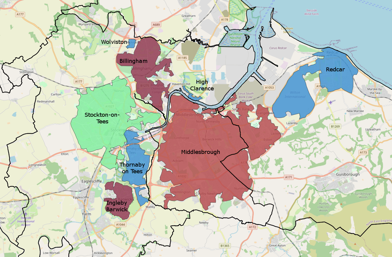
Teesside () is a built-up area around the River Tees in the north of England, split between County Durham and North Yorkshire. The name was initially used as a county borough in the North Riding of Yorkshire. Historically a hub for heavy manufacturing, the number of people employed in this type of work declined from the 1960s onwards, with steel-making and chemical manufacturing (particularly through Imperial Chemical Industries) replaced to some extent by new science businesses and service sector roles. History 1968–1974: County borough Before the county of Cleveland was created, the area (including Stockton-on-Tees) existed as a part of the North Riding of Yorkshire, due to most land being south of the Tees. Teesside was created due to Stockton-on-Tees being linked heavily with Thornaby (which had amalgamated with South Stockton/Mandale to form the Borough of Thornaby), Middlesbrough and Redcar by industry. Compared to the modern Teesside conurbation, the area was sma ... [...More Info...] [...Related Items...] OR: [Wikipedia] [Google] [Baidu] |
Cape Lookout (North Carolina)
Cape Lookout is the southern point of the Core Banks, one of the natural barrier islands on the Atlantic coast of North Carolina. It delimits Onslow Bay to the west from Raleigh Bay to the east. Core Banks and Shackleford Banks have been designated as parts of the Cape Lookout National Seashore. Part of Carteret County, the cape sits 11 miles southeast of Beaufort. It is one of the state's three major capes, along with Cape Hatteras to the north and Cape Fear to the south. The 163-foot Cape Lookout Lighthouse sits about three miles northeast of the cape's point. Climate According to the Trewartha climate classification system, Cape Lookout, North Carolina has a humid subtropical climate with hot and humid summers, cool winters and year-around precipitation (''Cfak''). Cfak climates are characterized by all months having an average mean temperature > 32.0 °F (> 0.0 °C), at least eight months with an average mean temperature ≥ 50.0 °F (≥ 10.0 °C), a ... [...More Info...] [...Related Items...] OR: [Wikipedia] [Google] [Baidu] |
Hatteras Island
Hatteras Island (historically Croatoan Island) is a barrier island located off the North Carolina coast. Dividing the Atlantic Ocean and the Pamlico Sound, it runs parallel to the coast, forming a bend at Cape Hatteras. It is part of North Carolina's Outer Banks and includes the communities of Rodanthe, Waves, Salvo, Avon, Buxton, Frisco, and Hatteras. It contains the largest part of the Cape Hatteras National Seashore. Prior to European settlement the island was inhabited by Croatoan Native Americans. The island has a land area of and a population of 4,322, as of the 2010 census. It lies in parts of Kinnakeet Township and Hatteras Township in Dare County, and Ocracoke Township in Hyde County. Hatteras Island is known for sport fishing, surfing, windsurfing and kiteboarding, and Hatteras Village is known as the "Blue Marlin Capital of the World". The island is one of the longest in the contiguous United States, measuring along a straight line from end to end, or rou ... [...More Info...] [...Related Items...] OR: [Wikipedia] [Google] [Baidu] |
Currituck Island
Currituck Island () is an island in Antarctica long marked by numerous small coves, lying on the northwest side of Edisto Channel in the Highjump Archipelago The Highjump Archipelago is a group of rocky islands, rocks and ice rises in Antarctica, about long and from wide, lying generally north of the Bunger Hills Bunger Hills, also known as Bunger Lakes or Bunger Oasis, is a coastal range on the Knox .... It was mapped from air photos taken by U.S. Navy Operation Highjump in February 1947, and named by the Advisory Committee on Antarctic Names in 1956 after the USS ''Currituck'', a seaplane tender and flagship of the western task group of U.S. Navy Operation Highjump, Task Force 68, 1946–47. At that time, the northern portion was thought to be a separate feature and was named "Mohaupt Island," but subsequent Soviet Expeditions (1956–57) found that only one large island exists. See also * List of antarctic and sub-antarctic islands References Islands of Quee ... [...More Info...] [...Related Items...] OR: [Wikipedia] [Google] [Baidu] |
Morehead City, North Carolina
Morehead City is a port town in Carteret County, North Carolina, United States. The population was 8,661 at the 2010 census. Morehead City celebrated the 150th anniversary of its founding on May 5, 2007. It forms part of the Crystal Coast. History By the early 1850s, a group of investors had been formed and incorporated a land development project known as the "Shepard Point Land Company," which purchased of land on the eastern tip of the peninsula bordering the Newport River, known then as "Shepards Point," which is the present location of Morehead City. The Shepard Point Land Company's objective was to take advantage of the natural deep channel of Topsail Inlet, known today as the Beaufort Inlet, which splits Bogue Banks from Shackleford Banks and provides access to Morehead City, Beaufort, North Carolina, the Newport River and the Intracoastal Waterway. The Shepard Point Land Company was established to construct a deepwater port to allow another access point for North Carolin ... [...More Info...] [...Related Items...] OR: [Wikipedia] [Google] [Baidu] |
Naval Station Norfolk
Naval Station Norfolk is a United States Navy base in Norfolk, Virginia, that is the headquarters and home port of the U.S. Navy's Fleet Forces Command. The installation occupies about of waterfront space and of pier and wharf space of the Hampton Roads peninsula known as Sewell's Point. It is the world's largest naval station, with the largest concentration of U.S. Navy forces through 75 ships alongside 14 piers and with 134 aircraft and 11 aircraft hangars at the adjacently operated Chambers Field. Port Services controls more than 3,100 ships' movements annually as they arrive and depart their berths. Air Operations conducts over 100,000 flight operations each year, an average of 275 flights per day or one every six minutes. Over 150,000 passengers and 264,000 tons of mail and cargo depart annually on Air Mobility Command (AMC) aircraft and other AMC-chartered flights from the airfield's AMC Terminal. History The area where the base is located was the site of the original ... [...More Info...] [...Related Items...] OR: [Wikipedia] [Google] [Baidu] |
Fifth Naval District
The naval district was a U.S. Navy military and administrative command ashore. Apart from Naval District Washington, the Districts were disestablished and renamed Navy Regions about 1999, and are now under Commander, Naval Installations Command (CNIC). They were established for the purpose of decentralizing the Navy Department's functions with respect to the control of the coastwise sea communications and the shore activities outside the department proper, and for the further purpose of centralizing under one command: : (a) For military coordination, all naval activities, and : (b) For administrative coordination, all naval activities with specific exceptions, within the district and the waters thereof. The limits of the naval districts are laid down in article 1480, Navy Regulations. Those limits extend to seaward so far as to include the coastwise sea lanes (art. 1486 (1), Navy Regulations). "Each naval district shall be commanded by a designated commandant, who is the dir ... [...More Info...] [...Related Items...] OR: [Wikipedia] [Google] [Baidu] |
Royal Naval Reserve
The Royal Naval Reserve (RNR) is one of the two volunteer reserve forces of the Royal Navy in the United Kingdom. Together with the Royal Marines Reserve, they form the Maritime Reserve. The present RNR was formed by merging the original Royal Naval Reserve, created in 1859, and the Royal Naval Volunteer Reserve (RNVR), created in 1903. The Royal Naval Reserve has seen action in World War I, World War II, the Iraq War, and War in Afghanistan. History Establishment The Royal Naval Reserve (RNR) has its origins in the Register of Seamen, established in 1835 to identify men for naval service in the event of war, although just 400 volunteered for duty in the Crimean War in 1854 out of 250,000 on the Register. This led to a Royal Commission on Manning the Navy in 1858, which in turn led to the Naval Reserve Act of 1859. This established the RNR as a reserve of professional seamen from the British Merchant Navy and fishing fleets, who could be called upon during times of war ... [...More Info...] [...Related Items...] OR: [Wikipedia] [Google] [Baidu] |
Operation Drumbeat
The "Second Happy Time" (; officially Operation Paukenschlag ("Operation Drumbeat"), and also known among German submarine commanders as the "American Shooting Season") was a phase in the Battle of the Atlantic during which Axis powers, Axis submarines attacked merchant shipping and Allied naval vessels along the east coast of North America. The First Happy Time, first "Happy Time" was in 1940–1941 in the North Atlantic and North Sea. Adolf Hitler and Benito Mussolini declared war on the United States on 11 December 1941, and as a result their navies could begin the "Second Happy Time". The "Second Happy Time" lasted from January 1942 to about August of that year and involved several German naval operations, including Operation Neuland. German submariners named it the "Happy Time" or the "Golden Time," as defense measures were weak and disorganized, and the U-boats were able to inflict massive damage with little risk. During this period, Axis submarines sank 609 ships totalin ... [...More Info...] [...Related Items...] OR: [Wikipedia] [Google] [Baidu] |
Bristol Channel
The Bristol Channel ( cy, Môr Hafren, literal translation: "Severn Sea") is a major inlet in the island of Great Britain, separating South Wales from Devon and Somerset in South West England. It extends from the lower estuary of the River Severn ( cy, Afon Hafren) to the North Atlantic Ocean. It takes its name from the English city of Bristol, and is over 30 miles (50 km) wide at its western limit. Long stretches of both sides of the coastline are designated as Heritage Coast. These include Exmoor, Bideford Bay, the Hartland Point peninsula, Lundy Island, Glamorgan, Gower Peninsula, Carmarthenshire, South Pembrokeshire and Caldey Island. Until Tudor times the Bristol Channel was known as the Severn Sea, and it is still known as this in both cy, Môr Hafren and kw, Mor Havren. Geography The International Hydrographic Organization now defines the western limit of the Bristol Channel as "a line joining Hartland Point in Devon () to St. Govan's Head in Pembrokeshire ... [...More Info...] [...Related Items...] OR: [Wikipedia] [Google] [Baidu] |


_docked_at_Naval_Station_Norfolk%2C_in_October_1937.jpg)

