|
HMS Simoom (1849)
HMS ''Simoom'' was an iron frigate converted to an iron screw troopship. She was laid down in October 1845; however, on 23 April 1847 her frigate design was abandoned as this type of iron warship was considered to be unsuitable against cannon fire and she was ordered to be completed as a troopship. She was launched by Robert Napier and Sons in Govan, Yard No 17, on 24 May 1849, then sold to Collings, Dartmouth in June 1887.Clyde Maritime Design and description ''Simoom'' was designed to serve as an iron frigate; however, testing under heavy gunfire, carried out on the paddle steamer ''Ruby'',Naval Database "demonstrated unmistakably that the splintering characteristics of the iron then used in shipbuilding rendered unprotected ships built of this material totally unsuitable as warships".Mariner's Mirror Consequently, ''Simoom'' and were reduced to serve as transport ships. The Royal Navy used troopships to carry soldiers and supplies to conflicts in British overseas interest ... [...More Info...] [...Related Items...] OR: [Wikipedia] [Google] [Baidu] |
Robert Napier And Sons
Messrs Robert Napier and Sons was a famous firm of River Clyde, Clyde shipbuilders and marine engineers at Govan, City of Glasgow, Glasgow founded by Robert Napier (engineer), Robert Napier in 1826. It was moved to Govan for more space in 1841. His sons James and John were taken into partnership in 1853. The whole Clyde, every engineer and shipbuilder in it, was considered to have benefitted from the firm's achievements and celebrity. By the 1840s it was universally recognised as the finest in Britain. Many firms were founded by former employees.ed. W H Fraser and I Maver. ''Glasgow: 1830 to 1912'' Manchester University Press 1996 After Robert Napier's death in 1876 the plant and goodwill were sold by auction in March 1877 and purchased by a group of engineers led by the previous manager, A C Kirk. It continued to build ships and engines until 1900 when it was incorporated in William Beardmore and Company. Beginnings In 1800 Glasgow had no shipbuilding firms. Aged 23, Robert Nap ... [...More Info...] [...Related Items...] OR: [Wikipedia] [Google] [Baidu] |
Bohai Sea
The Bohai Sea () is a gulf/inland sea approximately in area on the east coast of Mainland China. It is the northwestern and innermost extension of the Yellow Sea, to which it connects to the east via the Bohai Strait. It has a mean depth of approximately , with a maximum depth of about located in the northern part of the Bohai Strait. The Bohai Sea is enclosed by three provinces and one direct-administered municipality from three different regions of China—Liaoning Province (of Northeast China), Hebei Province and Tianjin Municipality (of North China), and Shandong Province (of East China). It is the center of the Bohai Economic Rim, and its proximity to the Chinese capital of Beijing and the municipality of Tianjin makes it one of the busiest seaways in the world. The entrance to the Bohai Sea is considered a part of the territorial sea of the People's Republic of China due to the presence of the Miaodao islands. China declared the Bohai sea to be part of its inland water ... [...More Info...] [...Related Items...] OR: [Wikipedia] [Google] [Baidu] |
Devonport, Plymouth
Devonport ( ), formerly named Plymouth Dock or just Dock, is a district of Plymouth in the English county of Devon, although it was, at one time, the more important settlement. It became a county borough in 1889. Devonport was originally one of the "Three Towns" (along with Plymouth and East Stonehouse); these merged in 1914 to form what would become in 1928 the City of Plymouth. It is represented in the Parliament of the United Kingdom as part of the Plymouth Sutton and Devonport constituency. Its elected Member of Parliament (MP) is Luke Pollard, who is a member of the Labour Party. The population of the ward at the 2011 census was 14,788. History Plymouth Dock In 1690 the Admiralty gave a contract to Robert Waters from Portsmouth to build a stone dock at Point Froward on the east bank of the Hamoaze at the mouth of the River Tamar. Plymouth Dock, as Devonport was originally called, began around 1700 as a small settlement to house workers employed on the new naval base tha ... [...More Info...] [...Related Items...] OR: [Wikipedia] [Google] [Baidu] |
Saint Vincent (Antilles)
Saint Vincent is a volcanic island in the Caribbean. It is the largest island of the country Saint Vincent and the Grenadines and is located in the Caribbean Sea, between Saint Lucia and Grenada. It is composed of partially submerged volcanic mountains. Its largest volcano and the country's highest peak, La Soufrière, is active, with the latest episode of volcanic activity having begun in December 2020 and intensifying in April 2021. There were major territory wars between the indigenous population of the Black Caribs, also called the Garifuna, and Great Britain in the 18th century, before the island was ceded to the British in 1763 and again in 1783. Saint Vincent and the Grenadines gained independence from the United Kingdom on 27 October 1979 and became part of the British Commonwealth of Nations thereafter. Approximately 130,000 people currently live on the island, and the population saw significant migration to the UK in the early 1900s and between the 1940s and 1980s. T ... [...More Info...] [...Related Items...] OR: [Wikipedia] [Google] [Baidu] |
Cape Coast
Cape Coast is a city, fishing port, and the capital of Cape Coast Metropolitan District and Central Region of Ghana. It is one of the country's most historic cities, a World Heritage Site, home to the Cape Coast Castle, with the Gulf of Guinea situated to its south. According to the 2010 census, Cape Coast had a settlement population of 169,894 people. The language of the people of Cape Coast is Fante. The older traditional names of the city are Oguaa and Kotokuraba (meaning "River of Crabs" or "Village of Crabs"). The Portuguese navigators João de Santarém and Pedro Escobar who sailed past Oguaa in 1471 designated the place ''Cabo Corso'' (meaning "short cape"), from which the name Cape Coast derives. From the 16th century to the country's independence in 1957, the city changed hands between the British, the Portuguese, the Swedish, the Danish and the Dutch. It is home to 32 festivals and celebrations. History Cape Coast was founded by the people of Oguaa and the region rul ... [...More Info...] [...Related Items...] OR: [Wikipedia] [Google] [Baidu] |
Sierra Leone
Sierra Leone,)]. officially the Republic of Sierra Leone, is a country on the southwest coast of West Africa. It is bordered by Liberia to the southeast and Guinea surrounds the northern half of the nation. Covering a total area of , Sierra Leone has a tropical climate, with diverse environments ranging from savanna to rainforests. The country has a population of 7,092,113 as of the 2015 census. The capital and largest city is Freetown. The country is divided into five administrative regions, which are subdivided into Districts of Sierra Leone, 16 districts. Sierra Leone is a constitutional republic with a unicameral parliament and a directly elected executive president, president serving a five-year term with a maximum of two terms. The current president is Julius Maada Bio. Sierra Leone is a Secular state, secular nation with Constitution of Sierra Leone, the constitution providing for the separation of state and religion and freedom of conscience (which includes freedom of ... [...More Info...] [...Related Items...] OR: [Wikipedia] [Google] [Baidu] |
Freetown
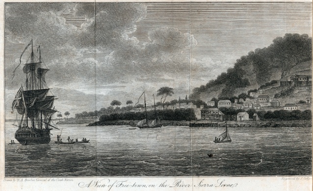
Freetown is the capital and largest city of Sierra Leone. It is a major port city on the Atlantic Ocean and is located in the Western Area of the country. Freetown is Sierra Leone's major urban, economic, financial, cultural, educational and political centre, as it is the seat of the Government of Sierra Leone. The population of Freetown was 1,055,964 at the 2015 census. The city's economy revolves largely around its harbour, which occupies a part of the estuary of the Sierra Leone River in one of the world's largest natural deep water harbours. Although the city has traditionally been the homeland of the Sierra Leone Creole people, the population of Freetown is ethnically, culturally, and religiously diverse. The city is home to a significant population of all of Sierra Leone's ethnic groups, with no single ethnic group forming more than 27% of the city's population. As in virtually all parts of Sierra Leone, the Krio language of the Sierra Leone Creole people is Freetown's ... [...More Info...] [...Related Items...] OR: [Wikipedia] [Google] [Baidu] |
Ashanti War
The Anglo-Ashanti wars were a series of five conflicts that took place between 1824 and 1900 between the Ashanti Empire—in the Akan interior of the Gold Coast—and the British Empire and its African allies. Though the Ashanti emerged victorious in some of these conflicts, the British ultimately prevailed in the fourth and fifth conflicts, resulting in the complete annexation of the Ashanti Empire by 1900. The wars were mainly due to Ashanti attempts to establish a stronghold over the coastal areas of present-day Ghana. Coastal peoples such as the Fante and the Ga came to rely on British protection against Ashanti incursions. Earlier wars The British fought three earlier wars in the Gold Coast: In the Ashanti-Fante War of 1806–07, the British refused to hand over two rebels pursued by the Ashanti, but eventually handed one over (the other escaped). In the Ga-Fante War of 1811, the Ashanti sought to aid their Ga allies in a war against the Fante and their British alli ... [...More Info...] [...Related Items...] OR: [Wikipedia] [Google] [Baidu] |
Cape Palmas
Cape Palmas is a headland on the extreme southeast end of the coast of Liberia, Africa, at the extreme southwest corner of the northern half of the continent. The Cape itself consists of a small, rocky peninsula connected to the mainland by a sandy isthmus. Immediately to the west of the peninsula is the estuary of the Hoffman River. Approximately 21 km (15 mi) further along the coast to the east, the Cavalla River empties into the sea, marking the border between Liberia and the Côte d'Ivoire. It marks the western limit of the Gulf of Guinea, according to the International Hydrographic Organization (IHO). Approached from the sea, there are several landmarks at the cape. Offshore from the estuary of the Hoffman lies the small, oblong shape of ''Russwurm Island'', which was named after the first black governor of Maryland In Africa (later Republic of Maryland), John Brown Russwurm. This island is connected to the peninsula by a breakwater. There is also a lighthouse warn ... [...More Info...] [...Related Items...] OR: [Wikipedia] [Google] [Baidu] |
Ashantee
The Asante, also known as Ashanti () are part of the Akan ethnic group and are native to the Ashanti Region of modern-day Ghana. Asantes are the last group to emerge out of the various Akan civilisations. Twi is spoken by over nine million Asante people as a first or second language. The wealthy, gold-rich Asante people developed the large and influential Ashanti Empire, along the Lake Volta and Gulf of Guinea. The empire was founded in 1670, and the capital Kumase was founded in 1680 by Asantehene (emperor) Osei Kofi Tutu I on the advice of Okomfo Anokye, his premier. Sited at the crossroads of the Trans-Saharan trade, the Kumase megacity's strategic location contributed significantly to its growing wealth. Over the duration of the Kumase metropolis' existence, a number of peculiar factors have combined to transform the Kumase metropolis into a financial centre and political capital. The main causal factors included the unquestioning loyalty to the Asante rulers and the Kumase m ... [...More Info...] [...Related Items...] OR: [Wikipedia] [Google] [Baidu] |
Cape Coast Castle
Cape Coast Castle ( sv, Carolusborg) is one of about forty "slave castles", or large commercial forts, built on the Gold Coast of West Africa (now Ghana) by European traders. It was originally a Portuguese "feitoria" or trading post, established in 1555, which they named ''Cabo Corso''. However, in 1653 the Swedish Africa Company constructed a timber fort there. It originally was a centre for the trade in timber and gold. It was later used in the trans-Atlantic slave trade. Other Ghanaian slave castles include Elmina Castle and Fort Christiansborg. They were used to hold enslaved Africans before they were loaded onto ships and sold in the Americas, especially the Caribbean. This "gate of no return" was the last stop before crossing the Atlantic Ocean. Cape Coast Castle, along with other forts and castles in Ghana, are included on the UNESCO World Heritage List because of their testimony to the Atlantic gold and slave trades. Trade history The large quantity of gold dust fo ... [...More Info...] [...Related Items...] OR: [Wikipedia] [Google] [Baidu] |
Ascension Island
Ascension Island is an isolated volcanic island, 7°56′ south of the Equator in the South Atlantic Ocean. It is about from the coast of Africa and from the coast of South America. It is governed as part of the British Overseas Territory of Saint Helena, Ascension and Tristan da Cunha, of which the main island, Saint Helena, is around to the southeast. The territory also includes the sparsely populated Tristan da Cunha archipelago, to the south, about halfway to the Antarctic Circle. Named after the day of its recorded discovery, Ascension of Jesus, Ascension Island was an important safe haven as a coaling station to mariners and a refueling stop for commercial airliners back in the days of international air travel by flying boats. Ascension Island was garrisoned by the British Admiralty from 22 October 1815 to 1922. During World War II, it was an important naval and air station, especially providing antisubmarine warfare bases in the Battle of the Atlantic.Victory at ... [...More Info...] [...Related Items...] OR: [Wikipedia] [Google] [Baidu] |


_p0636_LIBERIA%2C_CAPE_PALMAS.jpg)
