|
Gulfton, Houston, Texas
Gulfton is a community in Southwest Houston, Texas, United States that includes a group of apartment complexes that primarily house refugee and immigrant populations. It is located between the 610 Loop and Beltway 8, west of the City of Bellaire, southeast of Interstate 69/U.S. Highway 59, and north of Bellaire Boulevard. In the 1960s and 1970s Gulfton experienced rapid development, with new apartment complexes built for young individuals from the Northeast and Midwest United States. They came to work in the oil industry during the 1970s oil boom. In the 1980s, as the economy declined, existing tenants left, resulting in a significant drop in occupancy rates in the apartment complexes and forcing many complexes into bankruptcy and foreclosure. Owners marketed the empty units to newly arrived immigrants and Gulfton became a predominantly immigrant community. Beginning in the 1980s Gulfton's crime rate increased and schools were increasingly overwhelmed with excess students. "H ... [...More Info...] [...Related Items...] OR: [Wikipedia] [Google] [Baidu] |
List Of Houston Neighborhoods
The city of Houston, Texas, contains many neighborhoods, ranging from planned communities to historic wards. There is no uniform standard for what constitutes an individual neighborhood within the city; however, the city of Houston does recognize a list of 88 ''super neighborhoods'' which encompass broadly recognized regions. According to the city, a super neighborhood is a "geographically designated area where residents, civic organizations, institutions and businesses work together to identify, plan, and set priorities to address the needs and concerns of their community."A list of the super neighborhoods, in the numerical order as assigned by the city, is shown below: In addition to the recognized super neighborhoods, Houston is further divided into a number of other formal and informal regions, including special districts and individual subdivisions. An ''incomplete'' list of these communities and jurisdictions is provided below. Management districts In Texas, ''municipal m ... [...More Info...] [...Related Items...] OR: [Wikipedia] [Google] [Baidu] |
Honduras
Honduras, officially the Republic of Honduras, is a country in Central America. The republic of Honduras is bordered to the west by Guatemala, to the southwest by El Salvador, to the southeast by Nicaragua, to the south by the Pacific Ocean at the Gulf of Fonseca, and to the north by the Gulf of Honduras, a large inlet of the Caribbean Sea. Its capital and largest city is Tegucigalpa. Honduras was home to several important Mesoamerican cultures, most notably the Maya, before the Spanish Colonization in the sixteenth century. The Spanish introduced Catholicism and the now predominant Spanish language, along with numerous customs that have blended with the indigenous culture. Honduras became independent in 1821 and has since been a republic, although it has consistently endured much social strife and political instability, and remains one of the poorest countries in the Western Hemisphere. In 1960, the northern part of what was the Mosquito Coast was transferred from Nicara ... [...More Info...] [...Related Items...] OR: [Wikipedia] [Google] [Baidu] |
Rice University
William Marsh Rice University (Rice University) is a Private university, private research university in Houston, Houston, Texas. It is on a 300-acre campus near the Houston Museum District and adjacent to the Texas Medical Center. Rice is ranked among the top universities in the United States. Opened in 1912 as the Rice Institute after the murder of its namesake William Marsh Rice, Rice is a research university with an undergraduate focus. Its emphasis on undergraduate education is demonstrated by its 6:1 student-faculty ratio. The university has a Research I university, very high level of research activity, with $156 million in sponsored research funding in 2019. Rice is noted for its applied science programs in the fields of artificial heart research, structural chemical analysis, signal processing, space science, and nanotechnology. Rice has been a member of the Association of American Universities since 1985 and is Carnegie Classification of Institutions of Higher Education ... [...More Info...] [...Related Items...] OR: [Wikipedia] [Google] [Baidu] |
Videocassette Recorder
A videocassette recorder (VCR) or video recorder is an electromechanical device that records analog audio and analog video from broadcast television or other source on a removable, magnetic tape videocassette Videotape is magnetic tape used for storing video and usually sound in addition. Information stored can be in the form of either an analog or digital signal. Videotape is used in both video tape recorders (VTRs) and, more commonly, videocasset ..., and can play back the recording. Use of a VCR to record a television program to play back at a more convenient time is commonly referred to as ''timeshifting''. VCRs can also play back prerecorded tapes. In the 1980s and 1990s, prerecorded videotapes were widely available for purchase and rental, and blank tapes were sold to make recordings. VCRs declined in popularity during the early 2000s and in July 2016, Funai Electric, the last manufacturer of them ceased production. History Early machines and formats The h ... [...More Info...] [...Related Items...] OR: [Wikipedia] [Google] [Baidu] |
Midwestern United States
The Midwestern United States, also referred to as the Midwest or the American Midwest, is one of four census regions of the United States Census Bureau (also known as "Region 2"). It occupies the northern central part of the United States. It was officially named the North Central Region by the Census Bureau until 1984. It is between the Northeastern United States and the Western United States, with Canada to the north and the Southern United States to the south. The Census Bureau's definition consists of 12 states in the north central United States: Illinois, Indiana, Iowa, Kansas, Michigan, Minnesota, Missouri, Nebraska, North Dakota, Ohio, South Dakota, and Wisconsin. The region generally lies on the broad Interior Plain between the states occupying the Appalachian Mountain range and the states occupying the Rocky Mountain range. Major rivers in the region include, from east to west, the Ohio River, the Upper Mississippi River, and the Missouri River. ... [...More Info...] [...Related Items...] OR: [Wikipedia] [Google] [Baidu] |
Northeast United States
The Northeastern United States, also referred to as the Northeast, the East Coast, or the American Northeast, is a geographic list of regions of the United States, region of the United States. It is located on the Atlantic Ocean, Atlantic coast of North America, with Canada to its north, the Southern United States to its south, and the Midwestern United States to its west. The Northeast is one of the four regions defined by the United States Census Bureau, U.S. Census Bureau for the collection and analysis of statistics. The region is usually defined as including nine U.S. states: Connecticut, Maine, Massachusetts, New Hampshire, New Jersey, New York (state), New York, Pennsylvania, Rhode Island, and Vermont. The United States Census Bureau, U.S. Census Bureau–defined region of the Northeastern United States has a total area of with of that being land mass, making it the smallest region of the United States by both land mass and total area. The Northeastern region is the nati ... [...More Info...] [...Related Items...] OR: [Wikipedia] [Google] [Baidu] |
Rust Belt
The Rust Belt is a region of the United States that experienced industrial decline starting in the 1950s. The U.S. manufacturing sector as a percentage of the U.S. GDP peaked in 1953 and has been in decline since, impacting certain regions and cities primarily in the Northeast and Midwest regions of the U.S., including Allentown, Buffalo, Cincinnati, Cleveland, Columbus, Jersey City, Newark, Pittsburgh, Rochester, Toledo, Trenton, Youngstown, and other areas of New Jersey, Ohio, Pennsylvania, and Upstate New York. These regions experienced and, in some cases, are continuing to experience the elimination or outsourcing of manufacturing jobs beginning in the late 20th century. The term "Rust" refers to the impact of deindustrialization, economic decline, population loss, and urban decay on these regions attributable to the shrinking of the once-powerful industrial sector especially including steelmaking, automobile manufacturing, and coal mining. The term gained popularity ... [...More Info...] [...Related Items...] OR: [Wikipedia] [Google] [Baidu] |
White People
White is a racialized classification of people and a skin color specifier, generally used for people of European origin, although the definition can vary depending on context, nationality, and point of view. Description of populations as "White" in reference to their skin color predates this notion and is occasionally found in Greco-Roman ethnography and other ancient or medieval sources, but these societies did not have any notion of a White or pan-European race. The term "White race" or "White people", defined by their light skin among other physical characteristics, entered the major European languages in the later seventeenth century, when the concept of a "unified White" achieve universal acceptance in Europe, in the context of racialized slavery and unequal social status in the European colonies. Scholarship on race distinguishes the modern concept from pre-modern descriptions, which focused on physical complexion rather than race. Prior to the modern era, no Europe ... [...More Info...] [...Related Items...] OR: [Wikipedia] [Google] [Baidu] |
Ranch-style House
Ranch (also known as American ranch, California ranch, rambler, or rancher) is a domestic architectural style that originated in the United States. The ranch-style house is noted for its long, close-to-the-ground profile, and wide open layout. The style fused modernist ideas and styles with notions of the American Western period of wide open spaces to create a very informal and casual living style. While the original ranch style was informal and basic in design, ranch-style houses built in the United States (particularly in the Sun Belt region) from around the early 1960s increasingly had more dramatic features such as varying roof lines, cathedral ceilings, sunken living rooms, and extensive landscaping and grounds. First appearing as a residential style in the 1920s, the ranch was extremely popular with the booming post-war middle class of the 1940s to the 1970s. The style is often associated with tract housing built at this time, particularly in the southwest United States, ... [...More Info...] [...Related Items...] OR: [Wikipedia] [Google] [Baidu] |
Shenandoah, Houston, Texas
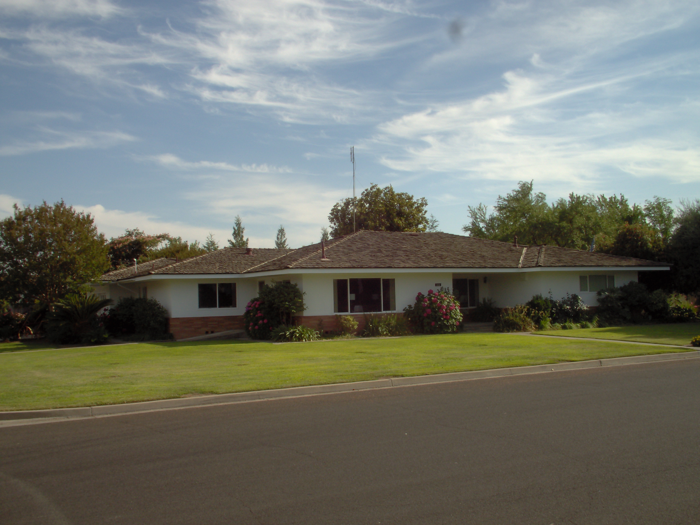
Shenandoah is a subdivision in Houston, Texas, United States. Shenandoah, located outside the 610 Loop, inside Beltway 8, and south and east of U.S. Highway 59 (Southwest Freeway), is surrounded by a community of apartment complexes called Gulfton. Shenandoah's sections include Shenandoah Section 1, Shenandoah Section 2, Shenandoah Section 3. The Shenandoah Civic Association has control over all of these sections and also controls a portion of the neighboring Sigrid subdivision. History Shenandoah, the first subdivision in the area, opened in the mid-1950s on former greenfield. Shenandoah had 16 blocks of ranch-style homes.Rogers, Susan.Superneighborhood 27: A Brief History of Change" ''California Digital Library''. The Shenandoah Civic Association opened in 1956; since the City of Houston has no zoning, the Shenandoah Civic Association's main goal is to enforce deed restrictions which regulate construction of housing and prevent businesses being operated from homes.Fisher, Rober ... [...More Info...] [...Related Items...] OR: [Wikipedia] [Google] [Baidu] |
Greenfield Land
Greenfield land is a British English term referring to undeveloped land in an urban or rural area either used for agriculture or landscape design, or left to evolve naturally. These areas of land are usually agricultural or amenity properties being considered for urban development. Greenfield land can be unfenced open fields, urban lots or restricted closed properties. They are kept off limits to the general public by a private or government entity. Greenfield sites offer a high degree of freedom for a developer, compared to sites with existing developments. For example, a greenfield site is a welcome opportunity for a cable operator to choose equipment based on cost and aesthetic parameters, without considering migration issues related to legacy equipment on the site. Rather than building upon greenfield land, a developer may choose to redevelop brownfield or greyfield lands, which have been developed but left abandoned or underused. Other uses The term has broadened in sco ... [...More Info...] [...Related Items...] OR: [Wikipedia] [Google] [Baidu] |


