|
Gulf Low
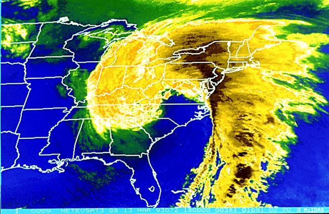
A Gulf low or Texas Low is a low pressure area that forms or intensifies over the Gulf of Mexico and move northeast on the western side of the Appalachian mountains and sometimes on the Atlantic coast to become a nor'easter. Because they move from over or near the Gulf of Mexico, these storm systems are capable of transporting copious amounts of moisture with them. At their strongest, these storm systems are even more potent snowfall producers than panhandle hooks, primarily because of the mixing of Atlantic Ocean moisture into the storm system once they cross the Appalachian Mountains. Because of the general west to east movement of weather systems in the mid latitudes of the northern hemisphere, Gulf Lows rarely affect areas west of the Mississippi River. One such exception was the Halloween Blizzard of 1991. Types There are two types of "Gulf Lows": West and East Gulf Cyclones or Types Ga and Gb.as per the California Institute of Technology (CIT) As western storms (Alberta cli ... [...More Info...] [...Related Items...] OR: [Wikipedia] [Google] [Baidu] |
Cyclogenesis
Cyclogenesis is the development or strengthening of cyclonic circulation in the atmosphere (a low-pressure area). Cyclogenesis is an umbrella term for at least three different processes, all of which result in the development of some sort of cyclone, and at any size from the microscale to the synoptic scale. * Tropical cyclones form due to latent heat driven by significant thunderstorm activity, developing a warm core. * Extratropical cyclones form as waves along weather fronts before occluding later in their life cycle as cold core cyclones. * Mesocyclones form as warm core cyclones over land, and can lead to tornado formation. Waterspouts can also form from mesocyclones, but more often develop from environments of high instability and low vertical wind shear. The process in which an extratropical cyclone undergoes a rapid drop in atmospheric pressure (24 millibars or more) in a 24-hour period is referred to as explosive cyclogenesis, and is usually present during the formation ... [...More Info...] [...Related Items...] OR: [Wikipedia] [Google] [Baidu] |
Panhandle Hook
A panhandle hook (also called a pan handle hook or Texas hooker) is a relatively infrequent winter storm system whose cyclogenesis occurs in the South to southwestern United States from the late fall through winter and into the early spring months. They trek to the northeast on a path towards the Great Lakes region, as the southwesterly jet streams are most prevalent, usually affecting the Midwestern United States and Eastern Canada. Panhandle hooks account for some of the most memorable and deadly blizzards and snowstorms in North America. The name is derived from the region of surface cyclogenesis in the Texas panhandle and Oklahoma panhandle regions. In some winters, there are no panhandle hook storms; in others, there are several. Formation A panhandle hook storm has its origins as a strong shortwave low pressure system which traverses the base of a long-wave low pressure trough while geographically coincident with the southwestern United States. Such systems ubiquitousl ... [...More Info...] [...Related Items...] OR: [Wikipedia] [Google] [Baidu] |
Nor'easter
A nor'easter (also northeaster; see below), or an East Coast low is a synoptic-scale extratropical cyclone in the western North Atlantic Ocean. The name derives from the direction of the winds that blow from the northeast. The original use of the term in North America is associated with storms that impact the upper north Atlantic coast of the United States and the Atlantic Provinces of Canada. Typically, such storms originate as a low-pressure area that forms within of the shore between North Carolina and Massachusetts. The precipitation pattern is similar to that of other extratropical storms. Nor'easters are usually accompanied by heavy rain or snow, and can cause severe coastal flooding, coastal erosion, hurricane-force winds, or blizzard conditions. Nor'easters are usually most intense during winter in New England and Atlantic Canada. They thrive on converging air masses—the cold polar air mass and the warmer air over the water—and are more severe in winter when t ... [...More Info...] [...Related Items...] OR: [Wikipedia] [Google] [Baidu] |
Colorado Low
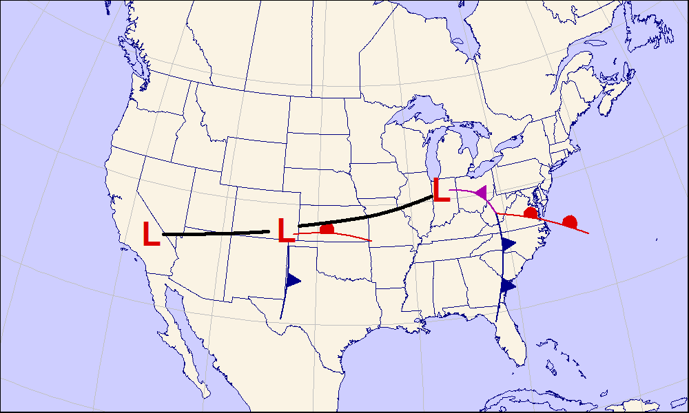
A Colorado low is a low-pressure area that forms in southeastern Colorado or northeastern New Mexico, typically in the winter. After forming, the system moves across the Great Plains. Colorado lows can produce heavy wintry precipitation, and have a general east to northeast movement, impacting regions as far north as Winnipeg and as far east as the Atlantic coast. If upper-level conditions are right, the jet stream can push the low farther south, bringing wintry precipitation as far as Texas. When pushed this far south, the system is often referred to as a " blue norther". On the more typical track, a Colorado low can be similar to an Alberta clipper. In the winter Colorado lows are responsible for a majority of the snow that the Midwest receives; however, summer systems can trigger long-lasting convective systems, including severe weather. Spring and early summer Colorado low cyclogenesis can result in significant tornado outbreaks over the Great Plains and Midwest. See also * Den ... [...More Info...] [...Related Items...] OR: [Wikipedia] [Google] [Baidu] |
United States
The United States of America (U.S.A. or USA), commonly known as the United States (U.S. or US) or America, is a country primarily located in North America. It consists of 50 states, a federal district, five major unincorporated territories, nine Minor Outlying Islands, and 326 Indian reservations. The United States is also in free association with three Pacific Island sovereign states: the Federated States of Micronesia, the Marshall Islands, and the Republic of Palau. It is the world's third-largest country by both land and total area. It shares land borders with Canada to its north and with Mexico to its south and has maritime borders with the Bahamas, Cuba, Russia, and other nations. With a population of over 333 million, it is the most populous country in the Americas and the third most populous in the world. The national capital of the United States is Washington, D.C. and its most populous city and principal financial center is New York City. Paleo-Americ ... [...More Info...] [...Related Items...] OR: [Wikipedia] [Google] [Baidu] |
Great Blizzard Of 1978
The Great Blizzard of 1978 was an historic winter storm that struck the Ohio Valley and Great Lakes regions of the United States as well as Southern Ontario in Canada from Wednesday, January 25 through Friday, January 27, 1978. It is often cited as one of the most severe blizzards in US history. The third lowest non-tropical atmospheric pressure ever recorded in the mainland United States occurred as the storm passed over Mount Clemens, Michigan, where barometer readings fell to on January 26. Meteorological synopsis Late on Tuesday, January 24, 1978, surface maps revealed a moisture-laden Gulf low-pressure system developing over the southern United States, while a separate and unrelated low-pressure system was present over the Upper Midwest. A powerful Arctic jet stream (containing a wind max of 110 knots) surged straight south through the Northern Great Plains while a powerful subtropical jet (containing a wind max of 130 knots) moved south through Arizona, both during the tim ... [...More Info...] [...Related Items...] OR: [Wikipedia] [Google] [Baidu] |
1993 North American Storm Complex
The 1993 Storm of the Century (also known as the 93 Superstorm, The No Name Storm, or the Great Blizzard of '93/1993) was a cyclonic storm that formed over the Gulf of Mexico on March 12, 1993. The cold weather, heavy snowfall, high winds and storm surges that the storm brought affected a very large area; at its height, it stretched from Canada to Honduras. The cyclone moved through the Gulf of Mexico and then through the eastern United States before moving on to eastern Canada. It eventually dissipated in the North Atlantic Ocean on March 15. Heavy snow was first reported in highland areas as far south as Alabama and northern Georgia, with Union County, Georgia reporting up to of snow. Birmingham, Alabama, reported a rare of snow. The Florida Panhandle reported up to of snow, with hurricane-force wind gusts and record low barometric pressures. Between Louisiana and Cuba, the hurricane-force winds produced high storm surges across the big bend of Florida which, in combination ... [...More Info...] [...Related Items...] OR: [Wikipedia] [Google] [Baidu] |
Alberta Clipper
An Alberta clipper, also known as an Alberta low, Alberta cyclone, Alberta lee cyclone, Canadian clipper, or simply clipper, is a fast-moving low-pressure system that originates in or near the Canadian province of Alberta just east of the Rocky Mountains and tracks east-southeastward across southern Canada and the northern United States to the North Atlantic Ocean. Alberta clippers constitute a major winter-season storm track for extratropical cyclones in the Northern Hemisphere, tracking across the continent in 2–3 days while affecting weather in parts of the Prairies and central provinces of Canada, as well as the Upper Midwest, Great Lakes, and New England portions of the United States. They are associated with cold, dry continental air masses and generate small-scale, short-lived weather events typically producing 8–15 cm (3-6 inches) of snow in a 3-6 hour period. However, they can precipitate sudden temperature drops and sharp winds leading to local blizzard c ... [...More Info...] [...Related Items...] OR: [Wikipedia] [Google] [Baidu] |
Low Pressure Area
In meteorology, a low-pressure area, low area or low is a region where the atmospheric pressure is lower than that of surrounding locations. Low-pressure areas are commonly associated with inclement weather (such as cloudy, windy, with possible rain or storms), while high-pressure areas are associated with lighter winds and clear skies. Winds circle anti-clockwise around lows in the northern hemisphere, and clockwise in the southern hemisphere, due to opposing Coriolis forces. Low-pressure systems form under areas of wind divergence that occur in the upper levels of the atmosphere (aloft). The formation process of a low-pressure area is known as cyclogenesis. In meteorology, atmospheric divergence aloft occurs in two kinds of places: * The first is in the area on the east side of upper troughs, which form half of a Rossby wave within the Westerlies (a trough with large wavelength that extends through the troposphere). * A second is an area where wind divergence aloft occurs a ... [...More Info...] [...Related Items...] OR: [Wikipedia] [Google] [Baidu] |
California Institute Of Technology
The California Institute of Technology (branded as Caltech or CIT)The university itself only spells its short form as "Caltech"; the institution considers other spellings such a"Cal Tech" and "CalTech" incorrect. The institute is also occasionally referred to as "CIT", most notably in its alma mater, but this is uncommon. is a private research university in Pasadena, California. Caltech is ranked among the best and most selective academic institutions in the world, and with an enrollment of approximately 2400 students (acceptance rate of only 5.7%), it is one of the world's most selective universities. The university is known for its strength in science and engineering, and is among a small group of institutes of technology in the United States which is primarily devoted to the instruction of pure and applied sciences. The institution was founded as a preparatory and vocational school by Amos G. Throop in 1891 and began attracting influential scientists such as George Ellery H ... [...More Info...] [...Related Items...] OR: [Wikipedia] [Google] [Baidu] |
Halloween Blizzard
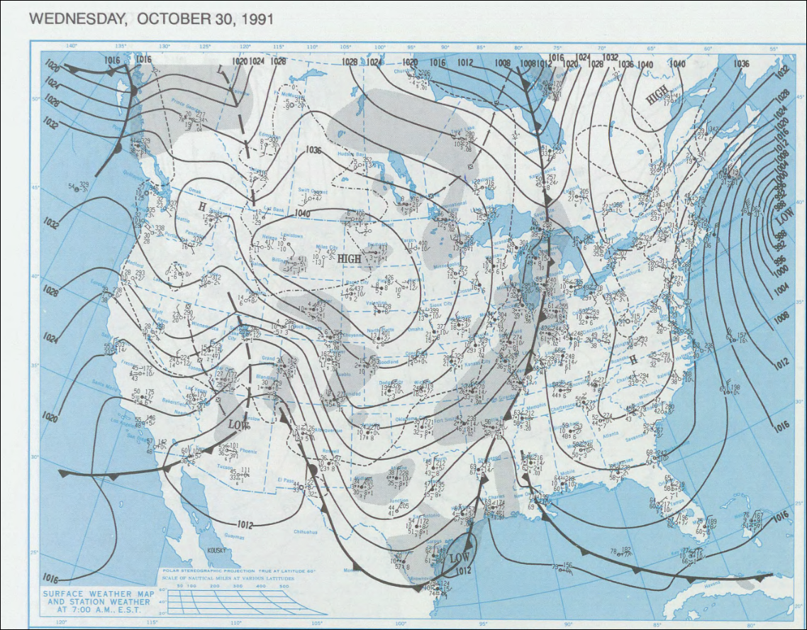
The 1991 Halloween blizzard was a powerful storm that caused a period of heavy snowfall and ice accumulation, which affected parts of the Upper Midwest of the United States, from October 31 to November 3, 1991. Over the last week of October 1991, a large storm system over the Atlantic Ocean (1991 Perfect Storm) blocked most of the weather patterns over the eastern half of the United States, and in turn, moisture from the Gulf of Mexico was funneled straight northward over the affected region. By the time the precipitation stopped falling, many cities in the eastern half of Minnesota and northwestern Wisconsin had witnessed record early-season snowfall accumulations, while parts of southern Minnesota and northern Iowa were crippled by a large ice storm. Arctic air that was pulled southward behind the storm had combined with the heavy snow pack to produce many record low temperatures. Between the blizzard and the ice storm, 22 people were killed and over 100 were injured. Meteorol ... [...More Info...] [...Related Items...] OR: [Wikipedia] [Google] [Baidu] |

.jpg)

.jpg)
