|
Guatavita
Guatavita is a municipality and town of Colombia in the Guavio Province of the department of Cundinamarca. Guatavita is located 75 km northeast of the capital Bogotá. It borders Sesquilé and Machetá in the north, Gachetá and Junín in the east, Guasca in the south and in the west are Tocancipá and Gachancipá.Official website Guatavita - accessed 05-05-2016 History Before the on the , the central plateau in the Colombian |
Muisca Confederation
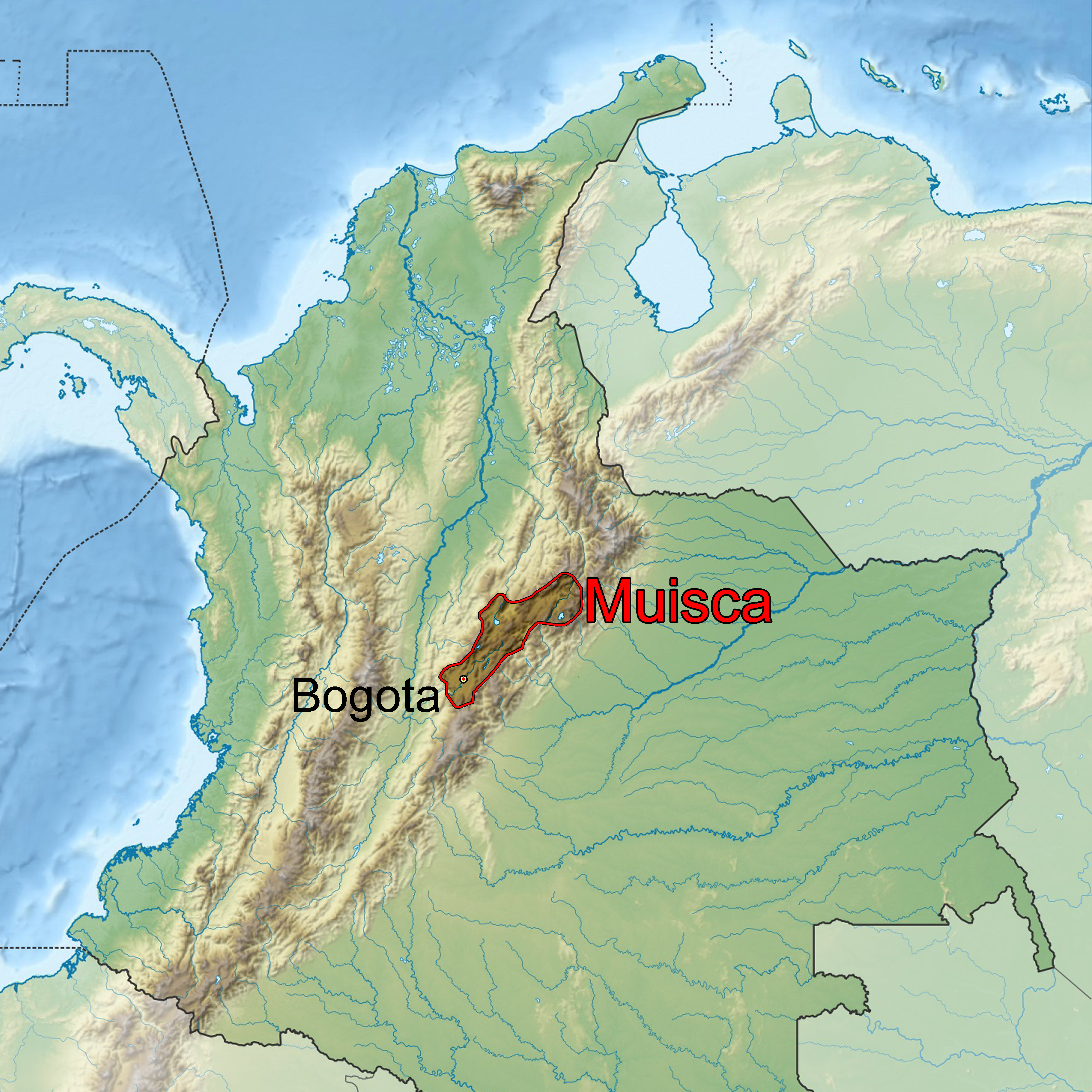
The Muisca Confederation was a loose confederation of different Muisca rulers (''zaques'', ''zipas'', '' iraca'', and ''tundama'') in the central Andean highlands of present-day Colombia before the Spanish conquest of northern South America. The area, presently called Altiplano Cundiboyacense, comprised the current departments of Boyacá, Cundinamarca and minor parts of Santander. According to some Muisca scholars the Muisca Confederation was one of the best-organized confederations of tribes on the South American continent. Modern anthropologists, such as Jorge Gamboa Mendoza, attribute the present-day knowledge about the confederation and its organization more to a reflection by Spanish chroniclers who predominantly wrote about it a century or more after the Muisca were conquered and proposed the idea of a loose collection of different people with slightly different languages and backgrounds.Gamboa Mendoza, 2016 Geography Climate Muisca Confederation In the time ... [...More Info...] [...Related Items...] OR: [Wikipedia] [Google] [Baidu] |
Muisca People
The Muisca (also called Chibcha) are an indigenous people and culture of the Altiplano Cundiboyacense, Colombia, that formed the Muisca Confederation before the Spanish conquest. The people spoke Muysccubun, a language of the Chibchan language family, also called ''Muysca'' and ''Mosca''. They were encountered by conquistadors dispatched by the Spanish Empire in 1537 at the time of the conquest. Subgroupings of the Muisca were mostly identified by their allegiances to three great rulers: the '' hoa'', centered in Hunza, ruling a territory roughly covering modern southern and northeastern Boyacá and southern Santander; the '' psihipqua'', centered in Muyquytá and encompassing most of modern Cundinamarca, the western Llanos; and the ''iraca'', religious ruler of Suamox and modern northeastern Boyacá and southwestern Santander. The territory of the Muisca spanned an area of around from the north of Boyacá to the Sumapaz Páramo and from the summits to the western p ... [...More Info...] [...Related Items...] OR: [Wikipedia] [Google] [Baidu] |
Spanish Conquest Of The Muisca
The Spanish conquest of the Muisca took place from 1537 to 1540. The Muisca were the inhabitants of the central Andean highlands of Colombia before the arrival of the Spanish conquistadors. They were organised in a loose confederation of different rulers; the '' psihipqua'' of Muyquytá, with his headquarters in Funza, the '' hoa'' of Hunza, the ''iraca'' of the sacred City of the Sun Sugamuxi, the Tundama of Tundama, and several other independent ''caciques''. The most important rulers at the time of the conquest were ''psihipqua'' Tisquesusa, ''hoa'' Eucaneme, ''iraca'' Sugamuxi and Tundama in the northernmost portion of their territories. The Muisca were organised in small communities of circular enclosures (''ca'' in their language Muysccubbun; literally "language of the people"), with a central square where the '' bohío'' of the ''cacique'' was located. They were called "Salt People" because of their extraction of salt in various locations throughout their territories, ma ... [...More Info...] [...Related Items...] OR: [Wikipedia] [Google] [Baidu] |
Muisca Raft
The Muisca raft (''Balsa Muisca'' in Spanish), sometimes referred to as the Golden Raft of El Dorado, is a pre-Columbian votive piece created by the Muisca, an indigenous people of Colombia in the Eastern Ranges of the Colombian Andes. The piece probably refers to the gold offering ceremony described in the legend of ''El Dorado'', which occasionally took place at Lake Guatavita. In this ritual, the new chief (''zipa''), who was aboard a raft and covered with gold dust, tossed gold objects into the lake as offerings to the gods, before immersing himself into the lake. The figure was created between 1295 and 1410 AD by lost-wax casting in an alloy of gold with silver and copper. The raft was part of an offering that was placed in a cave in the municipality of Pasca. Since its discovery in 1969, the Muisca raft has become a national emblem for Colombia and has been depicted on postage stamps. The piece is exhibited at the Gold Museum in Bogotá. Background Muisca people The Muisc ... [...More Info...] [...Related Items...] OR: [Wikipedia] [Google] [Baidu] |
Muisca Religion
Muisca religion describes the religion of the Muisca people, Muisca who inhabited the central highlands of the Colombian Andes before the Spanish conquest of the Muisca. The Muisca formed a Muisca Confederation, confederation of holy Muisca rulers, rulers and had a variety of deity, deities, temples and rituals incorporated in their culture. Supreme being of the Muisca was Chiminigagua who created light and the Earth. He was not directly honoured, yet that was done through Chía (goddess), Chía, goddess of the Moon, and her husband Sué, god of the Sun. The representation of the two main celestial bodies as husband and wife showed the complementary character of man and Women in Muisca society, woman and the sacred status of marriage.Muisca religion - Pueblos Originarios - accessed 04-05-2016 The Muisca worshipped the ... [...More Info...] [...Related Items...] OR: [Wikipedia] [Google] [Baidu] |
Sesquilé
Sesquilé is a town and municipality in Almeidas Province in the department of Cundinamarca, Colombia. Sesquilé in the Chibcha language of the Muisca means "hot water".Official website Sesquilé - accessed 06-05-2016 Sesquilé is adjacent to and nearby , the suspected site of the '''' legend. Tourism * Laguna del c ...[...More Info...] [...Related Items...] OR: [Wikipedia] [Google] [Baidu] |
Saguamanchica
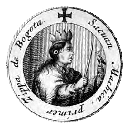
Saguamanchica (died Chocontá, 1490) was the second ruler (''zipa'') of Muyquytá, as of 1470. His ''zaque'' enemy ruling over the northern area of the Muisca territory was Michuá. Alternative spellings of his name are Sacuan Machica, Saguanmachica and Saguanmanchica. Biography As former ''cacique'' of Chía, Saguamanchica accessed the throne of the southern Muisca around 1470. His predecessor, the first ''zipa'' of Muyquytá Meicuchuca, left him a rich kingdom with many guecha warriors. This led Saguamanchica to seek expansion of his ''zipazgo''. The first campaign of warfare he planned was to submit the eternal enemies of the Muisca, the Panche and the Sutagao to the west of the Muisca territories. The Carib-speaking peoples formed an alliance against their common and far outnumbered enemy. Saguamanchica together with his vassal Pasca defeated his enemies led by general Uzatama with ease and annexed Fusagasugá and Tibacuy. The expansion policies of the southern Muisc ... [...More Info...] [...Related Items...] OR: [Wikipedia] [Google] [Baidu] |
Michuá
Michuá or Michica (died Chocontá, 1490) was the second ''zaque'' of Hunza, currently known as Tunja, as of 1470. His contemporary enemy ''zipa'' of the southern Muisca was Saguamanchica. Biography Little is known about the history of Michuá, who accessed the throne of the northern Muisca in 1470. He broke the political peace established under his predecessor Hunzahúa and fought a 16-year war with the southern enemies led by Saguamanchica. The latter, supported by his vassal Pasca conquered Fusagasugá and Tibacuy. Saguamanchica attempted to submit the ''cacique'' of Guatavita who asked Michúa for assistance. Michuá sent a messenger to Bacatá to negotiate the ''zipa'' would listen to the complaints of the ''cacique''. Saguamanchica was not amused by undermining his authority and abused the messenger. When Michuá found out about the mistreatment of his messenger he sent an army of forty thousand guecha warriors to the ''zipa''. Realising the strength of the army Saguamanchi ... [...More Info...] [...Related Items...] OR: [Wikipedia] [Google] [Baidu] |
Guavio Province
The Guavio Province ( es, Provincia del Guavio) is one of the 15 provinces in the Cundinamarca department, Colombia. Guavio borders the Capital District of Bogotá and the Central Savanna Province to the west, to the north the Almeidas Province, to the east the Boyacá Department and Medina Province and to the south the Meta Department and the Eastern Province. The Alberto Lleras Dam is also located in this area. The eastern municipalities Gachalá and Ubalá are rich in emeralds. Subdivision Guavio Province is subdivided into 8 municipalities A municipality is usually a single administrative division having corporate status and powers of self-government or jurisdiction as granted by national and regional laws to which it is subordinate. The term ''municipality'' may also mean the go ...: [...More Info...] [...Related Items...] OR: [Wikipedia] [Google] [Baidu] |
Battle Of Chocontá
The Battle of Chocontá was one of a series of battles in the ongoing conflict between the northern and southern Muisca of pre-Columbian central Colombia. The battle was fought 1490 in the vicinity of Chocontá. An army of 50,000 southern Muisca guecha warriors, led by their ruler, or ''zipa'', Saguamanchica, attacked 60,000 northern Muisca troops commanded by Zaque Michuá, who was supported by the Cacique of Guatavita. Background In the decades before the Spanish conquistadors arrived in the central highlands of Colombia in 1537, the area was ruled by two main groups: the ''zacazgo'' of the northern Muisca and the ''zipazgo'' of the southern Muisca. While the two factions were joined in a confederation, they fought numerous wars to conquer terrain and to gain access to the resources of the area, mainly gold, copper, and emeralds. The northern Muisca inhabited the area of the current department of Boyacá while the southern Muisca lived in the present-day Cundinamarca Depart ... [...More Info...] [...Related Items...] OR: [Wikipedia] [Google] [Baidu] |
Gachetá
Gachetá is a municipality and town of Colombia, capital of the Guavio Province, part of the department of Cundinamarca. The urban centre of Gachetá is situated at an altitude of in the Eastern Ranges of the Colombian Andes. The municipality borders Machetá and Manta in the north, the department of Boyacá and Ubalá in the east, Gama and Junín in the south and Guatavita in the west.Official website Gachetá Etymology The name Gachetá comes from Muysccubun and means "behind our farmfields".History Gachetá before the |
Guasca
Guasca is a Colombian town and municipality in the Guavio Province, part of the Cundinamarca Department located approximately 55 km from Bogotá passing through the town of La Calera, Cundinamarca or 65 km passing through Sopó. Guasca borders the municipalities Tocancipá and Guatavita in the north, Junín in the east, in the south La Calera and in the west Sopó.Official website Guasca - accessed 05-05-2016 History Before the of the central highlands of the Colombian , the |


.jpg)

