|
Greylake
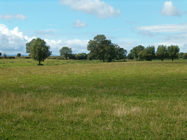
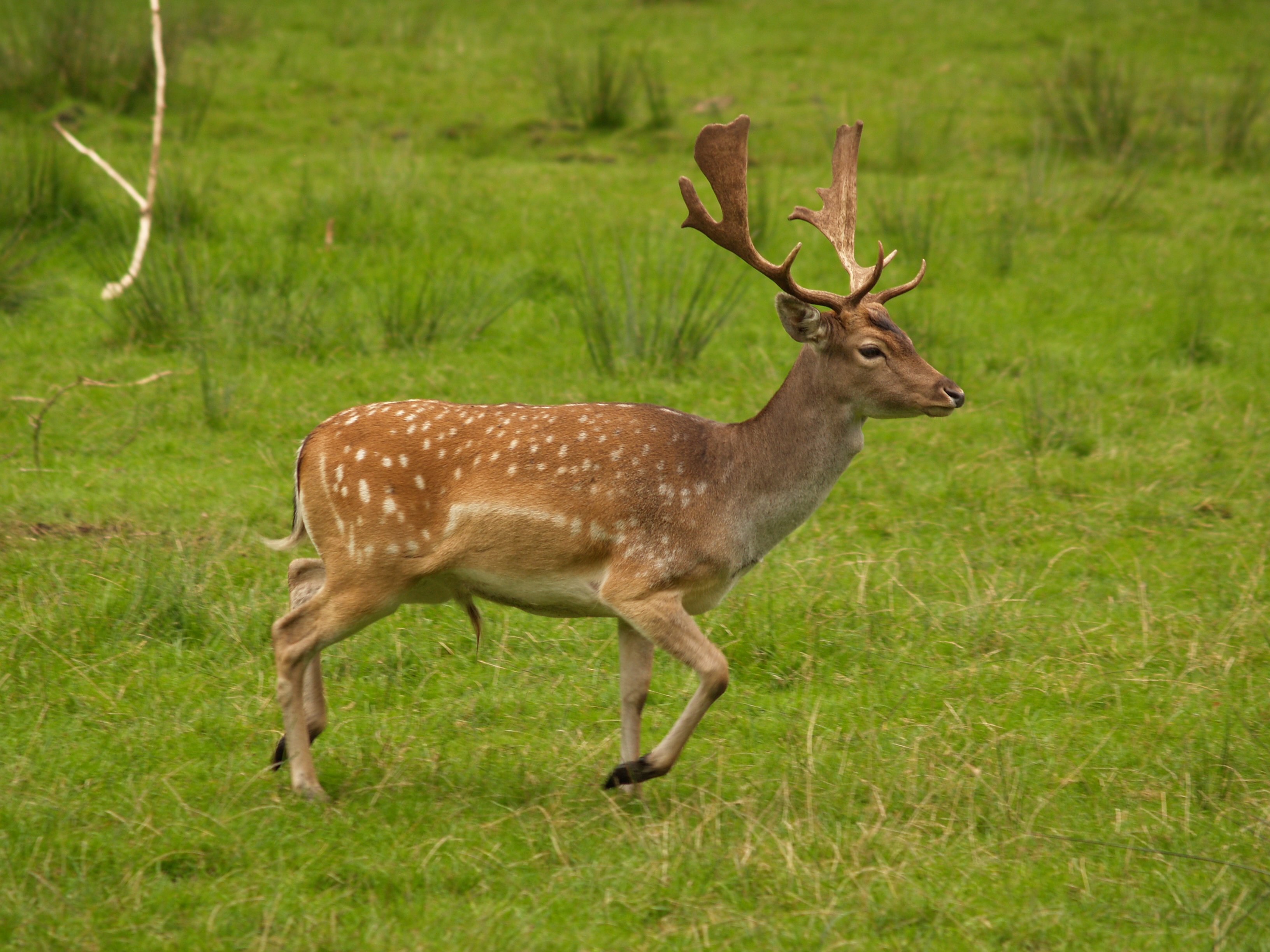
Greylake () is a 9.3 hectare geological Site of Special Scientific Interest near Middlezoy in Somerset, SSSI notification, notified in 1987. This site, on the Somerset Levels, consists of 20 low-lying fields in the north west corner of King's Sedgemoor, and includes the Royal Society for the Protection of Birds Greylake nature reserve which has taken over arable farmland and is now home to northern lapwings, common snipe, Eurasian curlews, Common redshank, redshanks, Western yellow wagtail, yellow wagtails, Eurasian skylark, skylarks, and meadow pipits. This location is the type section for the Pleistocene Burtle Beds, as it is probably the most complete Burtle Beds sequence in Somerset. It demonstrates a sequence of fluvial (or possibly glacial) gravels, marine Intertidal zone, intertidal silts and marine subtidal. Rich Mollusca, molluscan, ostracod, and foraminifera assemblages and a mammalian fauna, including red deer (''Cervus elephus''), aurochs (''Bos primigenius''), and fa ... [...More Info...] [...Related Items...] OR: [Wikipedia] [Google] [Baidu] |
Middlezoy
Middlezoy is a village and civil parish on the Somerset Levels in the Sedgemoor district of Somerset, England. Situated between the two other villages of Westonzoyland and Othery and is about six miles from the Town of Bridgwater which is on the tidal river Parret. History The name Middlezoy meaning ''the middle stream island'', derives from ''Sowi'', the name of Glastonbury Abbey's major estate, ''sow'', a British river name from a root meaning ''flowing''. The extra i is derived from the Saxon ''ig'' for island. The parish of Middlezoy was part of the Whitley Hundred. In 1800 1,100 acres of common land were enclosed as a result of the Inclosure Acts. In 2006 the village shop closed and a grant was obtained for the erection of a new modular structure to house a community shop and post office. In 2018 Middlezoy Aerodrome was founded on the south side of nearby (1.5 miles away) ex RAF Westonzoyland Airfield. The site includes a recently built hangar & original Nissen hut. ... [...More Info...] [...Related Items...] OR: [Wikipedia] [Google] [Baidu] |
Winter Flooding Of 2013–14 On The Somerset Levels
From December 2013 onwards the Somerset Levels suffered severe flooding as part of the wider 2013–2014 Atlantic winter storms in Europe and subsequent 2013–2014 United Kingdom winter floods. The Somerset Levels, or the Somerset Levels and Moors as they are less commonly but more correctly known, is a coastal plain and wetland area of central Somerset, in South West England, running south from the Mendip Hills to the Blackdown Hills. The Levels are a low-lying area around above mean sea level ( O.D.) which have been prone to flooding from fresh water and occasional salt water inundations. People have attempted to drain the area for hundreds of years. In the Middle Ages, the monasteries of Glastonbury, Athelney, and Muchelney reclaimed and enclosed much of the land. Drains and artificial rivers have been built and pumping stations installed. During December 2013 and January 2014 heavy rainfall led to extensive flooding with over 600 houses and of agricultural land, includi ... [...More Info...] [...Related Items...] OR: [Wikipedia] [Google] [Baidu] |
Sites Of Special Scientific Interest In Somerset
__NOTOC__ This is a list of the Sites of Special Scientific Interest (SSSIs) in Somerset, England, United Kingdom. In England the body responsible for designating SSSIs is Natural England Natural England is a non-departmental public body in the United Kingdom sponsored by the Department for Environment, Food and Rural Affairs. It is responsible for ensuring that England's natural environment, including its land, flora and fauna, ..., which chooses a site because of its fauna, plant, flora, geology, geological or physiographical features. There are 127 sites designated in this Area of Search, of which 83 have been designated due to their biological interest, 35 due to their geological interest, and 9 for both. Natural England took over the role of designating and managing SSSIs from English Nature in October 2006 when it was formed from the amalgamation of English Nature, parts of the Countryside Agency and the Rural Development Service. Natural England, like its predecessor, u ... [...More Info...] [...Related Items...] OR: [Wikipedia] [Google] [Baidu] |
Somerset Levels
The Somerset Levels are a coastal plain and wetland area of Somerset, England, running south from the Mendip Hills, Mendips to the Blackdown Hills. The Somerset Levels have an area of about and are bisected by the Polden Hills; the areas to the south are drained by the River Parrett, and the areas to the north by the rivers River Axe (Bristol Channel), Axe and River Brue, Brue. The Mendip Hills separate the Somerset Levels from the North Somerset Levels. The Somerset Levels consist of marine clay "levels" along the coast and inland peat-based "moors"; agriculturally, about 70 per cent is used as grassland and the rest is arable. Willow and Dipsacus fullonum, teazel are grown commercially and peat is extracted. A Palaeolithic flint tool found in West Sedgemoor is the earliest indication of human presence in the area. The Neolithic people exploited the reed swamps for their natural resources and started to construct wooden trackways, including the world's oldest known tim ... [...More Info...] [...Related Items...] OR: [Wikipedia] [Google] [Baidu] |
King's Sedgemoor
King's Sedgemoor is a piece of rich animal habitat and farming land, that forms part of the Somerset Levels and Moors in South West England. The area of King's Sedgemoor fell within the Whitley Hundred, It is a Site of Special Scientific Interest, at the centre of the larger Altcar series peat basin of King’s Sedgemoor; lying between the Sowy River to the west, Cradle Bridge to the east and extending to the south over Beer Wall into part of Aller Moor. It is adjacent to the Greylake SSSI. King's Sedgemoor Drain, originally constructed in 1797-8, proved inadequate for draining the village of Chedzoy's moors, so in 1861 the Chedzoy Internal Drainage District built a small pumping station on the River Parrett, in Westonzoyland Westonzoyland is a village and civil parish in Somerset, England. It is situated on the Somerset Levels, south east of Bridgwater. History The name of the parish derives from its location on the "island" of Sowy, an area of slightly higher groun ... [...More Info...] [...Related Items...] OR: [Wikipedia] [Google] [Baidu] |
Fluvial
In geography and geology, fluvial processes are associated with rivers and streams and the deposits and landforms created by them. When the stream or rivers are associated with glaciers, ice sheets, or ice caps, the term glaciofluvial or fluvioglacial is used. Fluvial processes Fluvial processes include the motion of sediment and erosion or deposition on the river bed. The movement of water across the stream bed exerts a shear stress directly onto the bed. If the cohesive strength of the substrate is lower than the shear exerted, or the bed is composed of loose sediment which can be mobilized by such stresses, then the bed will be lowered purely by clearwater flow. In addition, if the river carries significant quantities of sediment, this material can act as tools to enhance wear of the bed ( abrasion). At the same time the fragments themselves are ground down, becoming smaller and more rounded (attrition). Sediment in rivers is transported as either bedload (the coarser fr ... [...More Info...] [...Related Items...] OR: [Wikipedia] [Google] [Baidu] |
Fallow Deer
''Dama'' is a genus of deer in the subfamily Cervinae, commonly referred to as fallow deer. Name The name fallow is derived from the deer's pale brown colour. The Latin word ''dāma'' or ''damma'', used for roe deer, gazelles, and antelopes, lies at the root of the modern scientific name, as well as the German ''Damhirsch'', French ''daim'', Dutch ''damhert'', and Italian ''daino''. In Croatian and Serbian, the name for the fallow deer is ''jelen lopatar'' ("shovel deer"), due to the form of its antlers. The Modern Hebrew name of the fallow deer is ''yachmur'' (יחמור). Taxonomy and evolution The genus includes two extant species: Extant species Some taxonomists include the Persian fallow deer as a subspecies In biological classification, subspecies is a rank below species, used for populations that live in different areas and vary in size, shape, or other physical characteristics (morphology), but that can successfully interbreed. Not all species ... (''D. d. me ... [...More Info...] [...Related Items...] OR: [Wikipedia] [Google] [Baidu] |
Aurochs
The aurochs (''Bos primigenius'') ( or ) is an extinct cattle species, considered to be the wild ancestor of modern domestic cattle. With a shoulder height of up to in bulls and in cows, it was one of the largest herbivores in the Holocene; it had massive elongated and broad horns that reached in length. The aurochs was part of the Pleistocene megafauna. It probably evolved in Asia and migrated west and north during warm interglacial periods. The oldest known aurochs fossils found in India and North Africa date to the Middle Pleistocene and in Europe to the Holstein interglacial. As indicated by fossil remains in Northern Europe, it reached Denmark and southern Sweden during the Holocene. The aurochs declined during the late Holocene due to habitat loss and hunting, and became extinct when the last individual died in 1627 in Jaktorów forest in Poland. The aurochs is depicted in Paleolithic cave paintings, Neolithic petroglyphs, Ancient Egyptian reliefs and Bronze ... [...More Info...] [...Related Items...] OR: [Wikipedia] [Google] [Baidu] |
Red Deer
The red deer (''Cervus elaphus'') is one of the largest deer species. A male red deer is called a stag or hart, and a female is called a hind. The red deer inhabits most of Europe, the Caucasus Mountains region, Anatolia, Iran, and parts of western Asia. It also inhabits the Atlas Mountains of Northern Africa; its early ancestors are thought to have crossed over to Morocco, then to Algeria, Libya and Tunisia via the Strait of Gibraltar, becoming the only species of true deer (Cervidae) to inhabit Africa. Red deer have been introduced to other areas, including Australia, New Zealand, the United States, Canada, Peru, Uruguay, Chile and Argentina. In many parts of the world, the meat (venison) from red deer is used as a food source. Red deer are ruminants, characterized by a four-chambered stomach. Genetics, Genetic evidence indicates that the red deer, as traditionally defined, is a species group, rather than a single species, though exactly how many species the group includes rem ... [...More Info...] [...Related Items...] OR: [Wikipedia] [Google] [Baidu] |
Foraminifera
Foraminifera (; Latin for "hole bearers"; informally called "forams") are single-celled organisms, members of a phylum or class of amoeboid protists characterized by streaming granular Ectoplasm (cell biology), ectoplasm for catching food and other uses; and commonly an external shell (called a "Test (biology), test") of diverse forms and materials. Tests of chitin (found in some simple genera, and Textularia in particular) are believed to be the most primitive type. Most foraminifera are marine, the majority of which live on or within the seafloor sediment (i.e., are benthos, benthic), while a smaller number float in the water column at various depths (i.e., are planktonic), which belong to the suborder Globigerinina. Fewer are known from freshwater or brackish conditions, and some very few (nonaquatic) soil species have been identified through molecular analysis of small subunit ribosomal DNA. Foraminifera typically produce a test (biology), test, or shell, which can have eithe ... [...More Info...] [...Related Items...] OR: [Wikipedia] [Google] [Baidu] |
Ostracod
Ostracods, or ostracodes, are a class of the Crustacea (class Ostracoda), sometimes known as seed shrimp. Some 70,000 species (only 13,000 of which are extant) have been identified, grouped into several orders. They are small crustaceans, typically around in size, but varying from in the case of ''Gigantocypris''. Their bodies are flattened from side to side and protected by a bivalve-like, chitinous or calcareous valve or "shell". The hinge of the two valves is in the upper (dorsal) region of the body. Ostracods are grouped together based on gross morphology. While early work indicated the group may not be monophyletic and early molecular phylogeny was ambiguous on this front, recent combined analyses of molecular and morphological data found support for monophyly in analyses with broadest taxon sampling. Ecologically, marine ostracods can be part of the zooplankton or (most commonly) are part of the benthos, living on or inside the upper layer of the sea floor. While Myodoc ... [...More Info...] [...Related Items...] OR: [Wikipedia] [Google] [Baidu] |


