|
Green Lake County, Wisconsin
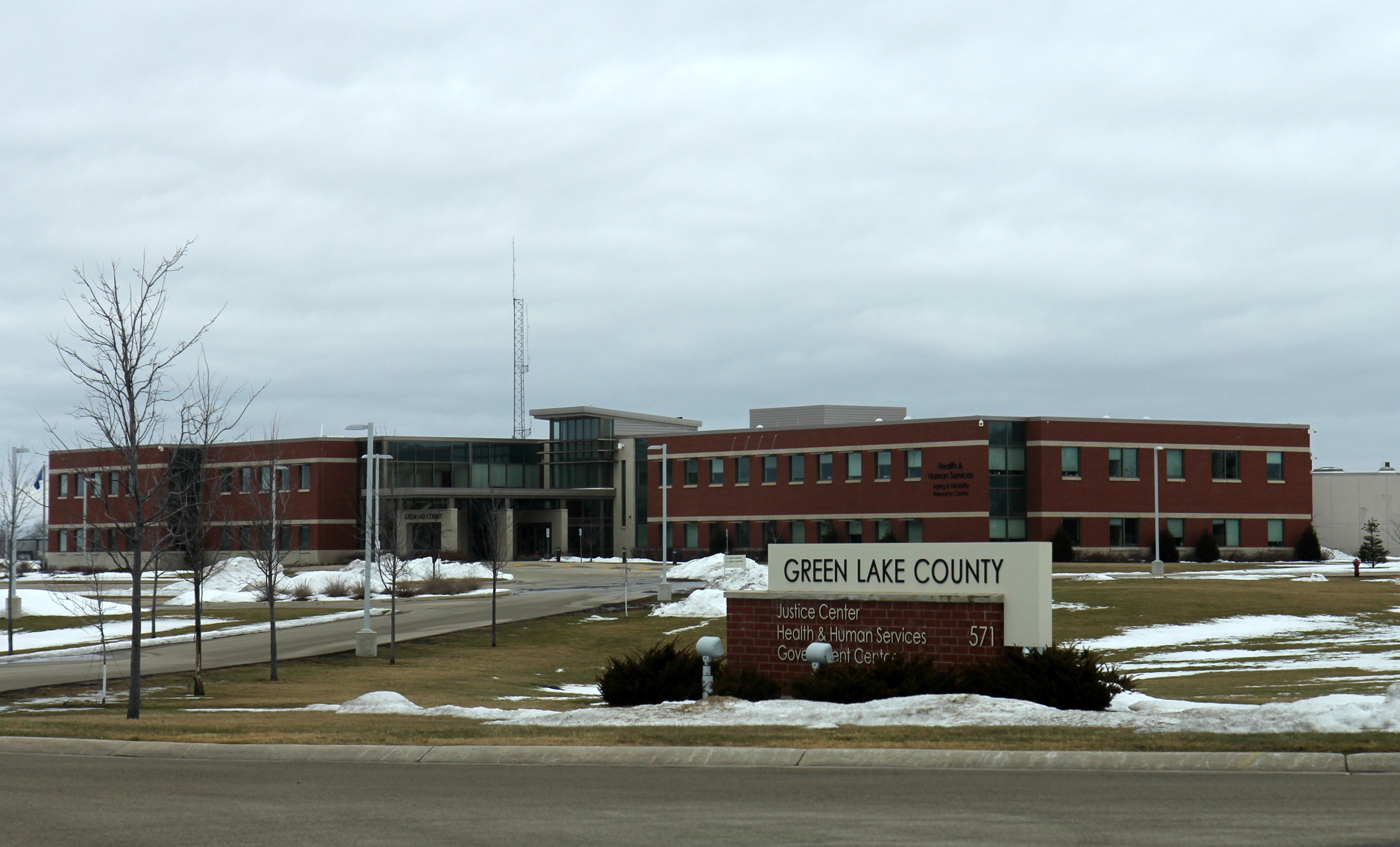
Green Lake County is a county located in the U.S. state of Wisconsin. As of the 2020 census, the population was 19,018. Its county seat is Green Lake. In 2020, the center of population of Wisconsin was located in Green Lake County, near the city of Markesan. Geography According to the U.S. Census Bureau, the county has a total area of , of which are land and (8.1%) are covered by water. It is the third-smallest county in Wisconsin by total area. Major highways * Highway 23 (Wisconsin) * Highway 44 (Wisconsin) * Highway 49 (Wisconsin) * Highway 73 (Wisconsin) * Highway 91 (Wisconsin) Railroads *Union Pacific *Wisconsin and Southern Railroad Buses *List of intercity bus stops in Wisconsin Adjacent counties * Waushara County – north * Winnebago County – northeast * Fond du Lac County – east * Dodge County – southeast * Columbia County – southwest * Marquette County – west Demographics 2020 census As of the census of 2020, the population was 1 ... [...More Info...] [...Related Items...] OR: [Wikipedia] [Google] [Baidu] |
Green Lake (Wisconsin)
Green Lake — also known as Big Green Lake (to distinguish it from Little Green Lake, which is near Markesan, Wisconsin, Markesan)— is a lake in Green Lake County, Wisconsin, United States. Green Lake has a maximum depth of , making it the deepest natural inland lake in Wisconsin and the second largest by volume. The lake covers and has an average depth of . Green Lake has of diverse shoreline, ranging from sandstone bluffs to marshes. History First Settlers The Ho-Chunk Nation of Wisconsin, also referred to as the Winnebago, were some of the first residents in the Green Lake Area. Green Lake, also known as Daycholah, is a spiritual place for the Winnebago. One legend describes how one must bring gifts for the Water Spirit that lives under the lake in order to enter. With the increase of European settlers, the Winnebago were subject to forced relocation by the United States government several times. Once they were removed from the Green Lake area, they were moved to Iowa ... [...More Info...] [...Related Items...] OR: [Wikipedia] [Google] [Baidu] |
WIS 73
State Trunk Highway 73 (often called Highway 73, STH-73 or WIS 73) is a state highway in the central part of the US state of Wisconsin that runs mostly north–south from Ingram to near Edgerton. The exception is in Wood and Adams counties, where this highway runs east–west. It is one of the longer Wisconsin state highways. Route description WIS 73 starts in Dane County at an interchange with Interstate 39 (I-39), I-90 (exit 160), US Highway 51 (US 51) north of the city of Edgerton. Also near this junction, WIS 106 meets WIS 73 east of Albion. WIS 73 heads north where it meets US 12 and US 18. WIS 73 continues north and heads to Deerfield. About north of Deerfield, it meets I-94 at exit 250, and continues north another four miles to Marshall where it has a brief overlap with WIS 19. It continues north about to the city of Columbus. Just before it goes under an overpass of US 151, it cro ... [...More Info...] [...Related Items...] OR: [Wikipedia] [Google] [Baidu] |
2020 United States Census
The United States census of 2020 was the twenty-fourth decennial United States census. Census Day, the reference day used for the census, was April 1, 2020. Other than a pilot study during the 2000 census, this was the first U.S. census to offer options to respond online or by phone, in addition to the paper response form used for previous censuses. The census was taken during the COVID-19 pandemic, which affected its administration. The census recorded a resident population of 331,449,281 in the fifty states and the District of Columbia, an increase of 7.4 percent, or 22,703,743, over the preceding decade. The growth rate was the second-lowest ever recorded, and the net increase was the sixth highest in history. This was the first census where the ten most populous states each surpassed 10 million residents as well as the first census where the ten most populous cities each surpassed 1 million residents. Background As required by the United States Constitution, the U.S. cens ... [...More Info...] [...Related Items...] OR: [Wikipedia] [Google] [Baidu] |
Marquette County, Wisconsin
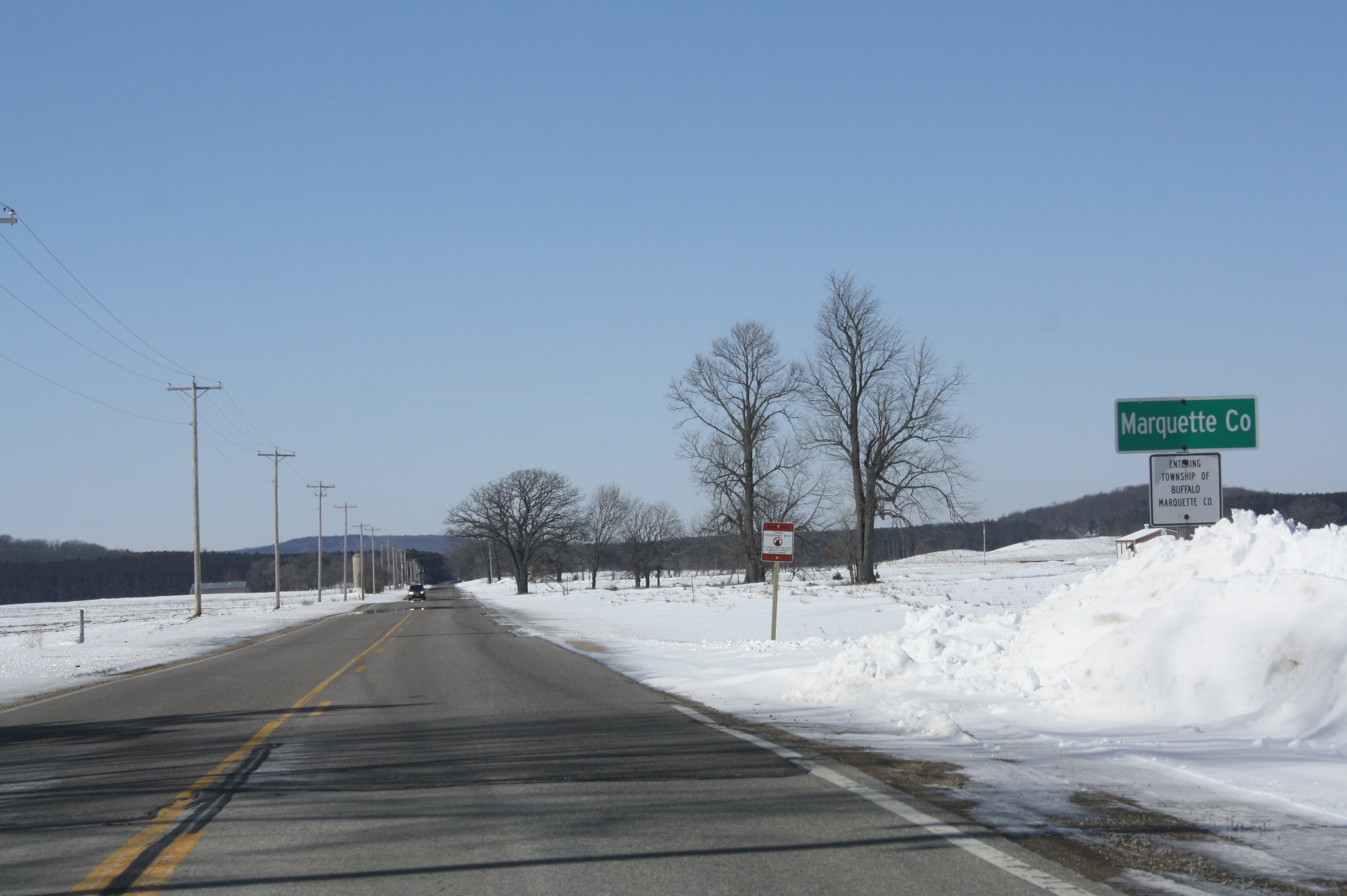
Marquette County is a county located in the U.S. state of Wisconsin. As of the 2020 census, the population was 15,592. Its county seat is Montello. The county was created in 1836 from the Wisconsin Territory and organized in 1848. Geography According to the U.S. Census Bureau, the county has a total area of , of which is land and (1.9%) is water. The Mecan River, Buffalo Lake, and Puckaway Lake lie within Marquette County. The highest altitude in the county is a rocky area known as Mt. Shaw. Major highways * Interstate 39 * U.S. Highway 51 * Highway 22 (Wisconsin) * Highway 23 (Wisconsin) * Highway 73 (Wisconsin) * Highway 82 (Wisconsin) Railroads *Union Pacific Buses *List of intercity bus stops in Wisconsin Adjacent counties * Waushara County - north * Green Lake County - east * Columbia County - south * Adams County - west National protected area * Fox River National Wildlife Refuge Demographics 2020 census As of the census of 2020, the population was ... [...More Info...] [...Related Items...] OR: [Wikipedia] [Google] [Baidu] |
Columbia County, Wisconsin
Columbia County is a county located in the U.S. state of Wisconsin. As of the 2020 census, the population was 58,490. Its county seat and largest city is Portage. The county was created in 1846 as part of Wisconsin Territory. Columbia County is part of the Madison, WI Metropolitan Statistical Area as well as the Madison- Janesville- Beloit, WI Combined Statistical Area. Geography According to the U.S. Census Bureau, the county has a total area of , of which is land and (3.8%) is water. The county's highest point is in the Baraboo Range, near Durward's Glen at 1,480 feet above sea level. Major highways * Interstate 39 * Interstate 90 * Interstate 94 * U.S. Highway 51 * U.S. Highway 151 * Highway 13 * Highway 16 * Highway 22 * Highway 23 * Highway 33 * Highway 44 * Highway 60 * Highway 73 * Highway 78 * Highway 89 * Highway 113 * Highway 127 * Highway 146 * Highway 188 Railroads *Amtrak *Wisconsin and Southern Railroad *Canadian Pacific *Union ... [...More Info...] [...Related Items...] OR: [Wikipedia] [Google] [Baidu] |
Dodge County, Wisconsin
Dodge County is a county located in the U.S. state of Wisconsin. As of the 2020 census, the population was 89,396. Its county seat is Juneau. The county was created from the Wisconsin Territory in 1836 and organized in 1844. Dodge County comprises the Beaver Dam, WI Micropolitan Statistical Area, which is included in the Milwaukee- Racine- Waukesha, WI Combined Statistical Area. Geography According to the U.S. Census Bureau, the county has a total area of , of which is land and (3.5%) is water. The 6,718 acre Beaver Dam Lake and the 2,713 acre Fox Lake are found within the county. Adjacent counties * Fond du Lac County – northeast * Washington County – east * Waukesha County – southeast * Jefferson County – south * Dane County – southwest * Columbia County – west * Green Lake County – northwest National protected area * Horicon National Wildlife Refuge (part) Climate Demographics 2020 census As of the census of 2020, the population was 89,396 ... [...More Info...] [...Related Items...] OR: [Wikipedia] [Google] [Baidu] |
Fond Du Lac County, Wisconsin
Fond du Lac County is a county in the U.S. state of Wisconsin. As of the 2020 census, the population was 104,154. Its county seat is Fond du Lac. The county was created in the Wisconsin Territory in 1836 and later organized in 1844. Fond du Lac is French for "bottom of the lake", so given because of the county's location at the southern shore of Lake Winnebago. Fond du Lac County comprises the Fond du Lac, Wisconsin Metropolitan Statistical Area. The Holyland region is in northeastern Fond du Lac County. Geography According to the U.S. Census Bureau, the county has a total area of , of which is land and (6.0%) is water. Adjacent counties * Winnebago County – north * Calumet County – northeast * Sheboygan County – east * Washington County – southeast * Dodge County – southwest * Green Lake County – west National protected area * Horicon National Wildlife Refuge (part) Transportation Major highways * Interstate 41 * U.S. Highway 41 * U.S. Highway ... [...More Info...] [...Related Items...] OR: [Wikipedia] [Google] [Baidu] |
Winnebago County, Wisconsin
Winnebago County is a county in the U.S. state of Wisconsin. As of the 2020 census, the population was 171,730. Its county seat is Oshkosh. It was named for the historic Winnebago people, a federally recognized Native American tribe now known as the Ho-Chunk Nation. Chief Oshkosh was a Menominee leader in the area. Winnebago County comprises the Oshkosh-Neenah, WI Metropolitan Statistical Area, which is included in the Appleton-Oshkosh-Neenah, WI Combined Statistical Area. History The region was occupied by several Native American tribes in the period of European encounter, including the Sauk, Fox, Menominee, and Ojibwa (known as Chippewa in the US). French traders from what is now Canada had early interaction with them, as did French Jesuit missionaries, who sought to convert them to Catholicism. European and American settlement encroached on their traditional territories, and the United States negotiated treaties in the mid-19th century to keep pushing the Indians to the we ... [...More Info...] [...Related Items...] OR: [Wikipedia] [Google] [Baidu] |
Waushara County, Wisconsin
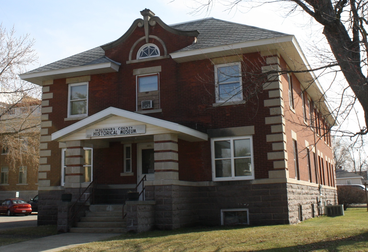
Waushara County is a county located in the U.S. state of Wisconsin. As of the 2020 census, the population was 24,520. Its county seat is Wautoma. Waushara County is located in central Wisconsin, about north of Madison. History Waushara County was established by an act of the Wisconsin Legislature on February 15, 1851. It originally consisted of a single organized Town of Waushara. In 1852 the county achieved full organization. The county seat was first located at Sacramento and was relocated to Wautoma in 1854 after a bitter fight between proponents of the two places. The name is of Ho-Chunk origin and is believed to mean "good land". Geography According to the U.S. Census Bureau, the county has a total area of , of which is land and (1.8%) is water. Major highways * Interstate 39 * U.S. Highway 51 * Highway 21 (Wisconsin) * Highway 22 (Wisconsin) * Highway 49 (Wisconsin) * Highway 73 (Wisconsin) Buses *List of intercity bus stops in Wisconsin Airports * Waut ... [...More Info...] [...Related Items...] OR: [Wikipedia] [Google] [Baidu] |
List Of Intercity Bus Stops In Wisconsin
The following is a list of presently operating intercity bus stops in Wisconsin with regular service. The list excludes charter buses, local transit buses, paratransit systems, and trolleybus systems. The following companies provide intercity bus service in Wisconsin as of September 2022: * Amtrak Thruway * Badger Bus * Flixbus * Greyhound Lines * Indian Trails * Jefferson Lines * Lamers Bus Lines * Megabus * Tornado Bus Company * Van Galder Bus Company * Wisconsin Coach Lines Stops This is the list of 71 active intercity bus stops serving 54 cities in Wisconsin. This list does not include stops that are served only by commuter buses and not intercity buses. This list also does not include Tornado Bus Company stops, due to the difficulty of acquiring information on routes and stop locations. Notes The following intercity bus stops in Illinois and Minnesota connect with local transit systems which operate in Wisconsin. Former See also * List of Amtrak statio ... [...More Info...] [...Related Items...] OR: [Wikipedia] [Google] [Baidu] |
Wisconsin And Southern Railroad
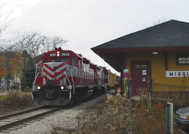
The Wisconsin and Southern Railroad is a Class II regional railroad in Southern Wisconsin and Northeastern Illinois currently operated by Watco. It operates former Chicago, Milwaukee, St. Paul and Pacific Railroad (Milwaukee Road) and Chicago and North Western Railway (C&NW) trackage, mostly acquired by the state of Wisconsin in the 1980s. Within Wisconsin, WSOR connects with four western Class I railroads: BNSF Railway, Canadian National Railway, Canadian Pacific Railway, and Union Pacific Railroad. Through trackage rights over Metra, WSOR accesses Chicago to connect with the two eastern Class I railroads, CSX Transportation and Norfolk Southern Railway. WSOR also has access to harbor facilities in Prairie du Chien, and transload facilities are located in Milwaukee, Janesville, Madison, and Oshkosh. 22 grain elevators have located rail load-out facilities on the WSOR system. For train operation purposes, the WSOR system is divided into two divisions, the Northern Division ... [...More Info...] [...Related Items...] OR: [Wikipedia] [Google] [Baidu] |
Union Pacific
The Union Pacific Railroad , legally Union Pacific Railroad Company and often called simply Union Pacific, is a freight-hauling railroad that operates 8,300 locomotives over routes in 23 U.S. states west of Chicago and New Orleans. Union Pacific is the second largest railroad in the United States after BNSF, with which it shares a duopoly on transcontinental freight rail lines in the Western, Midwestern and Southern United States. Founded in 1862, the original Union Pacific Rail Road was part of the first transcontinental railroad project, later known as the Overland Route. Over the next century, UP absorbed the Missouri Pacific Railroad, the Chicago and North Western Transportation Company, the Western Pacific Railroad, the Missouri–Kansas–Texas Railroad and the Chicago, Rock Island and Pacific Railroad. In 1996, the Union Pacific merged with Southern Pacific Transportation Company, itself a giant system that was absorbed by the Denver and Rio Grande Western Railroad. ... [...More Info...] [...Related Items...] OR: [Wikipedia] [Google] [Baidu] |


