|
Great Council Of Mechelen
From the 15th century onwards, the Great Council of the Netherlands at Mechelen (Dutch: ''De Grote Raad der Nederlanden te Mechelen''; French: ''le grand conseil des Pays-Bas à Malines''; German: ''der Grosse Rat der Niederlände zu Mecheln'') was the highest court in the Burgundian Netherlands. It was responsible for the Dutch-, French- and German-speaking areas. In Luxembourgish the phrase ''"mir ginn op Mechelen"'' (we'll go to Mechelen) still means playing one's last trump card. The Grote Raad first sat in the Schepenhuis in Mechelen then, from 1616, in the (old) palace of Margaretha of Austria on Keizerstraat. Origins and history The medieval rulers were assisted by advisers. Together with the ruler they formed the Council of State, also called the ''consilium'' or ''curia''. Gradually the council became more specialised, with separate financial, judicial and political council emerging. In the Burgundian Netherlands, the councils initially travelled with the Duke. In 147 ... [...More Info...] [...Related Items...] OR: [Wikipedia] [Google] [Baidu] |
Overijssel
Overijssel (, ; nds, Oaveriessel ; german: Oberyssel) is a province of the Netherlands located in the eastern part of the country. The province's name translates to "across the IJssel", from the perspective of the Episcopal principality of Utrecht by which it was held until 1528. The capital city of Overijssel is Zwolle (pop. 127,497) and the largest city is Enschede (pop. 158,986). The province had a population of 1,162,215 as of November 2019. The land mostly consists of grasslands and some forests (including Sallandse Heuvelrug National Park); it also borders a small part of the IJsselmeer to the west. Geography Overijssel is bordered by Germany (Lower Saxony and North Rhine-Westphalia) to the east, the Achterhoek region of Gelderland to the south, the Veluwe region of Gelderland and Flevoland to the west, and Friesland and the former moors of Drenthe to the north. Overijssel comprises three regions: Kop van Overijssel in the northwest, Salland in the centre ... [...More Info...] [...Related Items...] OR: [Wikipedia] [Google] [Baidu] |
Duchy Of Brabant
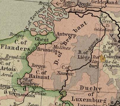
The Duchy of Brabant was a State of the Holy Roman Empire established in 1183. It developed from the Landgraviate of Brabant and formed the heart of the historic Low Countries, part of the Burgundian Netherlands from 1430 and of the Habsburg Netherlands from 1482, until it was partitioned after the Dutch revolt. Present-day North Brabant (''Noord-Brabant'') was ceded to the Generality Lands of the Dutch Republic according to the 1648 Peace of Westphalia, while the reduced duchy remained part of the Habsburg Netherlands until it was conquered by French Revolutionary forces in 1794, which was recognized by treaty in 1797. Today all the duchy's former territories, apart from exclaves, are in Belgium except for the Dutch province of North Brabant. Geography The Duchy of Brabant (adjective: '' Brabantian'' or '' Brabantine'') was historically divided into four parts, each with its own capital. The four capitals were Leuven, Brussels, Antwerp and 's-Hertogenbosch. Before ' ... [...More Info...] [...Related Items...] OR: [Wikipedia] [Google] [Baidu] |
Duchy Of Luxembourg
The Duchy of Luxemburg ( nl, Luxemburg; french: Luxembourg; german: Luxemburg; lb, Lëtzebuerg) was a state of the Holy Roman Empire, the ancestral homeland of the noble House of Luxembourg. The House of Luxembourg, now Duke of Limburg, became one of the most important political forces in the 14th century, competing against the House of Habsburg for supremacy in Central Europe. They would be the heirs to the Přemyslid dynasty in the Kingdom of Bohemia, succeeding the Kingdom of Hungary and contributing four Holy Roman Emperors until their own line of male heirs came to an end and the House of Habsburg got the pieces that the two Houses had originally agreed upon in the Treaty of Brünn in 1364. In 1443, the duchy passed to Duke Philip the Good of Burgundy of the French House of Valois, and, in 1477, by marriage to Archduke Maximilian I of Austria of the House of Habsburg. The Seventeen Provinces of the former Burgundian Netherlands were formed into an integral u ... [...More Info...] [...Related Items...] OR: [Wikipedia] [Google] [Baidu] |
County Of Hainaut
The County of Hainaut (french: Comté de Hainaut; nl, Graafschap Henegouwen; la, comitatus hanoniensis), sometimes spelled Hainault, was a territorial lordship within the medieval Holy Roman Empire that straddled what is now the border of Belgium and France. Its most important towns included Mons ( nl, Bergen), now in Belgium, and Valenciennes, now in France. The core of the county was named after the river Haine. It stretched southeast to include the '' Avesnois'' region and southwest to the Selle (Scheldt tributary). In the Middle Ages, it also gained control of part of the original ''pagus'' of Brabant to its north and the ''pagus'' of Oosterbant to the east, but they were not part of the old ''pagus'' of Hainaut. In modern terms, the original core of Hainaut consisted of the central part of the Belgian province of Hainaut, and the eastern part of the French ''département'' of Nord (the arrondissements of Avesnes-sur-Helpe and Valenciennes). Hainaut already appeared ... [...More Info...] [...Related Items...] OR: [Wikipedia] [Google] [Baidu] |
County Of Flanders
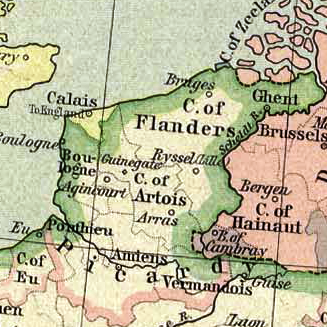
The County of Flanders was a historic territory in the Low Countries. From 862 onwards, the counts of Flanders were among the original twelve peers of the Kingdom of France. For centuries, their estates around the cities of Ghent, Bruges and Ypres formed one of the most affluent regions in Europe. Up to 1477, the area under French suzerainty was west of the Scheldt and was called "Royal Flanders" (Dutch: ''Kroon-Vlaanderen'', French: ''Flandre royale''). Aside from this, the counts, from the 11th century onward, held land east of the river as a fief of the Holy Roman Empire: "Imperial Flanders" (''Rijks-Vlaanderen'' or ''Flandre impériale''). Part of the Burgundian Netherlands from 1384, which had a complex relation with France, the whole county fell to the Empire after the Peace of Madrid in 1526 and the Peace of the Ladies in 1529. Having already regained much, by 1795, the rest – within the Austrian Netherlands – was acquired likewise by France under the Fren ... [...More Info...] [...Related Items...] OR: [Wikipedia] [Google] [Baidu] |
Artois
Artois ( ; ; nl, Artesië; English adjective: ''Artesian'') is a region of northern France. Its territory covers an area of about 4,000 km2 and it has a population of about one million. Its principal cities are Arras (Dutch: ''Atrecht''), Saint-Omer, Lens, and Béthune. It is the eponym for the term '' artesian''. Location Artois occupies the interior of the Pas-de-Calais ''département'',"Artois" in '' The New Encyclopædia Britannica''. Chicago: Encyclopædia Britannica Inc., 15th ed., 1992, Vol. 1, p. 607. the western part of which constitutes the former Boulonnais. Artois roughly corresponds to the arrondissements of Arras, Béthune, Saint Omer, and Lens, and the eastern part of the arrondissement of Montreuil. It occupies the western end of the coalfield which stretches eastward through the neighbouring Nord ''département'' and across central Belgium. History Originally a feudal county itself, Artois was annexed by the county of Flanders. It came to France in ... [...More Info...] [...Related Items...] OR: [Wikipedia] [Google] [Baidu] |
Southern Netherlands
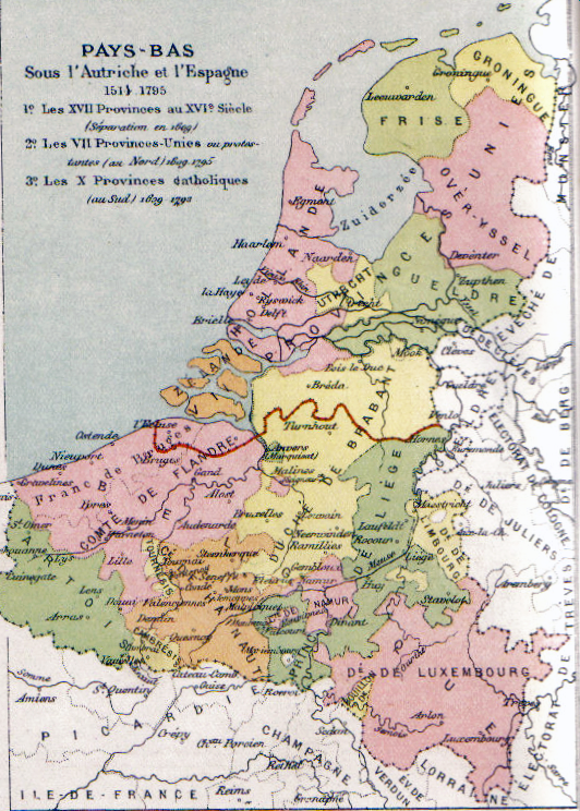
The Southern Netherlands, also called the Catholic Netherlands, were the parts of the Low Countries belonging to the Holy Roman Empire which were at first largely controlled by Habsburg Spain (Spanish Netherlands, 1556–1714) and later by the Austrian Habsburgs (Austrian Netherlands, 1714–1794) until occupied and annexed by Revolutionary France (1794–1815). The region also included a number of smaller states that were never ruled by Spain or Austria: the Prince-Bishopric of Liège, the Imperial Abbey of Stavelot-Malmedy, the County of Bouillon, the County of Horne and the Princely Abbey of Thorn. The Southern Netherlands comprised most of modern-day Belgium and Luxembourg, small parts of the modern Netherlands and Germany (the Upper Guelders region, as well as the Bitburg area in Germany, then part of Luxembourg), in addition to (until 1678) most of the present Nord-Pas-de-Calais region, and Longwy area in northern France. The (southern) Upper Guelders region consiste ... [...More Info...] [...Related Items...] OR: [Wikipedia] [Google] [Baidu] |
Hoge Raad Van Holland En Zeeland
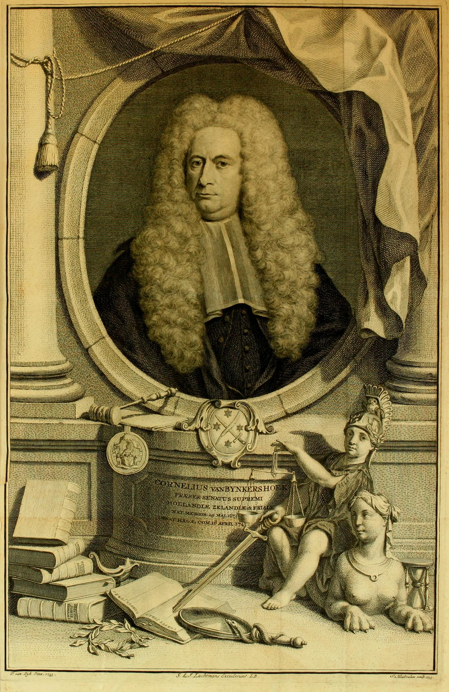
The Hoge Raad van Holland, Zeeland en West-Friesland (; usually translated in the literature as "High Court of Holland and Zeeland," though "Supreme Court" may better designate its function, and the literal translation is: "High ''Council'' of Holland and Zeeland") was the supreme court of the provinces of Holland and Zeeland in the Dutch Republic in the period 1582-1795. This court is considered a direct predecessor of the current ''Hoge Raad der Nederlanden'' (Supreme Court of the Netherlands). It played an important role in the formation of Roman-Dutch law, which still influences law in Southern Africa, through its jurisprudence. History The Great Council of Mechelen was the final Court of Appeal in the Habsburg Netherlands for all provincial High Courts. When, however, the rebellious provinces of Holland and Zeeland became physically separated from this court due to the difficulties for travellers during the military campaigns of the early Eighty Years' War after 1572, the pra ... [...More Info...] [...Related Items...] OR: [Wikipedia] [Google] [Baidu] |
Dutch Republic
The United Provinces of the Netherlands, also known as the (Seven) United Provinces, officially as the Republic of the Seven United Netherlands ( Dutch: ''Republiek der Zeven Verenigde Nederlanden''), and commonly referred to in historiography as the Dutch Republic, was a federal republic that existed from 1579, during the Dutch Revolt, to 1795 (the Batavian Revolution). It was a predecessor state of the Netherlands and the first fully independent Dutch nation state. The republic was established after seven Dutch provinces in the Spanish Netherlands revolted against rule by Spain. The provinces formed a mutual alliance against Spain in 1579 (the Union of Utrecht) and declared their independence in 1581 (the Act of Abjuration). It comprised Groningen, Frisia, Overijssel, Guelders, Utrecht, Holland and Zeeland. Although the state was small and contained only around 1.5 million inhabitants, it controlled a worldwide network of seafaring trade routes. Through it ... [...More Info...] [...Related Items...] OR: [Wikipedia] [Google] [Baidu] |
Eighty Years' War
The Eighty Years' War or Dutch Revolt ( nl, Nederlandse Opstand) ( c.1566/1568–1648) was an armed conflict in the Habsburg Netherlands between disparate groups of rebels and the Spanish government. The causes of the war included the Reformation, centralisation, taxation, and the rights and privileges of the nobility and cities. After the initial stages, Philip II of Spain, the sovereign of the Netherlands, deployed his armies and regained control over most of the rebel-held territories. However, widespread mutinies in the Spanish army caused a general uprising. Under the leadership of the exiled William the Silent, the Catholic- and Protestant-dominated provinces sought to establish religious peace while jointly opposing the king's regime with the Pacification of Ghent, but the general rebellion failed to sustain itself. Despite Governor of Spanish Netherlands and General for Spain, the Duke of Parma's steady military and diplomatic successes, the Union of Utr ... [...More Info...] [...Related Items...] OR: [Wikipedia] [Google] [Baidu] |
Brabantine Gothic
Brabantine Gothic, occasionally called Brabantian Gothic, is a significant variant of Gothic architecture that is typical for the Low Countries. It surfaced in the first half of the 14th century at St. Rumbold's Cathedral in the City of Mechelen.The earliest Brabantine Gothic style elements were built soon after 1333 when the Prince-Bishop of Liège passed his feudal claim on Mechelen, in particular through its cathedral chapter, to Louis II, Count of Flanders, who married the heiress of Brabant and in 1355 took the title of Duke of Brabant. Reputed architects such as Jean d'Oisy, Jacob van Thienen, Everaert Spoorwater, (This architect is also known as Evert van der Weyden.) Matheus de Layens, and the Keldermans and De Waghemakere families disseminated the style and techniques to cities and towns of the Duchy of Brabant and beyond.About Gothic architecture in the Low Countries, the Dutch-language term ''kustgotiek'' ('Coastal Gothic') occurs. Apparently, that literature ... [...More Info...] [...Related Items...] OR: [Wikipedia] [Google] [Baidu] |


.png)


.jpg)
