|
Grange Park, Enfield
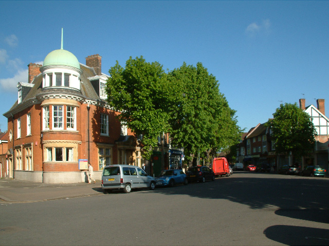
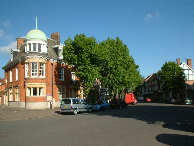
Grange Park is a suburban part of Greater London in the London Borough of Enfield, United Kingdom. It is served by Grange Park railway station. Grange Park is located between Enfield Town to the north Bush Hill to the east, Southgate and World's End to the west, and Winchmore Hill to the south. It was largely built in the early 20th century on the site of Enfield Old Park. As well as housing there is a retail and commercial area around The Grangeway, that includes the railway station and a public house, the Gryphon. There are two schools, Grange Park Primary School and Grange Park Preparatory School, and two churches, St. Peter's Church of England and Grange Park Methodist Church (The Church in the Orchard). An annual Boxing Day Tug of War takes place. Etymology Named from ''Old Park Grange'' (marked thus on the Ordnance Survey map of 1877) which was in ''Old Park'' (also 1887) earlier ''the oulde park'' 1658, ''Old Bull Park'' 1822, from Middle English Middle Engl ... [...More Info...] [...Related Items...] OR: [Wikipedia] [Google] [Baidu] |
Enfield Southgate (UK Parliament Constituency)
Enfield Southgate is a List of United Kingdom Parliament constituencies, constituency in the House of Commons of the United Kingdom, House of Commons of the Parliament of the United Kingdom, UK Parliament. It was created in 1950 as Southgate, and has been represented since 2017 by Bambos Charalambous, a member of the Labour Party (UK), Labour Party. History From 1950 to the 1983 United Kingdom general election, 1983 general election, this constituency was known as Southgate. The prefix of the seat's London Borough was added to some parts of the legislation, but not others, in 1974. It was regarded as a safe seat for the Conservative party, but it gained national attention in the 1997 United Kingdom general election, 1997 general election when Michael Portillo, Secretary of State for Defence was unexpectedly defeated on a massive swing (politics), swing - the 'Portillo moment'. Portillo had been widely expected to contest the Conservative leadership and his defeat the media took ... [...More Info...] [...Related Items...] OR: [Wikipedia] [Google] [Baidu] |
Winchmore Hill
Winchmore Hill is a suburb and electoral ward in the Borough of Enfield, North London, in the N21 postal district. With the Winchmore Hill conservation area as a focal point, the district is bounded on the east by Green Lanes (the A105 road), Barrowell Green, Firs Lane and Fords Grove, and on the north-west by Grovelands Park; in the south it extends to part of Aldermans Hill, and in the north to Vicars Moor Lane and Houndsden Road. Winchmore Hill is north north-east of Charing Cross. History Once a small hamlet in the parish of Edmonton, Winchmore Hill borders Palmers Green, Southgate, Edmonton, and Grange Park. Prior to the Roman invasion, Hertfordshire, Essex and Middlesex were occupied by the Catuvellauni tribe. It is believed that this tribe built a hill fort on the mound now occupied by Bush Hill Park Golf Club. The earliest recorded mention of Winchmore Hill is in a deed dated A.D. 1319 in which it is spelt Wynsemerhull. In Old English, 'merhull' translates ac ... [...More Info...] [...Related Items...] OR: [Wikipedia] [Google] [Baidu] |
Places In Enfield, London
Place may refer to: Geography * Place (United States Census Bureau), defined as any concentration of population ** Census-designated place, a populated area lacking its own municipal government * "Place", a type of street or road name ** Often implies a dead end (street) or cul-de-sac * Place, based on the Cornish word "plas" meaning mansion * Place, a populated place, an area of human settlement ** Incorporated place (see municipal corporation), a populated area with its own municipal government * Location (geography), an area with definite or indefinite boundaries or a portion of space which has a name in an area Placenames * Placé, a commune in Pays de la Loire, Paris, France * Plače, a small settlement in Slovenia * Place (Mysia), a town of ancient Mysia, Anatolia, now in Turkey * Place, New Hampshire, a location in the United States * Place House, a 16th-century mansion largely remodelled in the 19th century, in Fowey, Cornwall * Place House, a 19th-century mansi ... [...More Info...] [...Related Items...] OR: [Wikipedia] [Google] [Baidu] |
Middle English
Middle English (abbreviated to ME) is a form of the English language that was spoken after the Norman conquest of 1066, until the late 15th century. The English language underwent distinct variations and developments following the Old English period. Scholarly opinion varies, but the ''Oxford English Dictionary'' specifies the period when Middle English was spoken as being from 1150 to 1500. This stage of the development of the English language roughly followed the High to the Late Middle Ages. Middle English saw significant changes to its vocabulary, grammar, pronunciation, and orthography. Writing conventions during the Middle English period varied widely. Examples of writing from this period that have survived show extensive regional variation. The more standardized Old English language became fragmented, localized, and was, for the most part, being improvised. By the end of the period (about 1470) and aided by the invention of the printing press by Johannes Gutenberg in 14 ... [...More Info...] [...Related Items...] OR: [Wikipedia] [Google] [Baidu] |
Ordnance Survey
, nativename_a = , nativename_r = , logo = Ordnance Survey 2015 Logo.svg , logo_width = 240px , logo_caption = , seal = , seal_width = , seal_caption = , picture = , picture_width = , picture_caption = , formed = , preceding1 = , dissolved = , superseding = , jurisdiction = Great BritainThe Ordnance Survey deals only with maps of Great Britain, and, to an extent, the Isle of Man, but not Northern Ireland, which has its own, separate government agency, the Ordnance Survey of Northern Ireland. , headquarters = Southampton, England, UK , region_code = GB , coordinates = , employees = 1,244 , budget = , minister1_name = , minister1_pfo = , chief1_name = Steve Blair , chief1_position = CEO , agency_type = , parent_agency = , child1_agency = , keydocument1 = , website = , footnotes = , map = , map_width = , map_caption = Ordnance Survey (OS) is the national mapping agency for Great Britain. The agency's name indicates its original military purpose (se ... [...More Info...] [...Related Items...] OR: [Wikipedia] [Google] [Baidu] |
Grange Park Methodist Church
Grange Park Methodist Church, also known as The Church in the Orchard, is an architecturally notable church in the Art Deco style in Park Drive, Grange Park, in the London Borough of Enfield The London Borough of Enfield () is a London boroughs, London borough in North London. It borders the London boroughs of London Borough of Barnet, Barnet to the west, London Borough of Haringey, Haringey to the south, and London Borough of Walt .... It was designed by Charles H. Brightiff and opened in 1938."Grange Park Methodist Church" by Eileen Nicholls in ''Enfield Society News'', No. 208 (Winter 2017), p. 8. References External links *https://www.grangeparkmethodistchurch.com/[...More Info...] [...Related Items...] OR: [Wikipedia] [Google] [Baidu] |
Church Of England
The Church of England (C of E) is the established Christian church in England and the mother church of the international Anglican Communion. It traces its history to the Christian church recorded as existing in the Roman province of Britain by the 3rd century and to the 6th-century Gregorian mission to Kent led by Augustine of Canterbury. The English church renounced papal authority in 1534 when Henry VIII failed to secure a papal annulment of his marriage to Catherine of Aragon. The English Reformation accelerated under Edward VI's regents, before a brief restoration of papal authority under Queen Mary I and King Philip. The Act of Supremacy 1558 renewed the breach, and the Elizabethan Settlement charted a course enabling the English church to describe itself as both Reformed and Catholic. In the earlier phase of the English Reformation there were both Roman Catholic martyrs and radical Protestant martyrs. The later phases saw the Penal Laws punish Ro ... [...More Info...] [...Related Items...] OR: [Wikipedia] [Google] [Baidu] |
Enfield Old Park
Enfield Old Park was an ancient deer park located in Enfield. It is mentioned in the Domesday Book. The Domesday Book mentions only one other Park in Middlesex, at Ruislip, and according to Historic England both are therefore considered to be "rare and important historical sites". Today part of Old Park is built over as part of the suburb of Grange Park, but large areas also remain open and undeveloped. Early history The Park was situated around the site of an Iron Age hill fort, the remains of which can still be seen in the vicinity of the building of Old Park House (now belonging to the Bush Hill Golf Club). These constitute the largest present-day hill fort remains in the old county of Middlesex. The Domesday Book (1086) records the Manor of Enfield as being held by Geoffrey de Mandeville and mentions 'there is a park there'. The word 'park' in this sense refers to a preserve for game, and the park was reserved for this use until the 18th century. As the manor of Enfield ha ... [...More Info...] [...Related Items...] OR: [Wikipedia] [Google] [Baidu] |
World's End, Enfield
World's End is an area in the London Borough of Enfield, southwest of Enfield Town, and runs north–south along the western edge of Grange Park, Enfield, Grange Park. History "World's End" is a whimsical name for a dwelling or piece of land considered to be in a remote spot or situated on the boundary of a parish. This World's End lay on the boundary between the parishes of Enfield and Edmonton, London, Edmonton when it was established as a farm in 1777. Between 1879 and 1882, residential buildings were constructed along Slade's Hill, at the northern border of World's End. The site of the farm was purchased by Enfield's local board in 1889 to build an isolation hospital. Further development took place in the 1930s, when residential roads were built off Slade's Hill and the still-standing local pub was first opened. Geography Salmons Brook meets Merryhill Brook in World's End and runs southwards through Enfield Golf Club, which used to be part of the Enfield Old Park. Nearby pl ... [...More Info...] [...Related Items...] OR: [Wikipedia] [Google] [Baidu] |
Greater London
Greater may refer to: *Greatness, the state of being great *Greater than, in inequality (mathematics), inequality *Greater (film), ''Greater'' (film), a 2016 American film *Greater (flamingo), the oldest flamingo on record *Greater (song), "Greater" (song), by MercyMe, 2014 *Greater Bank, an Australian bank *Greater Media, an American media company See also * * {{Disambiguation ... [...More Info...] [...Related Items...] OR: [Wikipedia] [Google] [Baidu] |
Southgate, London
Southgate is a suburban area of North London, England in the London Borough of Enfield. It is located around north of Charing Cross. The name is derived from being the south gate to Enfield Chase. History Southgate was originally the ''South Gate'' of Enfield Chase, the King's hunting grounds. This is reflected in the street names Chase Road (which leads due north from the station to Oakwood, and was formerly the avenue into the Chase) and Chase Side. There is a blue plaque on a building on the site of the south gate. A little further to the south was another small medieval settlement called South Street which had grown up around a village green; by 1829 the two settlements had merged and the village green became today's Southgate Green. Southgate was predominantly developed in the 1930s: largish semi-detached houses were built on the hilly former estates (Walker, Osidge, Monkfrith, etc.) following increased transport development. In 1933, the North Circular Road was compl ... [...More Info...] [...Related Items...] OR: [Wikipedia] [Google] [Baidu] |
Bush Hill Park
Bush Hill Park is an area of Enfield, located to the south-east of Enfield Town, on the outskirts of north London, and historically in Middlesex. Much of the district is a planned suburban estate, developed mainly in the late-19th and early-20th centuries, and designated a conservation area in 1986.Bush Hill Park conservation area Retrieved 18 August 2010 History  Bush Hill Park was farmland that was part of an estate centred on Bush Hill Park House, a country house. The estate changed hands s ...
[...More Info...] [...Related Items...] OR: [Wikipedia] [Google] [Baidu] |


