|
Grande Ronde Valley
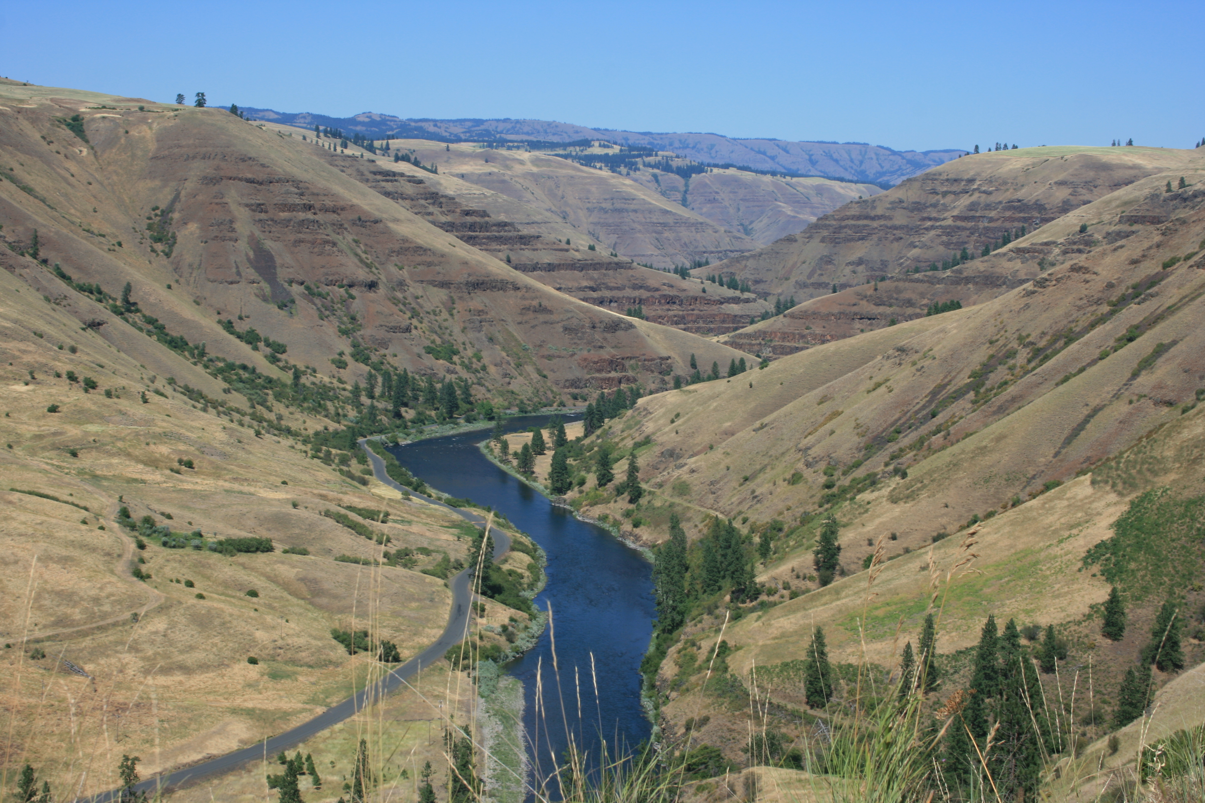
The Grande Ronde Valley is a valley in Union County in northeastern Oregon, United States. It is surrounded by the Blue Mountains, and is drained by the Grande Ronde River. La Grande is its largest community. The valley is long, north to south, from Pumpkin Ridge to Pyles Canyon, and wide, east to west, from Cove to the Grande Ronde River's canyon. Its name, fittingly, means, "great circle." Geology The Grande Ronde Valley is part of the Columbia River Plateau. The Columbia River Plateau was created by a series of basalt flood eruptions. These happen when a long crack in the Earth's crust spews floods of lava. The molten rock then hardens and creates layers of basalt. The Grande Ronde Valley floor began to sink from this plateau at a rate of about .07-.18 millimeters per year about nine million years ago. Geography The Grande Ronde Valley floor is at about above sea level. Its horizon is dominated by the Blue Mountains. Eagle Cap Wilderness is to the southeast. The hi ... [...More Info...] [...Related Items...] OR: [Wikipedia] [Google] [Baidu] |
Union County, Oregon
Union County is one of the 36 counties in the U.S. state of Oregon. As of the 2020 census, the population was 26,196. Its county seat is La Grande. Union County comprises the La Grande, OR Micropolitan Statistical Area. It is one of the eight counties of eastern Oregon. History According to ''Oregon Geographic Names'', the county is named for the town of Union. Union County was originally part of Baker County (which was originally a part of Wasco County, which was originally part of Clackamas County). The northern end of the Grande Ronde Valley was the first part to be settled. During the 1860s, population growth in eastern Oregon prompted the State Legislature to split Umatilla and Baker Counties from Wasco County in 1862. Further settlement in the Grande Ronde Valley led to the division of Baker County to create Union County on October 14, 1864. The county doubled in population between 1880 and 1890. The choice of a county seat resulted in competition, based on geogra ... [...More Info...] [...Related Items...] OR: [Wikipedia] [Google] [Baidu] |
Mount Emily (Union County, Oregon)
Mount Emily is a mountain in the Blue Mountains of eastern Oregon in the United States The United States of America (U.S.A. or USA), commonly known as the United States (U.S. or US) or America, is a country primarily located in North America. It consists of 50 states, a federal district, five major unincorporated territorie .... It is located in western Union County on the Wallowa-Whitman National Forest. Mount Emily is visible from much of the Grande Ronde Valley. Its southern edge is a landmark in, and symbol of, the city of La Grande. Mt. Emily was named after Emily Leasey, of the Leasey family who were among the first white settlers of the Grande Ronde Valley. The area hosts many opportunities for recreation, includinmountain biking References External links * Mountains of Oregon La Grande, Oregon Landforms of Union County, Oregon {{UnionCountyOR-geo-stub ... [...More Info...] [...Related Items...] OR: [Wikipedia] [Google] [Baidu] |
Astor Expedition
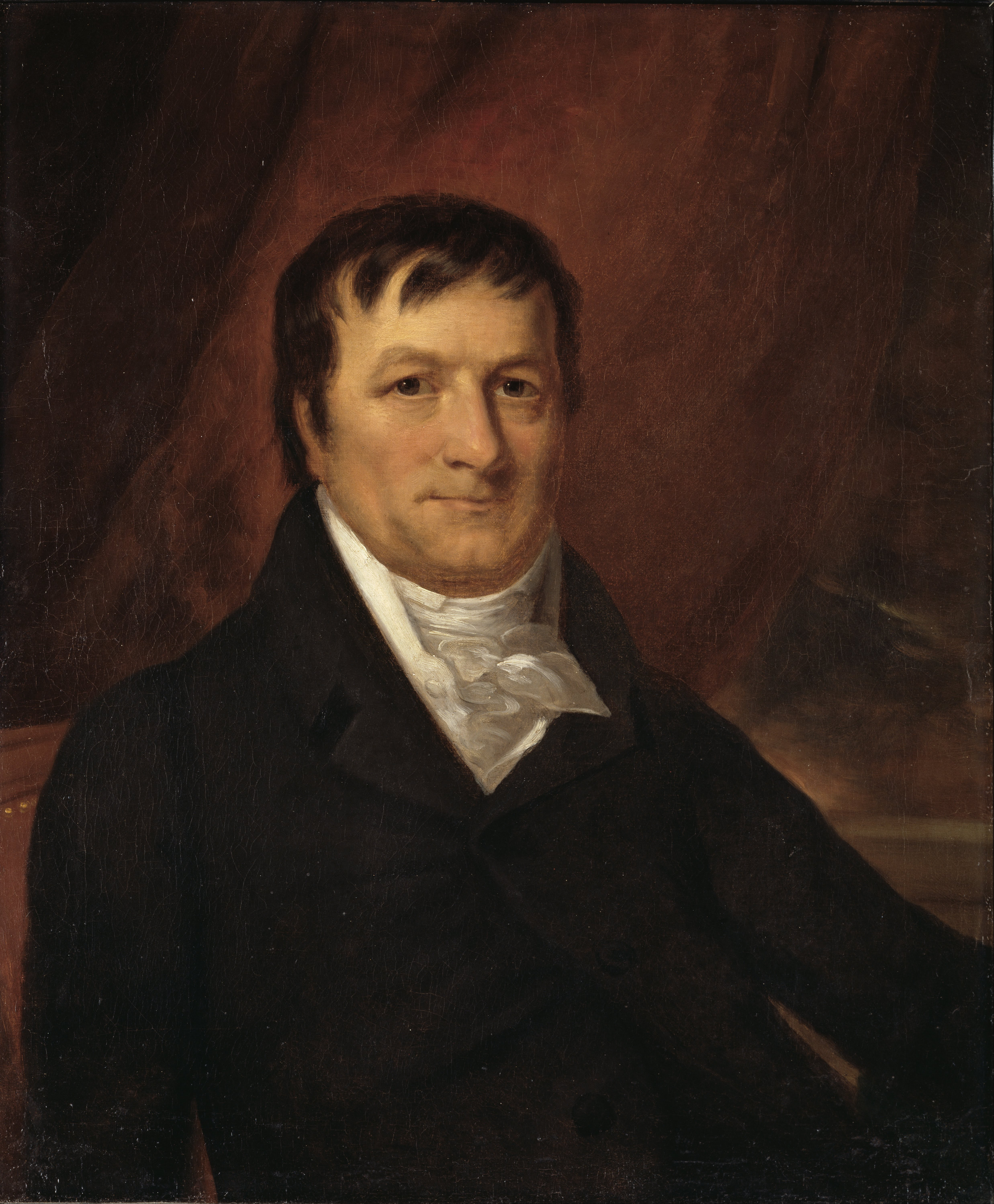
The Pacific Fur Company (PFC) was an American fur trade venture wholly owned and funded by John Jacob Astor that functioned from 1810 to 1813. It was based in the Pacific Northwest, an area contested over the decades between the United Kingdom of Great Britain and Ireland, the Spanish Empire, the United States of America and the Russian Empire. Management, clerks and fur trappers were sent both by land and by sea to the Pacific Coast in the Autumn of 1810. The base of operations was constructed at the mouth of the Columbia River in 1811, Fort Astoria (present-day Astoria, Oregon). The destruction of the company vessel the '' Tonquin'' later that year off the shore of Vancouver Island took with it the majority of the annual trading goods. Commercial competition with the British-Canadian North West Company began soon after the foundation of Fort Astoria. The Canadian competitors maintained several stations in the interior, primarily Spokane House, Kootanae House and Saleesh House. ... [...More Info...] [...Related Items...] OR: [Wikipedia] [Google] [Baidu] |
Shoshone People
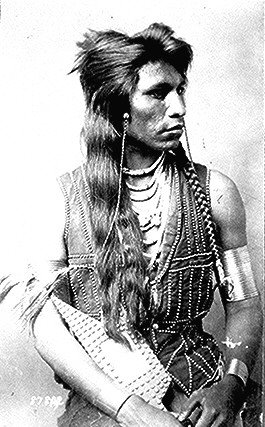
The Shoshone or Shoshoni ( or ) are a Tribe (Native American), Native American tribe with four large cultural/linguistic divisions: * Eastern Shoshone: Wyoming * Northern Shoshone: southern Idaho * Western Shoshone: Nevada, northern Utah * Goshute: western Utah, eastern Nevada They traditionally speak the Shoshoni language, part of the Numic languages branch of the large Uto-Aztecan languages, Uto-Aztecan language family. The Shoshone were sometimes called the Snake Indians by neighboring tribes and early American explorers. Their peoples have become members of List of federally recognized tribes, federally recognized tribes throughout their traditional areas of settlement, often co-located with the Northern Paiute people of the Great Basin. Etymology The name "Shoshone" comes from ''Sosoni'', a Shoshoni language, Shoshone word for high-growing grasses. Some neighboring tribes call the Shoshone "Grass House People," based on their traditional homes made from ''sosoni''. Shosho ... [...More Info...] [...Related Items...] OR: [Wikipedia] [Google] [Baidu] |
Walla Walla People
Walla Walla (), Walawalałáma ("People of Walula region along Walla Walla River"), sometimes Walúulapam, are a Sahaptin indigenous people of the Northwest Plateau. The duplication in their name expresses the diminutive form. The name ''Walla Walla'' is translated several ways but most often as "many waters". Many Walla Wallas live on the Confederated Tribes of the Umatilla Indian Reservation. Walla Wallas share land and a governmental structure with the Cayuse and the Umatilla tribes as part of the Confederated Tribes of the Umatilla. The reservation is located in the area of Pendleton, Oregon, United States, near the Blue Mountains. Some Walla Wallas are also enrolled in the federally recognized Confederated Tribes and Bands of the Yakama Nation. History The people are a Sahaptin-speaking tribe that traditionally inhabited the interior Columbia River region of present-day northwestern United States. For centuries before the coming of European settlers, the Walla Wallas, con ... [...More Info...] [...Related Items...] OR: [Wikipedia] [Google] [Baidu] |
Umatilla People
The Umatilla are a Sahaptin-speaking Native American tribe who traditionally inhabited the Columbia Plateau region of the northwestern United States, along the Umatilla and Columbia rivers."Umatilla," in Barbara A. Leitch, ''A Concise Dictionary of Indian Tribes of North America.'' Algonac, MI: Reference Publications, Inc., 1979; pp. 490-491. The Umatilla people are called Imatalamłáma, a Umatilla person is called Imatalamłá (with orthographic ł representing IPA /ɬ/). Some sources say that ''Umatilla'' is derived from ''imatilám-hlama'': ''hlama'' means 'those living at' or 'people of' and there is an ongoing debate about the meaning of ''imatilám'', but it is said to be an island in the Columbia River. B. Rigsby and N. Rude mention the village of ''ímatalam'' that was situated at the mouth of the Umatilla River and where the language was spoken. The Nez Perce refer to the Umatilla people as ''hiyówatalampoo'' (Aoki (1994:171)). History Early development The Umatill ... [...More Info...] [...Related Items...] OR: [Wikipedia] [Google] [Baidu] |
Cayuse People
The Cayuse are a Native American tribe in what is now the state of Oregon in the United States. The Cayuse tribe shares a reservation and government in northeastern Oregon with the Umatilla and the Walla Walla tribes as part of the Confederated Tribes of the Umatilla Indian Reservation. The reservation is located near Pendleton, Oregon, at the base of the Blue Mountains. The Cayuse called themselves the ''Liksiyu'' in the Cayuse language. Originally located in present-day northeastern Oregon and southeastern Washington, they lived adjacent to territory occupied by the Nez Perce and had close associations with them. Like the Plains tribes, the Cayuse placed a high premium on warfare and were skilled horsemen. They developed the Cayuse pony. The Cayuse ceded most of their traditional territory to the United States in 1855 by treaty and moved to the Umatilla Reservation, where they have formed a confederated tribe. History According to Haruo Aoki (1998), the Cayuse called ... [...More Info...] [...Related Items...] OR: [Wikipedia] [Google] [Baidu] |
Nez Perce People
The Nez Percé (; autonym in Nez Perce language: , meaning "we, the people") are an Indigenous people of the Plateau who are presumed to have lived on the Columbia River Plateau in the Pacific Northwest region for at least 11,500 years.Ames, Kenneth and Alan Marshall. 1980. "Villages, Demography and Subsistence Intensification on the Southern Columbia Plateau". ''North American Archeologist'', 2(1): 25–52." Members of the Sahaptin language group, the Nimíipuu were the dominant people of the Columbia Plateau for much of that time, especially after acquiring the horses that led them to breed the appaloosa horse in the 18th century. Prior to first contact with European colonial people the Nimiipuu were economically and culturally influential in trade and war, interacting with other indigenous nations in a vast network from the western shores of Oregon and Washington, the high plains of Montana, and the northern Great Basin in southern Idaho and northern Nevada. French explor ... [...More Info...] [...Related Items...] OR: [Wikipedia] [Google] [Baidu] |
Native Americans In The United States
Native Americans, also known as American Indians, First Americans, Indigenous Americans, and other terms, are the Indigenous peoples of the mainland United States ( Indigenous peoples of Hawaii, Alaska and territories of the United States are generally known by other terms). There are 574 federally recognized tribes living within the US, about half of which are associated with Indian reservations. As defined by the United States Census, "Native Americans" are Indigenous tribes that are originally from the contiguous United States, along with Alaska Natives. Indigenous peoples of the United States who are not listed as American Indian or Alaska Native include Native Hawaiians, Samoan Americans, and the Chamorro people. The US Census groups these peoples as " Native Hawaiian and other Pacific Islanders". European colonization of the Americas, which began in 1492, resulted in a precipitous decline in Native American population because of new diseases, wars, ethni ... [...More Info...] [...Related Items...] OR: [Wikipedia] [Google] [Baidu] |
Eastern Oregon
Eastern Oregon is the eastern part of the U.S. state of Oregon. It is not an officially recognized geographic entity; thus, the boundaries of the region vary according to context. It is sometimes understood to include only the eight easternmost counties in the state; in other contexts, it includes the entire area east of the Cascade Range. Cities in the basic eight-county definition include Baker City, Burns, Hermiston, Pendleton, Boardman, John Day, La Grande, and Ontario. Umatilla County is home to the largest population base in Eastern Oregon; accounting for 42% of the region's residents. Hermiston, located in Umatilla County, is the largest city in the region, accounting for 10% of Eastern Oregon's residents. Major industries include transportation/warehousing, timber, agriculture and tourism. The main transportation corridors are I-84, U.S. Route 395, U.S. Route 97, U.S. Route 26, U.S. Route 30, and U.S. Route 20. Compared to the climate of Western Oregon, the clima ... [...More Info...] [...Related Items...] OR: [Wikipedia] [Google] [Baidu] |
Catherine Creek
Catherine Creek is a creek in northeastern Oregon, United States. A tributary of the Grande Ronde River, it is the second-longest stream in the Grande Ronde Valley. Originating in the foothills of the Wallowa Mountains, it flows generally northwest through Catherine Creek State Park and the city of Union before joining the river. The creek was named for Catherine Godley, a daughter of Thomas and M. E. Godley, who settled near Union in the 19th century. A former variant name for the stream on some maps was Ladd Creek. However, Ladd Creek on more recent maps is a stream flowing generally northeast from hills southeast of La Grande through the Ladd Marsh Game Management Area, joining Gekeler Slough before entering Catherine Creek. Little Creek, a tributary of Catherine Creek, was formerly called Julianna Creek for the Godleys' other daughter. Course Catherine Creek, flowing entirely within Union County, begins at the confluence of North Fork Catherine Creek and South Fork ... [...More Info...] [...Related Items...] OR: [Wikipedia] [Google] [Baidu] |
Union, Oregon
Union is a city in Union County, Oregon, United States. The population was 2,121 at the 2010 census. Union is the namesake of Union County. History Union was platted on November 11, 1864 along the Oregon Trail. The name references the Union states, or Northern States, of the American Civil War. La Grande was named the county seat when Union County was created in 1865. Due to the Thomas and Ruckle Road going through Union, it elected the county seat in 1872, but when the railroad was built it was put through La Grande instead of Union. La Grande became the bigger town within the county and regained the county seat in 1902. J. W. Shelton, a local attorney, chartered the Union Electric Power and Light Company in March 1890 to bring the railroad from Union Junction (2.5 miles away) to Union itself. The company was renamed the Union Railway Company in July 1890, and the rail spur was built into Union by August 1892. Shelton planned to build more lines, had a fight with his compan ... [...More Info...] [...Related Items...] OR: [Wikipedia] [Google] [Baidu] |


.jpg)